|
Acton, Minnesota
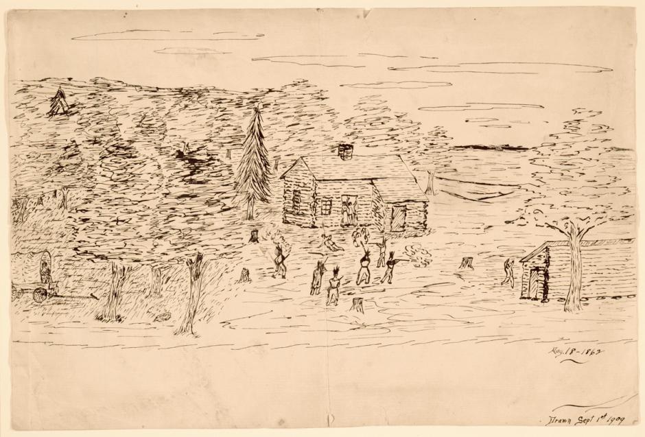
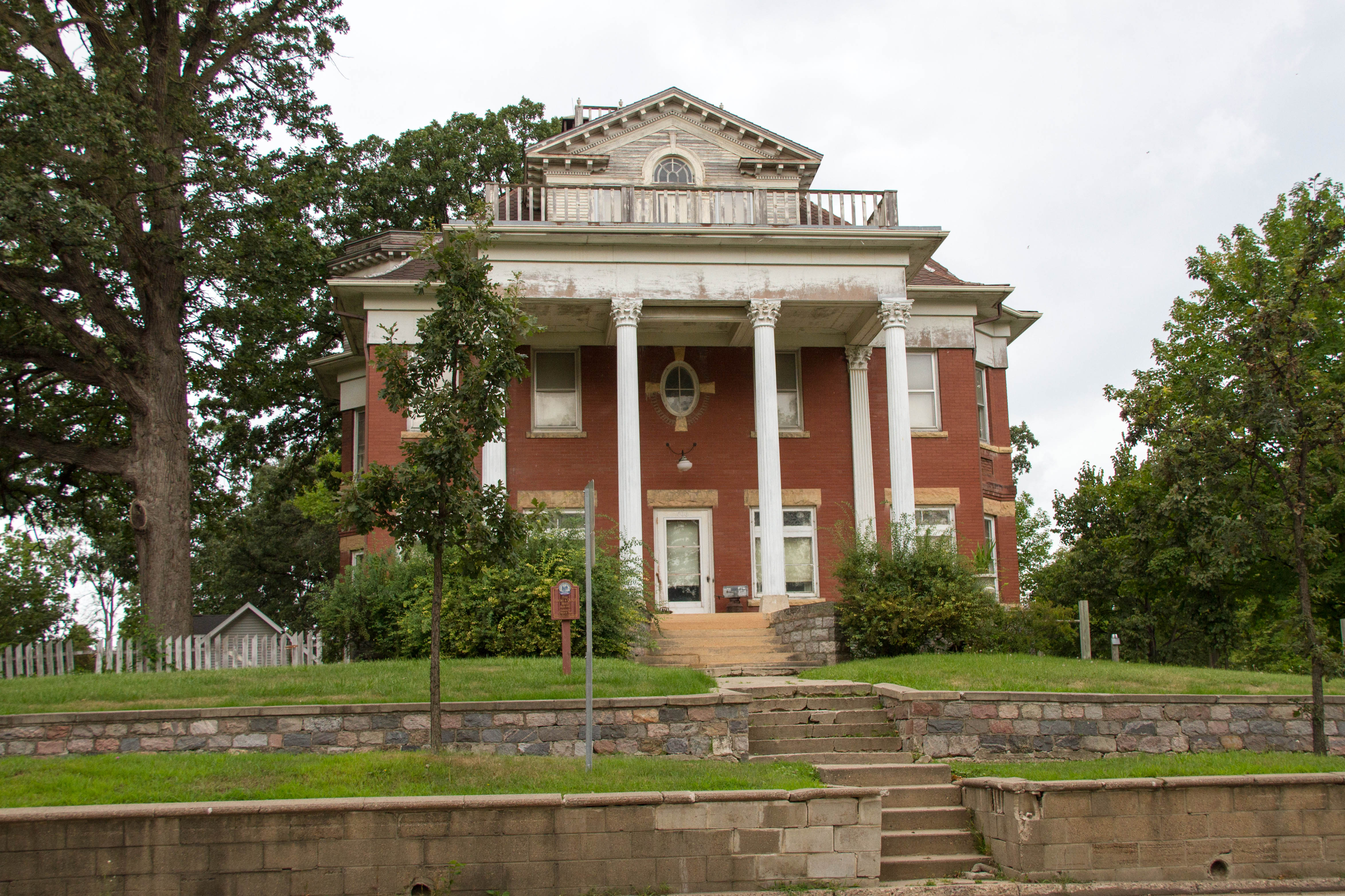
Acton is an unincorporated community in Acton Township, Meeker County, Minnesota, United States, near Grove City and Litchfield. The community is located along Meeker County Road 23 near State Highway 4 ( MN 4). County Road 32 is also in the immediate area. History A post office called Acton was established in 1857, and remained in operation until 1904. The community was named after Acton, Ontario. Dakota War of 1862 Acton Incident The incident that sparked the Dakota War of 1862 took place near Acton on August 17, 1862. Four Mdewakantons, Sungigidan (“Brown Wing”), Kaomdeiyeyedan (“Breaking Up”), Nagiwicakte (“Killing Ghost”), and Pazoiyopa (“Runs Against Something When Crawling”) from Rice Creek Village in the Lower Sioux Agency The Lower Sioux Agency, or Redwood Agency, was the federal administrative center for the Lower Sioux Indian Reservation in what became Redwood County, Minnesota, United States. It was the site of the Battle of Lower Sioux ... [...More Info...] [...Related Items...] OR: [Wikipedia] [Google] [Baidu] |
Unincorporated Area
An unincorporated area is a region that is not governed by a local municipal corporation. Widespread unincorporated communities and areas are a distinguishing feature of the United States and Canada. Most other countries of the world either have no unincorporated areas at all or these are very rare: typically remote, outlying, sparsely populated or List of uninhabited regions, uninhabited areas. By country Argentina In Argentina, the provinces of Chubut Province, Chubut, Córdoba Province (Argentina), Córdoba, Entre Ríos Province, Entre Ríos, Formosa Province, Formosa, Neuquén Province, Neuquén, Río Negro Province, Río Negro, San Luis Province, San Luis, Santa Cruz Province, Argentina, Santa Cruz, Santiago del Estero Province, Santiago del Estero, Tierra del Fuego Province, Argentina, Tierra del Fuego, and Tucumán Province, Tucumán have areas that are outside any municipality or commune. Australia Unlike many other countries, Australia has only local government in Aus ... [...More Info...] [...Related Items...] OR: [Wikipedia] [Google] [Baidu] |
Minnesota State Highway 4
Minnesota State Highway 4 (MN 4) is a highway in southwest and west-central Minnesota, which runs from Iowa Highway 4 at the Iowa state line (near Dunnell, MN and Estherville, IA), and continues north to its northern terminus at its interchange with Interstate Highway 94 near Sauk Centre and Melrose. Route description State Highway 4 serves as a north–south route between Sherburn, Saint James, Sleepy Eye, Fairfax, Hector, Paynesville, and Meire Grove in southwest and west-central Minnesota. Highway 4 parallels U.S. Highway 71 and State Highway 15 throughout its route. Fort Ridgely State Park is located on Highway 4 in Nicollet County on the Minnesota River. The park is located south of Fairfax and northwest of New Ulm. History The segment of Highway 4 between Paynesville and Interstate 94 is part of Minnesota Constitutional Route 4, established in 1920; the remainder of Highway 4 was authorized in 1933. Between Saint James and the Iowa border, Highway 4 ... [...More Info...] [...Related Items...] OR: [Wikipedia] [Google] [Baidu] |
Unincorporated Communities In Meeker County, Minnesota
Unincorporated may refer to: * Unincorporated area, land not governed by a local municipality * Unincorporated entity, a type of organization * Unincorporated territories of the United States, territories under U.S. jurisdiction, to which Congress has determined that only select parts of the U.S. Constitution apply * Unincorporated association Unincorporated associations are one vehicle for people to cooperate towards a common goal. The range of possible unincorporated associations is nearly limitless, but typical examples are: :* An amateur football team who agree to hire a pitch onc ..., also known as voluntary association, groups organized to accomplish a purpose * ''Unincorporated'' (album), a 2001 album by Earl Harvin Trio {{disambig ... [...More Info...] [...Related Items...] OR: [Wikipedia] [Google] [Baidu] |
Unincorporated Communities In Minnesota
Unincorporated may refer to: * Unincorporated area, land not governed by a local municipality * Unincorporated entity, a type of organization * Unincorporated territories of the United States, territories under U.S. jurisdiction, to which Congress has determined that only select parts of the U.S. Constitution apply * Unincorporated association Unincorporated associations are one vehicle for people to cooperate towards a common goal. The range of possible unincorporated associations is nearly limitless, but typical examples are: :* An amateur football team who agree to hire a pitch onc ..., also known as voluntary association, groups organized to accomplish a purpose * ''Unincorporated'' (album), a 2001 album by Earl Harvin Trio {{disambig ... [...More Info...] [...Related Items...] OR: [Wikipedia] [Google] [Baidu] |
Hutchinson, Minnesota
Hutchinson is the largest city in McLeod County, Minnesota, McLeod County, Minnesota, United States. It lies along the South Fork of the Crow River (Minnesota), Crow River. The population was 14,599 at the 2010 United States Census, 2020 census. History The Hutchinson Family Singers (John, Asa, and Judson Hutchinson) are credited with founding the town in November 1855. A post office has been in operation in Hutchinson since 1856. The city was incorporated in 1904. In 1942, muralist Elsa Jemne completed an egg tempera on plaster mural, ''The Hutchinson Singers'', in the town's post office. Federally commissioned murals were produced from 1934 to 1943 through the Section of Painting and Sculpture, later called the Section of Fine Arts, of the United States Department of the Treasury, Treasury Department. The program created public art for numerous buildings constructed during the Great Depression as part of President Franklin D. Roosevelt's Public Works Administration's program t ... [...More Info...] [...Related Items...] OR: [Wikipedia] [Google] [Baidu] |
10th Minnesota Infantry Regiment
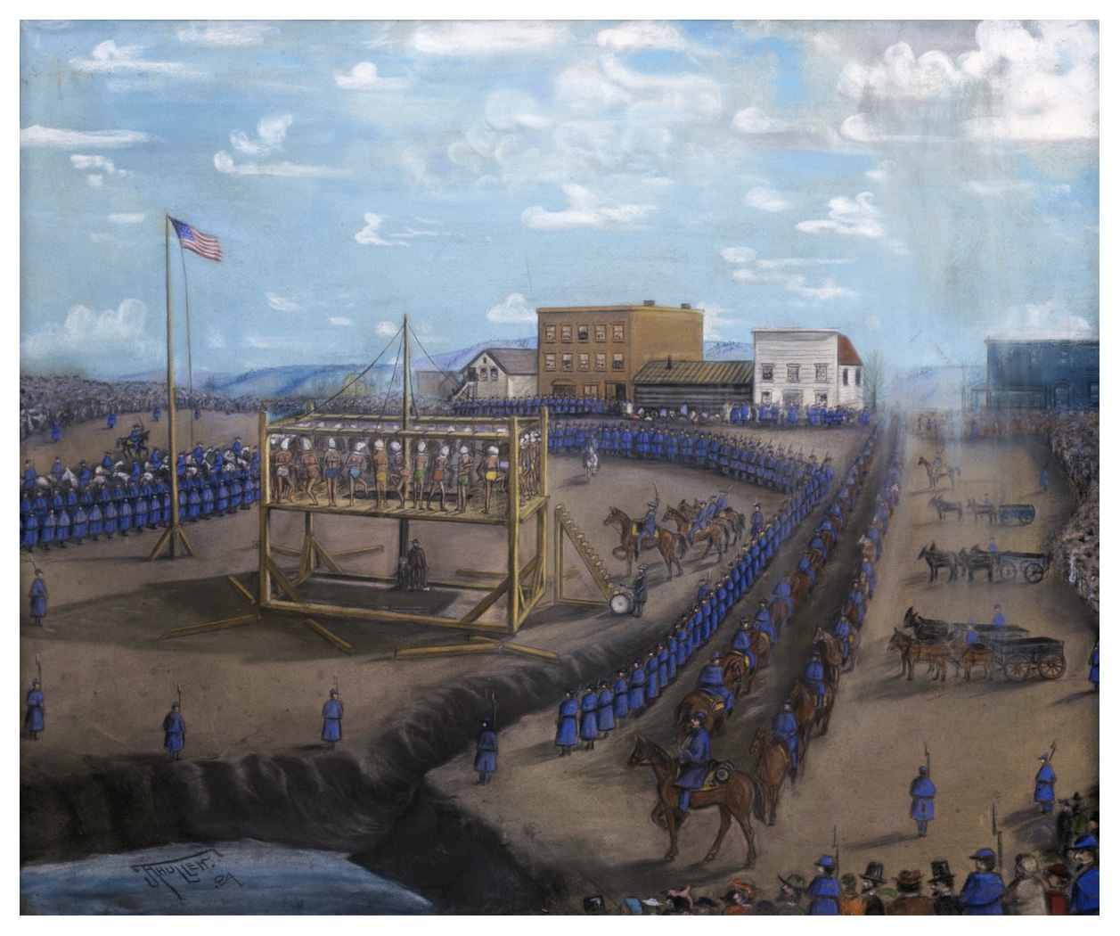
The 10th Minnesota Infantry Regiment was a Minnesota USV infantry regiment that served in the Union Army during the American Civil War. Service The 10th Minnesota Infantry Regiment was recruited into Federal service at Garden City, Winnebago Agency, Fort Snelling and St. Paul, Minnesota, between August 12 and November 15, 1862. Milita that took part in the defense of New Ulm on 24-25 August 1862 were posted to the 10th afterwards.10th Regiment, Minnesota Infantry, Battle Unit Details, Union Minnesota Volunteerss, National Park Service, Department of the Interior websit/ref> Companies G & I were at Fort Ridgely. A Company I detachment was at both the Battle of Birch Coulee and the Battle of Wood Lake. In December Companies A, B, F, G, H, and K were guards at the execution of 38 Santee Sioux in Mankato. Companies D, E, and H of the 9th Minnesota were posted there too. The Regiment was part of Col.Sibleys force at the Battle of Big Mound, Battle of Buffalo Lake, and the ... [...More Info...] [...Related Items...] OR: [Wikipedia] [Google] [Baidu] |
Lower Sioux Agency
The Lower Sioux Agency, or Redwood Agency, was the federal administrative center for the Lower Sioux Indian Reservation in what became Redwood County, Minnesota, United States. It was the site of the Battle of Lower Sioux Agency on August 18, 1862, the first organized battle of the Dakota War of 1862. Today it is a historic site managed by the Lower Sioux Community in partnership with the Minnesota Historical Society. In February 2021, ownership of half of the site was transferred from the historical society to the Lower Sioux Community. The site contains an interpretive center, self-guided trails, and a restored 1861 stone warehouse that is listed on the National Register of Historic Places. History The Lower Sioux Agency was established in 1853 by the United States government, to oversee the newly created Lower Sioux Indian Reservation. This reservation was to be the home for the Mdewakanton and Wahpekute bands following the 1851 Treaty of Mendota. On August 15, 1862, the ... [...More Info...] [...Related Items...] OR: [Wikipedia] [Google] [Baidu] |
Mdewakanton
The Mdewakanton or Mdewakantonwan (also spelled ''Mdewákhaŋthuŋwaŋ'' and currently pronounced ''Bdewákhaŋthuŋwaŋ'') are one of the sub-tribes of the Isanti (Santee) Dakota ( Sioux). Their historic home is Mille Lacs Lake (Dakota: ''Mde Wákhaŋ/Bde Wákhaŋ'', Spirit/Mystic Lake) in central Minnesota. Together with the Wahpekute (''Waȟpékhute'' – "Shooters Among the Trees"), they form the so-called ''Upper Council'' of the Dakota or Santee Sioux (''Isáŋyáthi'' – "Knife Makers"). Today their descendants are members of federally recognized tribes in Minnesota, South Dakota and Nebraska of the United States, and First Nations in Manitoba, Canada. History Tradition has it that the Mdewakanton were the leading tribe of ''Očhéthi Šakówiŋ.'' Their Siouan-speaking ancestors may have migrated to the upper Midwest from further south and east. Over the years they migrated up through present-day Ohio and into Wisconsin. Seven Sioux tribes formed an alliance, which the ... [...More Info...] [...Related Items...] OR: [Wikipedia] [Google] [Baidu] |
Dakota War Of 1862
The Dakota War of 1862, also known as the Sioux Uprising, the Dakota Uprising, the Sioux Outbreak of 1862, the Dakota Conflict, the U.S.-Dakota War of 1862, or Little Crow's War, was an armed conflict between the United States and several bands of eastern Dakota people, Dakota also known as the Santee Sioux. It began on August 18, 1862, at the Lower Sioux Agency along the Minnesota River in southwest Minnesota. The eastern Dakota were pressured into ceding large tracts of land to the United States in a series of treaties signed in 1837, 1851 and 1858, in exchange for cash annuities, debt payments, and other provisions. All four bands of eastern Dakota, particularly the Mdewakanton, were displaced and reluctantly moved to a reservation that was twenty miles wide, ten on both sides of the Minnesota River. There, they were encouraged by Indian agent, U.S. Indian agents to become farmers rather than continue their hunting traditions. Meanwhile, the settler population in Minnesota ... [...More Info...] [...Related Items...] OR: [Wikipedia] [Google] [Baidu] |
Acton Incident Illustration
Acton may refer to: Places Antarctica * Mount Acton Australia * Acton, Australian Capital Territory, a suburb of Canberra * Acton, Tasmania, a suburb of Burnie * Acton Park, Tasmania, a suburb of Hobart, Tasmania, formerly known as Acton Canada * Acton, Ontario, a community * Acton Island, District of Muskoka, Ontario * Acton, New Brunswick * Acton Regional County Municipality, Quebec New Zealand * Acton, New Zealand, a rural community United Kingdom * Acton, County Armagh, Northern Ireland, a hamlet and townland * Acton, Cheshire, a village and civil parish * Acton, Cheshire (ancient parish) * Acton, Dorset, a hamlet * Acton, London, an area of west London ** East Acton ** North Acton ** South Acton, London ** West Acton ** Municipal Borough of Acton, former local government district ** Acton (UK Parliament constituency) * Acton, Northumberland, a hamlet * Acton, Shropshire, a village * Acton, Staffordshire, a hamlet * Acton, Suffolk, a village and civil parish * Acton, ... [...More Info...] [...Related Items...] OR: [Wikipedia] [Google] [Baidu] |
Acton, Ontario
Acton (population 9,377 in 2021) is a community located in the town of Halton Hills, in Halton Region, Ontario, Canada. At the northern end of the Region, it is on the outer edge of the Greater Toronto Area and is one of two of the primary population centres of the Town; the other is Georgetown. From 1842 until 1986, the town was a major centre for the tanning and leather goods industry. In the early years, it was often referred to as "Leathertown". History In 1825, the area now known as Acton was settled by the Rev. Ezra, Rev. Zenas, and Rufus Adams. These men were Methodist preachers who took a sabbatical and began farming here on a branch of the Credit River. A fourth brother, Eliphalet, also settled here later. In the 1840s, the community had a grist mill and tannery. The community was initially named Danville when settler Wheeler Green opened a dry-goods store in 1828. It was later called Adamsville, after the three original settlers. When the Mississaugas still had the ... [...More Info...] [...Related Items...] OR: [Wikipedia] [Google] [Baidu] |


