|
Abitibi River
The Abitibi River is a river in northeastern Ontario, Canada, which flows northwest from Lake Abitibi to join the Moose River which empties into James Bay. This river is long, and descends . It is the fifth longest river entirely in Ontario Abitibi is an Algonquin word meaning "halfway water", derived from ''abitah'', which may be translated as "middle" or "halfway", and ''nipi'', "water". Originally used by the French to designate a band of Algonquin Indians who lived near the lake, the name was descriptive of their location halfway between the trading posts on the Hudson Bay and those on the Ottawa River. The river was an important fur trading route for the Hudson's Bay Company. Formerly, pulp and paper, centered on the town of Iroquois Falls, was an important industry in the heavily forested region through which it flows. The region also supports tourism and gold mining. The Abitibi Canyon Generating Station is located on the river at Abitibi Canyon. The experience of su ... [...More Info...] [...Related Items...] OR: [Wikipedia] [Google] [Baidu] |
Algonquin Language
Algonquin (also spelled Algonkin; in Algonquin: or ) is either a distinct Algonquian language closely related to the Ojibwe language or a particularly divergent Ojibwe dialect. It is spoken, alongside French and to some extent English, by the Algonquin First Nations of Quebec and Ontario. As of 2006, there were 2,680 Algonquin speakers,. less than 10% of whom were monolingual. Algonquin is the language for which the entire Algonquian language subgroup is named; the similarity among the names often causes considerable confusion. Like many Native American languages, it is strongly verb-based, with most meaning being incorporated into verbs instead of using separate words for prepositions, tense, etc. Classification Omàmìwininìmowin (Algonquin) is an Algonquian language, of the Algic family of languages, and is descended from Proto-Algonquian. It is considered a particularly divergent dialect of Ojibwe by many. But, although the speakers call themselves '' Omàmìwinin� ... [...More Info...] [...Related Items...] OR: [Wikipedia] [Google] [Baidu] |
Abitibi Canyon, Ontario
Abitibi Canyon was a community on the Abitibi River in northeastern Ontario, Canada. Abitibi Canyon was part of Northern Unorganized Cochrane District, in Cochrane District. It was located northeast of Fraserdale. History The construction of the Abitibi Canyon Generating Station at Abitibi Canyon began in 1930 for the Ontario Power Service Corporation, a subsidiary of the Abitibi Power and Paper Company, today's Resolute Forest Products. Work was suspended several years later, the company went into receivership and the project was taken over by the provincial Ontario Hydro in 1933. The Abitibi Canyon settlement was established in 1930 to support the construction of the dam. In early years, construction and later support staff came by Ontario Northland Railway train to Fraserdale, then further by private siding, or used floatplanes. In 1966, a road connection via Fraserdale to Smooth Rock Falls, Ontario Smooth Rock Falls is an incorporated town in the Cochrane District in No ... [...More Info...] [...Related Items...] OR: [Wikipedia] [Google] [Baidu] |
Hydroelectricity
Hydroelectricity, or hydroelectric power, is Electricity generation, electricity generated from hydropower (water power). Hydropower supplies one sixth of the world's electricity, almost 4500 TWh in 2020, which is more than all other Renewable energy, renewable sources combined and also more than nuclear power. Hydropower can provide large amounts of Low-carbon power, low-carbon electricity on demand, making it a key element for creating secure and clean electricity supply systems. A hydroelectric power station that has a dam and reservoir is a flexible source, since the amount of electricity produced can be increased or decreased in seconds or minutes in response to varying electricity demand. Once a hydroelectric complex is constructed, it produces no direct waste, and almost always emits considerably less greenhouse gas than fossil fuel-powered energy plants. [...More Info...] [...Related Items...] OR: [Wikipedia] [Google] [Baidu] |
Otter Rapids Dam
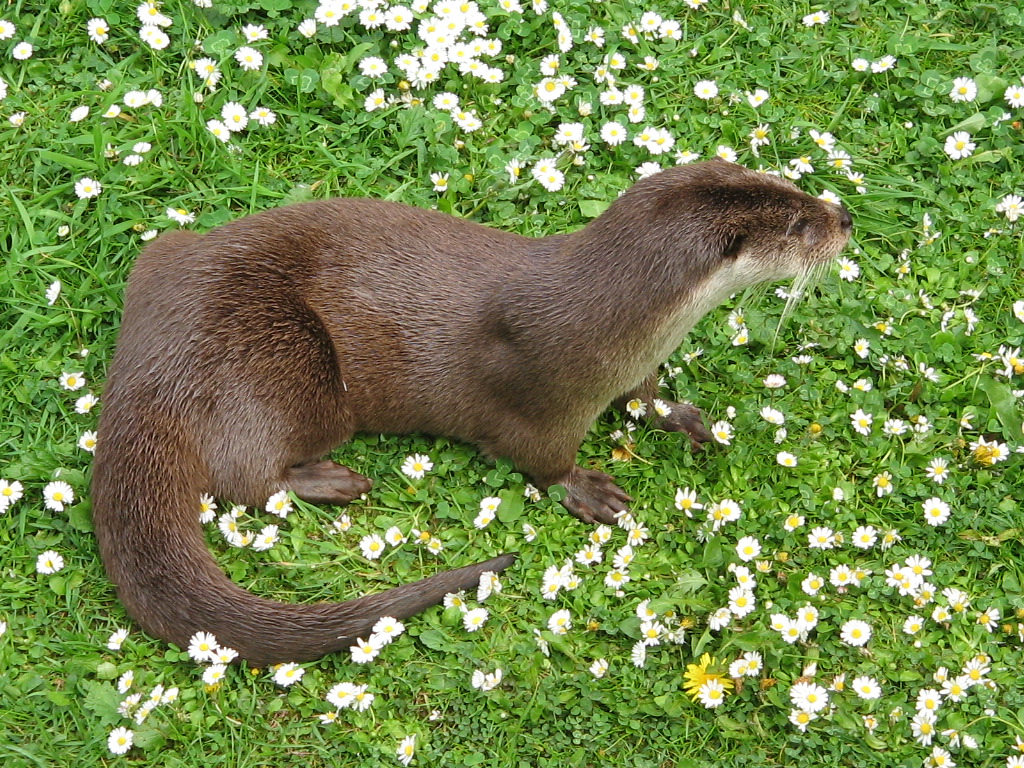
Otters are carnivorous mammals in the subfamily Lutrinae. The 13 extant otter species are all semiaquatic, aquatic, or marine, with diets based on fish and invertebrates. Lutrinae is a branch of the Mustelidae family, which also includes weasels, badgers, mink, and wolverines, among other animals. Etymology The word ''otter'' derives from the Old English word or . This, and cognate words in other Indo-European languages, ultimately stem from the Proto-Indo-European language root , which also gave rise to the English word "water". Terminology An otter's den is called a holt or couch. Male otters are called dogs or boars, females are called bitches or sows, and their offspring are called pups or cubs. The collective nouns for otters are bevy, family, lodge, romp (being descriptive of their often playful nature) or, when in water, raft. The feces of otters are typically identified by their distinctive aroma, the smell of which has been described as ranging from freshly mow ... [...More Info...] [...Related Items...] OR: [Wikipedia] [Google] [Baidu] |
Coral Rapids, Ontario
Coral Rapids is a community in Ontario, Canada. It is located on the Abitibi River northwest of Otter Rapids and has a station on the Ontario Northland's Polar Bear Express The ''Polar Bear Express'' is a Canadian passenger train operated by the Ontario Northland Railway in Northern Ontario. Service was introduced in 1964. While designated as a passenger train, the Polar Bear Express also carries freight and is equ .... Communities in Cochrane District {{Ontario-geo-stub ... [...More Info...] [...Related Items...] OR: [Wikipedia] [Google] [Baidu] |
Otter Rapids Generating Station
Otter Rapids Generating Station is a dam and hydroelectric power plant located in Pitt Township in the Unorganized North Part of Cochrane District in Northeastern Ontario, Canada. Owned by Ontario Power Generation, this 4-unit, 182 MW station is part of the Northeast Plant Group. The Ontario Northland Railway runs past this facility. Preliminary surveys of the site were conducted in 1945. In 1951 additional site information was gathered with studies and estimates refined. Approval under the Navigable Waters Protection Act was received in October 1958 and the first generating unit came online on September 26, 1961. The Otter Rapids Generating Station was the last of four generating stations completed on the Abitibi River in the James Bay watershed. A community of employees and their families inhabited the adjacent colony called Otter Rapids. This community of over 1,000 people was well equipped with a bank, post office, snack bar, grocery store, billiard hall, bowling alley, c ... [...More Info...] [...Related Items...] OR: [Wikipedia] [Google] [Baidu] |
Fraserdale, Ontario
Fraserdale is an unincorporated place and railroad point in Unorganized Cochrane, North Part in Cochrane District, Northern Ontario, Canada. It is located north of Timmins along the Ontario Northland Railway. The community/train stop was named for Alan Fraser, a railway engineer, and is counted as part of Unorganized Cochrane, North Part in Canadian census data. The neighbouring community Abitibi Canyon ( east) on the Abitibi River was the most extensive community ever built by the Ontario Hydro Electric Power Commission. It was home to 1500 residents and was established to house employees of Abitibi Canyon Generating Station. Fraserdale is connected to Smooth Rock Falls on Ontario Highway 11 to the south and to Abitibi Canyon to the northeast via Ontario Highway 634 Secondary Highway 634, commonly referred to as Highway 634, is a remote highway in Northern Ontario that connects Ontario Highway 11, Highway 11 in Smooth Rock Falls, Ontario, Smooth Rock Falls to the Abi ... [...More Info...] [...Related Items...] OR: [Wikipedia] [Google] [Baidu] |
Island Falls, Ontario
An island (or isle) is an isolated piece of habitat that is surrounded by a dramatically different habitat, such as water. Very small islands such as emergent land features on atolls can be called islets, skerry, skerries, cays or keys. An river island, island in a river or a lake island may be called an ait, eyot or ait, and a small island off the coast may be called a holm (island), holm. Sedimentary islands in the Ganges delta are called List of islands of Bangladesh, chars. A grouping of geographically or geologically related islands, such as the Philippines, is referred to as an archipelago. There are two main types of islands in the sea: continental and oceanic. There are also artificial islands, which are man-made. Etymology The word ''island'' derives from Middle English ''iland'', from Old English ''igland'' (from ''ig'' or ''ieg'', similarly meaning 'island' when used independently, and -land carrying its contemporary meaning; cf. Dutch language, Dutch ''eiland'' ... [...More Info...] [...Related Items...] OR: [Wikipedia] [Google] [Baidu] |
Island Falls Station, Ontario
An island (or isle) is an isolated piece of habitat that is surrounded by a dramatically different habitat, such as water. Very small islands such as emergent land features on atolls can be called islets, skerry, skerries, cays or keys. An river island, island in a river or a lake island may be called an ait, eyot or ait, and a small island off the coast may be called a holm (island), holm. Sedimentary islands in the Ganges delta are called List of islands of Bangladesh, chars. A grouping of geographically or geologically related islands, such as the Philippines, is referred to as an archipelago. There are two main types of islands in the sea: continental and oceanic. There are also artificial islands, which are man-made. Etymology The word ''island'' derives from Middle English ''iland'', from Old English ''igland'' (from ''ig'' or ''ieg'', similarly meaning 'island' when used independently, and -land carrying its contemporary meaning; cf. Dutch language, Dutch ''eiland'' ... [...More Info...] [...Related Items...] OR: [Wikipedia] [Google] [Baidu] |
Frederick House River
The Frederick House River is a river in the James Bay and Moose River (Ontario), Moose River drainage basins in Cochrane District, Ontario, Cochrane District in Northeastern Ontario, northeastern Ontario, Canada. It flows from Night Hawk Lake in the city of Timmins to its mouth at the Abitibi River in Cochrane, Unorganized, North Part, Ontario, Cochrane, Unorganized, North Part. Both the river and the associated Hudson's Bay Company Frederick House post (1785–1821) are named for Prince Frederick, Duke of York and Albany, son of George III of the United Kingdom, Course The Frederick House River begins at Night Hawk Lake in Timmins at an elevation of . It flows north into Frederick House Lake at the community of Neighbourhoods in Timmins#Connaught, Connaught, near the site of the Hudson's Bay Company Frederick House post, continues north out of the lake into Cochrane, Unorganized, North Part, flows over a small dam and the Wanatango Falls, and takes in the right tributary Wicklow ... [...More Info...] [...Related Items...] OR: [Wikipedia] [Google] [Baidu] |
Ontario Northland Railway
The Ontario Northland Railway is a Canadian railway operated by the Ontario Northland Transportation Commission, a provincial Crown agency of the government of Ontario. Originally built to develop the Lake Timiskaming and Lake Nipissing areas, the railway soon became a major factor in the economic growth of the province. After decades of difficult construction through the Canadian Shield, workers reached James Bay in 1932. While blasting the route through the shield, geologists discovered deposits of valuable minerals such as gold, silver, copper and nickel. The railway also made it possible to exploit the timber resources of Northern Ontario. Its north–south mainline is located entirely in Ontario, starting at its southern terminus at North Bay, running northward through Cobalt, New Liskeard, Cochrane, and on to its northern terminus at Moosonee on the Moose River, about south of the shore of James Bay. There is one major branchline running eastward from Swastika thr ... [...More Info...] [...Related Items...] OR: [Wikipedia] [Google] [Baidu] |


