|
Aa (Nethe)
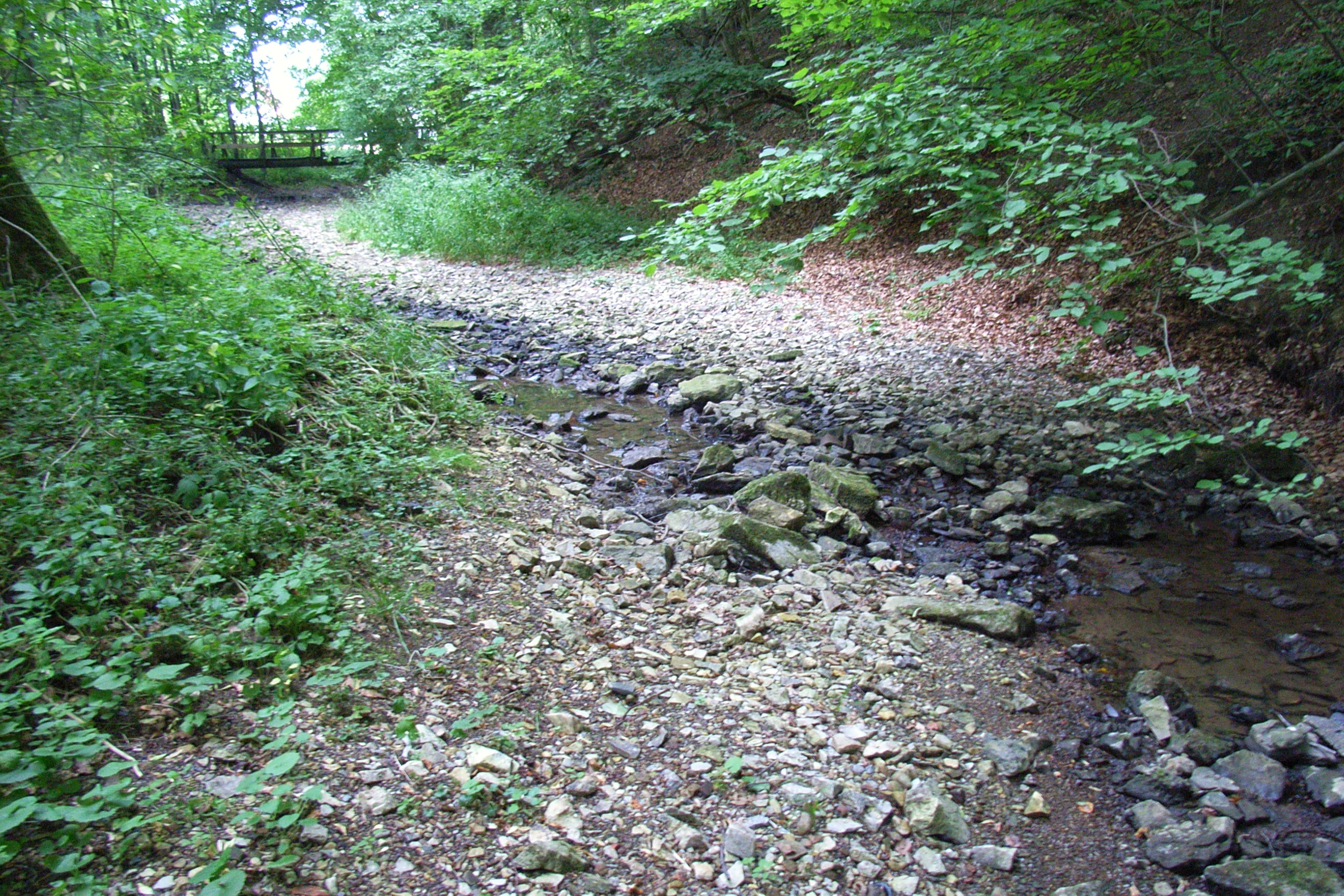
The Aa is a 20.6 km long, orographic left tributary of the Nethe river in North Rhine-Westphalia, Germany. The Aa belongs as a tributary of the Nethe to the river system of the Weser. Geography The Aa's source is located on the eastern slope of the Rehberg (427.4 m), part of the Egge Hills, at a height of 350 m, 2 kilometers east of Altenbeken and over the eastern entrance of the ''Rehbergtunnel'' in Langeland, Bad-Driburg. The creek flows 2 kilometers east before it passes beneath the Herford-Altenbeken train line. Shortly after the Aa turns primarily south-easterly and passes the eastern side of the Reelsen community. The ''Rautebach'' creek joins the Aa on the left at Alhausen. The ''Schwallenbach'' creek joins the Aa on the right east of Bad Driburg. After passing beneath the Altenbecken-Kreiensen train line, the Hilgenbach also joins on the right side. At Herste the ''Katzbach'', the 8.2-km longest tributary of the Aa, joins the former on the right hand. West of ... [...More Info...] [...Related Items...] OR: [Wikipedia] [Google] [Baidu] |
Bad Driburg
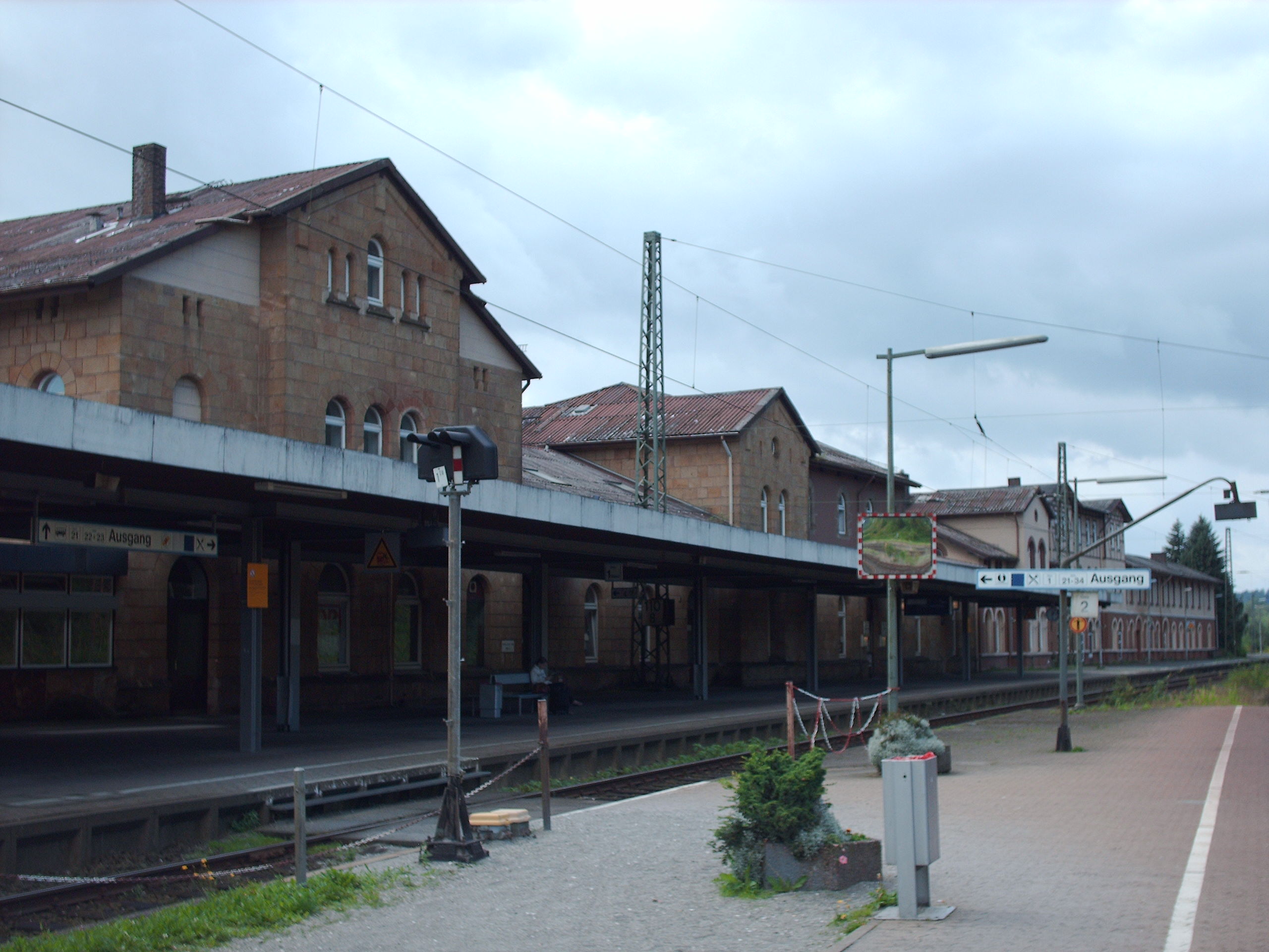
Bad Driburg () is a town and spa in Höxter district in North Rhine-Westphalia, Germany, situated on the river Aa and the Altenbeken–Kreiensen railway. Geography Bad Driburg lies on the eastern slopes of the Eggegebirge which is roughly 20 km east of Paderborn. Constituent communities Bad Driburg consists of 10 districts: * Alhausen * Driburg * Dringenberg with Siebenstern * Erpentrup * Herste * Kühlsen * Langeland * Neuenheerse * Pömbsen with Bad Hermannsborn * Reelsen History Prehistory Archaeological finds bear witness to settlement in the Driburg area between about 3000 and 1800 BC, in the Middle and New Stone Age. Further important finds from the Bronze Age attest to quite a high culture living in the area between about 1800 and 600 BC. Ancient times Finds of potsherds and above all coins dating up to AD 15 show at least that there was peaceful trade between the Romans and the Cherusci, a Germanic tribe living in the area in antiquity. Middle Ages In 772, ... [...More Info...] [...Related Items...] OR: [Wikipedia] [Google] [Baidu] |
List Of Rivers Of North Rhine-Westphalia
A list of rivers of North Rhine-Westphalia, Germany: A * Aa, left tributary of the Möhne * Aa, left tributary of the Nethe * Aa, left tributary of the Werre * Aabach, tributary of the Afte * Aabach, small river in the Ems river system *Abbabach *Abrocksbach * Afte *Agger * Ahler Bruchgraben * Ahr * Ahre *Ahse *Alaunbach *Albaumer Bach * Alche * Alme * Alte Emscher *Alte Hessel *Alte Issel * Altenau *Angel * Angerbach * Ankerbach *Arbach * Armuthsbach * Arpe, left tributary of the Wenne joining it at Berge (a district of Meschede) * Arpe, left tributary of the Wenne joining it at Niederberndorf (a district of Schmallenberg) *Arzdorfer Bach, alternative name for Godesberger Bach * Asbeke * Asdorf * Aue *Auelsbach * Auer Bach *Aupke *Axtbach B *Baagebach * Baarbach * Babenhausener Bach *Bachseifen *Bachumer Bach * Banfe * Bärenbach * Bastau * Beberbach *Beckendorfer Mühlenbach * Bega *Beilbach *Beke * Bekelbach * Belgenbach *Bendahler Bach * Benfe *Bennier Graben * Bentgraben *B ... [...More Info...] [...Related Items...] OR: [Wikipedia] [Google] [Baidu] |
Ashlar
Ashlar () is finely dressed (cut, worked) stone, either an individual stone that has been worked until squared, or a structure built from such stones. Ashlar is the finest stone masonry unit, generally rectangular cuboid, mentioned by Vitruvius as opus isodomum, or less frequently trapezoidal. Precisely cut "on all faces adjacent to those of other stones", ashlar is capable of very thin joints between blocks, and the visible face of the stone may be quarry-faced or feature a variety of treatments: tooled, smoothly polished or rendered with another material for decorative effect. One such decorative treatment consists of small grooves achieved by the application of a metal comb. Generally used only on softer stone ashlar, this decoration is known as "mason's drag". Ashlar is in contrast to rubble masonry, which employs irregularly shaped stones, sometimes minimally worked or selected for similar size, or both. Ashlar is related but distinct from other stone masonry tha ... [...More Info...] [...Related Items...] OR: [Wikipedia] [Google] [Baidu] |
Calcareous Sinter
Calcareous sinter is a freshwater calcium carbonate deposit, also known as calc-sinter. Deposits are characterised by low porosity and well-developed lamination, often forming crusts or sedimentary rock layers. Calcareous sinter should not be confused with siliceous sinter, which the term sinter more frequently refers to. It has been suggested that the term "sinter" should be restricted to siliceous spring deposits and be dropped for calcareous deposits entirely. Features Calcareous sinter is characterised by laminations of prismatic crystals growing perpendicular to the substrate; laminations are separated by thin layers of microcrystalline carbonate. Calcareous sinter is porous due to the calcareous crystals enclosing many small cavities. Macrophytes are absent, consequently porosity is very low. Exclusion of species is due either to high temperature (travertine), high pH/ionic strength (tufa) or absence of light (speleothems). Pedley (1990) suggests the term be abandoned in ... [...More Info...] [...Related Items...] OR: [Wikipedia] [Google] [Baidu] |
Tufa
Tufa is a variety of limestone formed when carbonate minerals precipitate out of water in unheated rivers or lakes. Geothermally heated hot springs sometimes produce similar (but less porous) carbonate deposits, which are known as travertine. Tufa is sometimes referred to as (meteogene) travertine. It should not be confused with hot spring (thermogene) travertine. Tufa, which is calcareous, should also not be confused with tuff, a porous volcanic rock with a similar etymology that is sometimes also called "tufa". Classification and features Modern and fossil tufa deposits abound with wetland plants; as such, many tufa deposits are characterised by their large macrobiological component, and are highly porous. Tufa forms either in fluvial channels or in lacustrine environments. Ford and Pedley (1996) provide a review of tufa systems worldwide. Fluvial deposits Deposits can be classified by their depositional environment (or otherwise by vegetation or petrographically). P ... [...More Info...] [...Related Items...] OR: [Wikipedia] [Google] [Baidu] |
Brakel, Germany
Brakel () is a town in the district of Höxter in North Rhine-Westphalia, Germany. Geography Location Brakel lies at the midpoint of the district of Höxter between the Eggegebirge and the Weser in the Oberwälder Land nature area in the old Saxon region of Nethegau. Constituent communities Brakel consists of the following centres: ''Heggedörfer'' Auenhausen (population 130), Frohnhausen (population 309) and Hampenhausen (population 54) are Brakel's highest constituent communities, and are sometimes also known as the ''Heggedörfer''. Between 1142 and 1147, these three villages had their first documentary mention. In the 12th and 13th centuries, the Gehrden Monastery had holdings in these three villages. The Heggedörfer, along with the town of Gehrden, were amalgamated into the greater community of Brakel after the old district of Warburg was dissolved. Beller Beller has a population of 187. The village is named by the great fish called "Beller", that joined the r ... [...More Info...] [...Related Items...] OR: [Wikipedia] [Google] [Baidu] |
Istrup
Istrup is one of 19 villages belonging to the city of Blomberg, North Rhine-Westphalia. It is about 4 km away from Blomberg and has a population of about 1600, making it the second-largest village in Blomberg. Infrastructure Istrup is located along the B252, a regional north-south highway. Locally available services include two churches, a graveyard A cemetery, burial ground, gravesite or graveyard is a place where the remains of dead people are buried or otherwise interred. The word ''cemetery'' (from Greek , "sleeping place") implies that the land is specifically designated as a bur ..., a gas station, a bakery, a fast-food place, and a sports ground. References Villages in North Rhine-Westphalia Principality of Lippe {{NorthRhineWestphalia-geo-stub ... [...More Info...] [...Related Items...] OR: [Wikipedia] [Google] [Baidu] |
Hilgenbach
Hilgenbach is a small river of North Rhine-Westphalia, Germany. It flows into the Aa near Bad Driburg. See also *List of rivers of North Rhine-Westphalia A list of rivers of North Rhine-Westphalia, Germany: A * Aa, left tributary of the Möhne * Aa, left tributary of the Nethe * Aa, left tributary of the Werre * Aabach, tributary of the Afte * Aabach, small river in the Ems river system *Abbabach ... Rivers of North Rhine-Westphalia Rivers of Germany {{NorthRhineWestphalia-river-stub ... [...More Info...] [...Related Items...] OR: [Wikipedia] [Google] [Baidu] |
Altenbeken–Kreiensen Railway
The Altenbeken–Kreiensen railway is part of a former long-distance route in Germany from the Ruhr area via Altenbeken, Höxter-Ottbergen, Holzminden, Kreiensen and Seesen towards Berlin. The once continuous double track main line railway is now operated as a single track east of Ottbergen. It runs through the Egge ridge and along the northern edge of the Solling hills. The section in North Rhine-Westphalia up to and including Holzminden is also known as the Egge Railway (german: Eggebahn). History The line from Altenbeken to Godelheim was opened on 1 October 1864 by the Royal Westphalian Railway Company and extended on 10 October 1865 to Holzminden. It connected with the Brunswick Southern Railway, which was opened by the Duchy of Brunswick State Railway between Holzminden and Kreiensen on 10 October 1865, creating a link with Brunswick (Braunschweig). To connect with the Brunswick area the line bypassed the town of Einbeck with two tunnels and a long climb. Originally ... [...More Info...] [...Related Items...] OR: [Wikipedia] [Google] [Baidu] |
Egge (Lower Saxon Hills)
The Egge Hills (german: Eggegebirge, ), or just the Egge (''die Egge'') is a range of forested hills, up to , in the east of the Germany, German state of North Rhine-Westphalia. Geography The Egge extends from the southern tip of the Teutoburg Forest range near Horn-Bad Meinberg and Steinheim, Westphalia southwards to the northern parts of the Sauerland near Marsberg. Its highest point is the ''Preußischer Velmerstot'' at an altitude of 468m. It is part of the Lower Saxon Hills and one of the two main lines of hills within the Teutoburg Forest / Egge Hills Nature Park. It also constitutes part of the watershed between the rivers Rhine and Weser. References External links Hill ranges of Germany Mountains and hills of North Rhine-Westphalia Natural regions of the Upper Weser Uplands {{NorthRhineWestphalia-geo-stub ... [...More Info...] [...Related Items...] OR: [Wikipedia] [Google] [Baidu] |


