|
A69 Road (England)
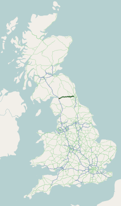
The A69 is a major northern trunk road in England, running east–west across the Pennines, through the counties of Tyne and Wear, Northumberland and Cumbria. Originally, the road started in the centre of Newcastle upon Tyne then later near Birtley, but since the creation of the A1 Western Bypass around Newcastle upon Tyne, it now starts at Denton Burn, a suburb of Newcastle upon Tyne. The route from the A1 junction to Carlisle city centre is 54 miles (87 km). Settlements on the route * Denton Burn * West Denton * Throckley * (Corbridge) * (Hexham) * (Haydon Bridge) * Bardon Mill * Melkridge * (Haltwhistle) * (Brampton) * Warwick Bridge * Warwick-on-Eden * Botcherby * Carlisle Places with parentheses are indicative of historically being on the A69, but have now been bypassed Description of the route The road runs westwards from the A1 at Denton Burn in Newcastle upon Tyne through the suburbs of Denton Burn and West Denton before a junction with the A6085 and the B6323 ... [...More Info...] [...Related Items...] OR: [Wikipedia] [Google] [Baidu] |
A69 Road Map
A69 or A-69 may refer to: * A69 road (England), a road in England * A69 type, another name for the ''D'Estienne d'Orves'' class of French anti-submarine corvettes * Benoni Defense, Encyclopaedia of Chess Openings code * HLA-A69, an HLA-A serotype * Abashiri Station, a station in Abashiri, Hokkaido, Japan, station code A69 {{Letter-NumberCombDisambig ... [...More Info...] [...Related Items...] OR: [Wikipedia] [Google] [Baidu] |
