|
A4117 Road
The A4117 is a single-carriageway 'A road' in western England, largely in Shropshire, which passes through part of the Wyre Forest and Clee Hills. Route It branches from the A456 west of Bewdley, at a place called Fingerpost. Only the first of the route is in Worcestershire,Google maps as immediately after passing through the small village of Far Forest it passes over the Lem Brook and into Shropshire. Heading in a roughly westerly direction, it passes through Cleobury Mortimer, Hopton Wafers and Clee Hill Village. The road's destination is the town of Ludlow,Ordnance Survey mapping where (since 1979) it ends at the Rocks Green roundabout on the A49 bypass. The route is long. Notable bridges are where the road crosses the River Rea on the eastern edge of Cleobury Mortimer, the Hopton Brook at Hopton Wafers, and also the Ledwyche Brook at Henley near Ludlow. B road junctions The A4117 has no 'A road' junctions other than at its two ends. It has five junctions with 'B road ... [...More Info...] [...Related Items...] OR: [Wikipedia] [Google] [Baidu] |
A456 Road
Known as the Hagley Road in Birmingham, the A456 is a main road in England running between Central Birmingham and Woofferton, Shropshire, south of Ludlow. Some sections of the route, for example Edgbaston near Bearwood, are also the route of the Elan Aqueduct which carries Birmingham's water supply from the Elan Valley. Route Birmingham - Kidderminster The A456 now starts in the underpass at the end of Broad Street ''Five Ways'' junction on the Middleway (A4540) in Birmingham. It previously started at the Paradise Circus junction with the former Inner Ring Road (A4400) but originally ran along New Street in the city centre. Heading West through the Birmingham suburbs of Edgbaston and Quinton using a mixture of dual carriageway and single carriageway roads, though maintaining at least 2 lanes in each direction. Just beyond Quinton, the A458 exits towards Halesowen, while the A456 bypasses the town to the South, meeting the M5 at Junction 3. This route was completed in the 1 ... [...More Info...] [...Related Items...] OR: [Wikipedia] [Google] [Baidu] |
Cleehill
Cleehill is a village in south Shropshire, England. It is sometimes written as Clee Hill Village (including the road sign entering the village) to avoid confusion. It lies in the civil parish of Caynham. The market towns of Ludlow and Cleobury Mortimer are both distant, Ludlow to the west and Cleobury to the east. It lies on the slope of Titterstone Clee Hill and, lying between and above sea level, it is one of the highest settlements in the county. Amenities The village has Shropshire's highest school (the Clee Hill Community Primary School). Cleehill has a pub (the ''Golden Cross''), a small convenience store and post office, a fish and chips take-a-way and a bakery with a cafe. Until it closed in 2015, Shropshire's highest public house, at , was The Kremlin (previously the Craven Arms), located on the upper slopes of the village. There is a public car park by the A4117, which affords a considerable view over the Teme valley below and further into the counties of Hereford ... [...More Info...] [...Related Items...] OR: [Wikipedia] [Google] [Baidu] |
Escape Lane
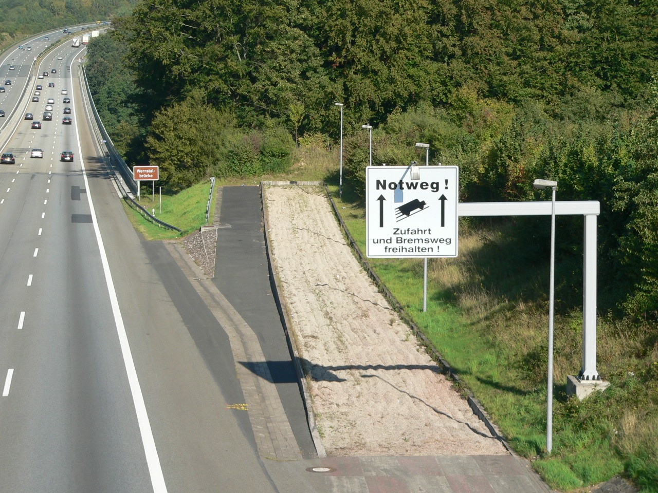
A runaway truck ramp, runaway truck lane, escape lane, emergency escape ramp, or truck arrester bed is a traffic device that enables vehicles which are having braking problems to safely stop. It is typically a long, sand- or gravel-filled lane connected to a steep downhill grade section of a main road, and is designed to accommodate large trucks or buses. It allows a moving vehicle's kinetic energy to be dissipated gradually in a controlled and relatively harmless way, helping the operator stop it safely. Design Emergency escape ramps are usually located in mountainous areas which cause high construction costs and present difficult site selection. A ramp may cost US$1 million. Designs include: *''Arrester bed'': a gravel-filled ramp adjacent to the road that uses rolling resistance to stop the vehicle. The required length of the bed depends on the mass and speed of the vehicle, the grade of the arrester bed, and the rolling resistance provided by the gravel. *''Gravity escape ... [...More Info...] [...Related Items...] OR: [Wikipedia] [Google] [Baidu] |
Angelbank
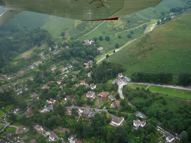
Angelbank (or Angel Bank) is a small settlement in south Shropshire, England. It is located on the A4117 road, between Ludlow and Cleehill; the road goes uphill towards Clee Hill Village and this incline is called Angel Bank. There is also a lane leading off this main road called Angel Lane.Ordnance Survey , nativename_a = , nativename_r = , logo = Ordnance Survey 2015 Logo.svg , logo_width = 240px , logo_caption = , seal = , seal_width = , seal_caption = , picture = , picture_width = , picture_caption = , formed = , preceding1 = , di ... mapping References External links * Hamlets in Shropshire {{Shropshire-geo-stub ... [...More Info...] [...Related Items...] OR: [Wikipedia] [Google] [Baidu] |
Shropshire Hills AONB
The Shropshire Hills area, in the English county of Shropshire, is designated as an Area of Outstanding Natural Beauty ( AONB). It is located in the south of the county, extending to its border with Wales. Designated in 1958, the area encompasses of land primarily in south-west Shropshire, taking its name from the upland region of the Shropshire Hills. The A49 road and Welsh Marches Railway Line bisect the area north-south, passing through or near Shrewsbury, Church Stretton, Craven Arms and Ludlow. Hills The Shropshire Hills, located in the Welsh Marches, are relatively high: the highest point in the county, Brown Clee Hill, near Ludlow, has an altitude of . This gives Shropshire the 13th highest hill per county in England. Titterstone Clee Hill, part of the Clee Hills, is nearly as high as Brown Clee, at , making it the third highest hill in the county. The Stiperstones are the second highest, at , and are notable for their tors of quartzite; particularly notable ar ... [...More Info...] [...Related Items...] OR: [Wikipedia] [Google] [Baidu] |
Snow
Snow comprises individual ice crystals that grow while suspended in the atmosphere—usually within clouds—and then fall, accumulating on the ground where they undergo further changes. It consists of frozen crystalline water throughout its life cycle, starting when, under suitable conditions, the ice crystals form in the atmosphere, increase to millimeter size, precipitate and accumulate on surfaces, then metamorphose in place, and ultimately melt, slide or sublimate away. Snowstorms organize and develop by feeding on sources of atmospheric moisture and cold air. Snowflakes nucleate around particles in the atmosphere by attracting supercooled water droplets, which freeze in hexagonal-shaped crystals. Snowflakes take on a variety of shapes, basic among these are platelets, needles, columns and rime. As snow accumulates into a snowpack, it may blow into drifts. Over time, accumulated snow metamorphoses, by sintering, sublimation and freeze-thaw. Where the climate is co ... [...More Info...] [...Related Items...] OR: [Wikipedia] [Google] [Baidu] |
Anchor, Shropshire
Anchor is a remote hamlet in southwest Shropshire, England. The hamlet is the most westerly place in Shropshire. Geography Anchor lies only 400 metres away from the border with Wales. The B4368 road runs through the hamlet on its way between the towns of Clun (in England) to Newtown (in Wales). The road reaches an elevation of , making it the highest classified road in Shropshire. The point at which the B4368 crosses over the Nant Rhuddwr (a small watercourse that runs along this part of the English-Welsh border; also known as the Rhuddwr Brook in English) into Wales is known as Anchor Bridge. Anchor is also the most westerly settlement in England on the English-Welsh border, with the most westerly point of the border being approximately to the southwest. The tripoint of Shropshire, Montgomeryshire and Radnorshire is near this most westerly point, located at the confluence of the Nant Rhydyfedw and the Nant Rhuddwr. Anchor is on the western fringes of the Clun Forest and t ... [...More Info...] [...Related Items...] OR: [Wikipedia] [Google] [Baidu] |
Titterstone Clee Hill
Titterstone Clee Hill, sometimes referred to as Titterstone Clee or Clee Hill, is a prominent hill in the rural English county of Shropshire, rising at the summit to above sea level. It is one of the Clee Hills, in the Shropshire Hills Area of Outstanding Natural Beauty. The nearest town to the hill is Ludlow, which can be seen from parts of Cleehill village. Geography Titterstone Clee is the third-highest hill in Shropshire, surpassed only by the nearby Brown Clee Hill () and Stiperstones (). Much of the higher part of the hill is common land, used for the grazing of sheep, air traffic control services and both working and disused quarries. The summit of Titterstone Clee is bleak, treeless and shaped by decades of quarrying. Many of the industrial structures still remain. Most of the summit of the hill is affected by man-made activity, the result of hill fort construction during the Bronze and Iron Ages and, more recently, by years of mining for coal and quarrying for dolerit ... [...More Info...] [...Related Items...] OR: [Wikipedia] [Google] [Baidu] |
Mountain Pass
A mountain pass is a navigable route through a mountain range or over a ridge. Since many of the world's mountain ranges have presented formidable barriers to travel, passes have played a key role in trade, war, and both Human migration, human and animal migration throughout history. At lower elevations it may be called a hill pass. A mountain pass is typically formed between two volcanic peaks or created by erosion from water or wind. Overview Mountain passes make use of a gap (landform), gap, saddle (landform), saddle, col or notch (landform), notch. A topographic saddle is analogous to the mathematical concept of a saddle surface, with a saddle point marking the highest point between two valleys and the lowest point along a ridge. On a topographic map, passes are characterized by contour lines with an hourglass shape, which indicates a low spot between two higher points. In the high mountains, a difference of between the summit and the mountain is defined as a mountain pas ... [...More Info...] [...Related Items...] OR: [Wikipedia] [Google] [Baidu] |
A4117 Over Titterstone Clee Hill
The A4117 is a single-carriageway ' A road' in western England, largely in Shropshire, which passes through part of the Wyre Forest and Clee Hills. Route It branches from the A456 west of Bewdley, at a place called Fingerpost. Only the first of the route is in Worcestershire,Google maps as immediately after passing through the small village of Far Forest it passes over the Lem Brook and into Shropshire. Heading in a roughly westerly direction, it passes through Cleobury Mortimer, Hopton Wafers and Clee Hill Village. The road's destination is the town of Ludlow,Ordnance Survey mapping where (since 1979) it ends at the Rocks Green roundabout on the A49 bypass. The route is long. Notable bridges are where the road crosses the River Rea on the eastern edge of Cleobury Mortimer, the Hopton Brook at Hopton Wafers, and also the Ledwyche Brook at Henley near Ludlow. B road junctions The A4117 has no 'A road' junctions other than at its two ends. It has five junctions with 'B roa ... [...More Info...] [...Related Items...] OR: [Wikipedia] [Google] [Baidu] |
Bridgnorth
Bridgnorth is a town in Shropshire, England. The River Severn splits it into High Town and Low Town, the upper town on the right bank and the lower on the left bank of the River Severn. The population at the 2011 Census was 12,079. History Bridgnorth is named after a bridge over the River Severn, which was built further north than an earlier bridge at Quatford. The earliest historical reference to the town is in 895, when it is recorded that the Danes created a camp at ''Cwatbridge''; subsequently in 912, Æthelfleda constructed a mound on the west bank of the River Severn, or possibly on the site of Bridgnorth Castle, as part of an offensive against the Danes. Earliest names for Bridgnorth include Brigge, Brug and Bruges, all referring to its position on the Severn. After the Norman conquest, William I granted the manor of Bridgnorth to Roger de Montgomerie. The town itself was not created until 1101, when Robert of Bellême, 3rd Earl of Shrewsbury, the son of Roger de M ... [...More Info...] [...Related Items...] OR: [Wikipedia] [Google] [Baidu] |
Tenbury Wells
Tenbury Wells (locally Tenbury) is a market town and Civil parishes in England, civil parish in the northwestern extremity of the Malvern Hills District of Worcestershire, England. Its northern border adjoins Shropshire, and at the 2011 census it had a population of 3,777. Geography Tenbury Wells lies on the south bank of the River Teme; the river forms the border between Shropshire and Worcestershire. The settlement of Burford, Shropshire, Burford in Shropshire lies on the north bank of the river. History From 1894 to 1974, it was a rural district, comprising the town itself and villages such as Stoke Bliss, Eastham, Worcestershire, Eastham and Rochford, Worcestershire, Rochford. From 1974 Tenbury was in the District of Leominster until it became part of Malvern Hills (district), Malvern Hills District when Leominster District Council was taken over by Herefordshire Council in April 1998. The history of Tenbury Wells extends as far back as the Iron Age. The town has been descr ... [...More Info...] [...Related Items...] OR: [Wikipedia] [Google] [Baidu] |


