|
A360 Road
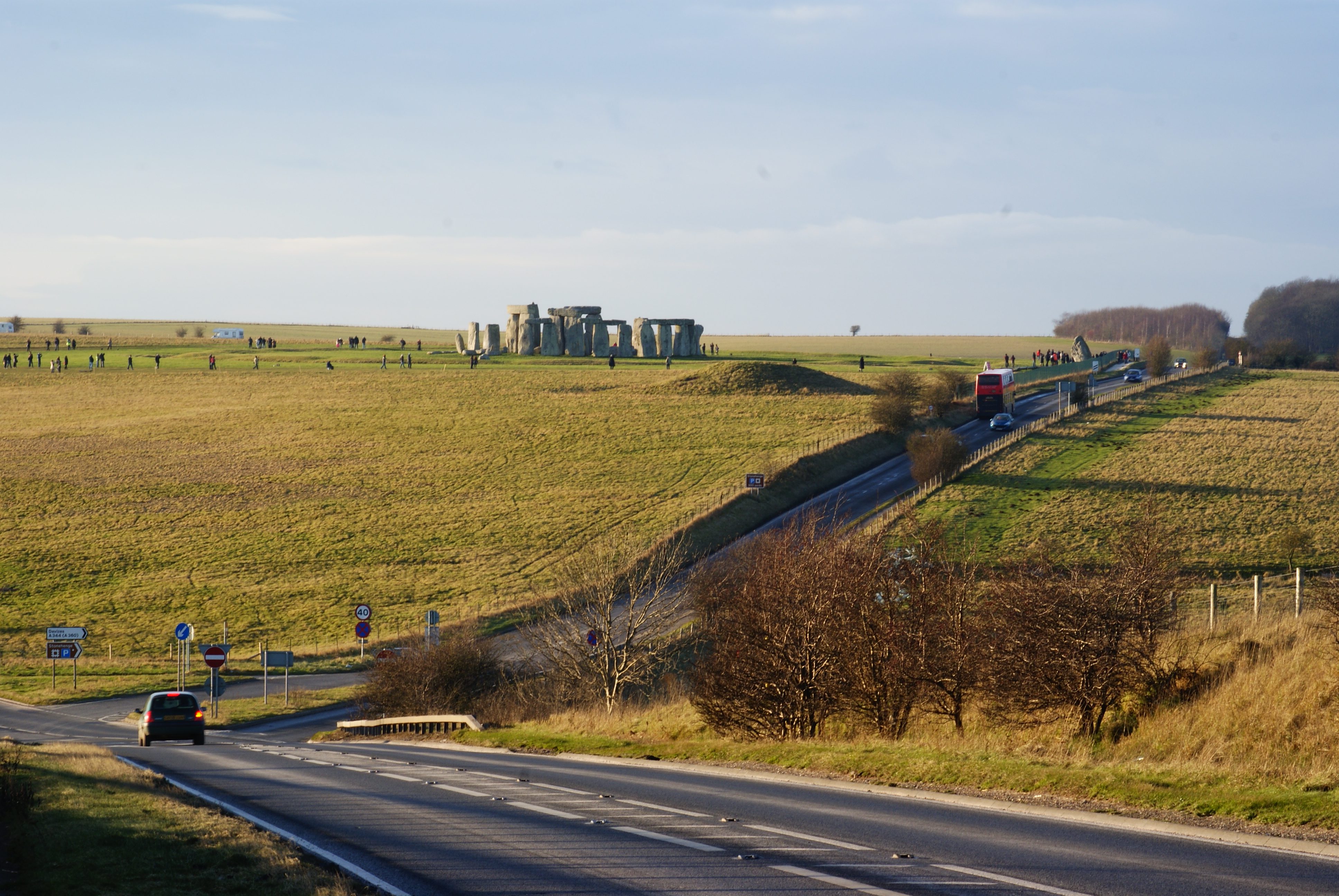
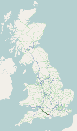
The A360 is an A road in Wiltshire, England, running from Devizes to Salisbury, through the villages of Potterne, West Lavington, Tilshead, and Shrewton, and passing near the Stonehenge ancient monument. Route The road is long and starts at the junction of the A342 and A361 roads in the town of Devizes. It continues southwards towards Salisbury Plain, passing West Lavington via Potterne, then south-east to Shrewton via Tilshead. It turns right at Airman's Corner (a junction with an entrance to Stonehenge and the B3086), crosses the A303 and continues southwards into Salisbury, joining the A36 near the centre of the city. History Original route The A360 originally ran south from Shrewton, following the River Till via Winterbourne Stoke to join the A36 beyond Stapleford. This section was re-routed sometime before 1958, at first eastward for about along the A344 Amesbury road, then turning south near Stonehenge onto the former Devizes-Salisbury road; a straighter route on ... [...More Info...] [...Related Items...] OR: [Wikipedia] [Google] [Baidu] |
Devizes
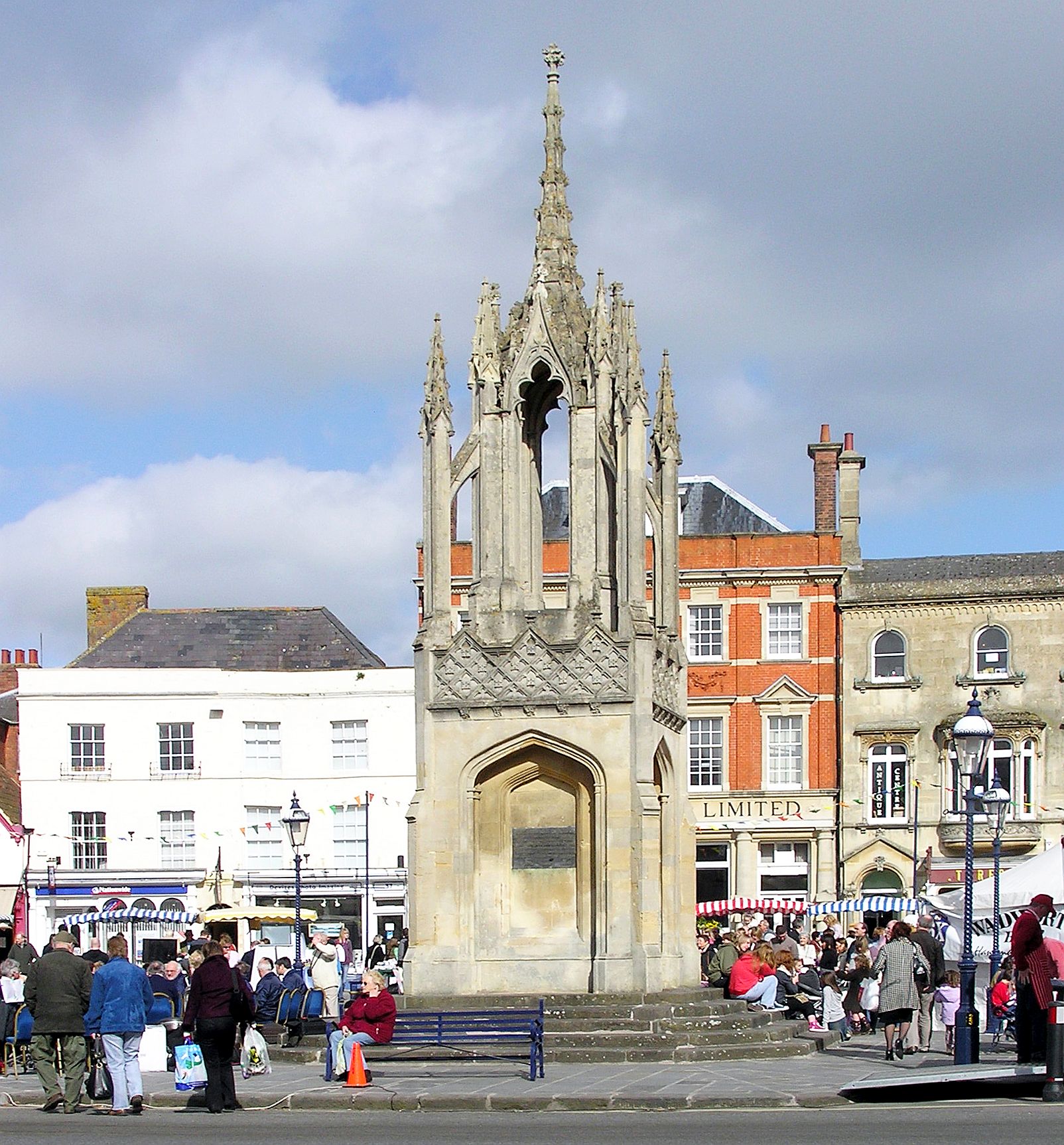
Devizes is a market town and civil parish in Wiltshire, England. It developed around Devizes Castle, an 11th-century Norman architecture, Norman castle, and received a charter in 1141. The castle was besieged during the Anarchy, a 12th-century civil war between Stephen of England and Empress Matilda, and again during the English Civil War when the Cavaliers lifted the siege at the Battle of Roundway Down. Devizes remained under Royalist control until 1645, when Oliver Cromwell attacked and forced the Royalists to surrender. The castle was Slighting, destroyed in 1648 on the orders of Parliament, and today little remains of it. From the 16th century Devizes became known for its textiles, and by the early 18th century it held the largest corn market in the West Country, constructing the Corn Exchange in 1857. In the 18th century, brewing, curing of tobacco, and Snuff (tobacco), snuff-making were established. The Wadworth Brewery was founded in the town in 1875. Standing at the w ... [...More Info...] [...Related Items...] OR: [Wikipedia] [Google] [Baidu] |
A36 Road
The A36 is a trunk road and primary route in southwest England that links the port city of Southampton to the city of Bath. At Bath, the A36 connects with the A4 to Bristol, thus providing a road link between the major ports of Southampton and Bristol. It also provides a link between Bristol and London via the A303. Route Originally, the A36 continued to Avonmouth, beyond Bristol, but this section was renumbered to the A4. Within Bath the A36 acts as a ring road on the southern side of the river, from the junction with the A4 at Newbridge to the west of the city. From here traffic can continue to Bristol on the A4 or to Wells and Weston-super-Mare via the A39 and A368 roads. Another link to the A4 on the eastern side at Cleveland Bridge, which provides a route to the M4 motorway via the A46, is highly congested. The A36 leaves Bath in an easterly direction towards Bathampton, then turns south to follow the Avon through its steep-sided valley, climbing out of the val ... [...More Info...] [...Related Items...] OR: [Wikipedia] [Google] [Baidu] |
Bowl Barrow
A bowl barrow is a type of burial mound or tumulus. A barrow is a mound of earth used to cover a tomb. The bowl barrow gets its name from its resemblance to an upturned bowl. Related terms include ''cairn circle'', ''cairn ring'', ''howe'', ''kerb cairn'', ''tump'' and ''rotunda grave''. Description Bowl barrows were created from the Neolithic through to the Bronze Age in Great Britain. A bowl barrow is an approximately hemispherical mound covering one or more Inhumations or cremations. Where the mound is composed entirely of stone, rather than earth, the term cairn replaces the word barrow. The mound may be simply a mass of earth or stone, or it may be structured by concentric rings of posts, low stone walls, or upright stone slabs. In addition, the mound may have a kerb of stones or wooden posts. Barrows were usually built in isolation in various situations on plains, valleys and hill slopes, although the most popular sites were those on hilltops. Bowl barrows were first ide ... [...More Info...] [...Related Items...] OR: [Wikipedia] [Google] [Baidu] |
Camp Down
Camp Down () is a biological Site of Special Scientific Interest in Wiltshire in South West England. It was designated as such in 1965. Location The area overlooks the valley of the River Avon, and is about northwest of Salisbury. It lies east of the A360 road, which runs from Salisbury to Devizes via Stonehenge. Environment The down has a chalk grassland that has been well grazed and contains numerous plants, as is typical of grass sites in South Wilshire. Over 20 types of grasses and sedges have been recorded at Camp Down, including red fescue, upright brome, quaking-grass, crested hair-grass and glaucous sedge. The turf contains a variety of herbs, including dwarf thistle and ox-eye daisy. There are a significant number of orchids, particularly ''Gymnadenia conopsea''. There are a number of young sycamore trees on the site, alongside patches of scrub and scattered bushes. The environment of chalk grassland mixed with scattered scrub means Camp Down is frequented to a ... [...More Info...] [...Related Items...] OR: [Wikipedia] [Google] [Baidu] |
Tank
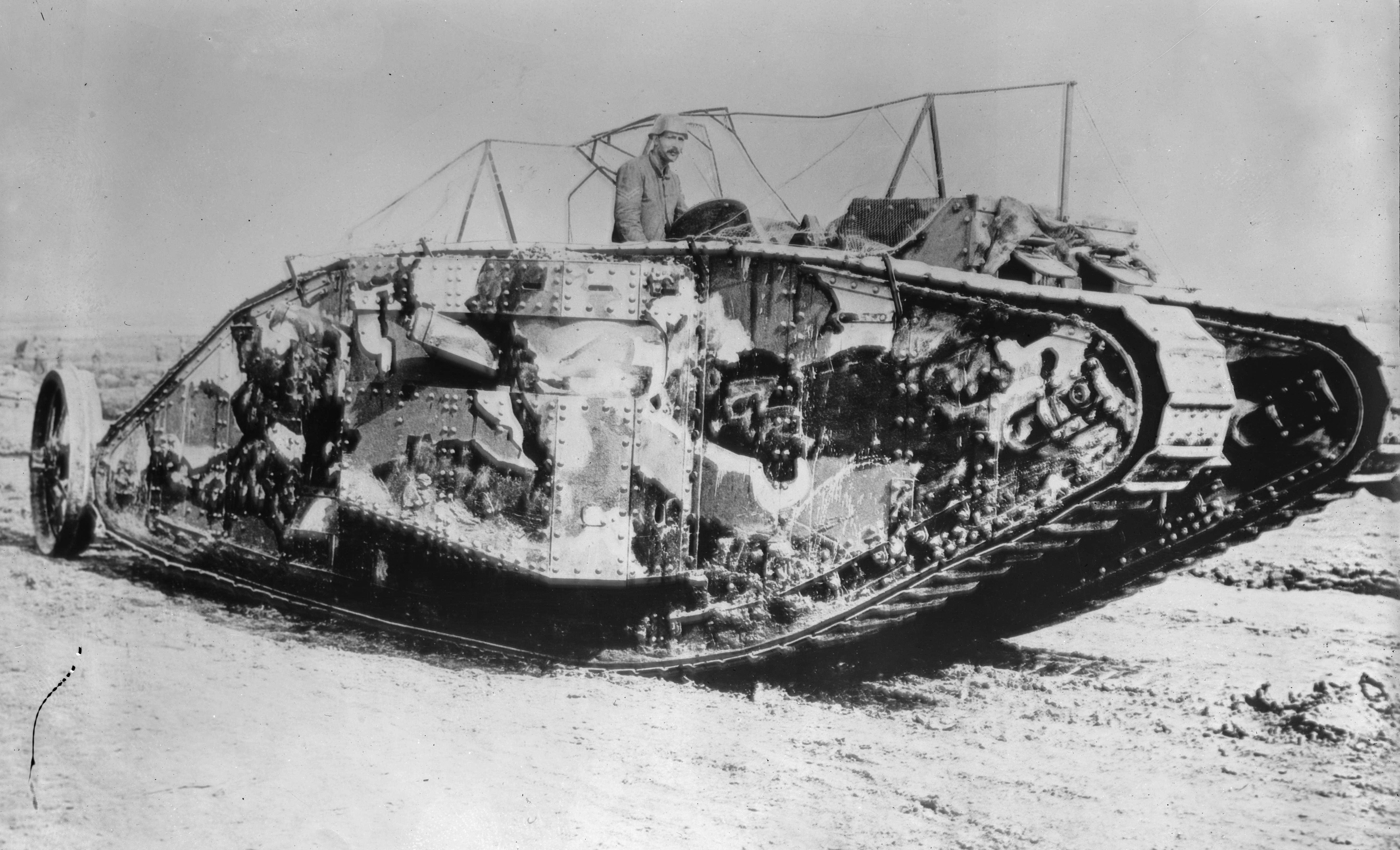
A tank is an armoured fighting vehicle intended as a primary offensive weapon in front-line ground combat. Tank designs are a balance of heavy firepower, strong armour, and good battlefield mobility provided by tracks and a powerful engine; usually their main armament is mounted in a turret. They are a mainstay of modern 20th and 21st century ground forces and a key part of combined arms combat. Modern tanks are versatile mobile land weapons platforms whose main armament is a large-caliber tank gun mounted in a rotating gun turret, supplemented by machine guns or other ranged weapons such as anti-tank guided missiles or rocket launchers. They have heavy vehicle armour which provides protection for the crew, the vehicle's munition storage, fuel tank and propulsion systems. The use of tracks rather than wheels provides improved operational mobility which allows the tank to overcome rugged terrain and adverse conditions such as mud and ice/snow better than wheeled vehicles, ... [...More Info...] [...Related Items...] OR: [Wikipedia] [Google] [Baidu] |
Ministry Of Defence (United Kingdom)
The Ministry of Defence (MOD or MoD) is the department responsible for implementing the defence policy set by His Majesty's Government, and is the headquarters of the British Armed Forces. The MOD states that its principal objectives are to defend the United Kingdom of Great Britain and Northern Ireland and its interests and to strengthen international peace and stability. The MOD also manages day-to-day running of the armed forces, contingency planning and defence procurement. The expenditure, administration and policy of the MOD are scrutinised by the Defence Select Committee, except for Defence Intelligence which instead falls under the Intelligence and Security Committee of Parliament. History During the 1920s and 1930s, British civil servants and politicians, looking back at the performance of the state during the First World War, concluded that there was a need for greater co-ordination between the three services that made up the armed forces of the United Kingdom: t ... [...More Info...] [...Related Items...] OR: [Wikipedia] [Google] [Baidu] |
Salisbury Plain Training Area
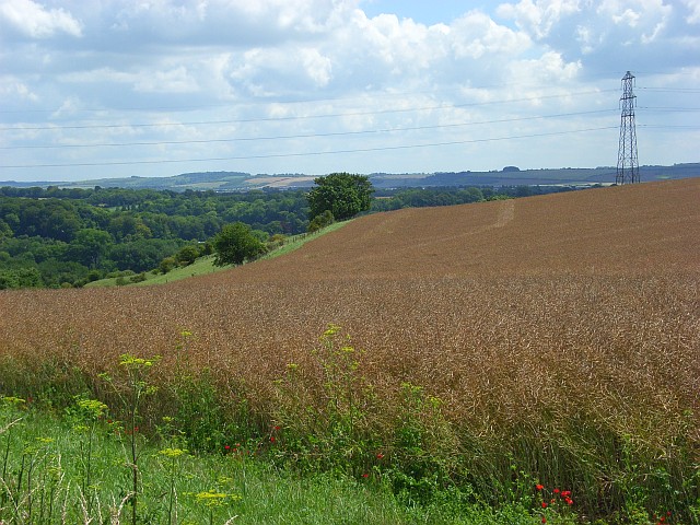
Salisbury Plain is a chalk plateau in the south western part of central southern England covering . It is part of a system of chalk downlands throughout eastern and southern England formed by the rocks of the Chalk Group and largely lies within the county of Wiltshire, but stretches into Hampshire. The plain is famous for its rich archaeology, including Stonehenge, one of England's best known landmarks. Large areas are given over to military training and thus the sparsely populated plain is the biggest remaining area of calcareous grassland in northwest Europe. Additionally the plain has arable land, and a few small areas of beech trees and coniferous woodland. Its highest point is Easton Hill. Physical geography The boundaries of Salisbury Plain have never been truly defined, and there is some difference of opinion as to its exact area. The river valleys surrounding it, and other downs and plains beyond them loosely define its boundaries. To the north the scarp of the d ... [...More Info...] [...Related Items...] OR: [Wikipedia] [Google] [Baidu] |
Tank Crossing Place, A360 - Geograph
A tank is an armoured fighting vehicle intended as a primary offensive weapon in front-line ground combat. Tank designs are a balance of heavy firepower, strong armour, and good battlefield mobility provided by tracks and a powerful engine; usually their main armament is mounted in a turret. They are a mainstay of modern 20th and 21st century ground forces and a key part of combined arms combat. Modern tanks are versatile mobile land weapons platforms whose main armament is a large- caliber tank gun mounted in a rotating gun turret, supplemented by machine guns or other ranged weapons such as anti-tank guided missiles or rocket launchers. They have heavy vehicle armour which provides protection for the crew, the vehicle's munition storage, fuel tank and propulsion systems. The use of tracks rather than wheels provides improved operational mobility which allows the tank to overcome rugged terrain and adverse conditions such as mud and ice/snow better than wheeled vehicle ... [...More Info...] [...Related Items...] OR: [Wikipedia] [Google] [Baidu] |
A344 Road (England)
The A344 was an A road in the English county of Wiltshire. Until 2013 it ran from its junction with the A303 at Stonehenge, northwest to its junction with the A360, away. The A344 was once part of a longer route, from Andover (Hampshire) in the east to Warminster in the west. The section from Andover to Amesbury was redesignated as the A303 when the new route to the South West was created as an alternative to the A30. A section between Airman's Corner near Stonehenge and Shrewton was (sometime before 1958) shared with the re-routed A360. The western section, from Shrewton to Heytesbury near Warminster, has been re-classified as the B390. The remaining section passed close to Stonehenge. In July 2012, work began on a £27m project which involved the closure and grassing over of the A344 between Stonehenge Bottom and the monument, with the pedestrian underpass beneath the road being filled in. This section of road was eventually closed in June 2013. The new Stonehenge visit ... [...More Info...] [...Related Items...] OR: [Wikipedia] [Google] [Baidu] |
Stapleford, Wiltshire
Stapleford is a village and civil parish about north of Wilton, Wiltshire, England. The village is on the River Till just above its confluence with the River Wylye. The village is on the B3083 road, which joins the A36 at the southern end of the village. The parish includes the hamlet of Serrington, on the A36 west of the B3083 junction. History The Domesday survey of 1086 recorded an estate held by Swein at Stapleford, with 28 households. The manor passed to the Hussey family; in part, from the late 14th century the Sturmy family and then the Seymours, including John Seymour (1474–1536), father of Jane Seymour, Henry VIII's third wife. Land remained in Seymour ownership until the 1940s. Other land passed to the Giffards in the 14th century, and through the Mautravers, in 1405 to the Earls of Arundel, then from 1580 various owners including Sir Richard Grobham Howe, 2nd Baronet, the Barons Chedworth and (from 1808 until c.1896) the Barons Ashburton. By the Till to ... [...More Info...] [...Related Items...] OR: [Wikipedia] [Google] [Baidu] |
Winterbourne Stoke
Winterbourne Stoke is a village and civil parish in Wiltshire, England, about west of Amesbury and west of the prehistoric monument of Stonehenge. The village is on the River Till at the southern edge of Salisbury Plain, on both sides of a single-carriageway stretch of the busy A303 trunk road. History Especially in its east part, the parish is rich in archaeological remains, beginning in the Neolithic period. The easternmost part of the parish (beyond the A360/B3086) is within the Stonehenge section of the Stonehenge and Avebury World Heritage site. This area includes the Lesser Cursus earthwork and adjacent barrows, and the western tip of the Greater Cursus (which predates Stonehenge) and the nearby Cursus Barrows. North of the village, on the slopes of the Till valley, are two cemetery sites with round barrows and later earthworks. A Romano-British settlement, medieval earthworks and a field system have been identified on Winterbourne Stoke Down, northeast of the villag ... [...More Info...] [...Related Items...] OR: [Wikipedia] [Google] [Baidu] |
River Till, Wiltshire
The River Till rises near Tilshead on Salisbury Plain in the English county of Wiltshire. It flows for about south and south-east, through Orcheston, Maddington, Shrewton, Winterbourne Stoke, Berwick St James and Stapleford, to join the River Wylye. The upper part of the river is a winterbourne, flowing only in winter and early spring. The whole length of the Till has been designated as a Site of Special Scientific Interest, as its vegetation includes water crowfoot which provides habitat for fish and snails. Although Tilshead village appears to be named from the river, the opposite applies. The village name was first used in the 16th century, and comes from older names based on "Theodwulf's hide" (recorded in Domesday Book as ''Tidolthide''). The river was called the Winterbourne until around the start of the 20th century, when the name River Till began to be used on Ordnance Survey maps. Water quality The Environment Agency measures the water quality of the river syste ... [...More Info...] [...Related Items...] OR: [Wikipedia] [Google] [Baidu] |


_(Tony_Radakin_cropped).jpg)


