|
A127
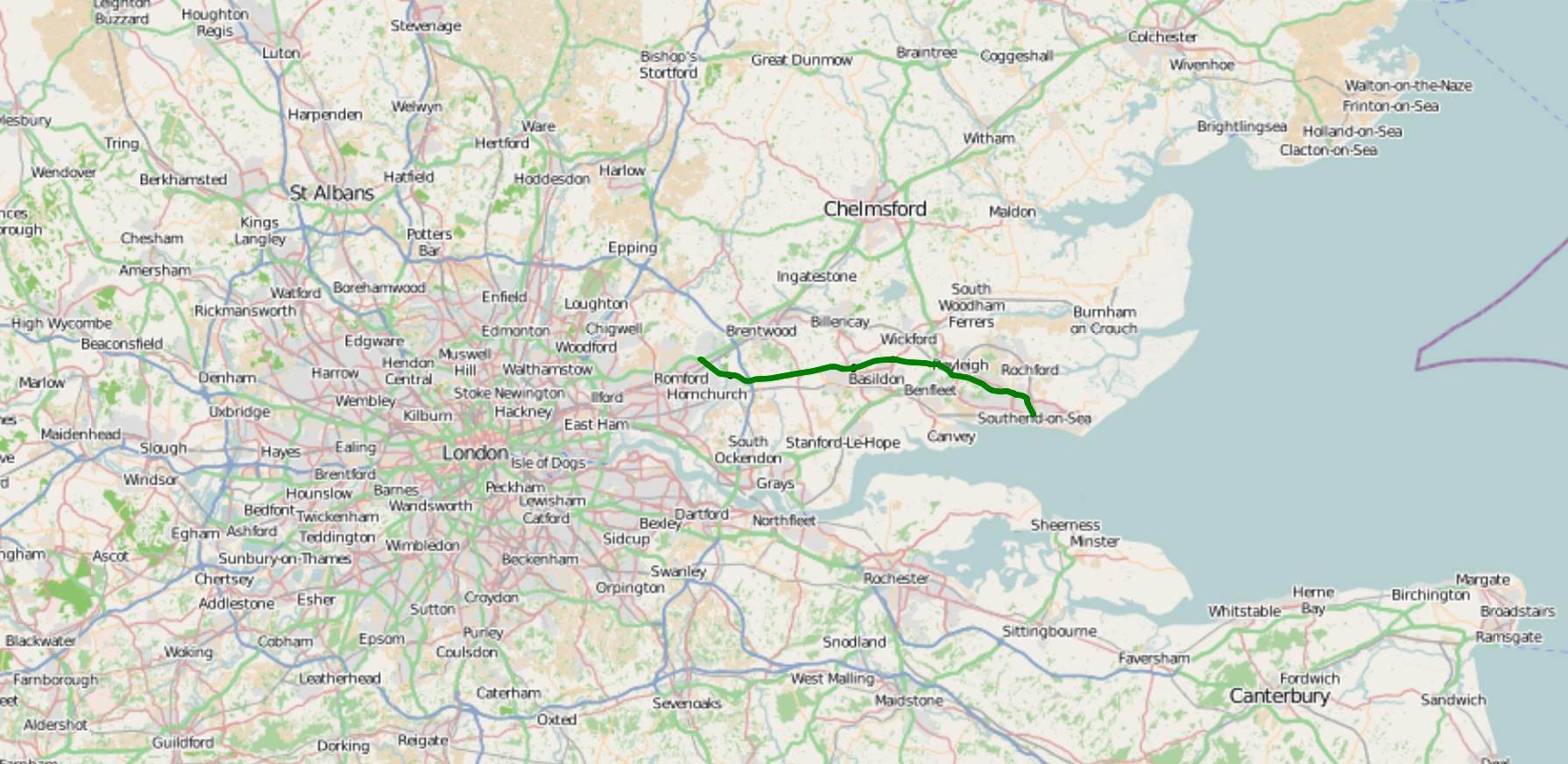
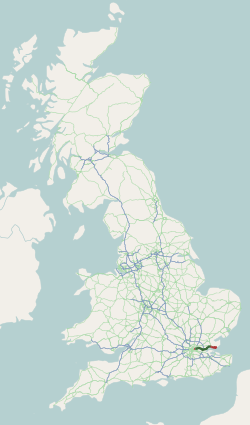
The A127, also known as the Southend Arterial Road, is a major road in Essex, England. It was constructed as a new arterial road project in the 1920s, linking Romford with Southend-on-Sea, replacing the older A13. Formerly classified as a trunk road, it was "de-trunked" in 1997. It is known as the ''Southend Arterial Road'' except for part of its length in Southend-on-Sea. It is also streetlit for its whole length despite its majority coverage through rural land. Route The A127 starts as a turning off the A12 at Gallows Corner in the London Borough of Havering. Traffic heading towards London goes over a flyover and joins the A12 traffic which merges onto the slip-road from the roundabout below, which is where the A127 ends. Traffic heading towards Southend also uses the flyover as well as slip roads. Its first significant junction is a crossroads after (''Squirrels Heath'') with ''Squirrels Heath Road'' and ''Ardleigh Green Road''. There are traffic lights here, but aft ... [...More Info...] [...Related Items...] OR: [Wikipedia] [Google] [Baidu] |
Basildon
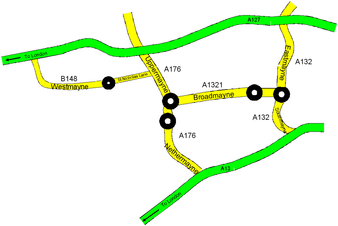
Basildon ( ) is the largest town in the borough of Basildon, within the county of Essex, England. It has a population of 107,123. In 1931 the parish had a population of 1159. It lies east of Central London, south of the city of Chelmsford and west of Southend-on-Sea. Nearby smaller towns include Billericay to the north-west, Wickford to the north-east and South Benfleet to the south-east. It was created as a new town after World War II in 1948, to accommodate the London population overspill from the conglomeration of four small villages, namely Pitsea, Laindon, Basildon (the most central of the four) and Vange. The local government district of Basildon, which was formed in 1974 and received borough status in 2010, encapsulates a larger area than the town itself; the two neighbouring towns of Billericay and Wickford, as well as rural villages and smaller settlements set among the surrounding countryside, fall within its borders. Basildon Town is one of the most densely populat ... [...More Info...] [...Related Items...] OR: [Wikipedia] [Google] [Baidu] |
A13 Road (Great Britain)
The A13 is a major road in England linking Central London with east London and south Essex. Its route is similar to that of the London, Tilbury and Southend line via Rainham, Grays, Tilbury & Stanford-Le-Hope, and runs the entire length of the northern Thames Gateway area, terminating on the Thames Estuary at Shoeburyness. It is a trunk road between London and the Tilbury junction, a primary route between there and Sadlers Hall Farm near South Benfleet, and a non-primary route between there and Shoeburyness. Route London The A13 used to start at Aldgate Pump; but now begins at the junction with the A11 at what used to be the Aldgate one way system in east London and heads eastwards through the boroughs of Tower Hamlets, Newham, Barking & Dagenham and Havering before reaching the Greater London boundary. Commercial Road and East India Dock Road At the cental London end, Commercial Road and East India Dock Road form one of two main arteries through the historic East End (th ... [...More Info...] [...Related Items...] OR: [Wikipedia] [Google] [Baidu] |
A1015 Road
List of A roads in zone 1 in Great Britain beginning north of the River Thames The River Thames ( ), known alternatively in parts as the The Isis, River Isis, is a river that flows through southern England including London. At , it is the longest river entirely in England and the Longest rivers of the United Kingdom, se ..., east of the A1 (roads beginning with 1). Single- and double-digit roads Triple-digit roads Four-digit roads 1000s 1100s 1200s and higher References {{DEFAULTSORT:A Roads in Zone 1 of the Great Britain Numbering Scheme 1 1 1 ... [...More Info...] [...Related Items...] OR: [Wikipedia] [Google] [Baidu] |
M25 Motorway
The M25 or London Orbital Motorway is a major road encircling most of Greater London. The motorway is one of the most important roads in the UK and one of the busiest. Margaret Thatcher opened the final section in 1986, making the M25 the longest ring road in Europe upon opening. The Dartford Crossing completes the orbital route but is not classed as motorway; it is classed as a trunk road and designated as the A282. In some cases, including notable legal contexts such as the Communications Act 2003, the M25 is used as a ''de facto'' alternative boundary for Greater London. In the 1944 ''Greater London Plan'', Patrick Abercrombie proposed an orbital motorway around London. This evolved into the London Ringways project in the early 1960s, and by 1966, planning had started on two projects, London Ringways#Ringway 3, Ringway 3 to the north and London Ringways#Ringway 4, Ringway 4 to the south. By the time the first sections opened in 1975, it was decided the ringways would be com ... [...More Info...] [...Related Items...] OR: [Wikipedia] [Google] [Baidu] |
Southend-on-Sea
Southend-on-Sea (), commonly referred to as Southend (), is a coastal city and unitary authority area with borough status in southeastern Essex, England. It lies on the north side of the Thames Estuary, east of central London. It is bordered to the north by Rochford and to the west by Castle Point. It is home to the longest pleasure pier in the world, Southend Pier. London Southend Airport is located north of the city centre. Southend-on-Sea originally consisted of a few poor fishermen's huts and farms at the southern end of the village of Prittlewell. In the 1790s, the first buildings around what was to become the High Street of Southend were completed. In the 19th century, Southend's status of a seaside resort grew after a visit from Princess Caroline of Brunswick, and Southend Pier was constructed. From the 1960s onwards, the city declined as a holiday destination. Southend redeveloped itself as the home of the Access credit card, due to its having one of the UK's first ... [...More Info...] [...Related Items...] OR: [Wikipedia] [Google] [Baidu] |
A1159 Road
The A1159 road is a short road skirting the north of Southend-on-Sea from Thorpe Bay to London Southend Airport, in the coastal city of Southend-on-Sea, Essex. Route The A1159 commences its journey at Bournes Green Roundabout, its junction with the A13. The road heads northwest as Royal Artillery Way, which skirts the northern edge of the Southend urban area. The road then reaches a roundabout, with access to a housing estate to the south, and a leisure centre to the north. We follow Eastern Avenue, where the A1159 reaches another roundabout, with Fossetts Way giving access to Fossetts Park Retail Centre and Wellesley Hospital, and Sutton Road giving access to Temple Farm Industrial Estate. We then pass over Prittlewell Station, on the c2c line from London Liverpool Street Station / London Fenchurch Street Station to Southend Victoria Station. It then skirts Priory Park to the north as Priory Crescent, before it reaches a junction with the A127. At the junction, the A1159 t ... [...More Info...] [...Related Items...] OR: [Wikipedia] [Google] [Baidu] |
West Horndon
West Horndon is a village and civil parish in the south of the Borough of Brentwood, Essex on the boundary with Thurrock. It is located 20 miles (32 km) east north-east of Charing Cross in London. The civil parish also includes East Horndon and Dunton Hills. The village has its own parish council and forms part of the 'Herongate, Ingrave and West Horndon' ward of Brentwood Council. The local school is West Horndon Primary School, and the village falls within the Brentwood County High catchment area. West Horndon parish was abolished in 1934 and created again in 2003 with new boundaries following a petition by residents in 2002. History West Horndon was an ancient parish in the Barnstable hundred of Essex. It was grouped into the Billericay poor law union and rural sanitary district. It became part of Billericay Rural District in 1894.http://www.visionofbritain.org.uk/unit_page.jsp?u_id=10186389#tab02 In 1934 the parish was abolished when it became part of Brentwood Urban ... [...More Info...] [...Related Items...] OR: [Wikipedia] [Google] [Baidu] |
Billericay
Billericay ( ) is a town and civil parish in the Borough of Basildon, Essex, England. It lies within the London Basin and constitutes a commuter town east of Central London. The town has three secondary schools and a variety of open spaces. It is thought to have been occupied since the Bronze Age. Toponym The origin of the name Billericay is unclear. It was first recorded as "Byllyrica" in 1291. The urban settlement, which was within the manor and parish of Great Burstead, was one of many founded in the late 13th century in an already densely populated rural landscape. Several suggestions for the origin of the place name include: * ''Villa Erica'' (Heather Villa), suggesting a Romano-British origin. * ''bellerīca'', a medieval Latin word meaning 'dyehouse or tanhouse'. * ''billers'', a traditional name for watercress, for which Bilbrook in Somerset and Staffordshire are named. Watercress was farmed in Billericay springs during the 20th century. Although the precise etymology ... [...More Info...] [...Related Items...] OR: [Wikipedia] [Google] [Baidu] |
A12 Road (Great Britain)
The A12 is a major road in Eastern England. It runs north-east/south-west between London and the coastal town of Lowestoft in the north-eastern corner of Suffolk, following a similar route to the Great Eastern Main Line until Ipswich. A section of the road between Lowestoft and Great Yarmouth became part of the A47 in 2017. Between the junctions with the M25 and the A14, the A12 forms part of the unsigned Euroroute E30 (prior to 1985, it was the E8). Unlike most A roads, this section of the A12, together with the A14 and the A55, has junction numbers as if it were a motorway. The section of the A12 through Essex has sections of dual two lanes and dual three lanes, with eight changes in width between the M25 to Ipswich. It was named as Britain's worst road because of "potholes and regular closures due to roadworks" in a 2007 survey by Cornhill Insurance. The A12 is covered by Highways England's A12 and A120 Route Management Strategy. Starting just north of the Blackwall Tu ... [...More Info...] [...Related Items...] OR: [Wikipedia] [Google] [Baidu] |
Hadleigh, Essex
Hadleigh is a town and former civil parish, now in the unparished area of Benfleet, in southeast Essex, England, on the A13 between Thundersley, Benfleet and Leigh-on-Sea with a population of 18,300. In 1951 the parish had a population of 5,209. It has a squared bypass to the north (the A127 'Southend Arterial Road'). History Hadleigh is known for its castle, and the country park to the south of the town centre. This gives its name to the local government district of Castle Point, with its extensive views overlooking the Thames Estuary. Most of the facing stones were stripped from the castle in the 16th century – the only bits still visible today being high inside the surviving towers and a small section of the 'gate house' – so most of what remains today is the rubble infill that was packed between the outer facing stones. Despite this the skeletal remains are pleasing to the eye and have been considered a romantic ruin for a few hundred years. John Constable painted H ... [...More Info...] [...Related Items...] OR: [Wikipedia] [Google] [Baidu] |
Wickford
Wickford is a town and civil parish in the south of the English county of Essex, with a population of 33,486. Located approximately 30 miles (50 km) east of London, it is within the Borough of Basildon along with the original town of Basildon, Billericay, Laindon and Pitsea. Wickford has a main high street which includes a wide range of shops. It also has a swimming pool, library, open-air market and a community centre within the vicinity of the town centre. History Wickford has a history going back over two thousand years. There is evidence that the area itself was inhabited in prehistoric times probably by a tribe of Britons called Trinovantes. There was a Roman military marching camp on the Beauchamps Farm site, which was succeeded by a Roman villa. This is now the site of Beauchamps High School. This area on higher ground was the historic core of Wickford, the site of the manor house and the parish church of St Catherine's. Over time, the commercial centre of Wickfo ... [...More Info...] [...Related Items...] OR: [Wikipedia] [Google] [Baidu] |
A128 Road
The A128 is an A-road in Essex, England. The road is approximately long and it runs from Orsett, at its southern origin, to Chipping Ongar at its north end. At its southern end, the A128 originates as an exit from the Stanford-le-Hope bypass of the A13 near Orsett, where it is named Brentwood Road. Continuing north, the road is named Tilbury Road as it meets the A127 at the Halfway House junction near West Horndon. As the road continues in a northbound direction, motorists pass through the villages of Herongate and Ingrave (where the A128 becomes known as Ingrave Road) before a junction at the eastern end of Brentwood High Street. At this double mini-roundabout, called Wilsons Corner, drivers can turn onto the A1023, westbound towards Brentwood or eastbound towards Shenfield. North bound from Wilsons Corner, the A128 becomes known as the Ongar Road for the next , and passes through Pilgrims Hatch and Kelvedon Hatch. The final stretch of the A128 at its northern end is ... [...More Info...] [...Related Items...] OR: [Wikipedia] [Google] [Baidu] |


