|
A1159 Road
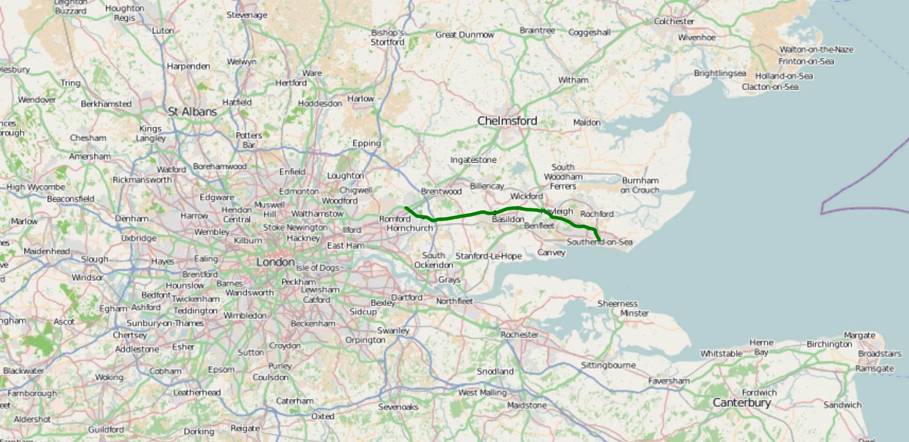
The A1159 road is a short road skirting the north of Southend-on-Sea from Thorpe Bay to London Southend Airport, in the coastal city of Southend-on-Sea, Essex. Route The A1159 commences its journey at Bournes Green Roundabout, its junction with the A13. The road heads northwest as Royal Artillery Way, which skirts the northern edge of the Southend urban area. The road then reaches a roundabout, with access to a housing estate to the south, and a leisure centre to the north. We follow Eastern Avenue, where the A1159 reaches another roundabout, with Fossetts Way giving access to Fossetts Park Retail Centre and Wellesley Hospital, and Sutton Road giving access to Temple Farm Industrial Estate. We then pass over Prittlewell Station, on the c2c line from London Liverpool Street Station / London Fenchurch Street Station to Southend Victoria Station. It then skirts Priory Park to the north as Priory Crescent, before it reaches a junction with the A127. At the junction, the A1159 t ... [...More Info...] [...Related Items...] OR: [Wikipedia] [Google] [Baidu] |
Thorpe Bay
Thorpe Bay is an area of the city of Southend-on-Sea, in the City of Southend-on-Sea, in the ceremonial county of Essex, England. located on the Thames Estuary. Thorpe Bay is situated within the Thorpe ward Ward may refer to: Division or unit * Hospital ward, a hospital division, floor, or room set aside for a particular class or group of patients, for example the psychiatric ward * Prison ward, a division of a penal institution such as a pris ... of Southend-on-Sea. It is around 4 miles to the east of Southend. Originally the area was called Thorpe, but it was renamed Thorpe Bay, after Thorpe Bay railway station, the railway station. The station had been given the name to indicate that it was a seaside settlement. The majority of Thorpe Bay consists of residential properties, mainly built in the 1920s, arranged in a grid pattern. Location Thorpe Bay can be defined as the area between the eastern side of Thorpe Hall Avenue to the west (beyond which is Southchurch), Thorpe ... [...More Info...] [...Related Items...] OR: [Wikipedia] [Google] [Baidu] |
County Borough Of Southend-on-Sea
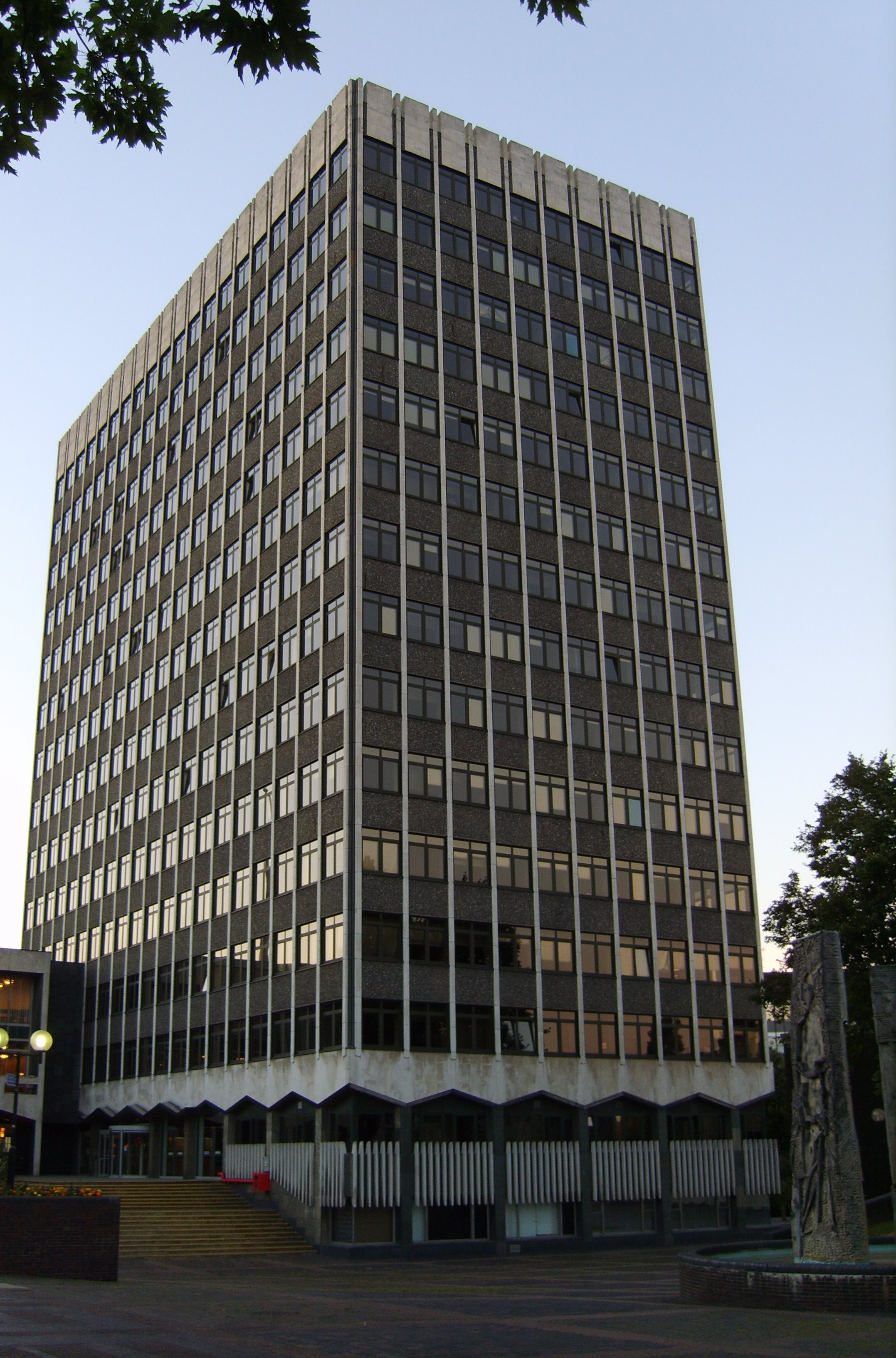
Southend-on-Sea was a local government district from 1866 to 1974 around the seaside resort of Southend-on-Sea in Essex, England. Its origin was a local board formed for the parish of St John the Baptist, which had been split off from Prittlewell for ecclesiastical purposes in 1842. It was incorporated as a municipal borough in 1892. In 1889, when Essex County Council was formed, Southend-on-Sea was within the administrative county of Essex. However, through expansion in area and population by 1914 it was split off from the administrative county as a county borough. The local authority was Southend Local Board from 1886 and Southend Corporation from 1892. The corporation changed the name of the town from Southend to Southend-on-Sea in 1893. In 1974 the county borough was reconstituted as a non-metropolitan district with the same boundaries and some powers were transferred to Essex County Council. Governance Southend adopted the Local Government Act 1858 and a local board was establi ... [...More Info...] [...Related Items...] OR: [Wikipedia] [Google] [Baidu] |
Camp Bling
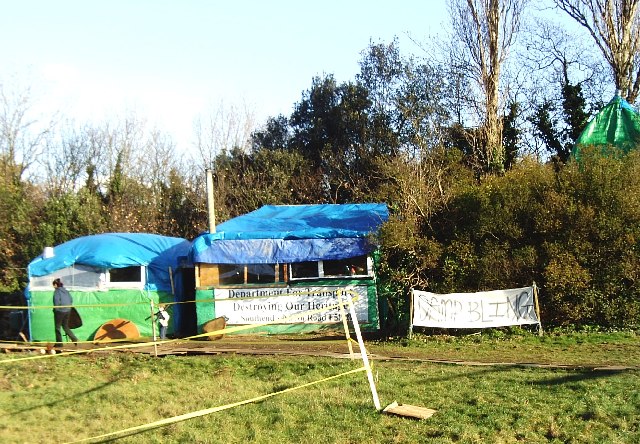
Camp Bling was a UK-based Road protest (UK), road protest camp set up in Southend-on-Sea, Essex during September 2005 to obstruct a £25 million plan to widen the Priory Crescent section of the A1159 road over the Royal Saxon tomb in Prittlewell. In April 2009 the authority announced that plans to build the road had been abandoned and the camp was disbanded in July 2009. History In 2004 Southend-on-Sea Borough Council proposed the 'Priory Crescent road widening scheme' and a public inquiry was held. The council proceeded with the scheme, estimated at £25 million, explaining that it was important to Southend and that a democratic decision had been taken after considering opposing views. During early excavations, an Anglo-Saxons, Anglo-Saxon king's burial chamber was discovered which was described by British archaeologists as "the most spectacular discovery of its kind made during the past 60 years". The widening of the road would have resulted in the felling of 111 trees and a ... [...More Info...] [...Related Items...] OR: [Wikipedia] [Google] [Baidu] |
Road Protest (UK)
Road protests in the United Kingdom usually occur as a reaction to a stated intention by the empowered authorities to build a new road, or to modify an existing road. Some of the reasons for opposition to opening new roads include: a desire to reduce air pollution and thus not wishing to incentivise increased or sustained car usage, and/or a desire to reduce or maintain low noise pollution by not having or increasing the use of motor vehicles in the area of the planned/proposed road. Protests may also be made by those wishing to see new roads built or improvements made to existing roads. Motivations for protests may be altruistic or selfish. In some cases, protests have also acted as a training ground for individuals and groups who continue to be active in campaigning and advocacy. Motivation Motivations have changed over time. Early actions, such as the response to the 1970s London urban motorway proposals, tended to be based on local environmental and social issues. Routing was ... [...More Info...] [...Related Items...] OR: [Wikipedia] [Google] [Baidu] |
Priory Park, Southend-on-Sea
Prittlewell Priory is a medieval priory in the Prittlewell area of Southend, Essex, England. It was founded in the 12th century, by monks from the Cluniac Priory of St Pancras in Lewes, East Sussex, and passed into private hands at the time of the Dissolution of the Monasteries under Henry VIII. The last private owner, the jeweller R. A. Jones, gave the priory and the grounds to the local council. The grounds now form a public park, Priory Park, and the Grade I listed building is open to the public as a museum. Priory Park is located adjacent to the priory. The remains of the priory are a scheduled monument. History Prittlewell Priory was founded by the Cluniac Order as a cell to the Priory of St Pancras at Lewes, East Sussex. Prittlewell was one of the lesser monasteries, housing not more than 18 monks. In 1536 much of the building was destroyed, and what remained was much altered during the 18th century. Alterations were made again in the early 20th century, when the r ... [...More Info...] [...Related Items...] OR: [Wikipedia] [Google] [Baidu] |
Museum Of London Archaeology Service
MOLA (Museum of London Archaeology) is an archaeology and built heritage practice and independent charitable company registered with the Chartered Institute for Archaeologists (CIfA), providing a wide range of professional archaeological services to clients in London and across the country. It is one of the largest archaeological service providers in the UK, and is the only one with IRO (Independent Research Organisation) status. MOLA’s operations were historically focused within Greater London but are increasingly nationwide. It employs over 300 staff across 4 locations: the central London headquarters, and further offices in Northampton, Basingstoke, and Birmingham. MOLA is a registered charity (since 2011) with its own academic research strategy and extensive community engagement and education programmes including the Thames Discovery Programme, CITiZAN and the Time Truck. Commercial services offered include expertise and advice at all stages of development from pre-plan ... [...More Info...] [...Related Items...] OR: [Wikipedia] [Google] [Baidu] |
Anglo-Saxon
The Anglo-Saxons were a Cultural identity, cultural group who inhabited England in the Early Middle Ages. They traced their origins to settlers who came to Britain from mainland Europe in the 5th century. However, the ethnogenesis of the Anglo-Saxons happened within Britain, and the identity was not merely imported. Anglo-Saxon identity arose from interaction between incoming groups from several Germanic peoples, Germanic tribes, both amongst themselves, and with Celtic Britons, indigenous Britons. Many of the natives, over time, adopted Anglo-Saxon culture and language and were assimilated. The Anglo-Saxons established the concept, and the Kingdom of England, Kingdom, of England, and though the modern English language owes somewhat less than 26% of its words to their language, this includes the vast majority of words used in everyday speech. Historically, the Anglo-Saxon period denotes the period in Britain between about 450 and 1066, after Anglo-Saxon settlement of Britain, th ... [...More Info...] [...Related Items...] OR: [Wikipedia] [Google] [Baidu] |
Royal Saxon Tomb In Prittlewell
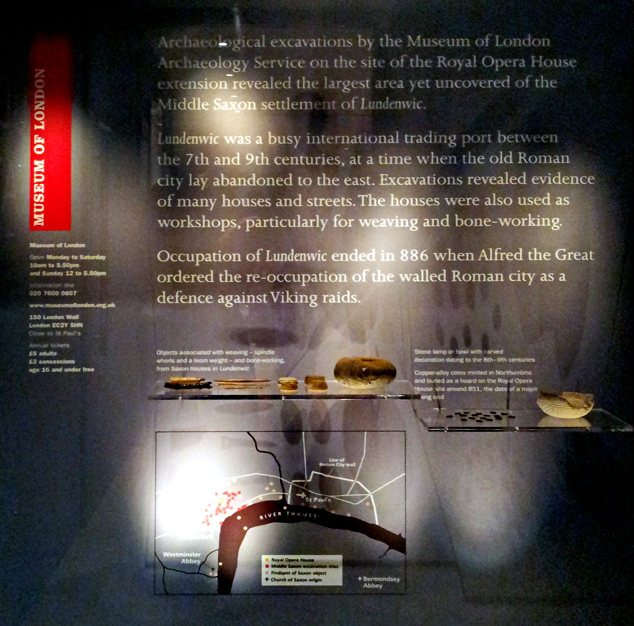
The Prittlewell royal Anglo-Saxon burial or Prittlewell princely burial is a high-status Anglo-Saxon burial mound which was excavated at Prittlewell, north of Southend-on-Sea, in the English county of Essex. Artefacts found by archaeologists in the burial chamber are of a quality that initially suggested that this tomb in Prittlewell was a tomb of one of the Anglo-Saxon Kings of Essex, and the discovery of golden foil crosses indicate that the burial was of an early Anglo-Saxon Christian. The burial is now dated to about 580 AD, and is thought that it contained the remains of Sæxa, brother of Sæberht of Essex. In May 2019, some of the excavated artefacts went on permanent display in Southend Central Museum. Excavation In the autumn of 2003, in preparation for a road-widening scheme, an archaeological survey was carried out on a plot of land to the north-east of Priory Park in Prittlewell. Earlier excavations had indicated Anglo-Saxon burials in the area, however it was ... [...More Info...] [...Related Items...] OR: [Wikipedia] [Google] [Baidu] |
A127
The A127, also known as the Southend Arterial Road, is a major road in Essex, England. It was constructed as a new arterial road project in the 1920s, linking Romford with Southend-on-Sea, replacing the older A13. Formerly classified as a trunk road, it was "de-trunked" in 1997. It is known as the ''Southend Arterial Road'' except for part of its length in Southend-on-Sea. It is also streetlit for its whole length despite its majority coverage through rural land. Route The A127 starts as a turning off the A12 at Gallows Corner in the London Borough of Havering. Traffic heading towards London goes over a flyover and joins the A12 traffic which merges onto the slip-road from the roundabout below, which is where the A127 ends. Traffic heading towards Southend also uses the flyover as well as slip roads. Its first significant junction is a crossroads after (''Squirrels Heath'') with ''Squirrels Heath Road'' and ''Ardleigh Green Road''. There are traffic lights here, but aft ... [...More Info...] [...Related Items...] OR: [Wikipedia] [Google] [Baidu] |
London Southend Airport
London Southend Airport is an international airport situated on the outskirts of Southend-on-Sea in Essex, England, approximately from the centre of London. The airport straddles the boundaries between the city of Southend-on-Sea and the Rochford District. Southend was London's third-busiest airport from the 1960s until the end of the 1970s, when it was overtaken in passenger numbers by London Stansted Airport.EasyJet Helps Make Southend London's Sixth Major Airport London.net, published 16 June 2011. Retrieved 17 June 2011 |
A127 Road
The A127, also known as the Southend Arterial Road, is a major road in Essex, England. It was constructed as a new arterial road project in the 1920s, linking Romford with Southend-on-Sea, replacing the older A13. Formerly classified as a trunk road, it was "de-trunked" in 1997. It is known as the ''Southend Arterial Road'' except for part of its length in Southend-on-Sea. It is also streetlit for its whole length despite its majority coverage through rural land. Route The A127 starts as a turning off the A12 at Gallows Corner in the London Borough of Havering. Traffic heading towards London goes over a flyover and joins the A12 traffic which merges onto the slip-road from the roundabout below, which is where the A127 ends. Traffic heading towards Southend also uses the flyover as well as slip roads. Its first significant junction is a crossroads after (''Squirrels Heath'') with ''Squirrels Heath Road'' and ''Ardleigh Green Road''. There are traffic lights here, but aft ... [...More Info...] [...Related Items...] OR: [Wikipedia] [Google] [Baidu] |
Southend Victoria Station
Southend-on-Sea (), commonly referred to as Southend (), is a coastal city and unitary authority area with borough status in southeastern Essex, England. It lies on the north side of the Thames Estuary, east of central London. It is bordered to the north by Rochford and to the west by Castle Point. It is home to the longest pleasure pier in the world, Southend Pier. London Southend Airport is located north of the city centre. Southend-on-Sea originally consisted of a few poor fishermen's huts and farms at the southern end of the village of Prittlewell. In the 1790s, the first buildings around what was to become the High Street of Southend were completed. In the 19th century, Southend's status of a seaside resort grew after a visit from Princess Caroline of Brunswick, and Southend Pier was constructed. From the 1960s onwards, the city declined as a holiday destination. Southend redeveloped itself as the home of the Access credit card, due to its having one of the UK's first el ... [...More Info...] [...Related Items...] OR: [Wikipedia] [Google] [Baidu] |


_SouthendMuseum_Essex.jpg)
