|
8th New Hampshire Volunteer Infantry
The 8th New Hampshire Infantry Regiment was an infantry regiment that served in the Union Army during the American Civil War. Service The 8th New Hampshire Infantry was organized in Manchester, New Hampshire, and mustered in for a three-year enlistment on December 23, 1861, under the command of Colonel Hawkes Fearing, Jr.. The regiment was attached to Butler's New Orleans Expedition to March 1862. 1st Brigade, Department of the Gulf, to November 1862. Independent Command, Department of the Gulf, to January 1863. 2nd Brigade, 3rd Division, XIX Corps, Department of the Gulf, to September 1863. The 8th New Hampshire Infantry ceased to exist in December 1863 when its designation was changed to the 2nd New Hampshire Cavalry. Detailed service Left New Hampshire for Boston, Massachusetts, January 24, 1862; then sailed for Ship Island, Mississippi, February 15, arriving there March 15. Duty at Ship Island until April 1862. Occupation of Forts Wood and Pike, Lake Pontchartrain, May 5. ... [...More Info...] [...Related Items...] OR: [Wikipedia] [Google] [Baidu] |
United States
The United States of America (U.S.A. or USA), commonly known as the United States (U.S. or US) or America, is a country primarily located in North America. It consists of 50 states, a federal district, five major unincorporated territories, nine Minor Outlying Islands, and 326 Indian reservations. The United States is also in free association with three Pacific Island sovereign states: the Federated States of Micronesia, the Marshall Islands, and the Republic of Palau. It is the world's third-largest country by both land and total area. It shares land borders with Canada to its north and with Mexico to its south and has maritime borders with the Bahamas, Cuba, Russia, and other nations. With a population of over 333 million, it is the most populous country in the Americas and the third most populous in the world. The national capital of the United States is Washington, D.C. and its most populous city and principal financial center is New York City. Paleo-Americ ... [...More Info...] [...Related Items...] OR: [Wikipedia] [Google] [Baidu] |
Colonel (United States)
The colonel () in the United States Army, Marine Corps, Air Force and Space Force, is the most senior field-grade military officer rank, immediately above the rank of lieutenant colonel and just below the rank of brigadier general. Colonel is equivalent to the naval rank of captain in the other uniformed services. By law, an officer previously required at least 22 years of cumulative service and a minimum of three years as a lieutenant colonel before being promoted to colonel. With the signing of the National Defense Authorization Act of 2019 (NDAA 2019), military services now have the authorization to directly commission new officers up to the rank of colonel. The pay grade for colonel is O-6. When worn alone, the insignia of rank seen at right is worn centered on headgear and fatigue uniforms. When worn in pairs, the insignia is worn on the officer's left side while a mirror-image reverse version is worn on the right side, such that both of the eagles' heads face forwa ... [...More Info...] [...Related Items...] OR: [Wikipedia] [Google] [Baidu] |
Bayou Teche
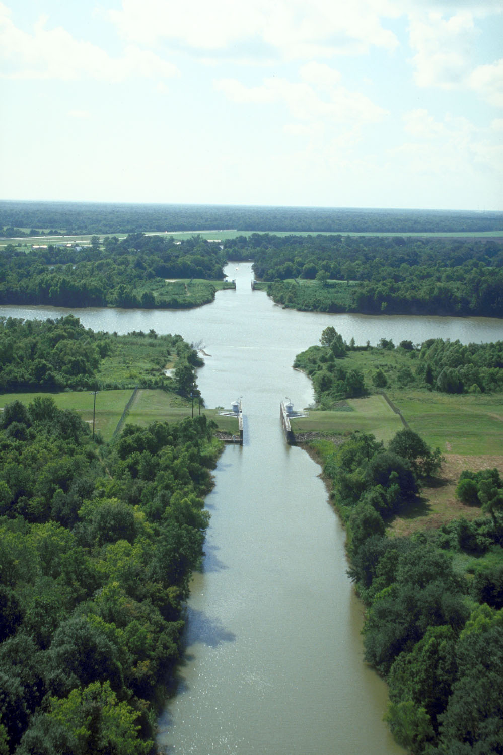
Bayou Teche (Louisiana French: ''Bayou Têche'') is a U.S. Geological Survey. National Hydrography Dataset high-resolution flowline dataThe National Map, accessed June 20, 2011 waterway of great cultural significance in south central Louisiana in the United States. Bayou Teche was the Mississippi River's main course when it developed a delta about 2,800 to 4,500 years ago. Through a natural process known as deltaic switching, the river's deposits of silt and sediment cause the Mississippi to change its course every thousand years or so. History The Teche begins in Port Barre where it draws water from Bayou Courtableau and then flows southward to meet the Lower Atchafalaya River at Patterson. During the 18th-century Acadian migration to the area - then known as the Attakapas region - the Teche was the primary means of transportation. During the American Civil War, there were two gunboat engagements on Bayou Teche. The first of these occurred on November 3–5, 1862. Four Federal ... [...More Info...] [...Related Items...] OR: [Wikipedia] [Google] [Baidu] |
Lafourche Parish, Louisiana
Lafourche Parish (french: Paroisse de la Fourche) is a parish located in the south of the U.S. state of Louisiana. The parish seat is Thibodaux. The parish was formed in 1807. It was originally the northern part of Lafourche Interior Parish, which consisted of the present parishes of Lafourche and Terrebonne. Lafourche Parish was named after the Bayou Lafourche. City buildings have been featured in television and movies, such as in ''Fletch Lives'', due to its architecture and rich history. At the 2020 census, its population was 97,557. Long a center of sugar cane plantations and sugar production, in November 1887 the parish was the site of the Thibodaux Massacre. After state militia were used to suppress a massive Knights of Labor strike involving 10,000 workers in four parishes, many African Americans retreated to Thibodaux. Local paramilitary forces attacked the men and their families, killing an estimated 50 persons. Hundreds more were missing, wounded, and presumed dead in ... [...More Info...] [...Related Items...] OR: [Wikipedia] [Google] [Baidu] |
Thibodaux, Louisiana
Thibodaux ( ) is a city in, and the parish seat of, Lafourche Parish, Louisiana, United States, along the banks of Bayou Lafourche in the northwestern part of the parish. The population was 15,948 at the 2020 census. Thibodaux is a principal city of the Houma– Bayou Cane–Thibodaux metropolitan statistical area. Thibodaux is nicknamed the "Queen City of Lafourche." History The first documented Native American inhabitants of the Thibodaux area were the Chawasha, a small tribe related to the Chitimacha of the upper Bayou Lafourche. The first settlers of European descent in this area arrived in the 18th century, when Louisiana was the Spanish province of Luisiana. They consisted of French nationals and Louisiana-born French and German creoles, followed shortly by Spanish and French Acadian immigrants. The colonists gradually began to import Africans in bondage as slaves to work on and develop rice and sugar cane plantations. The United States acquired Louisiana fro ... [...More Info...] [...Related Items...] OR: [Wikipedia] [Google] [Baidu] |
Labadieville, Louisiana
Labadieville is a census-designated place (CDP) in Assumption Parish, Louisiana, United States. The population was 1,854 at the 2010 census. It is part of the Pierre Part Micropolitan Statistical Area. History Labadieville, originally called "Brûlée Labadie", takes its name from a French pioneer and resident, Jean Louis L'Abadie. In 1721, there were some fifty warriors of the Chitimacha tribe. During the two decades after 1750, the area around Labadieville was taken up by French and Spanish, joined by Acadians, Isleños and a sprinkling of Germans from the Cote des Allemands or German Coast to the east on the Mississippi River. In 1843, a mission was established. St. Philomena Catholic Church dates from 1848 as an organized parish, and the first mass was said in the home of Widow Zacharie Boudreaux. The first building was occupied in 1847. During the Civil War, Labadieville was the scene of the Battle of Georgia Landing, Oct. 27, 1862, between Union forces under Gen. Weit ... [...More Info...] [...Related Items...] OR: [Wikipedia] [Google] [Baidu] |
Camp Parapet
Camp Parapet was a Civil War fortification at Shrewsbury, Jefferson Parish, Louisiana, a bit more than a mile upriver from the current city limits of New Orleans. History The fortification consisted of a Confederate defensive line about a mile and 3/4 long stretching from the Mississippi River northward to Metairie Ridge. (The area farther north from the ridge to Lake Pontchartrain was at the time swampland.) This was intended to protect the city of New Orleans from Union attack from upriver. As the Union fleet took the city by sailing in from below, the fortification was never used. After the capture of New Orleans, U.S. forces garrisoned and expanded the fortifications to defend against a Confederate counter-attack, which never came. Under Union control, the Camp lay in the district of Brigadier General Thomas W. Sherman. In late-September 1862, Halbert E. Paine, captain of the 4th Wisconsin Infantry Regiment, assumed command of the camp. George H. Hanks, a lieutenant in the 1 ... [...More Info...] [...Related Items...] OR: [Wikipedia] [Google] [Baidu] |
New Orleans
New Orleans ( , ,New Orleans Merriam-Webster. ; french: La Nouvelle-Orléans , es, Nueva Orleans) is a Consolidated city-county, consolidated city-parish located along the Mississippi River in the southeastern region of the U.S. state of Louisiana. With a population of 383,997 according to the 2020 U.S. census, it is the List of municipalities in Louisiana, most populous city in Louisiana and the twelfth-most populous city in the southeastern United States. Serving as a List of ports in the United States, major port, New Orleans is considered an economic and commercial hub for the broader Gulf Coast of the United States, Gulf Coast region of the United States. New Orleans is world-renowned for its Music of New Orleans, distinctive music, Louisiana Creole cuisine, Creole cuisine, New Orleans English, uniq ... [...More Info...] [...Related Items...] OR: [Wikipedia] [Google] [Baidu] |
Lake Pontchartrain
Lake Pontchartrain ( ) is an estuary located in southeastern Louisiana in the United States. It covers an area of with an average depth of . Some shipping channels are kept deeper through dredging. It is roughly oval in shape, about from west to east and from south to north. In descending order of area, the lake is located in parts of six Louisiana parishes: St. Tammany, Orleans, Jefferson, St. John the Baptist, St. Charles, and Tangipahoa. The water boundaries were defined in 1979 (see list of parishes in Louisiana). The lake is crossed by the Lake Pontchartrain Causeway, the longest continuous bridge over water in the world. A power line also crosses the lake. Its towers stand on caissons in Lake Pontchartrain, and its length can be used to visually demonstrate the curvature of the earth. Toponymy Lake Pontchartrain is named for , . He was the French Minister of the Marine, Chancellor, and Controller-General of Finances during the reign of France's "Sun King", L ... [...More Info...] [...Related Items...] OR: [Wikipedia] [Google] [Baidu] |
Mississippi
Mississippi () is a state in the Southeastern region of the United States, bordered to the north by Tennessee; to the east by Alabama; to the south by the Gulf of Mexico; to the southwest by Louisiana; and to the northwest by Arkansas. Mississippi's western boundary is largely defined by the Mississippi River. Mississippi is the 32nd largest and 35th-most populous of the 50 U.S. states and has the lowest per-capita income in the United States. Jackson is both the state's capital and largest city. Greater Jackson is the state's most populous metropolitan area, with a population of 591,978 in 2020. On December 10, 1817, Mississippi became the 20th state admitted to the Union. By 1860, Mississippi was the nation's top cotton-producing state and slaves accounted for 55% of the state population. Mississippi declared its secession from the Union on January 9, 1861, and was one of the seven original Confederate States, which constituted the largest slaveholding states in t ... [...More Info...] [...Related Items...] OR: [Wikipedia] [Google] [Baidu] |
Ship Island (Mississippi)
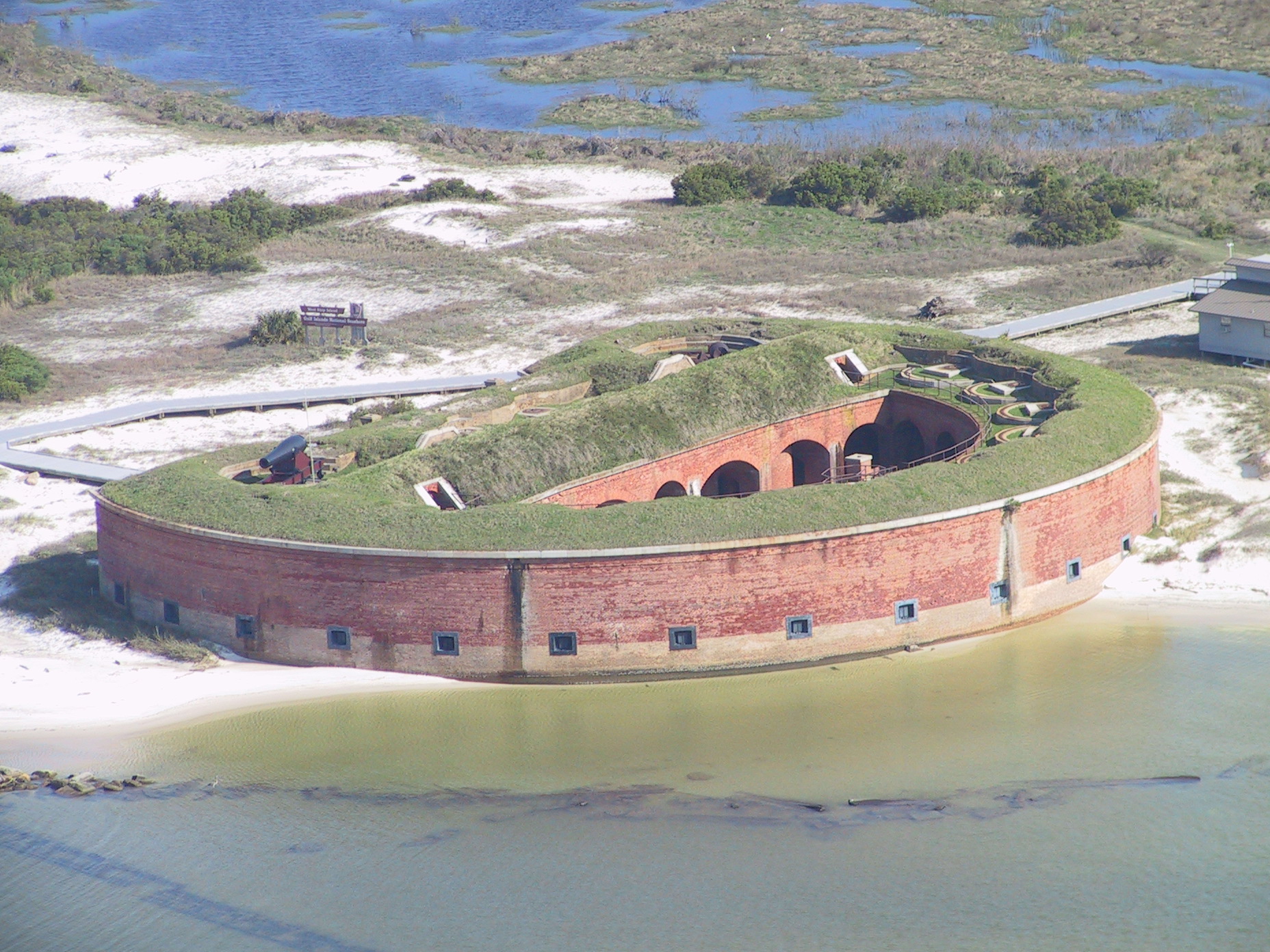
Ship Island is a barrier island off the Gulf Coast of Mississippi, one of the Mississippi–Alabama barrier islands. Hurricane Camille split the island into two separate islands (West Ship Island and East Ship Island) in 1969. In early 2019, the US Army Corps of Engineers completed the first stage of a project rejoining the two islands and recreating one Ship Island. Ship Island is the site of Fort Massachusetts (built 1859–66), as a Third System fortification. Part of the island is included in the Gulf Islands National Seashore. History Having the only deep-water harbor between Mobile Bay and the Mississippi River, the island served as a vital anchorage for ships bearing explorers, colonists, sailors, soldiers, defenders and invaders. The French, Spanish, British, Confederate and Union flags have all flown over Ship Island. French explorer Pierre Le Moyne d'Iberville charted Ship Island on 10 February 1699, "Hancock County, Then and Now", Hancock County Histor ... [...More Info...] [...Related Items...] OR: [Wikipedia] [Google] [Baidu] |
Boston
Boston (), officially the City of Boston, is the state capital and most populous city of the Commonwealth of Massachusetts, as well as the cultural and financial center of the New England region of the United States. It is the 24th- most populous city in the country. The city boundaries encompass an area of about and a population of 675,647 as of 2020. It is the seat of Suffolk County (although the county government was disbanded on July 1, 1999). The city is the economic and cultural anchor of a substantially larger metropolitan area known as Greater Boston, a metropolitan statistical area (MSA) home to a census-estimated 4.8 million people in 2016 and ranking as the tenth-largest MSA in the country. A broader combined statistical area (CSA), generally corresponding to the commuting area and including Providence, Rhode Island, is home to approximately 8.2 million people, making it the sixth most populous in the United States. Boston is one of the oldest ... [...More Info...] [...Related Items...] OR: [Wikipedia] [Google] [Baidu] |


