|
2023 Al Haouz Earthquake
On 8 September 2023 at 23:11 DST (22:11 UTC), an earthquake with a moment magnitude of 6.9 and maximum Mercalli intensity of IX (''Violent'') struck Morocco's Al Haouz Province. The earthquake's epicenter was southwest of Marrakesh, near the town of Ighil and the Oukaïmeden ski resort in the Atlas Mountains. It occurred as a result of shallow oblique-thrust faulting beneath the mountain range. At least 2,960 deaths were reported, with most occurring outside Marrakesh. Damage was widespread, and historic landmarks in Marrakesh were destroyed. The earthquake was also felt in Spain, Portugal, and Algeria. It is the strongest instrumentally recorded earthquake in Morocco, the deadliest in the country since the 1960 Agadir earthquake, and the second-deadliest earthquake of 2023 after the Turkey–Syria earthquakes. Its magnitude also makes it the largest earthquake on the African continent since the 2006 7.0 Mozambique earthquake and the largest in North Africa since the 19 ... [...More Info...] [...Related Items...] OR: [Wikipedia] [Google] [Baidu] |
Imi N'Tala
Imi N'Tala is a remote village in the Marrakesh–Safi region of Morocco. History The village was heavily destroyed in the 2023 Marrakesh-Safi earthquake. At least 70 people died in the village. References Mountain villages in Morocco Populated places in Marrakesh-Safi {{Morocco-geo-stub ... [...More Info...] [...Related Items...] OR: [Wikipedia] [Google] [Baidu] |
Atlas Mountains
The Atlas Mountains are a mountain range in the Maghreb in North Africa. It separates the Sahara Desert from the Mediterranean Sea and the Atlantic Ocean; the name "Atlantic" is derived from the mountain range. It stretches around through Morocco, Algeria and Tunisia. The range's highest peak is Toubkal, which is in central Morocco, with an elevation of . The Atlas mountains are primarily inhabited by Berbers, Berber populations. The terms for 'mountain' are ''Adrar'' and ''adras'' in some Berber languages, and these terms are believed to be cognates of the Toponymy, toponym ''Atlas''. The mountains are also home to a number of animals and plants which are mostly found within Africa but some of which can be found in Europe. Many of these species are endangered and a few are already extinct. The weather is cooling but has sunny summers, and the average temperature there is 25°C.Atlas Mountains are a mountain range in the Maghreb in North Africa. It separates the Sahara Desert fro ... [...More Info...] [...Related Items...] OR: [Wikipedia] [Google] [Baidu] |
Continental Collision
In geology, continental collision is a phenomenon of plate tectonics that occurs at convergent boundaries. Continental collision is a variation on the fundamental process of subduction, whereby the subduction zone is destroyed, mountains produced, and two continents sutured together. Continental collision is only known to occur on Earth. Continental collision is not an instantaneous event, but may take several tens of millions of years before the faulting and folding caused by collisions stops. The collision between India and Asia has been going on for about 50 million years already and shows no signs of abating. Collision between East and West Gondwana to form the East African Orogen took about 100 million years from beginning (610 Ma) to end (510 Ma). The collision between Gondwana and Laurasia to form Pangea occurred in a relatively brief interval, about 50 million years long. Subduction zone: the collision site The process begins as two conti ... [...More Info...] [...Related Items...] OR: [Wikipedia] [Google] [Baidu] |
Alboran Sea
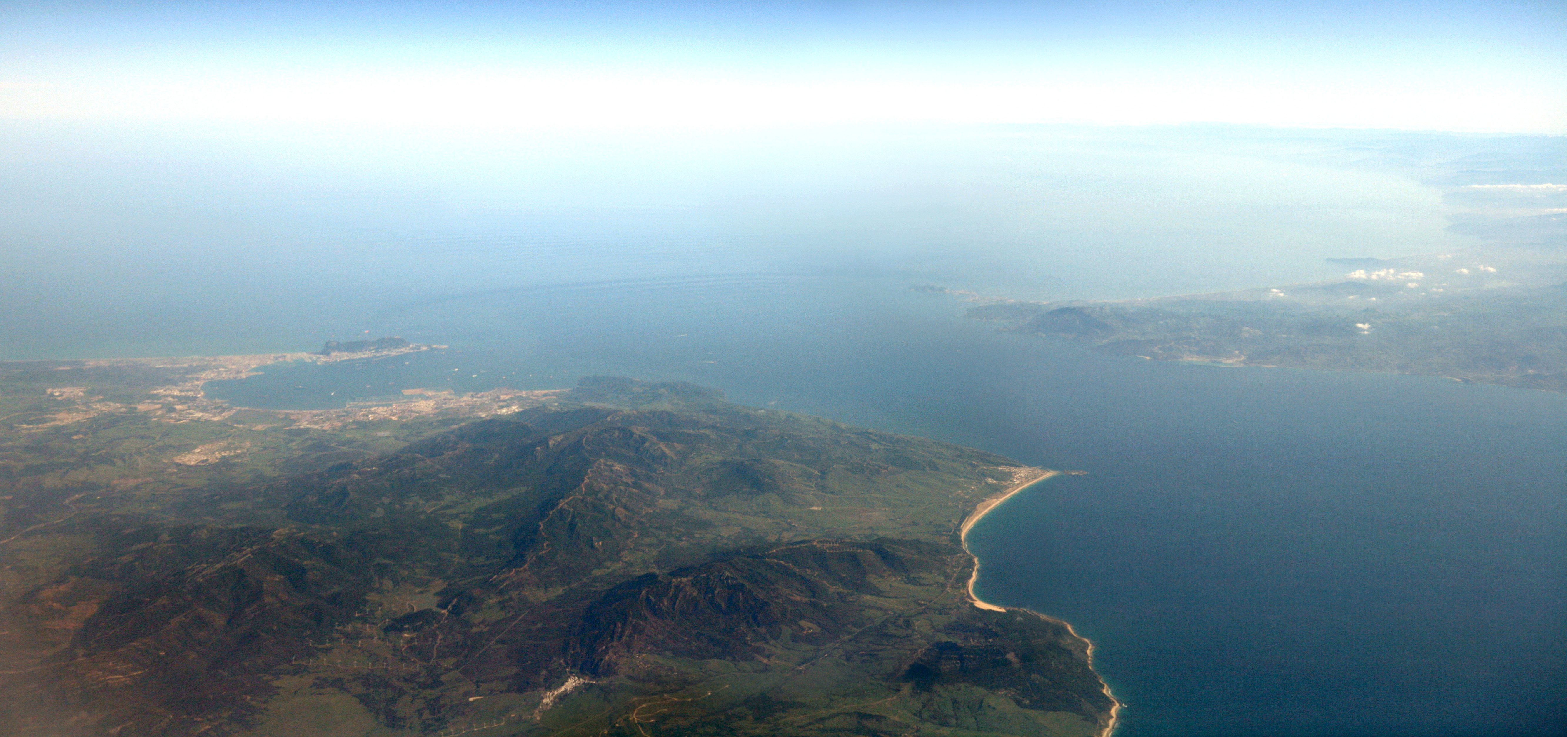
The Alboran Sea (from Arabic , ''al-Baḥrān'') is the westernmost portion of the Mediterranean Sea, lying between the Iberian Peninsula and the north of Africa (Spain on the north and Morocco and Algeria on the south). The Strait of Gibraltar, which lies at the west end of the Alboran Sea, connects the Mediterranean with the Atlantic Ocean. Geography Its average depth is and maximum depth is . The International Hydrographic Organization defines the limits of the Alboran Sea as follows: ''On the West.'' The Eastern limit of the Strait of Gibraltar: A line joining from tip (Europa Point) of '' Cap Gibraltar'' in Europe to the tip of the ''Península de Almina'' of Ceuta in Africa (). ''On the East.'' A line joining from '' Cabo de Gata'' in Andalusia in Europe to ''Cap Fegalo'', near Oran, Algeria in Africa (). Several small islands dot the sea, including the eponymous Isla de Alborán. Most, even those close to the African shore, belong to Spain. Geology The Alboran domain ... [...More Info...] [...Related Items...] OR: [Wikipedia] [Google] [Baidu] |
Strait Of Gibraltar
The Strait of Gibraltar ( ar, مضيق جبل طارق, Maḍīq Jabal Ṭāriq; es, Estrecho de Gibraltar, Archaic: Pillars of Hercules), also known as the Straits of Gibraltar, is a narrow strait that connects the Atlantic Ocean to the Mediterranean Sea and separates the Iberian Peninsula in Europe from Morocco in Africa. The two continents are separated by of ocean at the Strait's narrowest point between Point Marroquí in Spain and Point Cires in Morocco. Ferries cross between the two continents every day in as little as 35 minutes. The Strait's depth ranges between which possibly interacted with the lower mean sea level of the last major glaciation 20,000 years ago when the level of the sea is believed to have been lower by . The strait lies in the territorial waters of Morocco, Spain, and the British overseas territory of Gibraltar. Under the United Nations Convention on the Law of the Sea, foreign vessels and aircraft have the freedom of navigation and overflight t ... [...More Info...] [...Related Items...] OR: [Wikipedia] [Google] [Baidu] |
Transpression
In geology, transpression is a type of strike-slip deformation that deviates from simple shear because of a simultaneous component of shortening perpendicular to the fault plane. This movement ends up resulting in oblique shear. It is generally very unlikely that a deforming body will experience "pure" shortening or "pure" strike-slip. The relative amounts of shortening and strike-slip can be expressed in the convergence angle alpha which ranges from zero (ideal strike-slip) to 90 degrees (ideal convergence). During shortening, unless material is lost, transpression produces vertical thickening in the crust. Transpression that occurs on a regional scale along plate boundaries is characterized by oblique convergence. More locally, transpression occurs within restraining bends in strike-slip fault zones. Transpressional structures Transpressional shear zones are characterized by an association of structures that suggest zone-normal shortening and zone-parallel shearing. Commonly ... [...More Info...] [...Related Items...] OR: [Wikipedia] [Google] [Baidu] |
Eurasian Plate
The Eurasian Plate is a tectonic plate that includes most of the continent of Eurasia (a landmass consisting of the traditional continents of Europe and Asia), with the notable exceptions of the Indian subcontinent, the Arabian subcontinent and the area east of the Chersky Range in eastern Siberia. It also includes oceanic crust extending westward to the Mid-Atlantic Ridge and northward to the Gakkel Ridge. The eastern edge is a boundary with the North American Plate to the north and a boundary with the Philippine Sea Plate to the south and possibly with the Okhotsk Plate and the Amurian Plate. The southern edge is a boundary with the African Plate to the west, the Arabian Plate in the middle and the Indo-Australian Plate to the east. The western edge is a divergent boundary with the North American Plate forming the northernmost part of the Mid-Atlantic Ridge, which is straddled by Iceland. All volcanic eruptions in Iceland, such as the 1973 eruption of Eldfell, the 1783 eruptio ... [...More Info...] [...Related Items...] OR: [Wikipedia] [Google] [Baidu] |
African Plate
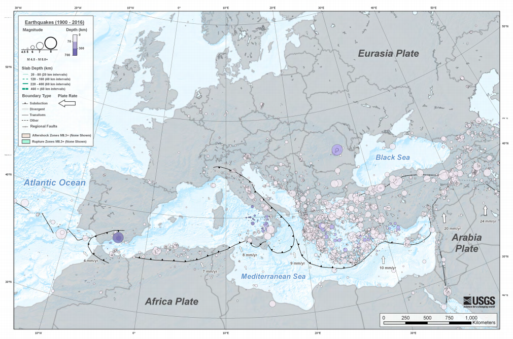
The African Plate is a major tectonic plate that includes much of the continent of Africa (except for its easternmost part) and the adjacent oceanic crust to the west and south. It is bounded by the North American Plate and South American Plate to the west (separated by the Mid-Atlantic Ridge); the Arabian Plate and Somali Plate to the east; the Eurasian Plate, Aegean Sea Plate and Anatolian Plate to the north; and the Antarctic Plate to the south. Between and , the Somali Plate began rifting from the African Plate along the East African Rift. Since the continent of Africa consists of crust from both the African and the Somali plates, some literature refers to the African Plate as the Nubian Plate to distinguish it from the continent as a whole. Boundaries The western edge of the African Plate is a divergent boundary with the North American Plate to the north and the South American Plate to the south which forms the central and southern part of the Mid-Atlantic Ridge. The A ... [...More Info...] [...Related Items...] OR: [Wikipedia] [Google] [Baidu] |
Azores–Gibraltar Transform Fault
The Azores–Gibraltar Transform Fault (AGFZ), also called a fault zone and a fracture zone, is a major seismic zone in the Eastern Atlantic Ocean between the Azores and the Strait of Gibraltar. It is the product of the complex interaction between the African, Eurasian, and Iberian plates. The AGFZ produced these large-magnitude earthquakes and, consequently, a number of large tsunamis: 1755 Lisbon, 1761 Lisbon, 1816 North Atlantic, 1941 Gloria Fault earthquake, 1969 Horseshoe and 1975. Geologic setting Forming the Atlantic segment of the boundary between the African and Eurasian plates, the AGFZ is largely dominated by compressional forces between these converging () plates, but it is subject to a dynamic tectonic regime that also involves extension and transform faulting. The oceanic lithosphere in the area is directly related to the opening of the North Atlantic Ocean and is one of the oldest preserved on Earth. The western end of the AGFZ, the Azores Triple Junction on t ... [...More Info...] [...Related Items...] OR: [Wikipedia] [Google] [Baidu] |
1980 El Asnam Earthquake
The 1980 El Asnam earthquake occurred on October 10 at with a moment magnitude of 7.1 and a maximum Mercalli intensity of X (''Extreme''). The shock occurred in the Algerian town of El Asnam (now known as Chlef). The shocks were felt over away, with the initial earthquake lasting 35 seconds. It was the largest earthquake in Algeria, and was followed three hours later by a magnitude 6.2 aftershock. The earthquake created about of surface rupture and had a vertical slip of up to . No foreshocks were recorded. The earthquake was found to have occurred very close to the epicenter of the 1954 Chlef earthquake using joint epicenter determination techniques. It occurred at a previously unknown reverse fault. The earthquake was the largest in the Atlas range since 1790. In addition to the earthquake, weak tsunami waves were recorded on tide gauges. The earthquake occurred at a populated region of Algeria, affecting 900,000 people. It destroyed 25,000 houses and made 300,000 inhabit ... [...More Info...] [...Related Items...] OR: [Wikipedia] [Google] [Baidu] |
2006 Mozambique Earthquake
The 2006 Mozambique earthquake occurred at 22:19 UTC on 22 February. It had a magnitude of 7.0 on the moment magnitude scale and caused 4 deaths and 36 injuries. The epicenter was near Machaze in Manica Province of southern Mozambique, just north of the Save River. It was the largest historical earthquake in Mozambique and the first earthquake in southern Africa to have an identified surface rupture. Tectonic setting Southern Mozambique is at the southern end of the East Africa Rift system, where the African Plate appears to be breaking into several smaller plates. The Somali Plate is moving westward relative to the Nubian Plate at a rate of several millimetres a year at the latitude of this earthquake. Most earthquakes in this zone are a result of either normal or strike-slip faulting. Earthquake The earthquake was felt throughout Mozambique and over a wide area of eastern southern Africa, including South Africa, Swaziland, Zambia, Zimbabwe and Botswana. Close to the epic ... [...More Info...] [...Related Items...] OR: [Wikipedia] [Google] [Baidu] |


