|
2011 New Zealand Snowstorms
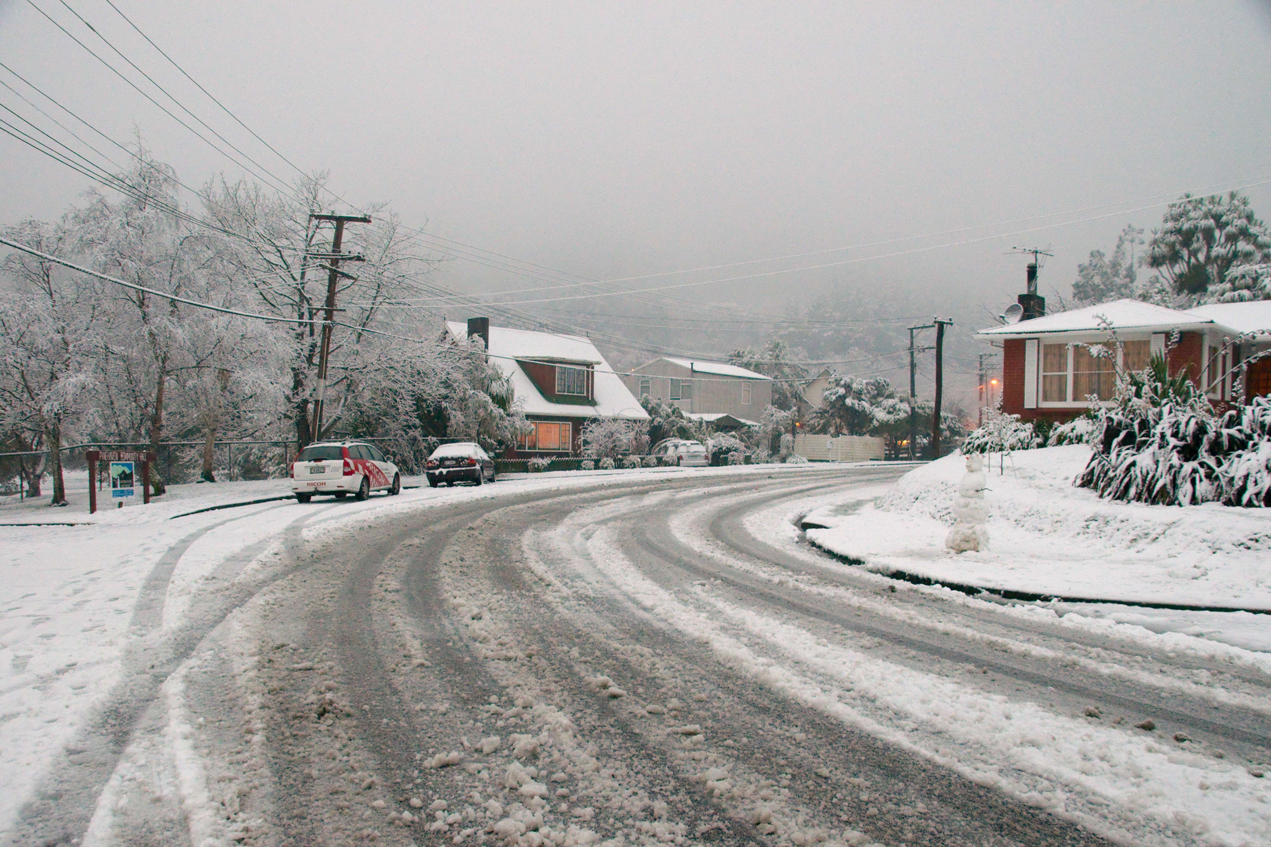
The 2011 New Zealand snowstorms were a series of record breaking snow falls that affected both the North Island and South Island. The storms occurred over the span of a few weeks, beginning on 25 July 2011 in the North Island and subsequently spreading to the South. The storms subsided in late July and returned in August. It was the worst winter storm to hit New Zealand in seventy years. The heavy snowfalls caused widespread closures in many cities, including Christchurch, Wellington and Dunedin. The South Island was the hardest hit, although the North Island was significantly affected, with the climatically mild cities of Auckland and Wellington reporting the first notable snowfall in over twenty years. The storms caused chaos around the country, leaving people stranded at airports, blocking state highways and resulting in entire regions, particularly Canterbury and Otago, being completely closed. The initial storm of July was relatively short lived, only to return again in A ... [...More Info...] [...Related Items...] OR: [Wikipedia] [Google] [Baidu] |
Aug 16 2011 Pinehaven Snow
Aug or AUG may refer to: *An abbreviation of August, the eighth month of the year in the Gregorian calendar *Augusta State Airport in Augusta, Maine (IATA Code: AUG) *Steyr AUG, an assault rifle *AUG, the most common start codon, the three-nucleotide sequence that starts translation of mRNA and encodes the amino acid methionine * Applicative Universal Grammar, a linguistic theory *Augite, a clinopyroxene mineral *An augmented chord *Augusta Railroad, defunct Arkansas railroad *Agricultural University of Georgia, Tbilisi People *Andrus Aug Andrus Aug (born 22 May 1972) is a retired Estonian professional road bicycle racer. He last rode for UCI Professional Continental team Ceramica Flaminia. Major results ;1995 : 2nd Road race, National Road Championships ;1996 : 1st Road r ... (born 1972), Estonian road bicycle racer Music * Aug (band), a New Jersey metal band {{disambiguation ... [...More Info...] [...Related Items...] OR: [Wikipedia] [Google] [Baidu] |
The Press
''The Press'' is a daily newspaper published in Christchurch, New Zealand owned by media business Stuff Ltd. First published in 1861, the newspaper is the largest circulating daily in the South Island and publishes Monday to Saturday. One community newspaper—''Northern Outlook''- is also published by ''The Press'' and is free. The newspaper has won the title of New Zealand Newspaper of the Year (in its circulation category) three times: in 2006, 2007 and 2012. It has also won the overall Newspaper of the Year title twice: in 2006 and 2007. History James FitzGerald came to Lyttelton on the ''Charlotte Jane'' in December 1850, and was from January 1851 the first editor of the ''Lyttelton Times'', Canterbury's first newspaper. From 1853, he focussed on politics and withdrew from the ''Lyttelton Times''. After several years in England, he returned to Canterbury concerned about the proposed capital works programme of the provincial government, with his chief concern the pro ... [...More Info...] [...Related Items...] OR: [Wikipedia] [Google] [Baidu] |
Greendale, New Zealand
Greendale is a lightly populated rural area, part of the Selwyn District, Canterbury, a region of New Zealand's South Island. One of the first farmers was Thomas William Adams, a pioneer of forestry and education in the area. Another one of the first farmers was Charles Early who moved to Greendale (Water ford) in 1876. On 4 September 2010, Greendale became further notable as the location of the strongest earthquake ground-shaking ever recorded in New Zealand, registering an acceleration 1.25 times that of gravity. This was later exceeded by the 2.2 g recordings during the February 2011 Christchurch earthquake at Heathcote Valley. Demographics Greendale is part of the rural Charing Cross statistical area, which covers . It had an estimated population of as of with a population density of people per km2. Charing Cross had a population of 885 at the 2018 New Zealand census, an increase of 42 people (5.0%) since the 2013 census, and an increase of 189 people (27.2%) since ... [...More Info...] [...Related Items...] OR: [Wikipedia] [Google] [Baidu] |
Leeston
Leeston (Māori language, Māori: ''Karumata'') is a town on the Canterbury Plains in the South Island of New Zealand. It is located 30 kilometres southwest of Christchurch, between the shore of Lake Ellesmere / Te Waihora and the mouth of the Rakaia River. The town is home to a growing number of services which have increased and diversified along with the population. Leeston has a supermarket, schools (pre-school, primary school and high school), churches, hospital (for the elderly only), gym, cafes, restaurants, medical centre, pharmacy and post office. The Selwyn District Council currently has a service office in Leeston, after the headquarters was shifted to Rolleston, New Zealand, Rolleston. Demographics Leeston is described by Statistics New Zealand as a small urban area, and covers . It had an estimated population of as of with a population density of people per km2. Leeston had a population of 2,208 at the 2018 New Zealand census, an increase of 669 people (43.5%) ... [...More Info...] [...Related Items...] OR: [Wikipedia] [Google] [Baidu] |
Rakaia
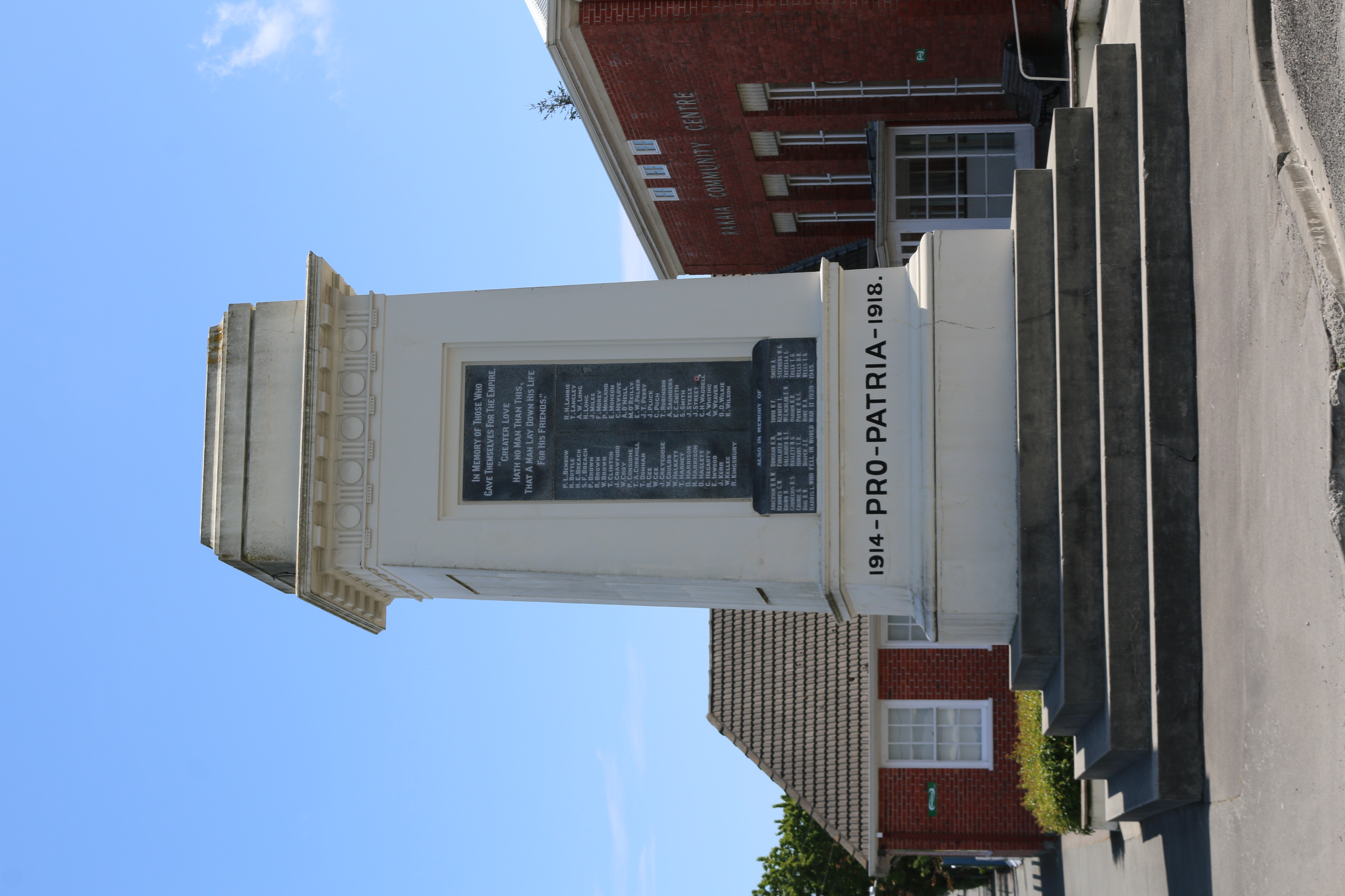
Rakaia is a town seated close to the southern banks of the Rakaia River on the Canterbury Plains in New Zealand's South Island, approximately 57 km south of Christchurch on State Highway 1 and the Main South Line. Immediately north of the township are New Zealand's longest road bridge and longest rail bridge, both of which cross the wide shingle beds of the braided river at this point. Both bridges are approximately 1750 metres in length. Rakaia was also the junction of the Methven Branch, a branch line railway to Methven that operated from 1880 until its closure in 1976. An accident at the railway station in 1899 killed four people. Rakaia's most obvious feature is a large fibreglass salmon. The river from which the town takes its name is known for its salmon fishing and jetboating. The town and river were previously known as ''Cholmondeley'', but the Maori name would eventually prevail over the English one. The rural community of Acton is located south of the Rakaia ... [...More Info...] [...Related Items...] OR: [Wikipedia] [Google] [Baidu] |
Queenstown, New Zealand
Queenstown ( mi, Tāhuna) is a resort town in Otago in the south-west of New Zealand's South Island. It has an urban population of The town is built around an inlet called Queenstown Bay on Lake Wakatipu, a long, thin, Z-shaped lake formed by glacial processes, and has views of nearby mountains such as The Remarkables, Cecil Peak, Walter Peak and just above the town, Ben Lomond and Queenstown Hill. The Queenstown-Lakes District has a land area of not counting its inland lakes Hāwea, Wakatipu, and Wānaka. The region has an estimated resident population of Neighbouring towns include Arrowtown, Glenorchy, Kingston, Wānaka, Alexandra, and Cromwell. The nearest cities are Dunedin and Invercargill. Queenstown is known for its commerce-oriented tourism, especially adventure and ski tourism. History Māori settlement and presence The area was discovered and first settled by Māori. Kāi Tahu say that the lake was dug by the Waitaha ancestor, Rākaihautū, with his kō (d ... [...More Info...] [...Related Items...] OR: [Wikipedia] [Google] [Baidu] |
Stuff (company)
Stuff Ltd (previously Fairfax New Zealand) is a privately held news media company operating in New Zealand. It operates Stuff, the country's largest news website, and owns nine daily newspapers, including New Zealand's second and third-highest circulation daily newspapers, '' The Dominion Post'' and ''The Press'', and the highest circulation weekly, '' Sunday Star-Times''. Magazines published include ''TV Guide'', New Zealand's top-selling weekly magazine. Stuff also owns social media network Neighbourly. Stuff Ltd has been owned by Sinead Boucher since 31 May 2020. It was called Fairfax New Zealand Limited until 1 February 2018. History The print publications and the Stuff website previously belonged to Independent Newspapers Limited, until they were sold to Australian company Fairfax Media in 2003. When a 7.8 earthquake struck Kaikōura 14 November 2016, cutting the town off via road access, Stuff (then Fairfax New Zealand) flew free copies of its newspapers to reside ... [...More Info...] [...Related Items...] OR: [Wikipedia] [Google] [Baidu] |
Dunedin Botanic Gardens Winter 2011 Panorama
Dunedin ( ; mi, Ōtepoti) is the second-largest city in the South Island of New Zealand (after Christchurch), and the principal city of the Otago region. Its name comes from , the Scottish Gaelic name for Edinburgh, the capital of Scotland. The city has a rich Scottish, Chinese and Māori heritage. With an estimated population of as of , Dunedin is both New Zealand's seventh-most populous metro and urban area. For historic, cultural and geographic reasons the city has long been considered one of New Zealand's four main centres. The urban area of Dunedin lies on the central-eastern coast of Otago, surrounding the head of Otago Harbour, and the harbour and hills around Dunedin are the remnants of an extinct volcano. The city suburbs extend out into the surrounding valleys and hills, onto the isthmus of the Otago Peninsula, and along the shores of the Otago Harbour and the Pacific Ocean. Archaeological evidence points to lengthy occupation of the area by Māori prior to the arr ... [...More Info...] [...Related Items...] OR: [Wikipedia] [Google] [Baidu] |
Milford Sound
Milford Sound / Piopiotahi is a fiord in the south west of New Zealand's South Island within Fiordland National Park, Piopiotahi (Milford Sound) Marine Reserve, and the Te Wahipounamu World Heritage site. It has been judged the world's top travel destination in an international survey (the ''2008 Travelers' Choice Destinations Awards'' by TripAdvisor) and is acclaimed as New Zealand's most famous tourist destination."Real Journeys rapt with Kiwi Must-Do's" ''Scoop'', 13 February 2007. had previously called it the |
Te Anau
Te Anau is a town in the Southland region of the South Island of New Zealand. In Maori, Te-Anau means the Place of the Swirling Waters. It is on the eastern shore of Lake Te Anau in Fiordland. Te Anau is 155 kilometres north of Invercargill and 171 kilometres to the southwest of Queenstown (via state highway 6). Manapouri lies 21 kilometres to the south. Te Anau lies at the southern end of the Milford Road, ( State Highway 94) 117 kilometres to the south of Milford Sound. History The first Europeans (C.J. Nairn and W.J. Stephen) to visit the lake were led by Maori guides visited in 1852. The lake was formally surveyed first in 1863. The township was surveyed in 1893. This was soon after the Milford Track opened. The town only really started to grow after the opening of the Homer Tunnel and road route to Milford in 1953. Demographics Te Anau covers and had an estimated population of as of with a population density of people per km2. Te Anau had a population of 2,53 ... [...More Info...] [...Related Items...] OR: [Wikipedia] [Google] [Baidu] |
State Highway 94 (New Zealand)
State Highway 94 is a New Zealand state highway connecting the large Southland town of Gore with one of New Zealand's most popular destinations, Milford Sound. It also passes the significant townships of Lumsden and Te Anau as well going through the Homer Tunnel (in this area it is also called the 'Milford Road', with the section from Te Anau up to the Sound being ). The road also goes through Fiordland and crosses the Main Divide of the Southern Alps. It is regarded as one of the most scenic roads in New Zealand, and with a peak elevation of , the country's third highest highway after the Desert Road () and the Lindis Pass (). However, the "Milford Road" part is also one of the more dangerous public roads in New Zealand, with injury crash rates around 65% higher than the rest of New Zealand's network, and a fatality crash rate of almost twice average (per vehicle kilometre travelled), [...More Info...] [...Related Items...] OR: [Wikipedia] [Google] [Baidu] |
Invercargill
Invercargill ( , mi, Waihōpai is the southernmost and westernmost city in New Zealand, and one of the southernmost cities in the world. It is the commercial centre of the Southland region. The city lies in the heart of the wide expanse of the Southland Plains to the east of the Ōreti or New River some north of Bluff, which is the southernmost town in the South Island. It sits amid rich farmland that is bordered by large areas of conservation land and marine reserves, including Fiordland National Park covering the south-west corner of the South Island and the Catlins coastal region. Many streets in the city, especially in the centre and main shopping district, are named after rivers in Scotland. These include the main streets Dee and Tay, as well as those named after the Tweed, Forth, Tyne, Esk, Don, Ness, Yarrow, Spey, Eye and Ythan rivers, amongst others. The 2018 census showed the population was 54,204, up 2.7% on the 2006 census number and up 4.8% on the 2013 ... [...More Info...] [...Related Items...] OR: [Wikipedia] [Google] [Baidu] |


.jpg)

.jpg)


