|
2008 Namibia Floods
The 2008 Namibia floods took place in early February 2008, a rapid onset of heavy rains triggered floods in northern Namibia, leading to one of its worst floods in 50 years. The floods had killed 42 people by early March and an estimated 65,000 people were affected, primarily in the regions of Omusati, Oshikoto, Oshana, Ohangwena and Caprivi. 40,000 people were assisted by the Namibian Red Cross with 4,600 in relocation camps. Over-crowding and insanitary conditions caused health concerns in relocation campsSibeene, P. (2008) Namibia: Cholera Outbreak in North. ''All Africa.'' March 11. nlineLast accessed 18/10/19. Available at https://allafrica.com/stories/200803110236.html and an outbreak of cholera was announced in March. On 14 March, the United Nations Office for Outer Space Affairs triggered the International Charter for "Space and Major Disasters". [...More Info...] [...Related Items...] OR: [Wikipedia] [Google] [Baidu] |
Omusati Region
Omusati ( ng, Mopane, after the dominant tree in the area) is one of the fourteen regions of Namibia, its capital is Outapi. The towns of Okahao, Oshikuku and Ruacana as well as the self-governed village Tsandi are situated in this region. , Omusati had 148,834 registered voters. The region is home to the Ruacana Falls and the Omugulugwombashe heritage site, where the Namibian struggle for independence started in 1966. Geography In the north, Omusati borders the Cunene Province of Angola. Domestically, it borders the following regions: *Ohangwena - northeast *Oshana - east * Kunene - south and west The region got its name from the Mopane tree (''omusati'': ng, Mopane) which is the dominant species in the region. The Makalani palms decrease rapidly westwards from the border with Oshana region. The change in vegetation type reflects ecological conditions forming a natural boundary between the two regions. The region is home to the Ruacana Falls. The waterfall is 120 meters (3 ... [...More Info...] [...Related Items...] OR: [Wikipedia] [Google] [Baidu] |
Floodplain
A floodplain or flood plain or bottomlands is an area of land adjacent to a river which stretches from the banks of its channel to the base of the enclosing valley walls, and which experiences flooding during periods of high discharge.Goudie, A. S., 2004, ''Encyclopedia of Geomorphology'', vol. 1. Routledge, New York. The soils usually consist of clays, silts, sands, and gravels deposited during floods. Because the regular flooding of floodplains can deposit nutrients and water, floodplains frequently have high soil fertility; some important agricultural regions, such as the Mississippi river basin and the Nile, rely heavily on the flood plains. Agricultural regions as well as urban areas have developed near or on floodplains to take advantage of the rich soil and fresh water. However, the risk of flooding has led to increasing efforts to control flooding. Formation Most floodplains are formed by deposition on the inside of river meanders and by overbank flow. Whereve ... [...More Info...] [...Related Items...] OR: [Wikipedia] [Google] [Baidu] |
European Food Safety Authority
The European Food Safety Authority (EFSA) is the agency of the European Union (EU) that provides independent scientific advice and communicates on existing and emerging risks associated with the food chain. EFSA was established in February 2002, is based in Parma, Italy, and for 2021 it has a budget of €118.6 million, and a total staff of 542. The work of EFSA covers all matters with a direct or indirect impact on food and feed safety, including animal health and welfare, plant protection and plant health and nutrition. EFSA supports the European Commission, the European Parliament and EU member states in taking effective and timely risk management decisions that ensure the protection of the health of European consumers and the safety of the food and feed chain. EFSA also communicates to the public in an open and transparent way on all matters within its remit. Structure Based on a regulation of 2002, the EFSA is composed of four bodies: * Management Board * Executive Dir ... [...More Info...] [...Related Items...] OR: [Wikipedia] [Google] [Baidu] |
Mahangu
Pearl millet (''Cenchrus americanus'', commonly known as the synonym ''Pennisetum glaucum''; also known as 'Bajra' in Hindi, 'Sajje' in Kannada, 'Kambu' in Tamil, 'Bajeer' in Kumaoni and 'Maiwa' in Hausa, 'Mexoeira' in Mozambique) is the most widely grown type of millet. It has been grown in Africa and the Indian subcontinent since prehistoric times. The center of diversity, and suggested area of domestication, for the crop is in the Sahel zone of West Africa. Recent archaeobotanical research has confirmed the presence of domesticated pearl millet on the Sahel zone of northern Mali between 2500 and 2000 BC. Description Pearl millet has ovoid grains of 3 – 4 mm length, the largest kernels of all varieties of millet (not including sorghum). These can be nearly white, pale yellow, brown, grey, slate blue or purple. The 1000-seed weight can be anything from 2.5 to 14 g with a mean of 8 g. The height of the plant ranges from 0.5 – 4 m. Cultivation Pearl millet is well ada ... [...More Info...] [...Related Items...] OR: [Wikipedia] [Google] [Baidu] |
Cultivating Mahangu
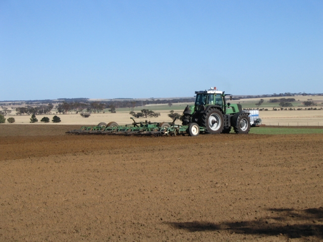
Tillage is the agriculture, agricultural preparation of soil by mechanical wikt:agitation#Noun, agitation of various types, such as digging, stirring, and overturning. Examples of manual labour, human-powered tilling methods using hand tools include shoveling, pickaxe, picking, mattock work, hoe (tool), hoeing, and rake (tool), raking. Examples of working animal, draft-animal-powered or mechanization, mechanized work include ploughing (overturning with moldboards or chiseling with chisel shanks), rotary tiller, rototilling, rolling with cultipackers or other roller (agricultural tool), rollers, harrow (tool), harrowing, and cultivating with cultivator shanks (teeth). Tillage that is deeper and more thorough is classified as primary, and tillage that is shallower and sometimes more selective of location is secondary. Primary tillage such as ploughing tends to produce a rough surface finish, whereas secondary tillage tends to produce a smoother surface finish, such as that require ... [...More Info...] [...Related Items...] OR: [Wikipedia] [Google] [Baidu] |


