|
1700 Cascadia Earthquake
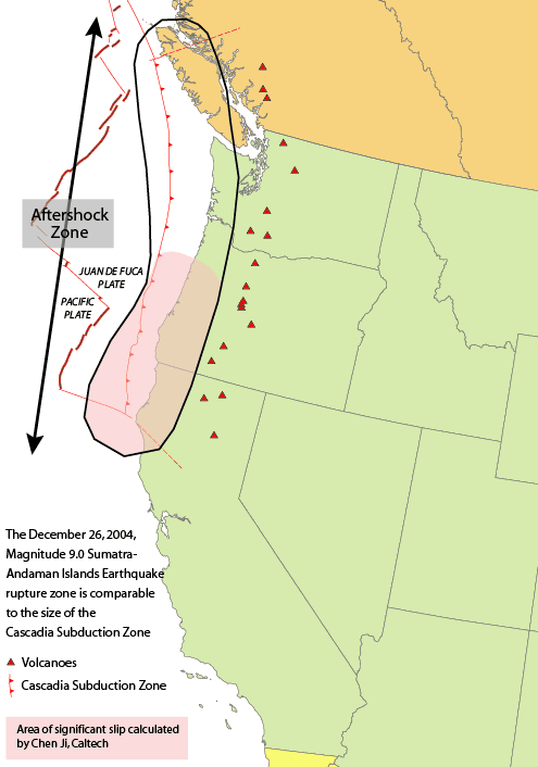
The 1700 Cascadia earthquake occurred along the Cascadia subduction zone on January 26, 1700, with an estimated moment magnitude of 8.7‚Äď9.2. The megathrust earthquake involved the Juan de Fuca Plate from mid-Vancouver Island, south along the Pacific Northwest coast as far as northern California. The length of the fault rupture was about , with an average slip of . The earthquake caused a tsunami which struck the west coast of North America and the coast of Japan. Japanese tsunami records, along with reconstructions of the wave moving across the ocean, put the earthquake at about 9pm on the evening of 26 January 1700. Evidence The earthquake took place at about 21:00 Pacific Time on January 26, 1700 ( NS). Although there are no written records for the region from the time, the timing of the earthquake has been inferred from Japanese records of a tsunami that does not correlate with any other Pacific Rim quake. The Japanese records exist primarily in the modern-day Iwate Pre ... [...More Info...] [...Related Items...] OR: [Wikipedia] [Google] [Baidu] |
Moment Magnitude Scale
The moment magnitude scale (MMS; denoted explicitly with or Mw, and generally implied with use of a single M for magnitude) is a measure of an earthquake's magnitude ("size" or strength) based on its seismic moment. It was defined in a 1979 paper by Thomas C. Hanks and Hiroo Kanamori. Similar to the local magnitude scale, local magnitude/Richter scale () defined by Charles Francis Richter in 1935, it uses a logarithmic scale; small earthquakes have approximately the same magnitudes on both scales. Despite the difference, news media often says "Richter scale" when referring to the moment magnitude scale. Moment magnitude () is considered the authoritative magnitude scale for ranking earthquakes by size. It is more directly related to the energy of an earthquake than other scales, and does not saturate‚ÄĒthat is, it does not underestimate magnitudes as other scales do in certain conditions. It has become the standard scale used by seismological authorities like the U.S. Geological ... [...More Info...] [...Related Items...] OR: [Wikipedia] [Google] [Baidu] |
Pacific Rim
The Pacific Rim comprises the lands around the rim of the Pacific Ocean. The ''Pacific Basin'' includes the Pacific Rim and the islands in the Pacific Ocean. The Pacific Rim roughly overlaps with the geologic Pacific Ring of Fire. List of countries on the Pacific Rim This is a list of countries that are generally considered to be a part of the Pacific Rim, since they lie along the Pacific Ocean. Arranging from north to south, west to east in directional order. Oceania * Oceania (sovereign states) ** ** ** ** ** ** ** ** ** ** ** ** ** ** * Oceania ( dependent territories) ** British Overseas Territory *** ** External territory of Australia *** ** French overseas collectivities *** *** *** ** Insular Chile *** ** Realm of New Zealand *** *** *** ** United States insular areas *** *** *** ** United States *** Americas * North America ** ** ** ** ** ** ** ** ** * South America ** ** ** ** Asia * Russian Federation * Eas ... [...More Info...] [...Related Items...] OR: [Wikipedia] [Google] [Baidu] |
Landslide
Landslides, also known as landslips, are several forms of mass wasting that may include a wide range of ground movements, such as rockfalls, deep-seated grade (slope), slope failures, mudflows, and debris flows. Landslides occur in a variety of environments, characterized by either steep or gentle slope gradients, from mountain ranges to coastal cliffs or even underwater, in which case they are called submarine landslides. Gravity is the primary driving force for a landslide to occur, but there are other factors affecting slope stability that produce specific conditions that make a slope prone to failure. In many cases, the landslide is triggered by a specific event (such as a heavy rainfall, an earthquake, a slope cut to build a road, and many others), although this is not always identifiable. Causes Landslides occur when the slope (or a portion of it) undergoes some processes that change its condition from stable to unstable. This is essentially due to a decrease in the She ... [...More Info...] [...Related Items...] OR: [Wikipedia] [Google] [Baidu] |
American Museum Of Natural History
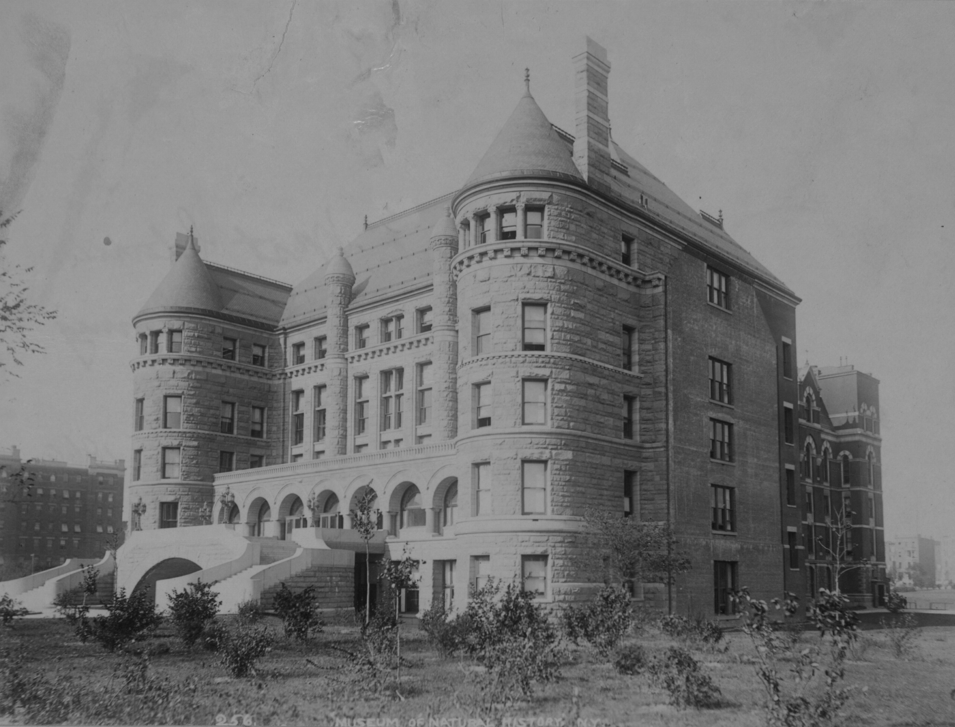
The American Museum of Natural History (abbreviated as AMNH) is a natural history museum on the Upper West Side of Manhattan in New York City. In Theodore Roosevelt Park, across the street from Central Park, the museum complex comprises 26 interconnected buildings housing 45 permanent exhibition halls, in addition to a planetarium and a library. The museum collections contain over 34 million specimens of plants, animals, fossils, minerals, rocks, meteorites, human remains, and human cultural artifacts, as well as specialized collections for frozen tissue and genomic and astrophysical data, of which only a small fraction can be displayed at any given time. The museum occupies more than . AMNH has a full-time scientific staff of 225, sponsors over 120 special field expeditions each year, and averages about five million visits annually. The AMNH is a private 501(c)(3) organization. Its mission statement is: "To discover, interpret, and disseminate‚ÄĒthrough scientific research and ... [...More Info...] [...Related Items...] OR: [Wikipedia] [Google] [Baidu] |
Oregon Public Broadcasting
Oregon Public Broadcasting (OPB) is the primary television and radio public broadcasting network for most of the U.S. state of Oregon as well as southern Washington. OPB consists of five full-power television stations, dozens of VHF or UHF translators, and over 20 radio stations and frequencies. Broadcasts include local and regional programming as well as television programs from the Public Broadcasting Service (PBS) and American Public Television (APT), and radio programs from National Public Radio (NPR), American Public Media (APM), Public Radio Exchange (PRX), and the BBC World Service, among other distributors. Its headquarters and television studios are located in Portland. OPB is also a major producer of television programming for national broadcast on PBS and Create through distributors like APT, with shows such as ''History Detectives'', ''Barbecue America'', ''Foreign Exchange'', ''Rick Steves' Europe'', and travel shows hosted by Art Wolfe. , OPB had over one millio ... [...More Info...] [...Related Items...] OR: [Wikipedia] [Google] [Baidu] |
The New Yorker
''The New Yorker'' is an American weekly magazine featuring journalism, commentary, criticism, essays, fiction, satire, cartoons, and poetry. Founded as a weekly in 1925, the magazine is published 47 times annually, with five of these issues covering two-week spans. Although its reviews and events listings often focus on the Culture of New York City, cultural life of New York City, ''The New Yorker'' has a wide audience outside New York and is read internationally. It is well known for its illustrated and often topical covers, its commentaries on popular culture and eccentric American culture, its attention to modern fiction by the inclusion of Short story, short stories and literary reviews, its rigorous Fact-checking, fact checking and copy editing, its journalism on politics and social issues, and its single-panel cartoons sprinkled throughout each issue. Overview and history ''The New Yorker'' was founded by Harold Ross and his wife Jane Grant, a ''The New York Times, N ... [...More Info...] [...Related Items...] OR: [Wikipedia] [Google] [Baidu] |
Washington (state)
Washington (), officially the State of Washington, is a state in the Pacific Northwest region of the Western United States. Named for George Washington‚ÄĒthe first U.S. president‚ÄĒthe state was formed from the western part of the Washington Territory, which was ceded by the British Empire in 1846, by the Oregon Treaty in the settlement of the Oregon boundary dispute. The state is bordered on the west by the Pacific Ocean, Oregon to the south, Idaho to the east, and the Canadian province of British Columbia to the north. It was admitted to the Union as the 42nd state in 1889. Olympia is the state capital; the state's largest city is Seattle. Washington is often referred to as Washington state to distinguish it from the nation's capital, Washington, D.C. Washington is the 18th-largest state, with an area of , and the 13th-most populous state, with more than 7.7 million people. The majority of Washington's residents live in the Seattle metropolitan area, the center of trans ... [...More Info...] [...Related Items...] OR: [Wikipedia] [Google] [Baidu] |
Oregon
Oregon () is a U.S. state, state in the Pacific Northwest region of the Western United States. The Columbia River delineates much of Oregon's northern boundary with Washington (state), Washington, while the Snake River delineates much of its eastern boundary with Idaho. The 42nd parallel north, 42¬į north parallel delineates the southern boundary with California and Nevada. Oregon has been home to many Indigenous peoples of the Americas, indigenous nations for thousands of years. The first European traders, explorers, and settlers began exploring what is now Oregon's Pacific coast in the early-mid 16th century. As early as 1564, the Spanish expeditions to the Pacific Northwest, Spanish began sending vessels northeast from the Philippines, riding the Kuroshio Current in a sweeping circular route across the northern part of the Pacific. In 1592, Juan de Fuca undertook detailed mapping and studies of ocean currents in the Pacific Northwest, including the Oregon coast as well as ... [...More Info...] [...Related Items...] OR: [Wikipedia] [Google] [Baidu] |
Thuja Plicata
''Thuja plicata'' is an evergreen coniferous tree in the cypress family Cupressaceae, native to western North America. Its common name is western redcedar (western red cedar in the UK), and it is also called Pacific redcedar, giant arborvitae, western arborvitae, just cedar, giant cedar, or shinglewood. It is not a true cedar of the genus ''Cedrus''. Description ''Thuja plicata'' is a large to very large tree, ranging up to tall and in trunk diameter. Trees growing in the open may have a crown that reaches the ground, whereas trees densely spaced together will exhibit a crown only at the top, where light can reach the leaves. The trunk swells at the base and has shallow roots. The bark is thin, gray-brown and fissured into vertical bands. As the tree ages, the top is damaged by wind and replaced by inferior branches. The species is long-lived; some trees can live well over a thousand years, with the oldest verified aged 1,460. The foliage forms flat sprays with scale-like ... [...More Info...] [...Related Items...] OR: [Wikipedia] [Google] [Baidu] |
Ghost Forest
Ghost forests are areas of dead trees in former forests, typically in coastal regions where rising sea levels or tectonic shifts have altered the height of a land mass. Forests located near the coast or estuaries may also be at risk of dying through saltwater poisoning, if invading seawater reduces the amount of freshwater that deciduous trees receive for sustenance. By looking at the stratigraphic record it is possible to reconstruct a series of events that lead to the creation of a ghost forest where, in a convergent plate boundary, there has been orogenic uplift, followed by earthquakes resulting in subsidence and tsunamis, altering the coast and creating a ghost forest. Formations Sea level changes When there is a change in sea level, coastal regions may become inundated with sea water. This can alter coastal areas and kill large areas of trees, leaving behind what is called a ‚Äúghost forest.‚ÄĚ This type of ghost forest may develop in a variety of environments and in man ... [...More Info...] [...Related Items...] OR: [Wikipedia] [Google] [Baidu] |
Dendrochronology
Dendrochronology (or tree-ring dating) is the scientific method of dating tree rings (also called growth rings) to the exact year they were formed. As well as dating them, this can give data for dendroclimatology, the study of climate and atmospheric conditions during different periods in history from wood. Dendrochronology derives from Ancient Greek (), meaning "tree", (), meaning "time", and (), "the study of". Dendrochronology is useful for determining the precise age of samples, especially those that are too recent for radiocarbon dating, which always produces a range rather than an exact date. However, for a precise date of the death of the tree a full sample to the edge is needed, which most trimmed timber will not provide. It also gives data on the timing of events and rates of change in the environment (most prominently climate) and also in wood found in archaeology or works of art and architecture, such as old panel paintings. It is also used as a check in radiocar ... [...More Info...] [...Related Items...] OR: [Wikipedia] [Google] [Baidu] |
ŇĆtsuchi, Iwate
270px, ŇĆtsuchi port is a town located in Kamihei District, Iwate Prefecture, in the TŇćhoku region of northern Japan. , the town had an estimated population of 11,572 and a population density of 58 persons per km¬≤ in 5308 households. The total area of the town is . Since 1973, the University of Tokyo has maintained a marine research laboratory in ŇĆtsuchi. It is now called the International Coastal Research Center (ICRC) and is managed by the Atmosphere and Ocean Research Institute. Geography ŇĆtsuchi is a coastal mountainous community situated on the Sanriku Coast along the Pacific Ocean. The inland portion of the town is within the Kitakami Mountains Neighboring municipalities Iwate Prefecture * Miyako * TŇćno *Kamaishi *Yamada Climate ŇĆtsuchi has a humid climate (K√∂ppen ''Cfa'') characterized by mild summers and cold winters. The average annual temperature in ŇĆtsuchi is 11.2 ¬įC. The average annual rainfall is 1402 mm with September as the wettest month ... [...More Info...] [...Related Items...] OR: [Wikipedia] [Google] [Baidu] |


.jpg)


.jpg)


