|
1969 New Year Honours (New Zealand)
The 1969 New Year Honours in New Zealand were appointments by Elizabeth II on the advice of the New Zealand government to various orders and honours to reward and highlight good works by New Zealanders. The awards celebrated the passing of 1968 and the beginning of 1969, and were announced on 1 January 1969. The recipients of honours are displayed here as they were styled before their new honour. Knight Bachelor * Walter Edwin Bate – of Hastings. For services to local government and to the community. * James Bell Donald – of Auckland. For services to the community. File:James Donald, 1928.jpg, Sir James Donald Order of Saint Michael and Saint George Companion (CMG) * Barton Albert Barton-Ginger – of Wellington. For services to the community. * George Robert Laking – Secretary of External Affairs. File:Barton Albert Barton-Ginger.jpg, Barton Barton-Ginger File:George Laking.jpg, George Laking Order of the British Empire Commander (CBE) ;Civil division * Wil ... [...More Info...] [...Related Items...] OR: [Wikipedia] [Google] [Baidu] |
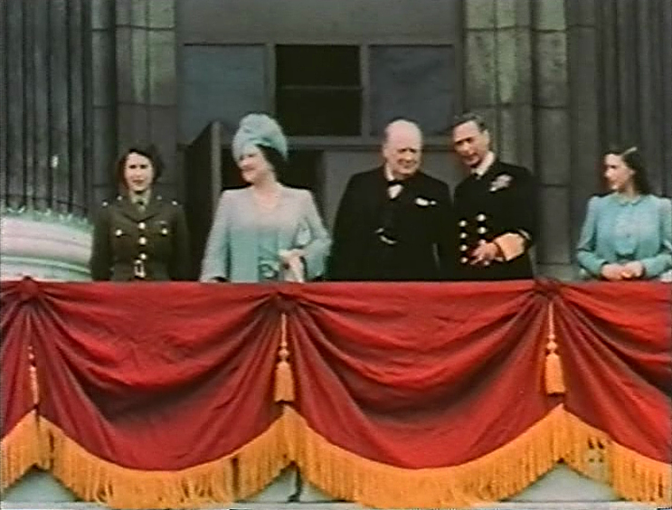
Elizabeth II
Elizabeth II (Elizabeth Alexandra Mary; 21 April 1926 – 8 September 2022) was Queen of the United Kingdom and other Commonwealth realms from 6 February 1952 until her death in 2022. She was queen regnant of 32 sovereign states during her lifetime, and was head of state of 15 realms at the time of her death. Her reign of 70 years and 214 days was the longest of any British monarch and the longest verified reign of any female monarch in history. Elizabeth was born in Mayfair, London, as the first child of the Duke and Duchess of York (later King George VI and Queen Elizabeth The Queen Mother). Her father acceded to the throne in 1936 upon the abdication of his brother Edward VIII, making the ten-year-old Princess Elizabeth the heir presumptive. She was educated privately at home and began to undertake public duties during the Second World War, serving in the Auxiliary Territorial Service. In November 1947, she married Philip Mountbatten, a former prince ... [...More Info...] [...Related Items...] OR: [Wikipedia] [Google] [Baidu] |
Napier, New Zealand
Napier ( ; mi, Ahuriri) is a city on the eastern coast of the North Island of New Zealand and the seat of the Hawke's Bay Region, Hawke's Bay region. It is a beachside city with a Napier Port, seaport, known for its sunny climate, esplanade lined with Araucaria heterophylla, Norfolk Pines and extensive Art Deco architecture. Napier is sometimes referred to as the "Nice of the Pacific Ocean, Pacific". The population of Napier is about About south of Napier is the inland city of Hastings, New Zealand, Hastings. These two neighbouring cities are often called "The Bay Cities" or "The Twin Cities" of New Zealand, with the two cities and the surrounding towns of Havelock North and Clive, New Zealand, Clive having a combined population of . The City of Napier has a land area of and a population density of 540.0 per square kilometre. Napier is the nexus of the largest wool centre in the Southern Hemisphere, and it has the primary export seaport for northeastern New Zealand – which ... [...More Info...] [...Related Items...] OR: [Wikipedia] [Google] [Baidu] |
Hunterville
Hunterville is a small community on State Highway 1, in the Rangitikei district of the North Island of New Zealand. It is located halfway between Taupo and Wellington and has a population (2018 census) of 411, a decrease of 18 people from 2013. The township was named for George Hunter, who was a member of the Wellington Provincial Council. It straddles the state highway as well as the main trunk railway in the foothills forming the gateway to the Central Plateau. Kiwiburn, the New Zealand Burning Man regional burn, has been held there since 2014. The closest airport or airfield to Hunterville is RNZAF Base Ohakea, an important Royal New Zealand Air Force base, which is sited 33 km to the south west. 6 km north of Hunterville is Vinegar Hill. The Hunterville railway station on the North Island Main Trunk line opened in 1887 and closed in 1988. Hunterville is well known for its statue of the huntaway, a specialised herding dog that uses its voice to drive the sh ... [...More Info...] [...Related Items...] OR: [Wikipedia] [Google] [Baidu] |
MB ChB
Bachelor of Medicine, Bachelor of Surgery ( la, Medicinae Baccalaureus, Baccalaureus Chirurgiae; abbreviated most commonly MBBS), is the primary medical degree awarded by medical schools in countries that follow the tradition of the United Kingdom. The historical degree nomenclature states that they are two separate undergraduate degrees. In practice, however, they are usually combined as one and conferred together, and may also be awarded at graduate-level medical schools. It usually takes five to six years to complete this degree. Bachelor of Medicine (MB, also BM, BMed) is the primary medical degree awarded by medical schools in China and some medical schools in Australia and UK. It usually takes five years to complete. These medical graduates with an MB degree can still practice surgery. Both medical degrees are considered MD-equivalent in US universities and medical institutions. In North America, the equivalent medical degree is awarded as Doctor of Medicine (MD) or Doc ... [...More Info...] [...Related Items...] OR: [Wikipedia] [Google] [Baidu] |
Putāruru
Putāruru is a small town in the South Waikato District and the Waikato region of New Zealand's North Island. It lies on the western side of the Mamaku Ranges and in the upper basin of the Waihou River. It is on the Oraka Stream 65 kilometres south-east of Hamilton. State Highway 1 and the Kinleith Branch railway run through the town. Name The town gets its name from a historic event which occurred nearby. Korekore a granddaughter of Raukawa, the founder of the Ngāti Raukawa iwi, was murdered by her husband Parahore. Her servant Ruru witnessed her murder and escaped into the forest where he hid and waited for Parahore and his men to give up their pursuit of him. The place where he exited the forest was named "Te Puta a Ruru" or "the exit of Ruru". This was eventually shorted to Putāruru. History and culture Pre-colonial history There were several Māori settlements in the Putāruru district in pre-colonial times. Ngāti Raukawa is the main tribe or iwi in the area and N ... [...More Info...] [...Related Items...] OR: [Wikipedia] [Google] [Baidu] |
Pahiatua
, image_skyline = Market day pahiatua 1st dec 2007 1.JPG , imagesize = , image_caption = , image_flag = , flag_size = , image_seal = , seal_size = , image_shield = , shield_size = , image_blank_emblem = , blank_emblem_type = , blank_emblem_size = , image_map = , mapsize = , map_caption = , image_map1 = , mapsize1 = , map_caption1 = , image_dot_map = , pushpin_map = , subdivision_type = Country , subdivision_name = New Zealand , subdivision_type1 = Region , subdivision_name1 = Manawatū-Whanganui , subdivision_type2 = Territorial authority , subdivision_name2 = Tararua , seat_type = Electorate , seat = Wairarapa , parts_type = , government_footnotes = , gove ... [...More Info...] [...Related Items...] OR: [Wikipedia] [Google] [Baidu] |
Palmerston North
Palmerston North (; mi, Te Papa-i-Oea, known colloquially as Palmy) is a city in the North Island of New Zealand and the seat of the Manawatū-Whanganui region. Located in the eastern Manawatu Plains, the city is near the north bank of the Manawatu River, from the river's mouth, and from the end of the Manawatu Gorge, about north of the capital, Wellington. Palmerston North is the country's eighth-largest urban area, with an urban population of The official limits of the city take in rural areas to the south, north-east, north-west and west of the main urban area, extending to the Tararua Ranges; including the town of Ashhurst at the mouth of the Manawatu Gorge, the villages of Bunnythorpe and Longburn in the north and west respectively. The city covers a land area of . The city's location was once little more than a clearing in a forest and occupied by small communities of Māori, who called it ''Papa-i-Oea'', believed to mean "How beautiful it is". In the mid-1 ... [...More Info...] [...Related Items...] OR: [Wikipedia] [Google] [Baidu] |
Royal New Zealand Navy
The Royal New Zealand Navy (RNZN; mi, Te Taua Moana o Aotearoa, , Sea Warriors of New Zealand) is the maritime arm of the New Zealand Defence Force. The fleet currently consists of nine ships. The Navy had its origins in the Naval Defence Act 1913, and the subsequent purchase of the cruiser , which by 1921 had been moored in Auckland as a training ship. A slow buildup occurred during the Interwar period, and then perhaps the infant Navy's finest hour occurred soon after the beginning of World War II when fought alongside two other Royal Navy cruisers at the Battle of the River Plate in December 1939. History Pre–World War I The first recorded maritime combat activity in New Zealand occurred when Māori in war waka attacked Dutch explorer Abel Tasman off the northern tip of the South Island in December 1642. The New Zealand Navy did not exist as a separate military force until 1941. The association of the Royal Navy with New Zealand began with the arrival of Lieutenant ... [...More Info...] [...Related Items...] OR: [Wikipedia] [Google] [Baidu] |
Territorial Force (NZ)
, image = New Zealand Army Logo.png , image_size = 175px , caption = , start_date = , country = , branch = , type = Army , role = Land warfare , website = https://www.nzdf.mil.nz/army/ , size = * 4,519 active personnel * 2,065 reserve , command_structure = , garrison = Wellington , garrison_label = , nickname = , patron = , motto = , colours = Red and black , colors_label = , march = , mascot = , equipment = List of equipment of the New Zealand Army , equipment_label = , battles ... [...More Info...] [...Related Items...] OR: [Wikipedia] [Google] [Baidu] |
Royal New Zealand Infantry Regiment
The Royal New Zealand Infantry Regiment is the parent administrative regiment and corps of regular and reserve infantry battalions in the New Zealand Army. It was originally formed in 1947 with a singular Regular regiment and multiple reserve regiments. Over time, the regiments were turned into battalions, the reserve units amalgamated and more regular units raised and disbanded. Currently, the Regiment currently consists of two regular and three reserve battalions. Throughout its existence, units raised in this regiment have served and deployed on operations in Malaya, Vietnam, Borneo and various United Nations peacekeeping operations. Structure The Royal New Zealand Infantry Regiment is the parent administrative unit of all infantry units in the New Zealand Army, and currently consists of two regular and three reserve infantry battalions: * 1st Battalion (1 RNZIR) – Regular * 2/1st Battalion (2/1 RNZIR) – Regular * 2nd/4th Battalion (2/4 RNZIR) – Reserve * 3rd/6t ... [...More Info...] [...Related Items...] OR: [Wikipedia] [Google] [Baidu] |
Dunedin
Dunedin ( ; mi, Ōtepoti) is the second-largest city in the South Island of New Zealand (after Christchurch), and the principal city of the Otago region. Its name comes from , the Scottish Gaelic name for Edinburgh, the capital of Scotland. The city has a rich Scottish, Chinese and Māori heritage. With an estimated population of as of , Dunedin is both New Zealand's seventh-most populous metro and urban area. For historic, cultural and geographic reasons the city has long been considered one of New Zealand's four main centres. The urban area of Dunedin lies on the central-eastern coast of Otago, surrounding the head of Otago Harbour, and the harbour and hills around Dunedin are the remnants of an extinct volcano. The city suburbs extend out into the surrounding valleys and hills, onto the isthmus of the Otago Peninsula, and along the shores of the Otago Harbour and the Pacific Ocean. Archaeological evidence points to lengthy occupation of the area by Māori prior to the ar ... [...More Info...] [...Related Items...] OR: [Wikipedia] [Google] [Baidu] |
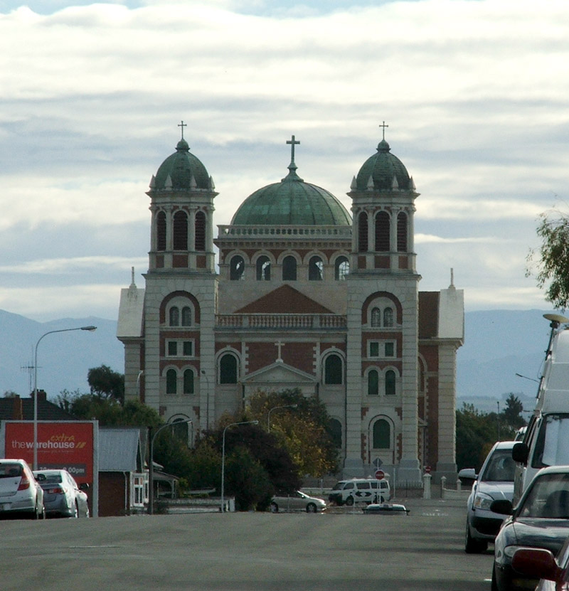
Timaru
Timaru (; mi, Te Tihi-o-Maru) is a port city in the southern Canterbury Region of New Zealand, located southwest of Christchurch and about northeast of Dunedin on the eastern Pacific coast of the South Island. The Timaru urban area is home to people, and is the largest urban area in South Canterbury, and the second largest in the Canterbury Region overall, after Christchurch. The town is the seat of the Timaru District, which includes the surrounding rural area and the towns of Geraldine, Pleasant Point and Temuka, which combined have a total population of . Caroline Bay beach is a popular recreational area located close to Timaru's main centre, just to the north of the substantial port facilities. Beyond Caroline Bay, the industrial suburb of Washdyke is at a major junction with State Highway 8, the main route into the Mackenzie Country. This provides a road link to Pleasant Point, Fairlie, Twizel, Lake Tekapo, Aoraki / Mount Cook and Queenstown. Timaru has been built ... [...More Info...] [...Related Items...] OR: [Wikipedia] [Google] [Baidu] |


.jpg)

.jpg)
.jpg)


