|
1923 Great Kantō Earthquake
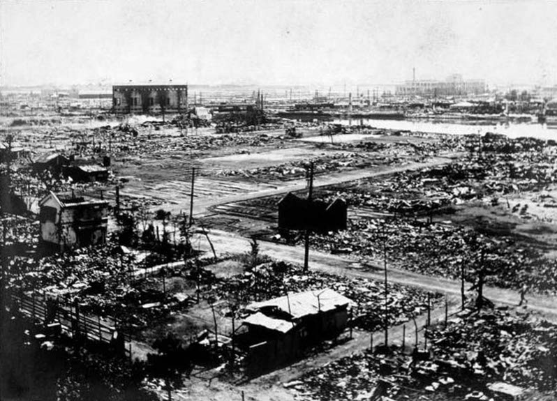
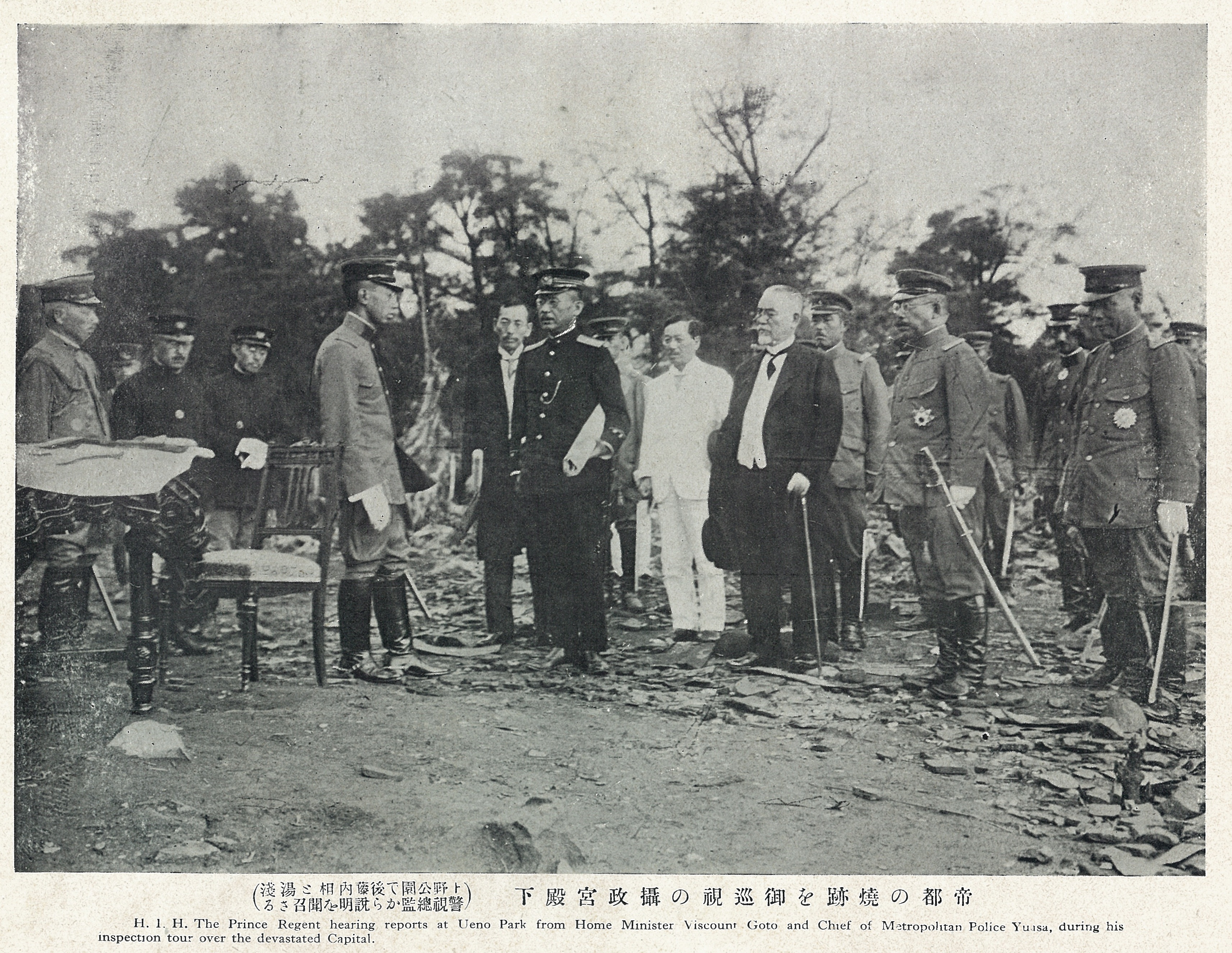
The 1923 Great Kantō earthquake (, or ) was a major earthquake that struck the Kantō Plain on the main Japanese island of Honshu at 11:58:32 JST (02:58:32 UTC) on Saturday, 1 September 1923. It had an approximate magnitude of 8.0 on the moment magnitude scale (Mw), with its epicenter located southwest of the capital Tokyo. The earthquake devastated Tokyo, the port city of Yokohama, and surrounding prefectures of Kanagawa, Chiba, and Shizuoka, and caused widespread damage throughout the Kantō region. Fires, exacerbated by strong winds from a nearby typhoon, spread rapidly through the densely populated urban areas, accounting for the majority of the devastation and casualties. The death toll is estimated to have been between 105,000 and 142,000 people, including tens of thousands who went missing and were presumed dead. Over half of Tokyo and nearly all of Yokohama were destroyed, leaving approximately 2.5 million people homeless. The disaster triggered widespread social ... [...More Info...] [...Related Items...] OR: [Wikipedia] [Google] [Baidu] |
Ryōunkaku
The was Japan's first Western-style skyscraper. It stood in the Asakusa district of City of Tokyo (now Taitō, Tokyo) from 1890 until its demolition in 1923 following the Great Kantō earthquake of 1923. The , as it was affectionately called by Tokyoites, was Tokyo's most popular attraction, and a showcase for new technologies. It housed Japan's first electric elevator. History The Ryōunkaku quickly became a landmark and symbol of Asakusa after its opening in 1890. It was a major leisure complex for visitors from all over Tokyo. When the 1894 Tokyo earthquake weakened the structure, it was reinforced with steel girders. However on September 1, 1923, the Great Kantō earthquake destroyed the upper floors and damaged the whole tower so severely that it had to be demolished with explosives on September 23. A supermarket stands on the former grounds of the Ryōunkaku, with a historic marker placed near its entrance. In 2018, a nearby construction project unearthed the bricks of ... [...More Info...] [...Related Items...] OR: [Wikipedia] [Google] [Baidu] |
Moment Magnitude Scale
The moment magnitude scale (MMS; denoted explicitly with or Mwg, and generally implied with use of a single M for magnitude) is a measure of an earthquake's magnitude ("size" or strength) based on its seismic moment. was defined in a 1979 paper by Thomas C. Hanks and Hiroo Kanamori. Similar to the local magnitude scale, local magnitude/Richter scale () defined by Charles Francis Richter in 1935, it uses a logarithmic scale; small earthquakes have approximately the same magnitudes on both scales. Despite the difference, news media often use the term "Richter scale" when referring to the moment magnitude scale. Moment magnitude () is considered the authoritative magnitude scale for ranking earthquakes by size. It is more directly related to the energy of an earthquake than other scales, and does not saturatethat is, it does not underestimate magnitudes as other scales do in certain conditions. It has become the standard scale used by seismological authorities like the United State ... [...More Info...] [...Related Items...] OR: [Wikipedia] [Google] [Baidu] |
Earthquake
An earthquakealso called a quake, tremor, or tembloris the shaking of the Earth's surface resulting from a sudden release of energy in the lithosphere that creates seismic waves. Earthquakes can range in intensity, from those so weak they cannot be felt, to those violent enough to propel objects and people into the air, damage critical infrastructure, and wreak destruction across entire cities. The seismic activity of an area is the frequency, type, and size of earthquakes experienced over a particular time. The seismicity at a particular location in the Earth is the average rate of seismic energy release per unit volume. In its most general sense, the word ''earthquake'' is used to describe any seismic event that generates seismic waves. Earthquakes can occur naturally or be induced by human activities, such as mining, fracking, and nuclear weapons testing. The initial point of rupture is called the hypocenter or focus, while the ground level directly above it is the ... [...More Info...] [...Related Items...] OR: [Wikipedia] [Google] [Baidu] |
Disaster Prevention Day
In Japan, September 1 is . This day commemorates the 1923 Great Kantō earthquake and is a day on which disaster preparations are taken nationwide, especially in the Kantō region. History On September 1, 1923, Tokyo and surrounding areas were devastated by a massive 7.9 magnitude earthquake, with a death toll of over 100,000 people from the disaster, including a large number of Koreans and socialists murdered by mobs. In June 1960 during the Prime Ministership of Nobusuke Kishi was a Japanese bureaucrat and politician who served as Prime Minister of Japan, prime minister of Japan from 1957 to 1960. He is remembered for his exploitative economic management of the Japanese puppet state of Manchukuo in China in the 1930s, ..., the decision was made that September 1 would become Disaster Prevention Day in order to reduce the death toll from disasters. One year after the 1995 Great Hanshin-Awaji Earthquake the Japanese government declared the anniversary date of January 17 to be ... [...More Info...] [...Related Items...] OR: [Wikipedia] [Google] [Baidu] |
Divine Retribution
Divine retribution is supernatural punishment of a person, a group of people, or everyone by a deity in response to some action. Many cultures have a story about how a deity imposed punishment on previous inhabitants of their land, causing their doom. An example of divine retribution is the story found in many religions about a great flood destroying all of humanity, as described in the Epic of Gilgamesh, the Hindu Vedas, or the Book of Genesis (6:9–8:22), leaving one principal 'chosen' survivor. In the first example, the survivor is Utnapishtim, in the Hindu Vedas, it is Manu, and in the last example, it is Noah. References in the Old Testament and the Quran to a man named Nuh (Noah) who was commanded by God to build an ark also suggest that one man and his followers were saved in a great flood. Other examples in Bible history include the dispersion of the builders of the Tower of Babel (Genesis 11:1–9), the destruction of Sodom and Gomorrah (Genesis 18:20–21, 19: ... [...More Info...] [...Related Items...] OR: [Wikipedia] [Google] [Baidu] |
Martial Law
Martial law is the replacement of civilian government by military rule and the suspension of civilian legal processes for military powers. Martial law can continue for a specified amount of time, or indefinitely, and standard civil liberties may be suspended for as long as martial law continues. Most often, martial law is declared in times of war or emergencies such as civil unrest and natural disasters. Alternatively, martial law may be declared in instances of Coup d'état, military coups d'état. Overview Despite the fact that it has been declared frequently throughout history, martial law is still often described as largely elusive as a legal entity. References to martial law date back to 1628 England, when Matthew Hale (jurist), Sir Matthew Hale described martial law as, "no Law, but something indulged rather than allowed as a Law." Despite being centuries old, this quote remains true in many countries around the world today. Most often, the implementation of martial l ... [...More Info...] [...Related Items...] OR: [Wikipedia] [Google] [Baidu] |
Vigilantism
Vigilantism () is the act of preventing, investigating, and punishing perceived offenses and crimes without legal authority. A vigilante is a person who practices or partakes in vigilantism, or undertakes public safety and retributive justice without commission. Definition The term is borrowed from Italian , which means 'sentinel' or 'watcher', from Latin . According to political scientist Regina Bateson, vigilantism is "the extralegal prevention, investigation, or punishment of offenses." The definition has three components: # Extralegal: Vigilantism is done outside of the law (not necessarily in violation of the law) # Prevention, investigation, or punishment: Vigilantism requires specific actions, not just attitudes or beliefs # Offense: Vigilantism is a response to a perceived crime or violation of an authoritative norm Other scholars have defined "collective vigilantism" as "group violence to punish perceived offenses to a community." Les Johnston argues that vigilant ... [...More Info...] [...Related Items...] OR: [Wikipedia] [Google] [Baidu] |
Kantō Massacre
The was a mass murder in the Kantō region of Japan committed in the aftermath of the 1923 Great Kantō earthquake. With the explicit and implicit approval of parts of the Japanese government, the Japanese military, police, and vigilantes murdered an estimated 6,000 people: mainly ethnic Koreans, but also Chinese and misidentified Japanese, and Japanese communists, socialists, and anarchists. The massacre began on the day of the earthquake, September 1, 1923, and continued for three weeks. A significant number of incidents occurred, including the Fukuda Village Incident. Meanwhile, government officials met and created a plan to suppress information about and minimize the scale of the killings. Beginning on September 18, the Japanese government arrested 735 participants in the massacre, but they were reportedly given light sentences. The Japanese Governor-General of Korea paid out 200 Japanese yen in compensation to 832 families of massacre victims, although the Japanese g ... [...More Info...] [...Related Items...] OR: [Wikipedia] [Google] [Baidu] |
Typhoon
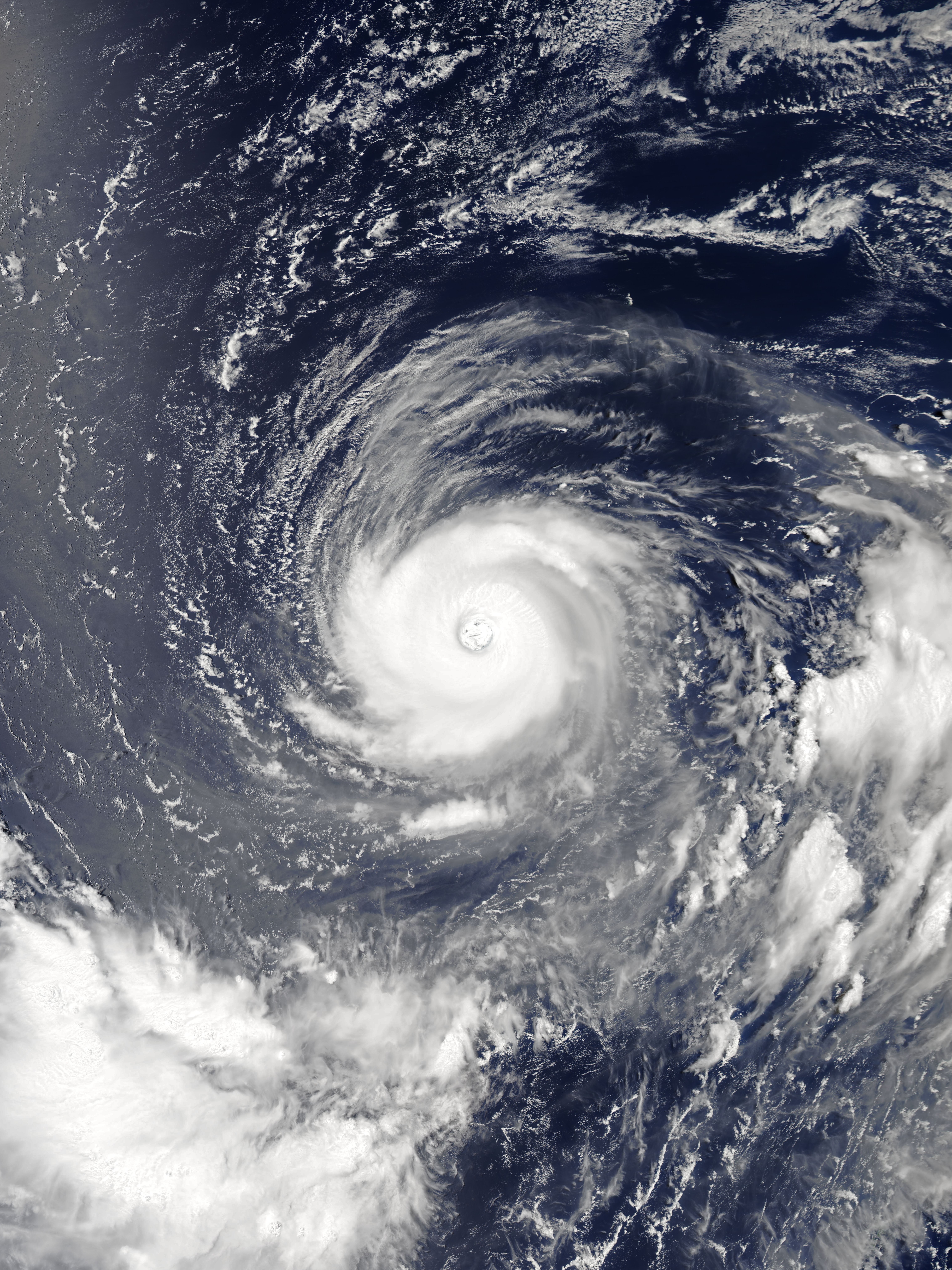
A typhoon is a tropical cyclone that develops between 180° and 100°E in the Northern Hemisphere and which produces sustained hurricane-force winds of at least . This region is referred to as the Northwestern Pacific Basin, accounting for almost one third of the world's tropical cyclones. For organizational purposes, the northern Pacific Ocean is divided into three regions: the eastern (North America to 140°W), central (140°W to 180°), and western (180° to 100°E). The Regional Specialized Meteorological Center (RSMC) for tropical cyclone forecasts is in Japan, with other tropical cyclone warning centres for the northwest Pacific in Hawaii (the Joint Typhoon Warning Center), the Philippines, and Hong Kong. Although the RSMC names each system, the main name list itself is coordinated among 18 countries that have territories threatened by typhoons each year. Within most of the northwestern Pacific, there are no official typhoon seasons as tropical cyclones form througho ... [...More Info...] [...Related Items...] OR: [Wikipedia] [Google] [Baidu] |
Kantō Region
The is a geography, geographical region of Honshu, the largest island of Japan. In a common definition, the region includes the Greater Tokyo Area and encompasses seven prefectures of Japan, prefectures: Chiba Prefecture, Chiba, Gunma Prefecture, Gunma, Ibaraki Prefecture, Ibaraki, Kanagawa Prefecture, Kanagawa, Saitama Prefecture, Saitama, Tochigi Prefecture, Tochigi, and Tokyo. Slightly more than 45 percent of the land area within its boundaries is the Kantō Plain. The rest consists of the hills and mountains that form land borders with other list of regions of Japan, regions of Japan. As the Kantō region contains Tokyo, the capital and largest city of Japan, the region is considered the center of Japan's politics and economy. According to the official census on October 1, 2010 by the Statistics Bureau (Japan), Statistics Bureau of Japan, the population was 42,607,376, amounting to approximately one third of the total population of Japan. Other definitions The assemb ... [...More Info...] [...Related Items...] OR: [Wikipedia] [Google] [Baidu] |
Chiba Prefecture
is a Prefectures of Japan, prefecture of Japan located in the Kantō region of Honshu. Chiba Prefecture has a population of 6,278,060 (1 June 2019) and has a geographic area of . Chiba Prefecture borders Ibaraki Prefecture to the north, Saitama Prefecture to the northwest, and Tokyo to the west. Chiba (city), Chiba is the capital and largest city of Chiba Prefecture, with other major cities including Funabashi, Matsudo, Ichikawa, Chiba, Ichikawa and Kashiwa. Chiba Prefecture is located on Japan's eastern Pacific Ocean, Pacific coast to the east of Tokyo, and is part of the Greater Tokyo Area, the most populous metropolitan area in the world. Chiba Prefecture largely consists of the Bōsō Peninsula, which encloses the eastern side of Tokyo Bay and separates it from Kanagawa Prefecture. Chiba Prefecture is home to Narita International Airport, the Tokyo Disney Resort, and the Keiyō Industrial Zone. Etymology The name of Chiba Prefecture in Japanese is formed from two kanji char ... [...More Info...] [...Related Items...] OR: [Wikipedia] [Google] [Baidu] |
Kanagawa Prefecture
is a Prefectures of Japan, prefecture of Japan located in the Kantō region of Honshu. Kanagawa Prefecture is the List of Japanese prefectures by population, second-most populous prefecture of Japan at 9,221,129 (1 April 2022) and third-densest at . Its geographic area of makes it fifth-smallest. Kanagawa Prefecture borders Tokyo to the north, Yamanashi Prefecture to the northwest and Shizuoka Prefecture to the west. Yokohama is the capital and largest city of Kanagawa Prefecture and the List of cities in Japan, second-largest city in Japan, with other major cities including Kawasaki, Kanagawa, Kawasaki, Sagamihara, and Fujisawa, Kanagawa, Fujisawa. Kanagawa Prefecture is located on Japan's eastern Pacific coast on Tokyo Bay and Sagami Bay, separated by the Miura Peninsula, across from Chiba Prefecture on the Bōsō Peninsula. Kanagawa Prefecture is part of the Greater Tokyo Area, the most populous metropolitan area in the world, with Yokohama and many of its cities being ma ... [...More Info...] [...Related Items...] OR: [Wikipedia] [Google] [Baidu] |


