|
148th Meridian East
The meridian 148° east of Greenwich is a line of longitude that extends from the North Pole across the Arctic Ocean, Asia, the Pacific Ocean, Australasia, the Southern Ocean, and Antarctica to the South Pole. The 148th meridian east forms a great circle with the 32nd meridian west. From Pole to Pole Starting at the North Pole and heading south to the South Pole The South Pole, also known as the Geographic South Pole, Terrestrial South Pole or 90th Parallel South, is one of the two points where Earth's axis of rotation intersects its surface. It is the southernmost point on Earth and lies antipod ..., the 148th meridian east passes through: : See also * 147th meridian east * 149th meridian east {{geographical coordinates, state=collapsed e148 meridian east ... [...More Info...] [...Related Items...] OR: [Wikipedia] [Google] [Baidu] |
Prime Meridian
A prime meridian is an arbitrary meridian (a line of longitude) in a geographic coordinate system at which longitude is defined to be 0°. Together, a prime meridian and its anti-meridian (the 180th meridian in a 360°-system) form a great circle. This great circle divides a spheroid, like the Earth, into two hemispheres: the Eastern Hemisphere and the Western Hemisphere (for an east-west notational system). For Earth's prime meridian, various conventions have been used or advocated in different regions throughout history. The Earth's current international standard prime meridian is the IERS Reference Meridian. It is derived, but differs slightly, from the Greenwich Meridian, the previous standard. A prime meridian for a planetary body not tidally locked (or at least not in synchronous rotation) is entirely arbitrary, unlike an equator, which is determined by the axis of rotation. However, for celestial objects that are tidally locked (more specifically, synchronous) ... [...More Info...] [...Related Items...] OR: [Wikipedia] [Google] [Baidu] |
Kuril Islands
The Kuril Islands or Kurile Islands (; rus, Кури́льские острова́, r=Kuril'skiye ostrova, p=kʊˈrʲilʲskʲɪjə ɐstrɐˈva; Japanese: or ) are a volcanic archipelago currently administered as part of Sakhalin Oblast in the Russian Far East. It stretches approximately northeast from Hokkaido in Japan to Kamchatka Peninsula in Russia separating the Sea of Okhotsk from the north Pacific Ocean. There are 56 islands and many minor rocks. The Kuril Islands consist of the Greater Kuril Chain and the Lesser Kuril Chain. They cover an area of around , with a population of roughly 20,000. The islands have been under Russian administration since their 1945 invasion as the Soviet Union towards the end of World War II. Japan claims the four southernmost islands, including two of the three largest ( Iturup and Kunashir), as part of its territory, as well as Shikotan and the Habomai islets, which has led to the ongoing Kuril Islands dispute. The disputed islands ... [...More Info...] [...Related Items...] OR: [Wikipedia] [Google] [Baidu] |
Queensland
) , nickname = Sunshine State , image_map = Queensland in Australia.svg , map_caption = Location of Queensland in Australia , subdivision_type = Country , subdivision_name = Australia , established_title = Before federation , established_date = Colony of Queensland , established_title2 = Separation from New South Wales , established_date2 = 6 June 1859 , established_title3 = Federation , established_date3 = 1 January 1901 , named_for = Queen Victoria , demonym = , capital = Brisbane , largest_city = capital , coordinates = , admin_center_type = Administration , admin_center = 77 local government areas , leader_title1 = Monarch , leader_name1 = Charles III , leader_title2 = Governor , leader_name2 = Jeannette Young , leader_title3 = Premier , leader_name3 = Annastacia Palaszczuk ( ALP) , legislature = Parliament of Queensland , judiciary = Supreme Court of Queensland , national_representation = Parliament of Australia , national_representation_t ... [...More Info...] [...Related Items...] OR: [Wikipedia] [Google] [Baidu] |
Coral Sea Islands
The Coral Sea Islands Territory is an external territory of Australia which comprises a group of small and mostly uninhabited tropical islands and reefs in the Coral Sea, northeast of Queensland, Australia. The only inhabited island is Willis Island. The territory covers , most of which is ocean, extending east and south from the outer edge of the Great Barrier Reef and includes Heralds Beacon Island, Osprey Reef, the Willis Group and fifteen other reef/island groups. Cato Island is the highest point in the Territory.Geoscience AustraliaCoral Sea Islands History and status The Coral Sea Islands were first charted in 1803. In the 1870s and 1880s the islands were mined for guano but the absence of a reliable supply of fresh water prevented long-term habitation. The Coral Sea Islands became an Australian external territory in 1969 by the ''Coral Sea Islands Act'' (prior to that, the area was considered a part of Queensland) and extended in 1997 to include Elizabeth Reef ... [...More Info...] [...Related Items...] OR: [Wikipedia] [Google] [Baidu] |
Coral Sea
The Coral Sea () is a marginal sea of the South Pacific off the northeast coast of Australia, and classified as an interim Australian bioregion. The Coral Sea extends down the Australian northeast coast. Most of it is protected by the French Natural Park of the Coral Sea (french: Parc Naturel de la Mer de Corail) and the Australian Coral Sea Marine Park. The sea was the location for the Battle of the Coral Sea, a major confrontation during World War II between the navies of the Empire of Japan, and the United States and Australia. The sea contains numerous islands and reefs, as well as the world's largest reef system, the Great Barrier Reef (GBR), which was declared a World Heritage Site by UNESCO in 1981. All previous oil exploration projects were terminated at the GBR in 1975, and fishing is restricted in many areas. The reefs and islands of the Coral Sea are particularly rich in birds and aquatic life and are a popular tourist destination, both domestically and interna ... [...More Info...] [...Related Items...] OR: [Wikipedia] [Google] [Baidu] |
New Guinea
New Guinea (; Hiri Motu: ''Niu Gini''; id, Papua, or , historically ) is the world's second-largest island with an area of . Located in Oceania in the southwestern Pacific Ocean, the island is separated from Australia by the wide Torres Strait, though both landmasses lie on the same continental shelf. Numerous smaller islands are located to the west and east. The eastern half of the island is the major land mass of the independent state of Papua New Guinea. The western half, known as Western New Guinea, forms a part of Indonesia and is organized as the provinces of Papua, Central Papua, Highland Papua, South Papua, Southwest Papua, and West Papua. The largest cities on the island are Jayapura (capital of Papua, Indonesia) and Port Moresby (capital of Papua New Guinea). Names The island has been known by various names: The name ''Papua'' was used to refer to parts of the island before contact with the West. Its etymology is unclear; one theory states that ... [...More Info...] [...Related Items...] OR: [Wikipedia] [Google] [Baidu] |
Solomon Sea
The Solomon Sea is a sea located within the Pacific Ocean. It lies between Papua New Guinea and Solomon Islands. Many major battles were fought there during World War II. Extent The International Hydrographic Organization defines the limits of the Solomon Sea as follows: ''On the Northwest.'' By the Southeast limit of Bismarck Sea New Ireland along the parallel of 4°50' South to the coast of New Britain">New_Ireland_(island).html" ;"title=" line from the Southern point of New Ireland (island)">New Ireland along the parallel of 4°50' South to the coast of New Britain, along its Northern coast and thence a line from its Western extreme through the Northern point of Umboi Island to Teliata Point, New Guinea ()]. ''On the Northeast.'' By a line from the Southern point of New Ireland to the North point of Buka Island, through this island to the Northwest point of Bougainville Island, along the Southern coasts of Bougainville, Choisel Choiseul.html" ;"title="/nowiki>Choiseul I ... [...More Info...] [...Related Items...] OR: [Wikipedia] [Google] [Baidu] |
Umboi Island
Umboi (also named Rooke or Siassi) is a volcanic island between the mainland of Papua New Guinea and the island of New Britain. It is separated from New Britain by the Dampier Strait and Huon Peninsula, and New Guinea by the Vitiaz Strait. It has an elevation of . Languages are Papuan Kobai; and Austronesian: Mbula, Karanai, and Saveng languages. The Siassi Archipelago lies off the southeast coast of Umboi Island (a total of 18 islands, only seven are inhabited). During the mid-1920s, the population of the Siassi Islands was a little over 700 people. It had more than doubled (to almost 1700 people) by the early 1960s, and then decreased to a little more than 1600 people by the early 1980s. The Siassi support themselves through traditional trade based on a barter system; they are important middlemen who deliver pigs, pots and wooden bowls by sea in their canoes. See also * List of volcanoes in Papua New Guinea * Siassi Rural LLG Siassi Rural LLG is a local-level govern ... [...More Info...] [...Related Items...] OR: [Wikipedia] [Google] [Baidu] |
Sakar Island
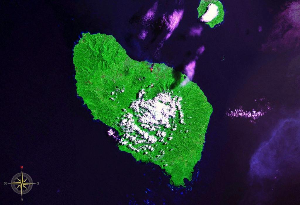
Sakar Island is a volcanic island north-west of New Britain in the Bismarck Sea, at . It is a stratovolcano with a summit crater lake Crater Lake ( Klamath: ''Giiwas'') is a volcanic crater lake in south-central Oregon in the western United States. It is the main feature of Crater Lake National Park and is famous for its deep blue color and water clarity. The lake partly fill .... No recorded eruptions are known. See also * List of volcanoes in Papua New Guinea References * Islands of Papua New Guinea Stratovolcanoes of Papua New Guinea Volcanic crater lakes Morobe Province {{MorobeProvince-geo-stub ... [...More Info...] [...Related Items...] OR: [Wikipedia] [Google] [Baidu] |
Bismarck Sea
The Bismarck Sea (, ) lies in the southwestern Pacific Ocean within the nation of Papua New Guinea. It is located northeast of the island of New Guinea and south of the Bismarck Archipelago. It has coastlines in districts of the Islands Region, Momase Region, and Papua Region. Geography Like the Bismarck Archipelago, it is named in honour of the first German Chancellor Otto von Bismarck. The Bismarck Archipelago extends round to the east and north of the sea, enclosing the Bismarck Sea and separating it from the Southern Pacific Ocean. To the south it is linked to the Solomon Sea by the Vitiaz Strait. Official boundaries The International Hydrographic Organization defines the Bismarck Sea as "that area of the South Pacific Ocean off the northeast coast of New Guinea", with the following limits: ''On the North and East.'' By the Northern and Northeastern coasts of the islands of New Ireland, New Hanover, the Admiralty Islands, Hermit Island, and the Ninigo Group, th ... [...More Info...] [...Related Items...] OR: [Wikipedia] [Google] [Baidu] |
Rambutyo Island
Rambutyo Island (or Rambutso Island) is one of the Admiralty Islands in the Bismarck Archipelago, located at . Politically, Rambutyo Island is part of Manus Province, Papua New Guinea. The population (unknown) is concentrated on the west coast. Villages include Mouklen (pop.500+, close to a defunct plantation) and Lengkau. Geography Rambutyo Island is 88 km2 and is located 50 km SE of Manus Island, part of the Hornos Island Group. It is roughly triangular in shape with a base 16 km in diameter East-West. The centre of the island has a volcanic peak about 230 m high. Offshore lie important reef complexes. The island was surveyed in 1958 by the Royal Australian Survey Corps. The vegetation is moist tropical and subtropical forest, with around 3,000mm of rainfall per year. Logging and coconut groves displaced forest at different times. There are endemic species of rats, bats, birds and a cuscus (Spilocuscus kraemeri, Admiralty Island cuscus) across the Admiralty Isl ... [...More Info...] [...Related Items...] OR: [Wikipedia] [Google] [Baidu] |
_033.jpg)


