|
é§andov
é§andov () is a town in áeskûÀ LûÙpa District in the Liberec Region of the Czech Republic. It has about 1,900 inhabitants. Administrative division é§andov consists of seven municipal parts (in brackets population according to the 2021 census): *é§andov (1,352) *DolnûÙ Police (54) *Heémanice (135) *Novosedlo (21) *Radeá (97) *Valteéice (148) *VelkûÀ JavorskûÀ (37) Etymology The original German name Sandau is a common German name, derived from 'sand' (with the same meaning in both German and English). The Czech name was created by transcription of the German one. Geography é§andov is located about west of áeskûÀ LûÙpa and east of ûstûÙ nad Labem. It lies in the Central Bohemian Uplands. The highest point is the hill HavranûÙ vrch at above sea level. The Plouánice River flows through the town. The entire municipal territory lies within the áeskûˋ stéedohoéûÙ Protected Landscape Area. History The first written mention of é§andov is from 1282. The longest and most impo ... [...More Info...] [...Related Items...] OR: [Wikipedia] [Google] [Baidu] |
áeskûÀ LûÙpa District
áeskûÀ LûÙpa District () is a Okres, district in the Liberec Region of the Czech Republic. Its capital is the town of áeskûÀ LûÙpa. Administrative division áeskûÀ LûÙpa District is divided into two Districts of the Czech Republic#Municipalities with extended competence, administrative districts of municipalities with extended competence: áeskûÀ LûÙpa and Novû§ Bor. List of municipalities Towns are marked in bold and market towns in ''italics'': Bezdáz - Blatce - BlûÙéƒevedly - Bohatice - BrniéÀtá - áeskûÀ LûÙpa - Chlum (áeskûÀ LûÙpa District), Chlum - Chotovice (áeskûÀ LûÙpa District), Chotovice - Cvikov - Doksy - DubûÀ - Dubnice - Hamr na Jezeée - ''Holany'' - HornûÙ Libchava - HornûÙ Police - JestéebûÙ (áeskûÀ LûÙpa District), JestéebûÙ - Kamenickû§ é enov - Kozly (áeskûÀ LûÙpa District), Kozly - Kravaée (áeskûÀ LûÙpa District), Kravaée - Krompach - Kunratice u Cvikova - KvûÙtkov - Luka (áeskûÀ LûÙpa District), Luka - Maéenice - Mimoé ... [...More Info...] [...Related Items...] OR: [Wikipedia] [Google] [Baidu] |
Plouánice
The Plouánice () is a river in the Czech Republic, a right tributary of the Elbe River. It flows through the Liberec Region, Liberec and ûstûÙ nad Labem Region, ûstûÙ nad Labem regions. It is long, making it the List of rivers of the Czech Republic, 23rd longest river in the Czech Republic. Etymology The name of the river is derived from the Czech word ''pléƒ'' (meaning 'Mollusca, mollusc'). The river was probably originally called ''pléƒánice'' (meaning "a stream full of molluscs"). Characteristic The Plouánice originates in the territory of OseánûÀ in the Ralsko Uplands at an elevation of . The spring area is considered to be one of the most abundant in Central Europe, which is why this spring is the main one. The secondary spring of the Plouánice is located in the territory of SvátlûÀ pod JeéÀtádem, on the slopes of Mt. JeéÀtád in the JeéÀtádãKozûÀkov Ridge at an elevation of . The river flows to DááûÙn, where it enters the Elbe River at an elevation of . It is ... [...More Info...] [...Related Items...] OR: [Wikipedia] [Google] [Baidu] |
áeskûˋ StéedohoéûÙ
The áeskûˋ stéedohoéûÙ (), also known as Central Bohemian Uplands or Central Bohemian Highlands,e.g. ''The New Encyclopaedia Britannica, Volume 31'', Encyclopaedia Britannica, 1998, p. 371 is a geomorphological region in northern Bohemia of the Czech Republic. Geography The region is about 80 km long, extending from áeskûÀ LûÙpa in the northeast to Louny in the southwest and from Litomáéice in the south to DááûÙn in the north, and is intersected by the river Elbe. The mountains, which are of volcanic origin, have distinctively sharp solitary peaks. Protection The eponymous protected landscape area covers most of the uplands' territory; consequently, construction through the area of the D8 motorway (part of European route E55 between Dresden and Prague Prague ( ; ) is the capital and List of cities and towns in the Czech Republic, largest city of the Czech Republic and the historical capital of Bohemia. Prague, located on the Vltava River, has a population ... [...More Info...] [...Related Items...] OR: [Wikipedia] [Google] [Baidu] |
DááûÙn
DááûÙn (; ) is a city in the ûstûÙ nad Labem Region of the Czech Republic. It has about 46,000 inhabitants. It is the seventth largest municipality in the country by area. DááûÙn is an important traffic junction. Administrative division DááûÙn consists of 35 municipal parts (in brackets population according to the 2021 census): *DááûÙn I-DááûÙn (4,723) *DááûÙn II-Novûˋ Másto (5,948) *DááûÙn III-Starûˋ Másto (3,687) *DááûÙn IV-Podmokly (5,376) *DááûÙn V-Rozbálesy (342) *DááûÙn VI-LetnûÀ (7,502) *DááûÙn VII-Chrochvice (1,252) *DááûÙn VIII-DolnûÙ Oldéichov (704) *DááûÙn IX-Bynov (3,670) *DááûÙn X-BálûÀ (907) *DááûÙn XI-HornûÙ é§leb (292) *DááûÙn XII-Vilsnice (277) *DááûÙn XIII-LoubûÙ (185) *DááûÙn XIV-DolnûÙ é§leb (141) *DááûÙn XV-ProstéednûÙ é§leb (232) *DááûÙn XVI-PéûÙpeé (97) *DááûÙn XVII-Jalé₤váûÙ (559) *DááûÙn XVIII-Maxiáky (100) *DááûÙn XIX-áechy (195) *DááûÙn XX-NovûÀ Ves (218) *DááûÙn XXI-HornûÙ Oldéichov (445) *Dá ... [...More Info...] [...Related Items...] OR: [Wikipedia] [Google] [Baidu] |
Liberec
Liberec (; ) is a city in the Czech Republic. It has about 108,000 inhabitants, making it the fifth largest city in the country. It lies on the Lusatian Neisse River, in a basin surrounded by mountains. The city centre is well preserved and is protected as an Cultural monument (Czech Republic)#Monument zones, urban monument zone. Liberec was once home to a thriving textile industry and hence nicknamed the "Manchester of Bohemia". A symbol of the city and the main landmark of the panorama of Liberec is the JeéÀtád Tower. Since the end of the 19th century, the city has been a conurbation with the suburb of Vratislavice nad Nisou and the neighbouring city of Jablonec nad Nisou. Administrative division Liberec consists of 33 municipal parts (in brackets population according to the 2021 census): *Liberec I-Starûˋ Másto (9,793) *Liberec II-Novûˋ Másto (2,979) *Liberec III-JeéûÀb (5,657) *Liberec IV-PeréÀtû§n (3,117) *Liberec V-KristiûÀnov (5,312) *Liberec VI-Rochlice (17,268) *Li ... [...More Info...] [...Related Items...] OR: [Wikipedia] [Google] [Baidu] |
Reichsgau Sudetenland
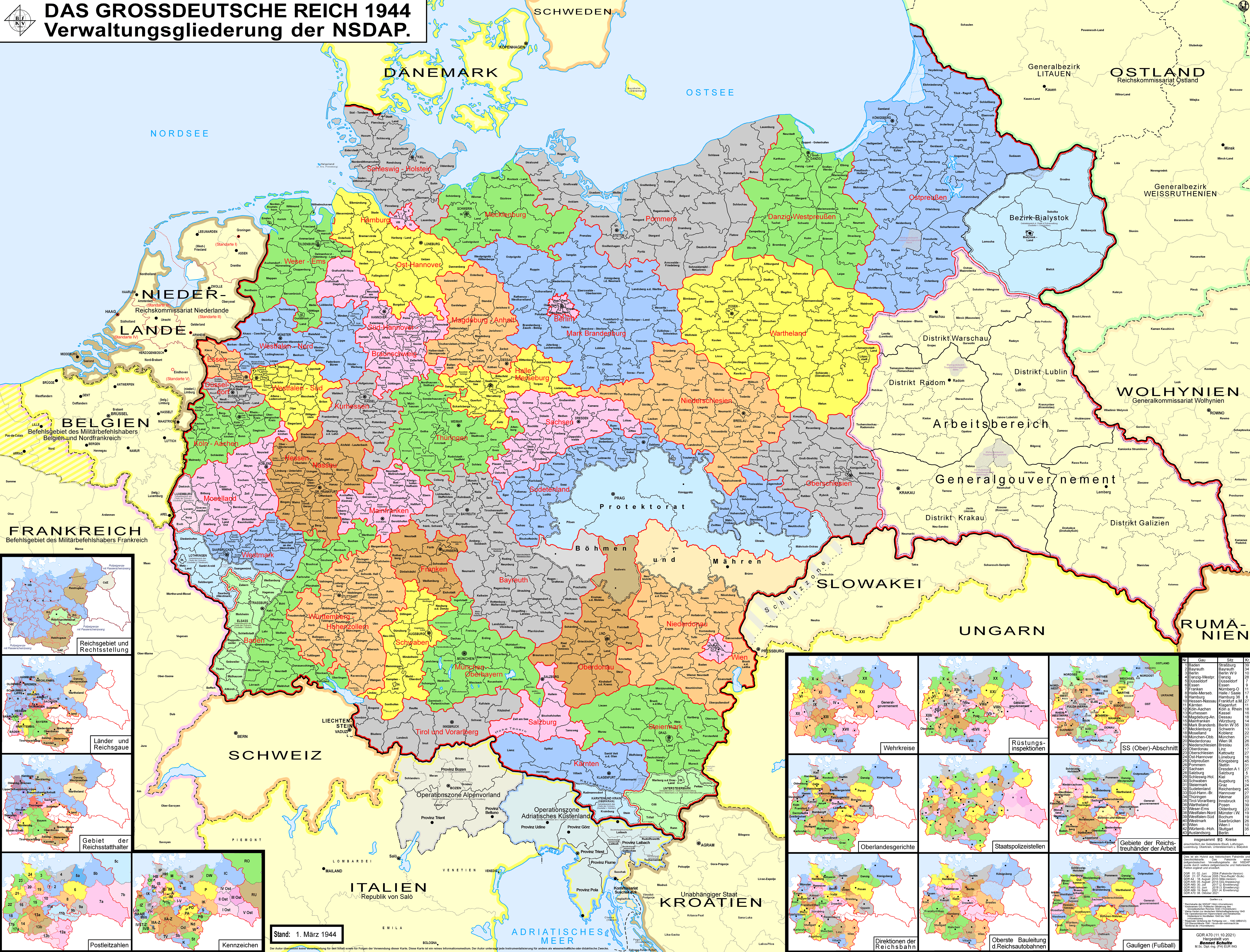
The Reichsgau Sudetenland was an administrative division of Nazi Germany from 1939 to 1945. It comprised the northern part of the ''Sudetenland'' territory, which was annexed from Czechoslovakia according to the 30 September 1938 Munich Agreement. The '' Reichsgau'' was headed by the former Sudeten German Party leader, now Nazi Party functionary Konrad Henlein as ''Gauleiter'' and ''Reichsstatthalter''. From October 1938 to May 1939, it was the regional subdivision of the Nazi Party in that area, also under Henlein's leadership. The administrative capital was Reichenberg (Liberec). History In the course of the German occupation of Czechoslovakia, on 30 September 1938 the Heads of Government of the United Kingdom, France, Italy, and Germany signed the Munich Agreement, which enforced the cession of the ''Sudetenland'' to Germany. Czechoslovak representatives were not invited. On 1 October, invading Wehrmacht forces occupied the territory. The new Czechoslovak-German borders were ... [...More Info...] [...Related Items...] OR: [Wikipedia] [Google] [Baidu] |
Nazi Germany
Nazi Germany, officially known as the German Reich and later the Greater German Reich, was the German Reich, German state between 1933 and 1945, when Adolf Hitler and the Nazi Party controlled the country, transforming it into a Totalitarianism, totalitarian dictatorship. The Third Reich, meaning "Third Realm" or "Third Empire", referred to the Nazi claim that Nazi Germany was the successor to the earlier Holy Roman Empire (800ã1806) and German Empire (1871ã1918). The Third Reich, which the Nazis referred to as the Thousand-Year Reich, ended in May 1945, after 12 years, when the Allies of World War II, Allies defeated Germany and entered the capital, Berlin, End of World War II in Europe, ending World War II in Europe. After Hitler was appointed Chancellor of Germany in 1933, the Nazi Party began to eliminate political opposition and consolidate power. A 1934 German referendum confirmed Hitler as sole ''Fû¥hrer'' (leader). Power was centralised in Hitler's person, an ... [...More Info...] [...Related Items...] OR: [Wikipedia] [Google] [Baidu] |
Berka Of DubûÀ
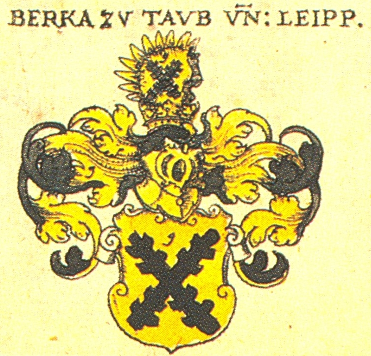
Berka of DubûÀ () was a cadet branch of a Bohemian noble family of Lords of DubûÀ established by Hynek Berka of DubûÀ (1249ã1306). It held estates in what is today the Czech Republic and Saxony in Germany throughout the Middle Ages. Ancestors This old Czech family separated from the family of the lords of Dubûˋ and are thus one of the lines of the :de:Ronow (Adelsgeschlecht), Ronows. The Ronows derive their origin from Smil from TuhûÀná from the end of the 12th century. His sons Jindéich and áastolov are mentioned in the first half of the 13th century as brothers from TuhûÀn and é§itava, who acquired the region in the north from the monarch. They and their sons founded other family branches, e.g. the lords of KlinéÀtejn, the lords of LipûÀ, the Lichtenburks and the lords of Duba (Berkov, AdréÀpach, é kop). The majority of the Ronians supported the king militarily and also obtained property, titles, and important positions in the kingdom for this. As regards the Berka from D ... [...More Info...] [...Related Items...] OR: [Wikipedia] [Google] [Baidu] |
Obec
(, ; plural ) is the Czech and Slovak word for a municipality (in the Czech Republic, in Slovakia and abroad). The literal meaning of the word is " commune" or " community". It is the smallest administrative unit that is governed by elected representatives. Cities and towns are also municipalities. Definition The legal definition (according to the Czech code of law with similar definition in the Slovak code of law) is: ''"The municipality is a basic territorial self-governing community of citizens; it forms a territorial unit, which is defined by the boundary of the municipality."'' Every municipality is composed of one or more cadastral areas. Every municipality is also composed of one or more municipal parts (), which are usually town quarters or villages. A municipality can have its own flag and coat of arms. Czech Republic Almost the entire area of the Czech Republic is divided into municipalities, with the only exception being military training areas. The smaller mu ... [...More Info...] [...Related Items...] OR: [Wikipedia] [Google] [Baidu] |
ûstûÙ Nad Labem
ûstûÙ nad Labem (; ) is a city in the Czech Republic. It has about 91,000 inhabitants and is the capital of the ûstûÙ nad Labem Region. It is a major industrial centre and, besides being an active river port, is an important railway junction. Administrative division ûstûÙ nad Labem is divided into four self-governing boroughs. In addition, ûstûÙ nad Labem consists of 22 municipal parts (in brackets population according to the 2021 census): *ûstûÙ nad Labem-másto (35,015) **BoéƒtáéÀice (496) **Bukov (5,988) **Habrovice (395) **Hostovice (249) **KlûÙéÀe (6,944) **Péedlice (1,544) **Skorotice (1,379) **StrûÀéƒky (234) **Vaéov (755) **VéÀeboéice (2,870) **ûstûÙ nad Labem-centrum (14,161) *ûstûÙ nad Labem-NeéÀtámice (22,148) **KrûÀsnûˋ Béezno (12,417) **MojéƒûÙé (4,222) **NeéÀtámice (5,509) *ûstûÙ nad Labem-SevernûÙ Terasa (18,965) **SevernûÙ Terasa (18,965) *ûstûÙ nad Labem-Stéekov (13,585) ** BrnûÀ (1,308) **CûÙrkvice (179) **Kojetice (129) **OleéÀnice (89) ** S ... [...More Info...] [...Related Items...] OR: [Wikipedia] [Google] [Baidu] |
Regions Of The Czech Republic
Regions of the Czech Republic ( ; singular ) are higher-level territorial self-governing units of the Czech Republic. History The first regions (''kraje'') were created in the Kingdom of Bohemia in the 14th century. At the beginning of the 15th century, Bohemia was already divided into 12 regions, but their borders were not fixed due to the frequent changes in the borders of the estates. During the reign of George of Podábrady (1458ã1471), Bohemia was divided into 14 regions, which remained so until 1714, when their number was reduced to 12 again. From 1751 to 1850, after the four largest regions were divided, the kingdom consisted of 16 regions. Between 1850 and 1862, there were several reforms and the number of regions fluctuated between 7 and 13. Due to the parallel establishment of political districts in 1848, however, their importance declined. In 1862, the regions were abolished, although the regional authorities had some powers until 1868. Moravia was divided into ... [...More Info...] [...Related Items...] OR: [Wikipedia] [Google] [Baidu] |


