|
≈Ýomrda
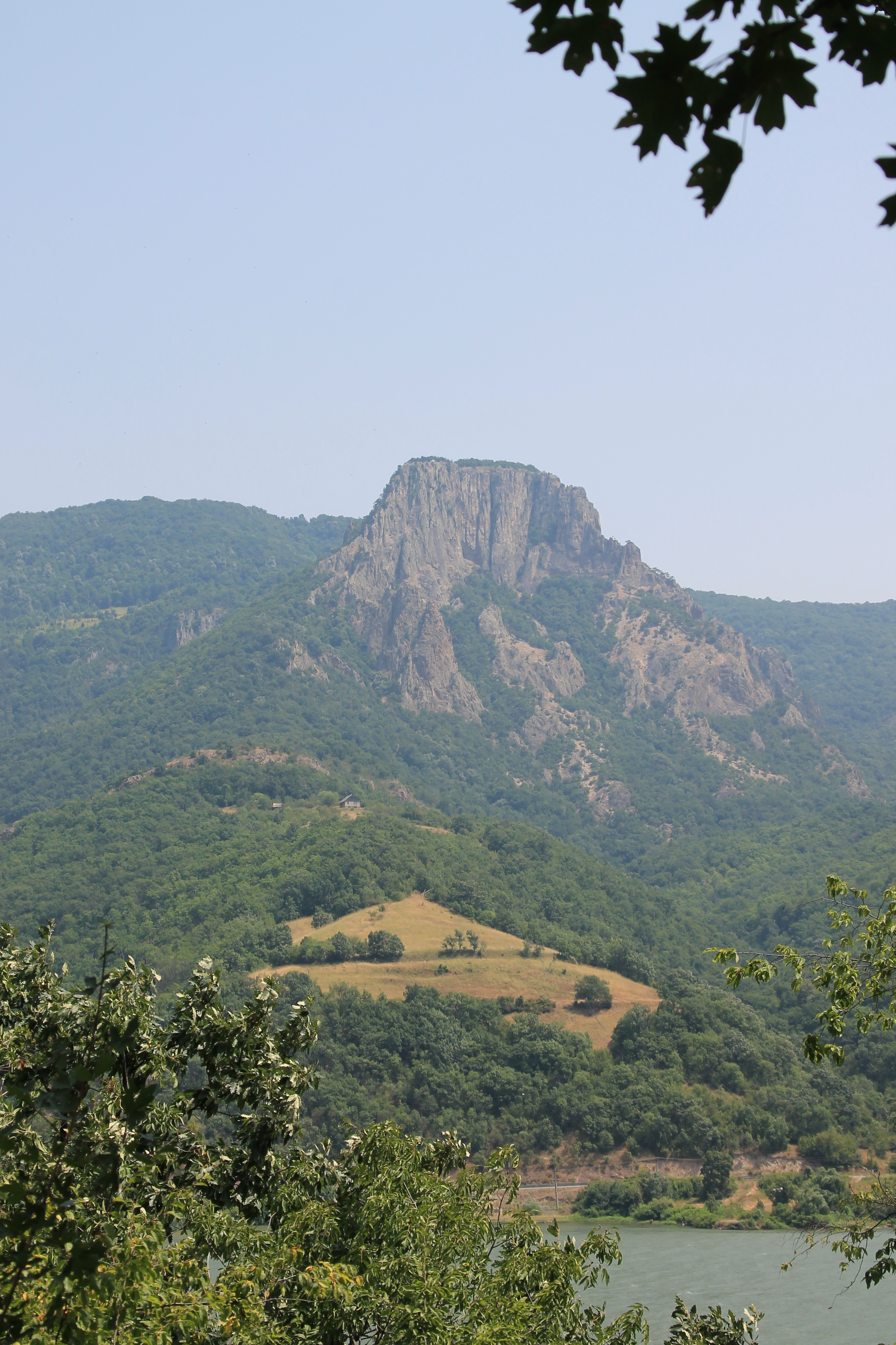
≈Ýomrda (Serbian Cyrillic: –®–æ–º—Ä–¥–∞) is a mountain in eastern Serbia, near the town of Lepenski Vir. Its highest peak has an elevation of 803 meters above sea level. Most of ≈Ýomrda is located in the ƒêerdap National Park The Iron Gates ( ro, Por»õile de Fier; sr, / or / ; Hungarian language, Hungarian: ''Vaskapu-szoros'') is a Canyon, gorge on the river Danube. It forms part of the boundary between Serbia (to the south) and Romania (north). In the broad .... References External linksPhoto tour on ≈Ýomrdaon freebiking.org Mountains of Serbia Serbian Carpathians {{serbia-geo-stub ... [...More Info...] [...Related Items...] OR: [Wikipedia] [Google] [Baidu] |
Serbian Carpathians
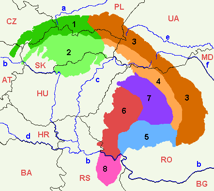
Serbian Carpathians ( sr, / ) is a mountain range in eastern Central Serbia, located in Central Europe. It presents an extension of proper Carpathian Mountains across the Danube, connecting them with the Balkan Mountains in the southeast. They stretch in north-south direction in eastern Serbia, east of the Great Morava valley and west of the White Timok Valley and north of the Nišava Valley. The mountains are 800–1500 m high, and dominated by karst limestone geologic features, the highest one being Rtanj Mountain (1,565 m). Definitions Under the strict definition (as defined by the Serbian Academy of Sciences and Arts and adopted by the Carpathian Convention), Serbian part of the Carpathian Mountains covers only 732 km², or less than 1% of the total Carpathian area. That part encompasses the southern bank of the Iron Gate and the area of Đerdap National Park. The extreme points of so defined Carpathian area in Serbia are Tekija in the north, in the south, ... [...More Info...] [...Related Items...] OR: [Wikipedia] [Google] [Baidu] |
Mountains Of Serbia
Serbia is mountainous, with complex geology and parts of several mountain ranges: Dinaric Alps in the southwest, the northwestern corner of the Rila-Rhodope Mountains in the southeast of the country, Carpathian Mountains in the northeast, and Balkan Mountains and the easternmost section of Srednogorie mountain chain system in the east, separated by a group of dome mountains along the Morava river valley. The northern province of Vojvodina lies in the Pannonian plain, with several Pannonian island mountains. Mountains of Kosovo are listed in a separate article. List This is the list of mountains and their highest peaks in Serbia, excluding Kosovo. When a mountain has several major peaks, they are listed separately.http://solair.eunet.rs/~s.ilic/planine.txt (Adopted with author's permission.) Peaks over 2,000 meters The following lists only those mountain peaks which reach over 2,000 meters in height.Statistical Yearbook of Serbia 2007; chapter 1. titled ''Geog ... [...More Info...] [...Related Items...] OR: [Wikipedia] [Google] [Baidu] |
Serbia
Serbia (, ; Serbian language, Serbian: , , ), officially the Republic of Serbia (Serbian language, Serbian: , , ), is a landlocked country in Southeast Europe, Southeastern and Central Europe, situated at the crossroads of the Pannonian Basin and the Balkans. It shares land borders with Hungary to the north, Romania to the northeast, Bulgaria to the southeast, North Macedonia to the south, Croatia and Bosnia and Herzegovina to the west, and Montenegro to the southwest, and claims a border with Albania through the Political status of Kosovo, disputed territory of Kosovo. Serbia without Kosovo has about 6.7 million inhabitants, about 8.4 million if Kosvo is included. Its capital Belgrade is also the List of cities in Serbia, largest city. Continuously inhabited since the Paleolithic Age, the territory of modern-day Serbia faced Slavs#Migrations, Slavic migrations in the 6th century, establishing several regional Principality of Serbia (early medieval), states in the early Mid ... [...More Info...] [...Related Items...] OR: [Wikipedia] [Google] [Baidu] |
Serbian Cyrillic
The Serbian Cyrillic alphabet ( sr, / , ) is a variation of the Cyrillic script used to write the Serbian language, updated in 1818 by Serbian linguist Vuk Karadžić. It is one of the two alphabets used to write standard modern Serbian, the other being Gaj's Latin alphabet. Karadžić based his alphabet on the previous Slavonic-Serbian script, following the principle of "write as you speak and read as it is written", removing obsolete letters and letters representing iotified vowels, introducing from the Latin alphabet instead, and adding several consonant letters for sounds specific to Serbian phonology. During the same period, linguists led by Ljudevit Gaj adapted the Latin alphabet, in use in western South Slavic areas, using the same principles. As a result of this joint effort, Serbian Cyrillic and Gaj's Latin alphabets for Serbian-Croatian have a complete one-to-one congruence, with the Latin digraphs Lj, Nj, and Dž counting as single letters. Karadžić's Cyril ... [...More Info...] [...Related Items...] OR: [Wikipedia] [Google] [Baidu] |
Lepenski Vir
Lepenski Vir ( sr-cyr, Лепенски Вир, "Lepena Whirlpool"), located in Serbia, is an important archaeological site of the Mesolithic Iron Gates culture of the Balkans. The latest radiocarbon and AMS data suggests that the chronology of Lepenski Vir spans between 9500/7200–6000 BC. There is some disagreement about when the settlement and culture of Lepenski Vir began, but the latest data indicates that it was between 9500–7200 BC. The late Lepenski Vir (6300–6000 BC) architectural phase saw the development of unique trapezoidal buildings and monumental sculpture. The Lepenski Vir site consists of one large settlement with around ten satellite villages. Numerous piscine sculptures and peculiar architectural remains have been found at the site. Archaeologist Dragoslav Srejović, who first explored the site, said that such large sculptures so early in human history, and the original architectural solutions, define Lepenski Vir as a specific and very early phase in the ... [...More Info...] [...Related Items...] OR: [Wikipedia] [Google] [Baidu] |
Đerdap National Park
The Iron Gates ( ro, Porțile de Fier; sr, / or / ; Hungarian language, Hungarian: ''Vaskapu-szoros'') is a Canyon, gorge on the river Danube. It forms part of the boundary between Serbia (to the south) and Romania (north). In the broad sense it encompasses a route of ; in the narrow sense it only encompasses the last barrier on this route, just beyond the Romanian city of Orșova, that contains two hydroelectricity, hydroelectric dams, with two power stations, Iron Gate I Hydroelectric Power Station and Iron Gate II Hydroelectric Power Station. At this point in the Danube, the river separates the southern Carpathian Mountains from the northwestern foothills of the Balkan Mountains. The Romanian side of the gorge constitutes the Iron Gates Natural Park, whereas the Serbian part constitutes the Đerdap National Park. A wider protected area on the Serbian side was declared the UNESCO Global Geoparks, UNESCO global geopark in July 2020. Archaeologists have named the Iron Ga ... [...More Info...] [...Related Items...] OR: [Wikipedia] [Google] [Baidu] |


