|
├║ltima Esperanza Province
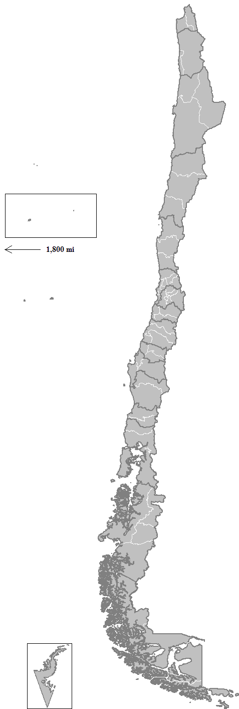
├Ültima Esperanza ( es, Provincia de ├Ültima Esperanza, meaning "Province of the Last Hope") is one of four provinces in the southern Chilean region of Magallanes and Ant├Īrtica Chilena. The capital is Puerto Natales and it is named after ├Ültima Esperanza Sound. A section of its border with Argentina in the Southern Patagonian Ice Field is under dispute. Administration As a province, ├Ültima Esperanza is a second-level administrative division of Chile, which is further divided into two communes (''comunas''): Puerto Natales and Torres del Paine. The province is administered by a presidentially appointed governor. Ana Ester Mayorga Bahamonde was appointed governor by president Sebasti├Īn Pi├▒era. Noted features Within this province, the noted Torres del Paine National Park, Cerro Torre and Cerro Chalt├®n is located, comprising some of the most spectacular mountain peaks of South America. Also part of the biggest non-polar glacier, the Southern Patagonian Ice Field is within ├Ült ... [...More Info...] [...Related Items...] OR: [Wikipedia] [Google] [Baidu] |
Provinces Of Chile
A province is the second largest administrative division in Chile with 56 in total. The largest administrative division in Chile is that of a region with 16 in total. Each provincial presidential delegation (''delegaci├│n presidencial provincial'') is headed by a provincial presidential delegate (''delegado presidencial provincial'') appointed by the President. The governor exercises their powers in accordance with instructions from the regional presidential delegate (''delegado presidencial regional''). The provincial delegate is advised by the Provincial Economic and Social Council (''Consejo Econ├│mico y Social Provincial'' or CESPRO). No provincial presidential delegations exist in those provinces where the regional capital is located; its functions were merged with those of the regional presidential delegate. The country's provinces are further divided into 346 communes which are administered by an alcalde and municipal council. Until 1976, a province was the main admini ... [...More Info...] [...Related Items...] OR: [Wikipedia] [Google] [Baidu] |
Southern Patagonian Ice Field
The Southern Patagonian Ice Field ( es, Hielo Continental or '), located at the Southern Patagonic Andes between Chile and Argentina, is the world's second largest contiguous extrapolar ice field. It is the bigger of two remnant parts of the Patagonian Ice Sheet, which covered all of southern Chile during the last glacial period, locally called the Llanquihue glaciation. Geography The Southern Patagonia Ice Field extends from parallels 48┬░ 15ŌĆ▓ S to 51┬░ 30ŌĆ▓ S for approximately , and has an approximate area of , of which 14,200 km2 belong to Chile and 2,600 km2 belong to Argentina. The ice mass feeds dozens of glaciers in the area, among which are the Upsala (765 km2), Viedma (978 km2) and Perito Moreno (258 km2) in the Los Glaciares National Park in Argentina, and the P├Ło XI Glacier or Bruggen Glacier (1,265 km2, the largest in area and longest in the southern hemisphere outside of Antarctica), O'Higgins (820 km2), Grey ... [...More Info...] [...Related Items...] OR: [Wikipedia] [Google] [Baidu] |
Cueva Del Milod├│n Natural Monument
Cueva del Milod├│n Natural Monument is a Natural Monument located in the Chilean Patagonia, northwest of Puerto Natales and north of Punta Arenas. The monument is situated along the flanks of Cerro Benitez. It comprises several caves and a rock formation called ''Silla del Diablo'' (Devil's Chair). The monument includes a cave which is notable for the discovery in 1895 of skin, bones and other parts of a ground sloth called '' Mylodon darwini,'' from which the cave takes its name. It is also part of the End of the World Route, a scenic touristic route. Milod├│n Cave The largest cave in the monument is the long Milod├│n Cave. It was discovered in 1895 by Hermann Eberhard, German explorer of Patagonia. He found a large, seemingly fresh piece of skin of an unidentified animal. In 1896 the cave was explored by Otto Nordenskj├Čld and later it was recognized that the skin belonged to ''Mylodon'' ŌĆō an extinct animal which died 10,200ŌĆō13,560 years ago. In the cave an ... [...More Info...] [...Related Items...] OR: [Wikipedia] [Google] [Baidu] |
Glacier
A glacier (; ) is a persistent body of dense ice that is constantly moving under its own weight. A glacier forms where the accumulation of snow exceeds its Ablation#Glaciology, ablation over many years, often Century, centuries. It acquires distinguishing features, such as Crevasse, crevasses and Serac, seracs, as it slowly flows and deforms under stresses induced by its weight. As it moves, it abrades rock and debris from its substrate to create landforms such as cirques, moraines, or fjords. Although a glacier may flow into a body of water, it forms only on land and is distinct from the much thinner sea ice and lake ice that form on the surface of bodies of water. On Earth, 99% of glacial ice is contained within vast ice sheets (also known as "continental glaciers") in the polar regions, but glaciers may be found in mountain ranges on every continent other than the Australian mainland, including Oceania's high-latitude oceanic island countries such as New Zealand. Between lati ... [...More Info...] [...Related Items...] OR: [Wikipedia] [Google] [Baidu] |
South America
South America is a continent entirely in the Western Hemisphere and mostly in the Southern Hemisphere, with a relatively small portion in the Northern Hemisphere at the northern tip of the continent. It can also be described as the southern subregion of a single continent called America. South America is bordered on the west by the Pacific Ocean and on the north and east by the Atlantic Ocean; North America and the Caribbean Sea lie to the northwest. The continent generally includes twelve sovereign states: Argentina, Bolivia, Brazil, Chile, Colombia, Ecuador, Guyana, Paraguay, Peru, Suriname, Uruguay, and Venezuela; two dependent territories: the Falkland Islands and South Georgia and the South Sandwich Islands; and one internal territory: French Guiana. In addition, the ABC islands of the Kingdom of the Netherlands, Ascension Island (dependency of Saint Helena, Ascension and Tristan da Cunha, a British Overseas Territory), Bouvet Island ( dependency of Norway), Pa ... [...More Info...] [...Related Items...] OR: [Wikipedia] [Google] [Baidu] |
Cerro Chalt├®n
Monte Fitz Roy (also known as Cerro Chalt├®n, Cerro Fitz Roy, or simply Mount Fitz Roy) is a mountain in Patagonia, on the border between Argentina and Chile.MONTE FITZ ROY ''Andes Hand Book, www.andeshandbook.org'', accessed 21 June 2021 /ref> ''www.interpatagonia.com'', accessed 21 June 2021 It is located in the |
Cerro Torre
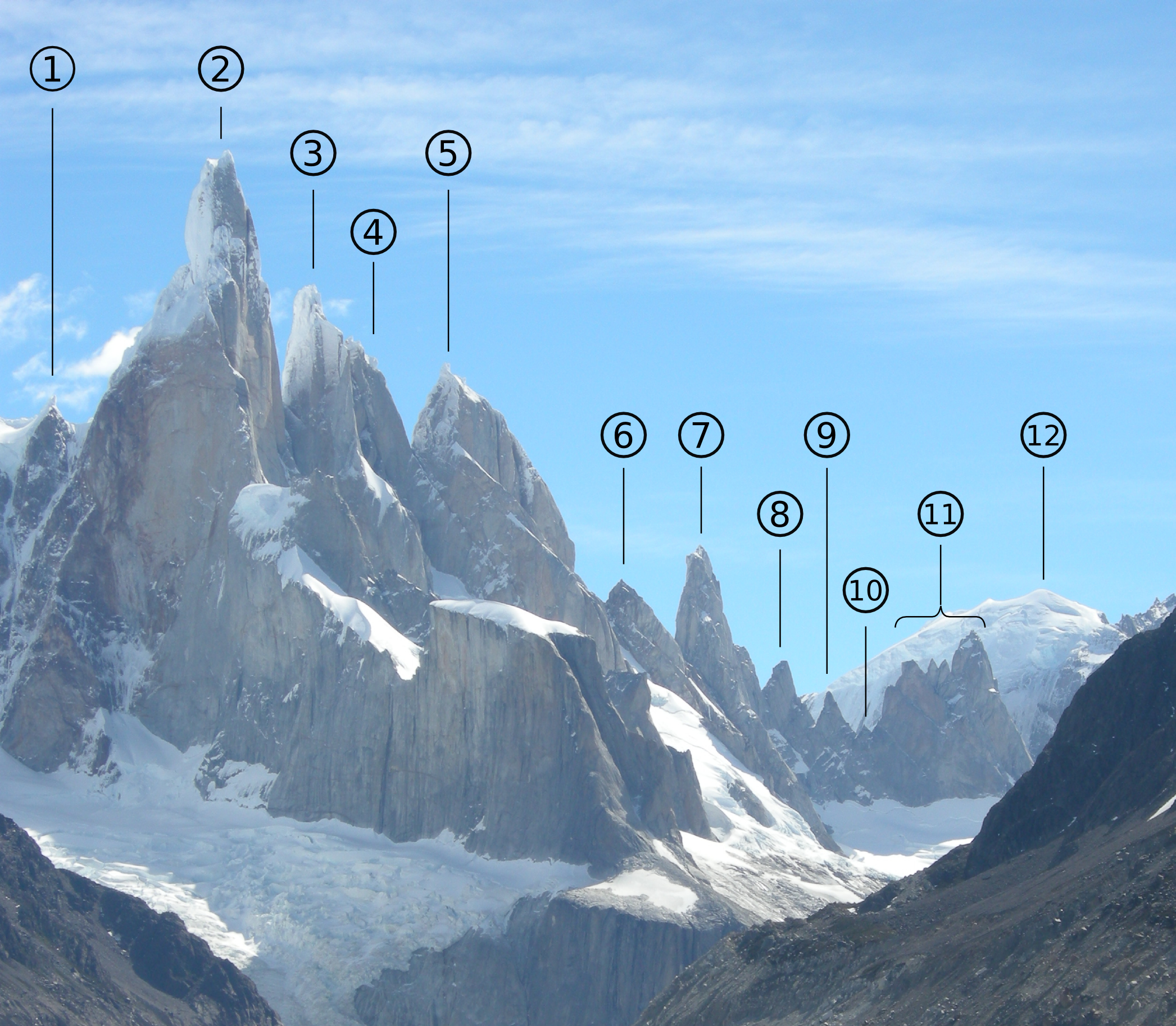
Cerro Torre is one of the mountains of the Southern Patagonian Ice Field in South America. It is located in Argentina and Chile, west of Fitz Roy (also known as Cerro Chalt├®n). The peak is the highest of a four mountain chain: the other peaks are Torre Egger (), Punta Herron, and Cerro Standhardt. The top of the mountain often has a mushroom of rime ice, formed by the constant strong winds, increasing the difficulty of reaching the actual summit. First ascent Cesare Maestri claimed in 1959 that he and Toni Egger had reached the summit and that Egger had been swept to his death by an avalanche while they were descending. Maestri declared that Egger had the camera with the pictures of the summit, but this camera was never found. Inconsistencies in Maestri's account, and the lack of bolts, pitons or fixed ropes on the route, have led most mountaineers to doubt Maestri's claim. In 2005, Ermanno Salvaterra, Rolando Garibotti and Alessandro Beltrami, after many attempts by world-cla ... [...More Info...] [...Related Items...] OR: [Wikipedia] [Google] [Baidu] |
Torres Del Paine National Park
Torres del Paine National Park ( es, Parque Nacional Torres del Paine) is a national park encompassing mountains, glaciers, lakes, and rivers in southern Chilean Patagonia. The Cordillera del Paine is the centerpiece of the park. It lies in a transition area between the Magellanic subpolar forests and the Patagonian Steppes. The park is located north of Puerto Natales and north of Punta Arenas. The park borders Bernardo O'Higgins National Park to the west and the Los Glaciares National Park to the north in Argentine territory. ''Paine'' means "blue" in the native Tehuelche (Aonikenk) language and is pronounced ''PIE-neh'', while ''Torres'' means "towers". It was established as a National Park in 1959. Torres del Paine National Park is part of the ''Sistema Nacional de Áreas Silvestres Protegidas del Estado de Chile'' (National System of Protected Forested Areas of Chile). In 2013, it measured approximately . It is one of the largest and most visited parks in Chile. The park ... [...More Info...] [...Related Items...] OR: [Wikipedia] [Google] [Baidu] |
Sebasti├Īn Pi├▒era
Miguel Juan Sebasti├Īn Pi├▒era Echenique OMCh (; born 1 December 1949) is a Chilean billionaire businessman and politician who served as president of Chile from 2010 to 2014 and again from 2018 to 2022. The son of a Christian Democratic politician and diplomat, he studied business administration at the Pontifical Catholic University of Chile and economics at Harvard University. He had an estimated net worth of 2.8 billion dollars in 2019 according to ''Forbes'', making him one of the richest people in Chile. A member of the liberal-conservative National Renewal party, he served as a senator for the East Santiago district from 1990 to 1998, running for the presidency in the 2005 election, which he lost to Michelle Bachelet, and again, successfully, in 2010. As a result, he became Chile's first conservative president to be democratically elected since 1958, and the first to hold the office since the departure of Augusto Pinochet in 1990. Following the social unrest th ... [...More Info...] [...Related Items...] OR: [Wikipedia] [Google] [Baidu] |
President Of Chile
The president of Chile ( es, Presidente de Chile), officially known as the President of the Republic of Chile ( es, Presidente de la Rep├║blica de Chile), is the head of state and head of government of the Republic of Chile. The president is responsible for both the Government of Chile and state administration. Although its role and significance has changed over the history of Chile, as well as its position and relations with other actors in the national political organization, it is one of the most prominent political offices. It is also considered one of the institutions that make up the "Historic Constitution of Chile", and is essential to the country's political stability. Under the current Constitution (adopted in 1980), the president serves a four-year term, with immediate re-election being prohibited. The shorter period (previously the term was six years) allows for parliamentary and presidential elections to be synchronized. The official seat of the president of Chile ... [...More Info...] [...Related Items...] OR: [Wikipedia] [Google] [Baidu] |
Administrative Division Of Chile
The administrative division or territorial organization of Chile exemplifies characteristics of a unitary state. State administration is functionally and geographically decentralized, as appropriate for each authority in accordance with the law. For the interior government and administration within the State, the territory of the republic has been divided into 16 Regions of Chile, regions (''regiones''), 56 Provinces of Chile, provinces (''provincias'') and 346 Communes of Chile, communes (''comunas'') since the 1970s process of reform, made at the request of the National Commission on Administrative Reform (''Comisi├│n Nacional de la Reforma Administrativa'' or CONARA). State agencies exist to promote the strengthening of its regionalization, equitable development and solidarity between regions, provinces and communes within the nation. Since 2005, the creation, abolition and designation of regions, provinces and communes, the altering of their boundaries, and the establishment ... [...More Info...] [...Related Items...] OR: [Wikipedia] [Google] [Baidu] |


.jpg)