|
ГЃsbyrgi
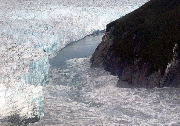
ГЃsbyrgi () is a Glacial landform, glacial canyon and forest in the north of Iceland, located approximately east of HГєsavГk on the Diamond Circle road. The horseshoe-shaped depression is part of the VatnajГ¶kull National Park and measures approximately 3.5 km in length and over 1 km wide. For more than half of its length, the canyon is divided through the middle by a distinctive rock formation 25 meters high called ''Eyjan'' (, "the Island"), from which a vast landscape is seen. The canyon's steep sides are formed by cliffs up to in height. Within the canyon is a woodland of birch and willow. Between 1947 and 1977, a number of foreign tree species were introduced, including spruce, larch and pine. The small lake ''BotnstjГ¶rn'' is home to a variety of waterfowl species. ГЃsbyrgi was most likely formed by JГ¶kulhlaup, catastrophic glacial flooding of the river JГ¶kulsГЎ ГЎ FjГ¶llum after the Last Glacial Period, last ice age, first 8–10,000 years ago, and then ... [...More Info...] [...Related Items...] OR: [Wikipedia] [Google] [Baidu] |
Diamond Circle
The Diamond Circle ( ) is a popular tourist route around HГєsavГk and MГЅvatn, Lake MГЅvatn in North Iceland. The route is fully Paved (road), paved and easily accessible during the summer. The southern section of the route follows Route 1 (Iceland), Route 1 (Ring road) from Akureyri, before turning north along Route 862, the new road to Dettifoss. Then it joins Route 85 (Iceland), Route 85 at ГЃsbyrgi Canyon and follows the coast through HГєsavГk and eventually re-joining Route 1. The four primary stops on the route are the town of HГєsavГk, ГЃsbyrgi, ГЃsbyrgi Canyon, Lake MГЅvatn and Dettifoss, Dettifoss Waterfall, the most powerful waterfall in Europe. Other stops include VatnajГ¶kull National Park, GoГ°afoss, GoГ°afoss Waterfall, Dimmuborgir, Dimmuborgir (Dark Castles), Eider Falls, The Whispering Cliffs and Laugar. The Diamond Circle covers an area rich in volcanic and Geothermal activity, geothermal features. The completion of the 55-km new paved road to Dettifoss, Rout ... [...More Info...] [...Related Items...] OR: [Wikipedia] [Google] [Baidu] |
Vatnajökull National Park
VatnajГ¶kull National Park ( ) is one of three national parks in Iceland, and is the largest one. It encompasses all of VatnajГ¶kull glacier and extensive surrounding areas. These include the national parks previously existing at Skaftafell in the southwest and JГ¶kulsГЎrgljГєfur in the north. The unique qualities of VatnajГ¶kull National Park are primarily its great variety of landscape features, created by the combined forces of rivers, glacial ice, and volcanic and geothermal activity. The park spans 14% of the country's area and is Europe's second largest national park in terms of area after Yugyd Va in the Ural Mountains of Russia. The glacier itself is the largest in Europe at . In 2019 the park was enlarged to the north. On 5 July 2019 VatnajГ¶kull National Park was inscribed as a World Heritage Site. History VatnajГ¶kull National Park was established on 7 June 2008. When established, the park covered an area of 12,000 km2, but with later additions of LakagГga ... [...More Info...] [...Related Items...] OR: [Wikipedia] [Google] [Baidu] |
Sleipnir
In Norse mythology, Sleipnir (Old Norse: "slippy"Orchard (1997:151). or "the slipper"Kermode (1904:6).) is an eight-legged horse ridden by Odin. Sleipnir is attested in the ''Poetic Edda'', compiled in the 13th century from earlier traditional sources, and the ''Prose Edda'', written in the 13th century by Snorri Sturluson. In both sources, Sleipnir is Odin's steed, is the child of Loki and Svaðilfari, is described as the best of all horses, and is sometimes ridden to the location of Hel. The ''Prose Edda'' contains extended information regarding the circumstances of Sleipnir's birth, and details that he is grey in color. Sleipnir is also mentioned in a riddle found in the 13th-century legendary saga '' Hervarar saga ok Heiðreks'', in the 13th-century legendary saga ''Völsunga saga'' as the ancestor of the horse Grani, and book I of '' Gesta Danorum'', written in the 12th century by Saxo Grammaticus, contains an episode considered by many scholars to involve Sleipnir. Slei ... [...More Info...] [...Related Items...] OR: [Wikipedia] [Google] [Baidu] |
Jökulsá á Fjöllum
Jökulsá á Fjöllum (; "glacial river in the mountains") is the second longest river in Iceland (206 km). Its Source (river or stream), source is the Vatnajökull glacier. It flows into the Greenland Sea. Jökulsá á Fjöllum streams over the waterfalls Selfoss (waterfall), Selfoss, Dettifoss, Hafragilsfoss, and , the second of which is the most powerful waterfall in Europe. The source of the river is in the Vatnajökull National Park, one of three national parks in Iceland. The river is located in the northeast of Iceland and forms the eastern boundary of Ódáðahraun, an extensive lava field. Its drainage basin is the largest in Iceland at 7,380 square kilometers. Glacial flooding Dettifoss drops into the Jökulsárgljúfur National Park, Jökulsárgljúfur canyon, a feature which, along with the Ásbyrgi gorge, appears to have been formed by catastrophic glacial flooding caused by volcanic activity. The volcano in question was possibly Bárðarbunga, which has been ... [...More Info...] [...Related Items...] OR: [Wikipedia] [Google] [Baidu] |
HГєsavГk
HГєsavГk () is a town in NorГ°urГѕing municipality on the northeast coast of Iceland on the shores of SkjГЎlfandi bay with 2,485 inhabitants. The most famous landmark of the town is the wooden church HГєsavГkurkirkja, built in 1907. HГєsavГk is served by HГєsavГk Airport. Overview Here income is derived from tourism and fishing, as well as from retail and small industries. Until 2004, HГєsavГk was the export harbour for silica that was extracted from nearby lake MГЅvatn. According to the '' LandnГЎmabГіk'' ("Book of Settlement"), HГєsavГk was the first place in Iceland to be settled in by a Norseman. The Swedish Viking GarГ°ar Svavarsson stayed there for one winter around 870 A.D. When he left the island in spring of 870, after a winter's stay, he left behind a man named NГЎttfari and two slaves, a man and a woman, and they established a farm there. The name of the town means "bay of houses", probably referring to GarГ°ar's homestead, which was probably the only ... [...More Info...] [...Related Items...] OR: [Wikipedia] [Google] [Baidu] |
Larch
Larches are deciduous conifers in the genus ''Larix'', of the family Pinaceae (subfamily Laricoideae). Growing from tall, they are native to the cooler regions of the northern hemisphere, where they are found in lowland forests in the high latitudes, and high in mountains further south. Larches are among the dominant plants in the boreal forests of Siberia and Canada. Although they are conifers, larches are deciduous trees that lose their needles in the autumn. Description and distribution The tallest species, '' Larix occidentalis'', can reach . Larch tree crowns are sparse, with the major branches horizontal; the second and third order branchlets are also ± horizontal in some species (e.g. '' L. gmelinii'', '' L. kaempferi''), or characteristically pendulous in some other species (e.g. '' L. decidua'', '' L. griffithii''). Larch shoots are dimorphic, with leaves borne singly on long shoots typically long and bearing several buds, and in dense clusters of 20–50 need ... [...More Info...] [...Related Items...] OR: [Wikipedia] [Google] [Baidu] |
Canyons And Gorges Of Iceland
A canyon (; archaic British English spelling: ''caГ±on''), gorge or chasm, is a deep cleft between escarpments or cliffs resulting from weathering and the erosive activity of a river over geologic time scales. Rivers have a natural tendency to cut through underlying surfaces, eventually wearing away rock layers as sediments are removed downstream. A river bed will gradually reach a baseline elevation, which is the same elevation as the body of water into which the river drains. The processes of weathering and erosion will form canyons when the river's headwaters and estuary are at significantly different elevations, particularly through regions where softer rock layers are intermingled with harder layers more resistant to weathering. A canyon may also refer to a rift between two mountain peaks, such as those in ranges including the Rocky Mountains, the Alps, the Himalayas or the Andes. Usually, a river or stream carves out such splits between mountains. Examples of mountain-type ... [...More Info...] [...Related Items...] OR: [Wikipedia] [Google] [Baidu] |
Odin
Odin (; from ) is a widely revered god in Norse mythology and Germanic paganism. Most surviving information on Odin comes from Norse mythology, but he figures prominently in the recorded history of Northern Europe. This includes the Roman Empire's partial occupation of Germania ( BCE), the Migration Period (4th–6th centuries CE) and the Viking Age (8th–11th centuries CE). Consequently, Odin has hundreds of names and titles. Several of these stem from the reconstructed Proto-Germanic theonym ''Wōðanaz'', meaning "lord of frenzy" or "leader of the possessed", which may relate to the god's strong association with poetry. Most mythological stories about Odin survive from the 13th-century ''Prose Edda'' and an earlier collection of Old Norse poems, the ''Poetic Edda'', along with other Old Norse items like '' Ynglinga saga''. The ''Prose Edda'' and other sources depict Odin as the head of the pantheon, sometimes called the Æsir, and bearing a spear and a ring. Wid ... [...More Info...] [...Related Items...] OR: [Wikipedia] [Google] [Baidu] |
Jökulhlaup
A jökulhlaup ( ) (literally "glacial run") is a type of glacial outburst flood. It is an Icelandic term that has been adopted in glaciological terminology in many languages. It originally referred to the well-known subglacial outburst floods from Vatnajökull, Iceland, which are triggered by geothermal heating and occasionally by a volcanic subglacial eruption, but it is now used to describe any large and abrupt release of water from a subglacial or proglacial lake/reservoir. Since jökulhlaups emerge from hydrostatically sealed lakes with floating levels far above the threshold, their peak discharge can be much larger than that of a marginal or extra-marginal lake burst. The hydrograph of a jökulhlaup from Vatnajökull typically either climbs over a period of weeks with the largest flow near the end, or it climbs much faster during the course of some hours. These patterns are suggested to reflect channel melting, and sheet flow under the front, respectively. Similar p ... [...More Info...] [...Related Items...] OR: [Wikipedia] [Google] [Baidu] |
Waterfowl
Anseriformes is an order of birds also known as waterfowl that comprises about 180 living species of birds in three families: Anhimidae (three species of screamers), Anseranatidae (the magpie goose), and Anatidae, the largest family, which includes over 170 species of waterfowl, among them the ducks, geese, and swans. Most modern species in the order are highly adapted for an aquatic existence at the water surface. With the exception of screamers, males have penises, a trait that has been lost in the Neoaves, the clade consisting of all other modern birds except the galliformes and paleognaths. Due to their aquatic nature, most species are web-footed. Evolution Anseriformes are one of only two types of modern bird to be confirmed present during the Mesozoic alongside the other dinosaurs, and in fact were among the very few birds to survive their extinction, along with their cousins, the Galliformes. These two groups only occupied two ecological niches during the Mesozoic, ... [...More Info...] [...Related Items...] OR: [Wikipedia] [Google] [Baidu] |


