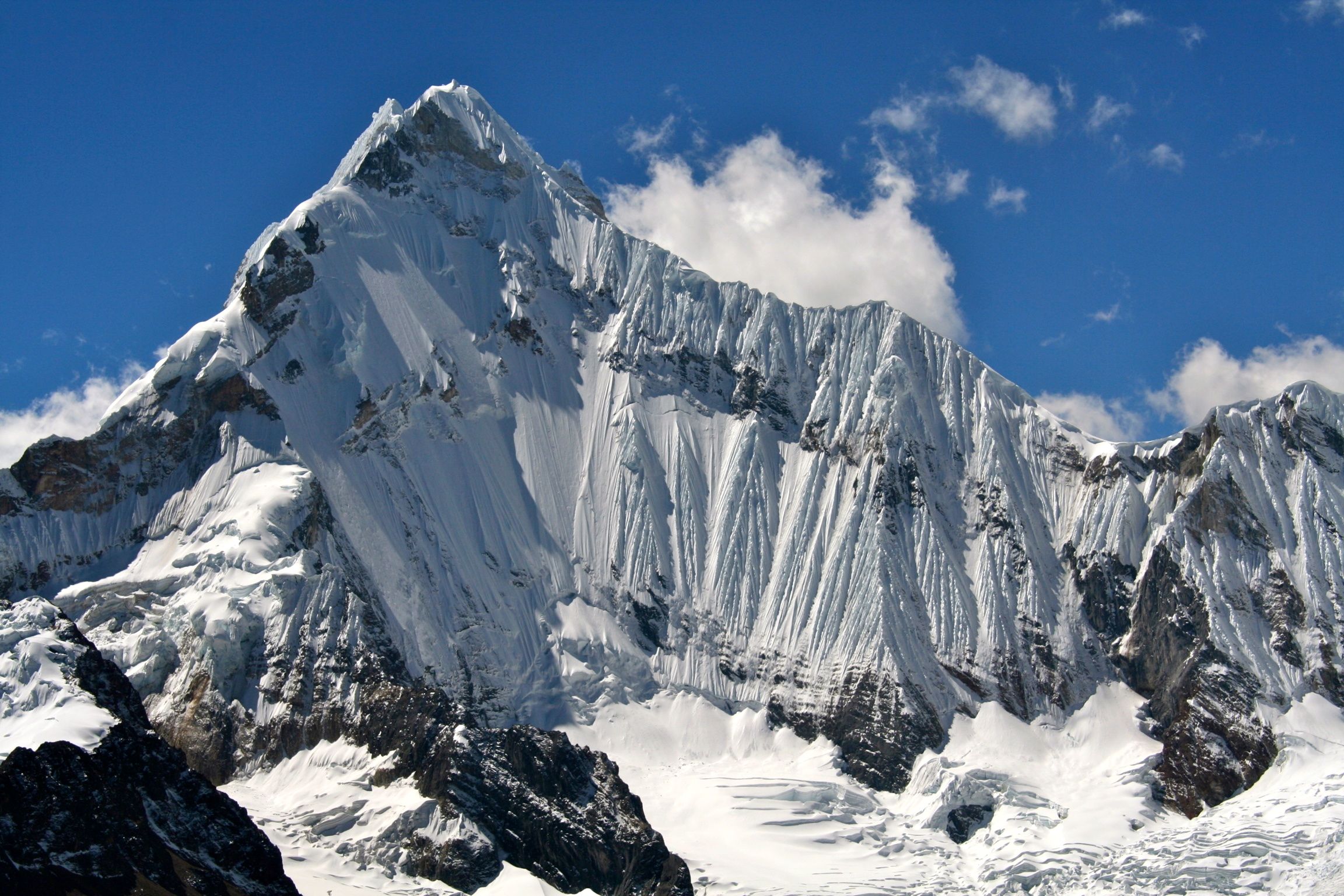
Yerupajá on:
[Wikipedia]
[Google]
[Amazon]
Yerupajá is a

Yerupajá on Summitpost
Complete guide to the Huayhuash Andean Circuit (in spanish)
Elevation information about Yerupaja
Weather Forecast at Yerupaja
mountain
A mountain is an elevated portion of the Earth's crust, generally with steep sides that show significant exposed bedrock. Although definitions vary, a mountain may differ from a plateau in having a limited summit area, and is usually higher t ...
of the Huayhuash mountain range in west central Peru
Peru, officially the Republic of Peru, is a country in western South America. It is bordered in the north by Ecuador and Colombia, in the east by Brazil, in the southeast by Bolivia, in the south by Chile, and in the south and west by the Pac ...
, part of the Andes
The Andes ( ), Andes Mountains or Andean Mountain Range (; ) are the List of longest mountain chains on Earth, longest continental mountain range in the world, forming a continuous highland along the western edge of South America. The range ...
. It is located at Áncash, Bolognesi Province, Lauricocha Province. At (other sources: ) it is the second-highest in Peru and the highest in the Huayhuash mountain range. The summit is the highest point in the Amazon River watershed, and was first reached in 1950 by Jim Maxwell and Dave Harrah, and its northern peak (Yerupajá Norte) in 1968 by the Wellington
Wellington is the capital city of New Zealand. It is located at the south-western tip of the North Island, between Cook Strait and the Remutaka Range. Wellington is the third-largest city in New Zealand (second largest in the North Island ...
ian Roger Bates and Graeme Dingle. Many visitors consider Yerupajá to be the most spectacular peak in South America.
There have been only a few successful ascents of the peak because it is one of the hardest Andean high peaks to climb. The most popular route is the southwest face. The approach is normally made from Huaraz southwards via Chiquián and Jahuacocha.
Notable ascents
* 1950 ''Southern flank of West Face'' First ascent of peak by David Harrah and James Maxwell. * 1966 ''Direct West Face'' 2nd ascent of peak, FA of route over 13 days by Leif Patterson and Jorge Peterek. * 1968 ''Northeast Face'' FA of route by Chris Jones and Paul Dix (summit, July 30), supported by Dean Caldwell and Roger Hart (all US). * 1969 ''East Face'' byReinhold Messner
Reinhold Andreas Messner (; born 17 September 1944) is an Italian climber, explorer, and author from the German-speaking province of South Tyrol. He made the first solo ascent of Mount Everest and, along with Peter Habeler, the first ascent o ...
and Peter Habeler.
*2002 Main summit solo by Santiago Quintero (July 15)
Elevation
Based on theelevation
The elevation of a geographic location (geography), ''location'' is its height above or below a fixed reference point, most commonly a reference geoid, a mathematical model of the Earth's sea level as an equipotential gravitational equipotenti ...
provided by the available Digital elevation models, SRTM2 (6558m with voids), SRTM filled with ASTER (6551m with voids), TanDEM-X
TanDEM-X (TerraSAR-X add-on for Digital Elevation Measurement) is a German twin satellite mission using interferometric synthetic aperture radar (InSAR). It is developed in a public-private partnership between the German Aerospace centre (DLR In ...
(6110m with voids), Yerupaja is about 6635 meters above sea level. This altitude was considered due to the lack of topographic data or even handheld GPS data.
The height of the nearest key col is 4592 metre
The metre (or meter in US spelling; symbol: m) is the base unit of length in the International System of Units (SI). Since 2019, the metre has been defined as the length of the path travelled by light in vacuum during a time interval of of ...
s, so its prominence is 2025 meters. Yerupaja is listed as range or area, based on the Dominance system and its dominance is 30.6%. Its parent peak is Huascaran Sur and the topographic isolation
The topographic isolation of a summit is the minimum geographical distance, horizontal distance to a point of equal elevation, representing a radius of dominance in which the peak is the highest point. It can be calculated for small hills and is ...
is 148.8 kilometers. This information was obtained during a research by Suzanne Imber in 2014.

See also
* List of ultras of South America *Siula Grande
Siula Grande is a mountain in the Huayhuash mountain range in the Peruvian Andes. It is high and has a subpeak, Siula Chico, high.
__NOTOC__
''Touching the Void'' ascent
In 1985, Siula Grande was climbed by Joe Simpson and Simon Yates. Alth ...
External links
Yerupajá on Summitpost
Complete guide to the Huayhuash Andean Circuit (in spanish)
Elevation information about Yerupaja
Weather Forecast at Yerupaja
References
Mountains of the Department of Ancash Mountains of the Department of Lima Mountains of the Department of Huánuco Six-thousanders of the Andes {{Ancash-geo-stub