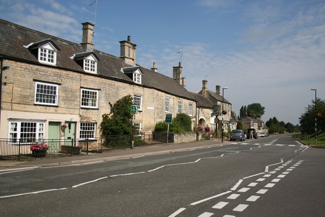
Weldon, Northamptonshire on:
[Wikipedia]
[Google]
[Amazon]
Weldon is a suburban village and
 Weldon currently has two
St Mary the Virgin is an early-13th century limestone built church and is located just to the south of the main village. The village is home to Weldon Cricket Club which runs ten teams for both adults and children, the team is going from strength to strength climbing the Northamptonshire leagues. Chairman Andy Warren . and the village football team, Weldon United, play in the Northamptonshire Football Combination division two.
Comprehensive village website
*
Open Domesday website
Villages in Northamptonshire Civil parishes in Northamptonshire North Northamptonshire {{Northamptonshire-geo-stub
civil parish
In England, a civil parish is a type of administrative parish used for local government. It is a territorial designation which is the lowest tier of local government. Civil parishes can trace their origin to the ancient system of parishes, w ...
on the eastern outskirts of Corby
Corby is a town and civil parish in the North Northamptonshire district of Northamptonshire, England, northeast of Northampton. In 2021 it had a population of 68,164. From 1974 to 2021, it was the administrative headquarters of the Borough of ...
, Northamptonshire
Northamptonshire ( ; abbreviated Northants.) is a Ceremonial counties of England, ceremonial county in the East Midlands of England. It is bordered by Leicestershire, Rutland and Lincolnshire to the north, Cambridgeshire to the east, Bedfordshi ...
, England. It is two miles away from Corby.
History
The village is listed in the Domesday Book as 'Weledene', in the Colby Hundred. The head of the manor before 1066 is listed as 'Weldon', likely Anglo-Saxon. The Lord in 1066 is listed as 'Northmann', perhaps an unnamed Viking or Dane. The Lord, and Tenant-in-Chief, in 1086 was Robert de Bucy (Buci), a Norman. The village's name means 'hill with a spring/stream'.Geography
It is, currently, administered byNorth Northamptonshire
North Northamptonshire is a Unitary authorities of England, unitary authority area in the Ceremonial counties of England, ceremonial county of Northamptonshire, England, and was created in 2021. The council is based in Corby, the district's la ...
council. Prior to local government changes in 2021 it was administered by Corby Borough Council; at the time of the 2001 census, the parish's population was 1,644 people, increasing to 2,099 at the 2011 census.
Weldon is at the crossroads of the north–south A43 trunk road which bypasses it to the west and the A427 that, locally, provides a route to Market Harborough
Market Harborough is a market town in the Harborough District, Harborough district of Leicestershire, England, close to the border with Northamptonshire. The population was 24,779 at the United Kingdom census, 2021, 2021 census. It is the ad ...
westbound and Oundle
Oundle () is a market town and civil parish on the left bank of the River Nene in North Northamptonshire, England, which had a population of 6,254 at the time of the 2021 United Kingdom census, 2021 census. It is north of London and south-wes ...
eastbound; traffic on this road is "calmed" by an extensive scheme.
Amenities
 Weldon currently has two
 public houses
A pub (short for public house) is in several countries a drinking establishment licensed to serve alcoholic drinks for consumption on the premises. The term first appeared in England in the late 17th century, to differentiate private ho ...
, the CAMRA
The Campaign for Real Ale (CAMRA) is an independent voluntary consumer organisation headquartered in St Albans, which promotes real ale, real cider, cider and perry and traditional British pubs and clubs.
History
The organisation was founde ...
-approved Shoulder of Mutton and The George, formerly a 17th-century coaching inn
The coaching inn (also coaching house or staging inn) was a vital part of Europe's inland transport infrastructure until the development of the railway, providing a resting point ( layover) for people and horses. The inn served the needs of t ...
. The ''King's Arms'' public house was demolished and replaced with housing. The Church oSt Mary the Virgin is an early-13th century limestone built church and is located just to the south of the main village. The village is home to Weldon Cricket Club which runs ten teams for both adults and children, the team is going from strength to strength climbing the Northamptonshire leagues. Chairman Andy Warren . and the village football team, Weldon United, play in the Northamptonshire Football Combination division two.
References
External links
Comprehensive village website
*
Open Domesday website
Villages in Northamptonshire Civil parishes in Northamptonshire North Northamptonshire {{Northamptonshire-geo-stub