Vestvågøya on:
[Wikipedia]
[Google]
[Amazon]
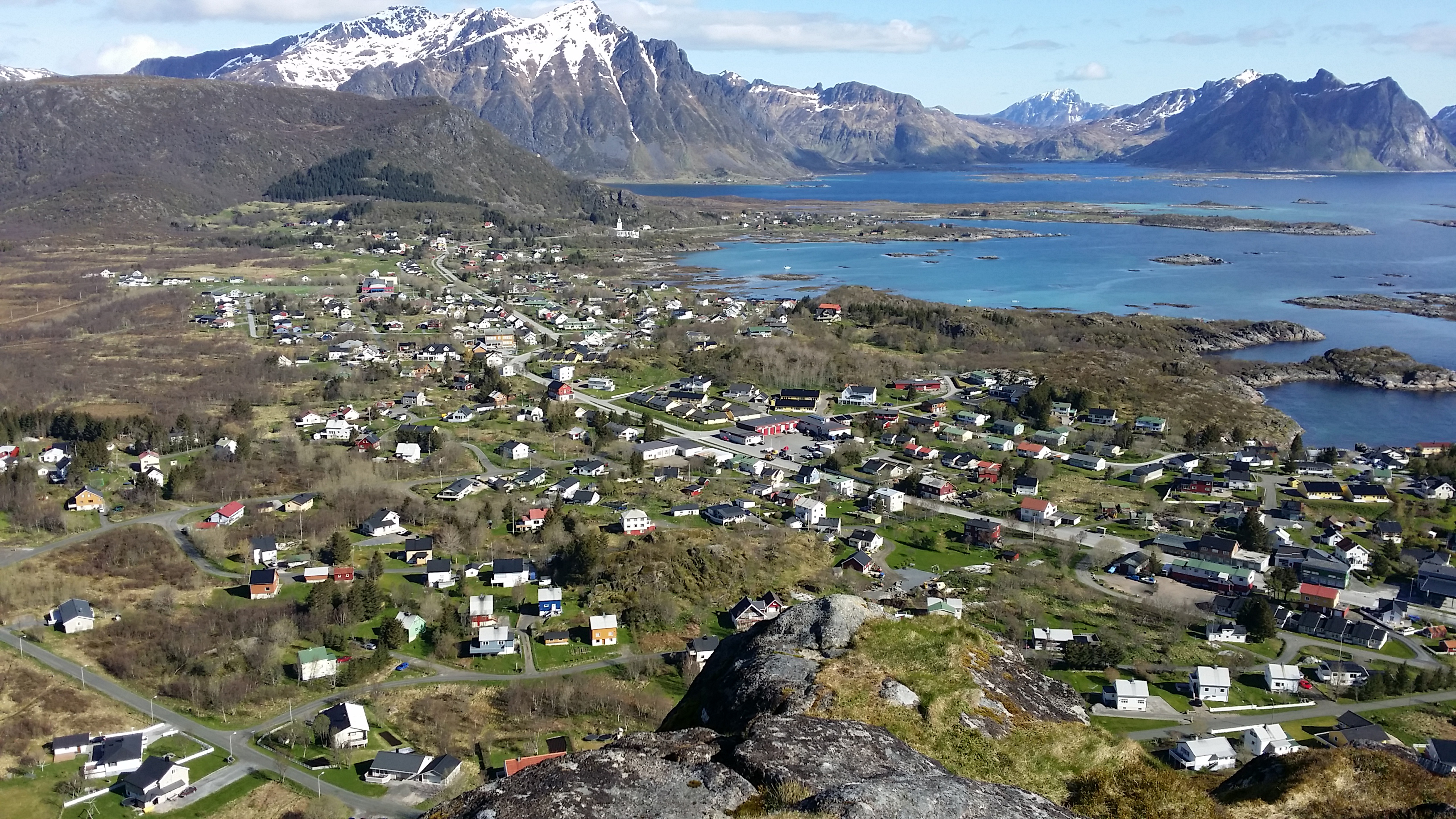
Vestvågøya or Vest-Vågøy is an  The middle part of the island is relatively flat and
island
An island (or isle) is an isolated piece of habitat that is surrounded by a dramatically different habitat, such as water. Very small islands such as emergent land features on atolls can be called islets, skerries, cays or keys. An island ...
in the Lofoten
Lofoten () is an archipelago and a traditional district in the county of Nordland, Norway. Lofoten has distinctive scenery with dramatic mountains and peaks, open sea and sheltered bays, beaches and untouched lands. There are two towns, Svolvær ...
archipelago
An archipelago ( ), sometimes called an island group or island chain, is a chain, cluster, or collection of islands, or sometimes a sea containing a small number of scattered islands.
Examples of archipelagos include: the Indonesian Archi ...
in Nordland
Nordland (; smj, Nordlánnda, sma, Nordlaante, sme, Nordlánda, en, Northland) is a county in Norway in the Northern Norway region, the least populous of all 11 counties, bordering Troms og Finnmark in the north, Trøndelag in the south, N ...
county, Norway
Norway, officially the Kingdom of Norway, is a Nordic country in Northern Europe, the mainland territory of which comprises the western and northernmost portion of the Scandinavian Peninsula. The remote Arctic island of Jan Mayen and t ...
. The island is located within Vestvågøy Municipality
Vestvågøy is a municipality in Nordland county, Norway. It is part of the traditional district of Lofoten. The administrative centre of the municipality is the town of Leknes. Some of the villages in the municipality include Ballstad, Borg, ...
. The island lies between the islands of Austvågøya and Gimsøya
Gimsøya is an island in Vågan Municipality in Nordland county, Norway. Gimsøya is situated between the islands of Austvågøya and Vestvågøya in the Lofoten archipelago. The island has a population (2016) of 181.
The European route E10 ...
to the northeast and Flakstadøya
Flakstadøya is an island in the Lofoten archipelago in Nordland county, Norway. The entire island lies within Flakstad Municipality with the Vestfjorden on the east side of the island and the Norwegian Sea on the west side of the island.
Geog ...
to the southwest. There are also several small islands and skerries surrounding the island. Vestvågøya makes up over 97% of the municipal area and about 99% of the inhabitants of the municipality live on the island. The European route E10
European route E10 is the second shortest Class A road which is part of the International E-road network. It begins in Å, Norway and ends in Luleå, Sweden. The road is about 850 km (530 mi) in length. The Norwegian part of the ...
highway crosses the island connecting to Flakstadøya by the Nappstraum Tunnel
The Nappstraum Tunnel ( no, Nappstraumtunnelen) is an undersea road tunnel in Nordland county, Norway. The long tunnel is located on the European route E10 highway, connecting the islands of Flakstadøya (in Flakstad Municipality) and Vestvåg� ...
and to Gimsøya by the Sundklakkstraumen Bridge.
 The middle part of the island is relatively flat and
 marsh
A marsh is a wetland that is dominated by herbaceous rather than woody plant species.Keddy, P.A. 2010. Wetland Ecology: Principles and Conservation (2nd edition). Cambridge University Press, Cambridge, UK. 497 p Marshes can often be found at ...
y, while the outer parts in the north and south are mountainous. The highest point on the island is the tall mountain ''Himmeltindan''. The flat parts of the island are largely agricultural
Agriculture or farming is the practice of cultivating Plant, plants and livestock. Agriculture was the key development in the rise of Sedentism, sedentary human civilization, whereby farming of Domestication, domesticated species created food ...
land. There is one town on the island (Leknes
is a town in Nordland county, Norway. The town is also the administrative centre of the municipality of Vestvågøy (with 10,764 inhabitants, it is the most populous municipality in Lofoten and Vesterålen). Leknes was designated a "town" ( no ...
) and several large villages on the island including Stamsund
Stamsund is a fishing village in Vestvågøy Municipality in Nordland county, Norway. It is located on the southern side of the island of Vestvågøy in the Lofoten archipelago, along the Vestfjorden. The village is located about east of the t ...
, Ballstad
Ballstad is a village in Vestvågøy Municipality in Nordland county, Norway. It is located on a small island off the southwestern tip of the island of Vestvågøya in the Lofoten archipelago. It is one of the largest fishing villages in Lofoten. ...
, and Gravdal.
In Vestvågøya mountains have steep slopes towards the open sea in the northwest and southeast while slopes pointing towards the interior of the island are more gentle. This is the result of erosion
Erosion is the action of surface processes (such as water flow or wind) that removes soil, rock, or dissolved material from one location on the Earth's crust, and then transports it to another location where it is deposited. Erosion is distin ...
acting on a landscape that has been uplifted along southwest-northwest-trending faults in the margins of Lofoten while the interior axis has remained more stable.

See also
*List of islands of Norway
This is a list of islands of Norway sorted by name. For a list sorted by area, see List of islands of Norway by area.
A
* Alden
* Aldra
* Algrøy
* Alsta
* Altra
* Anda
* Andabeløya
* Andørja
* Andøya, Vesterålen
* Andøya, Agder
* Ar ...
References
Vestvågøy Islands of Nordland {{Nordland-island-stub