Ruidoso Downs, New Mexico on:
[Wikipedia]
[Google]
[Amazon]
Ruidoso Downs is a city in Lincoln County,
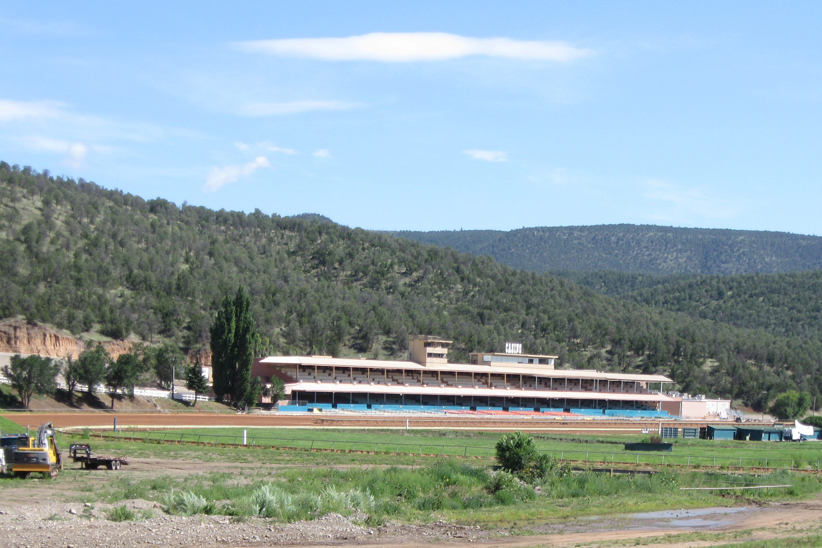
 * Ruidoso Downs Race Track
*Billy the Kid Casino
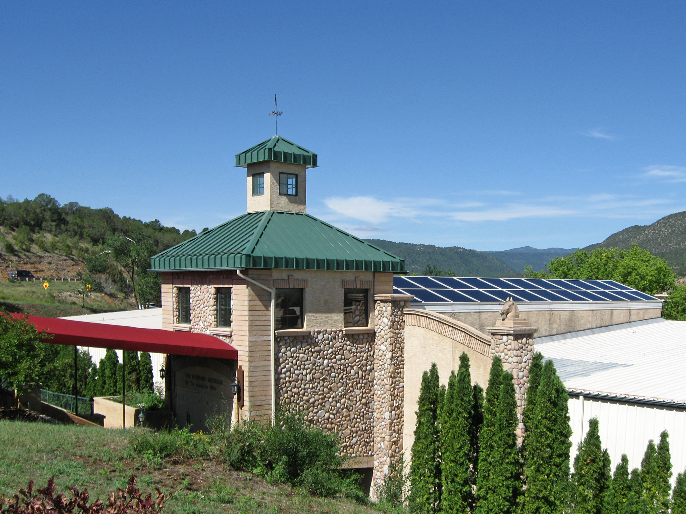
*Hubbard Museum of the American West
 The city is the annual location of the
 ruidownsracing.com
/ref>
New Mexico
New Mexico is a state in the Southwestern United States, Southwestern region of the United States. It is one of the Mountain States of the southern Rocky Mountains, sharing the Four Corners region with Utah, Colorado, and Arizona. It also ...
, United States, located within the Lincoln National Forest
Lincoln National Forest is a unit of the U.S. Forest Service located in southern New Mexico. The Lincoln National Forest covers an extensive 1.1 million acres in southeastern New Mexico. Established by Presidential Proclamation in 1902 as the Li ...
. The population was 1,824 at the 2000 census and 2,815 at the 2010 census. Originally incorporated as a village, it became a city in May 2002. Known locally as "the Downs", Ruidoso Downs is a suburb of adjacent Ruidoso and is a part of the Ruidoso Micropolitan Statistical Area. The city, located along U.S. Route 70
U.S. Route 70 or U.S. Highway 70 (US 70) is an east–west United States highway that runs for from eastern North Carolina to east-central Arizona. It is a major east–west highway of the Southeastern, Southern and Southwestern United States ...
, is named after the Ruidoso Downs Race Track, which is located in the city along with the Billy the Kid Casino and the Hubbard Museum of the American West.
History
According to a local Ruidoso Downs historian, early on Hispanos settlers called the area "San Juanito". The settlers began arriving in the early in the late 1840s, and introduced rodeo and horse racing to the area. Originally the area had scattered farms and ranches, with the Dowlin Mill constructed in 1868. A new wave of families arrived after theLincoln County War
The Lincoln County War was an Old West conflict between rival factions which began in 1878 in Lincoln County, New Mexico Territory, the predecessor of the state of New Mexico, and continued until 1881. The feud became famous because of the p ...
.
By around 1907 the road between Roswell and Alamogordo
Alamogordo () is a city in and the county seat of Otero County, New Mexico, Otero County, New Mexico, United States. A city in the Tularosa Basin of the Chihuahuan Desert, it is bordered on the east by the Sacramento Mountains (New Mexico), Sac ...
, which passed through the area, was still primitive, though it was improved in the 1920s through the Federal Aid Project. The road that would become US 70 was paved in the area around 1945, and then improved again in 1958. The road became four lanes in 1981.
In 1946 the ''Ruidoso News'' was founded and the airport opened, and two years later radio arrived. Electric lights appeared in the area in 1947. The White Mountain Inn opened in the 1940s as a sanatorium
A sanatorium (from Latin '' sānāre'' 'to heal'), also sanitarium or sanitorium, is a historic name for a specialised hospital for the treatment of specific diseases, related ailments, and convalescence.
Sanatoriums are often in a health ...
and as a lodging establishment.
Geography
Ruidoso Downs is located in southern Lincoln County and is bordered to the west by Ruidoso.U.S. Route 70
U.S. Route 70 or U.S. Highway 70 (US 70) is an east–west United States highway that runs for from eastern North Carolina to east-central Arizona. It is a major east–west highway of the Southeastern, Southern and Southwestern United States ...
passes through the city, leading east to Roswell and southwest over Apache Summit to Tularosa. New Mexico State Road 48 departs US 70 just west of the city limits, leading north to Capitan
Capitan and Kapitan are equivalents of the English Captain in other European languages.
Capitan, Capitano, and Kapitan may also refer to:
Places in the United States
* Capitan, Louisiana, an unincorporated community
* Capitan, New Mexico, a villa ...
.
According to the United States Census Bureau
The United States Census Bureau, officially the Bureau of the Census, is a principal agency of the Federal statistical system, U.S. federal statistical system, responsible for producing data about the American people and American economy, econ ...
, the city has an area of , all of it recorded as land. The city is in the valley of the Rio Ruidoso, which rises to the west on Sierra Blanca Peak and flows east to form the Rio Hondo.
Demographics
As of thecensus
A census (from Latin ''censere'', 'to assess') is the procedure of systematically acquiring, recording, and calculating population information about the members of a given Statistical population, population, usually displayed in the form of stati ...
of 2000, there were 1,824 people, 680 households, and 490 families residing in the village. The population density was . There were 921 housing units at an average density of . The racial makeup of the village was 67.32% White
White is the lightest color and is achromatic (having no chroma). It is the color of objects such as snow, chalk, and milk, and is the opposite of black. White objects fully (or almost fully) reflect and scatter all the visible wa ...
, 0.77% African American
African Americans, also known as Black Americans and formerly also called Afro-Americans, are an Race and ethnicity in the United States, American racial and ethnic group that consists of Americans who have total or partial ancestry from an ...
, 3.56% Native American, 0.71% Asian, 0.27% Pacific Islander
Pacific Islanders, Pasifika, Pasefika, Pacificans, or rarely Pacificers are the peoples of the list of islands in the Pacific Ocean, Pacific Islands. As an ethnic group, ethnic/race (human categorization), racial term, it is used to describe th ...
, 24.45% from other races, and 2.91% from two or more races. Hispanic
The term Hispanic () are people, Spanish culture, cultures, or countries related to Spain, the Spanish language, or broadly. In some contexts, Hispanic and Latino Americans, especially within the United States, "Hispanic" is used as an Ethnici ...
or Latino of any race were 43.70% of the population.
There were 680 households, out of which 39.0% had children under the age of 18 living with them, 48.8% were married couples
Marriage, also called matrimony or wedlock, is a culturally and often legally recognised union between people called spouses. It establishes rights and obligations between them, as well as between them and their children (if any), and b ...
living together, 17.4% had a female householder with no husband present, and 27.8% were non-families. 21.2% of all households were made up of individuals, and 5.1% had someone living alone who was 65 years of age or older. The average household size was 2.68 and the average family size was 3.09.
In the city the population was spread out, with 29.1% under the age of 18, 8.2% from 18 to 24, 28.6% from 25 to 44, 24.8% from 45 to 64, and 9.4% who were 65 years of age or older. The median age was 35 years. For every 100 females, there were 95.9 males. For every 100 females age 18 and over, there were 92.4 males.
The median income for a household in the village was $29,375, and the median income for a family was $30,500. Males had a median income of $22,000 versus $17,623 for females. The per capita income
Per capita income (PCI) or average income measures the average income earned per person in a given area (city, region, country, etc.) in a specified year.
In many countries, per capita income is determined using regular population surveys, such ...
for the village was $12,144. About 17.4% of families and 20.6% of the population were below the poverty line
The poverty threshold, poverty limit, poverty line, or breadline is the minimum level of income deemed adequate in a particular country. The poverty line is usually calculated by estimating the total cost of one year's worth of necessities for ...
, including 29.7% of those under age 18 and 5.9% of those age 65 or over.
Economy
Ruidoso Downs' economy is primarily driven by tourism with the industries that support it being major employers, with 27.1% of the employed population working in the "Arts, Entertainment and Recreation, and Accommodation and Food Services" industry.Transportation
Airports
* Sierra Blanca Regional Airport, located about by road northeast of Ruidoso Downs.Major highways
*U.S. Route 70
U.S. Route 70 or U.S. Highway 70 (US 70) is an east–west United States highway that runs for from eastern North Carolina to east-central Arizona. It is a major east–west highway of the Southeastern, Southern and Southwestern United States ...
Key facilities
 * Ruidoso Downs Race Track
*Billy the Kid Casino
*Hubbard Museum of the American West
Events and culture
 The city is the annual location of the
 All American Futurity
The All American Futurity is a race for two-year-old American Quarter Horse racehorses run at Ruidoso Downs (track), Ruidoso Downs Race Track in Ruidoso Downs, New Mexico on Labor Day. It is the last leg of the AQHA Triple Crown that has only been ...
, which claims to be the richest race in Quarter Horse
The American Quarter Horse, or Quarter Horse, is an American breed of horse that excels at sprinting short distances. Its name is derived from its ability to outrun other horse breeds in races of or less; some have been clocked at speeds up to . ...
racing./ref>
See also
*Lincoln National Forest
Lincoln National Forest is a unit of the U.S. Forest Service located in southern New Mexico. The Lincoln National Forest covers an extensive 1.1 million acres in southeastern New Mexico. Established by Presidential Proclamation in 1902 as the Li ...
References
External links
* {{authority control Cities in Lincoln County, New Mexico Cities in New Mexico