Rock Hall, Maryland on:
[Wikipedia]
[Google]
[Amazon]
Rock Hall, is a waterfront town located directly on the National Chesapeake Scenic Byway in Kent County,


Town website
from 1876 Atlas by Lake, Griffing and Stevenson {{authority control Fishing communities in Maryland Towns in Maryland Towns in Kent County, Maryland Maryland populated places on the Chesapeake Bay
Maryland
Maryland ( ) is a U.S. state, state in the Mid-Atlantic (United States), Mid-Atlantic region of the United States. It borders the states of Virginia to its south, West Virginia to its west, Pennsylvania to its north, and Delaware to its east ...
, United States. The population was 1,310 at the 2010 census.
History
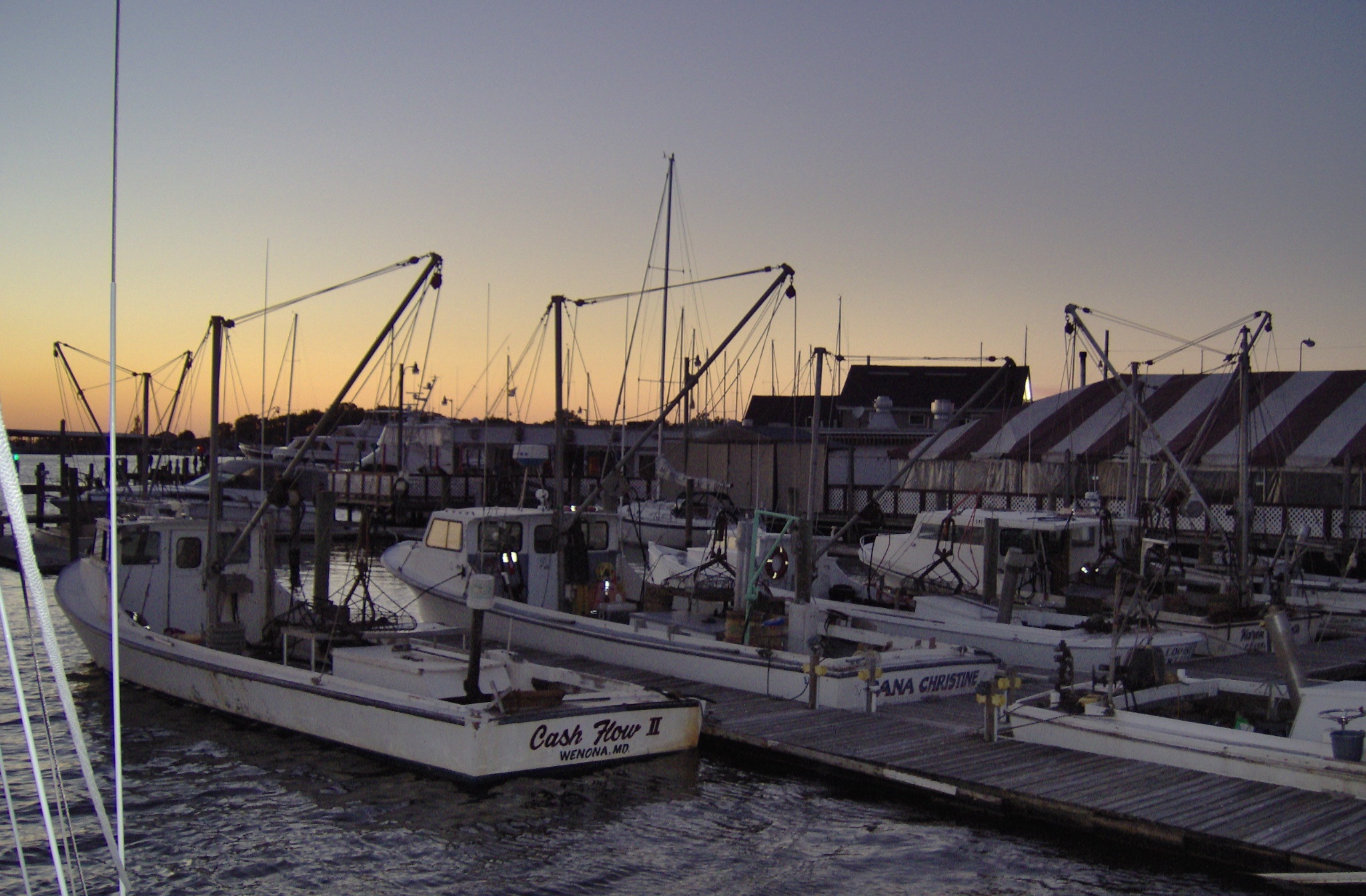
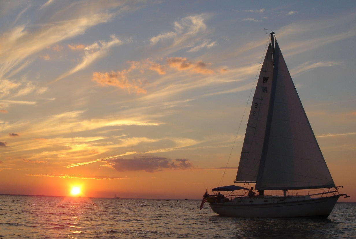
Originally called Rock Hall Crossroads, the city is now a fishing, sailing and recreational boating town situated on the upper Eastern Shore of the Chesapeake Bay. It is the center of Kent County's maritime industries, and is also a popular tourist destination. It was established in 1707. The city was named for a mansion made of white sandstone, and was incorporated in 1908. Rock Hall served as a shipping point for tobacco, seafood and other agricultural products, as well as a passenger transport connection for travelers during the Colonial era. Later, fishing and seafood processing became the town's largest industry. The town missed out on receiving a railroad connection in 1872, when the Kent County Railroad set out to build fromMassey
Massey may refer to:
Places
Canada
* Massey, Ontario
* Massey Island, Nunavut
New Zealand
* Massey, New Zealand, an Auckland suburb
United States
* Massey, Alabama
* Massey, Iowa
* Massey, Maryland
People
* Massey (surname)
Educati ...
via Chestertown and connect with a ferry to Baltimore for both passengers and freight. The company went bankrupt in 1877, having only built a stub from Chestertown to a place called Belair or Parsons and abandoning the rest unfinished.
Rock Hall Harbor remains a working harbor with an active fleet of commercial watermen, charter fishing and commercial sailing boats. It has three museums including a waterman's museum.
Hinchingham and Trumpington
Trumpington is a village in Cambridgeshire, England, mostly located in Cambridge, with a small southern area of the village extending into the South Cambridgeshire district. As of the 2021 United Kingdom census, 2021 UK census, the village had ...
are listed on the National Register of Historic Places
The National Register of Historic Places (NRHP) is the Federal government of the United States, United States federal government's official United States National Register of Historic Places listings, list of sites, buildings, structures, Hist ...
.
Geography
According to theUnited States Census Bureau
The United States Census Bureau, officially the Bureau of the Census, is a principal agency of the Federal statistical system, U.S. federal statistical system, responsible for producing data about the American people and American economy, econ ...
, the town has a total area of , of which is land and is water.
Transportation
The main method of transportation in and out of Rock Hall is by road, and two state highways serve the town. The primary highway serving the town is Maryland Route 20, which connects eastward from Rock Hall to Chestertown. Maryland Route 445 also traverses the town on a north-south alignment.

Demographics
2010 census
As of thecensus
A census (from Latin ''censere'', 'to assess') is the procedure of systematically acquiring, recording, and calculating population information about the members of a given Statistical population, population, usually displayed in the form of stati ...
of 2010, there were 1,310 people, 630 households, and 374 families residing in the town. The population density
Population density (in agriculture: Standing stock (disambiguation), standing stock or plant density) is a measurement of population per unit land area. It is mostly applied to humans, but sometimes to other living organisms too. It is a key geog ...
was . There were 930 housing units at an average density of . The racial makeup of the town was 92.0% White
White is the lightest color and is achromatic (having no chroma). It is the color of objects such as snow, chalk, and milk, and is the opposite of black. White objects fully (or almost fully) reflect and scatter all the visible wa ...
, 5.8% African American
African Americans, also known as Black Americans and formerly also called Afro-Americans, are an Race and ethnicity in the United States, American racial and ethnic group that consists of Americans who have total or partial ancestry from an ...
, 0.2% Asian, 0.1% from other races, and 1.9% from two or more races. Hispanic
The term Hispanic () are people, Spanish culture, cultures, or countries related to Spain, the Spanish language, or broadly. In some contexts, Hispanic and Latino Americans, especially within the United States, "Hispanic" is used as an Ethnici ...
or Latino of any race were 1.5% of the population.
There were 630 households, of which 19.2% had children under the age of 18 living with them, 43.5% were married couples
Marriage, also called matrimony or wedlock, is a culturally and often legally recognised union between people called spouses. It establishes rights and obligations between them, as well as between them and their children (if any), and b ...
living together, 11.4% had a female householder with no husband present, 4.4% had a male householder with no wife present, and 40.6% were non-families. 35.9% of all households were made up of individuals, and 19.7% had someone living alone who was 65 years of age or older. The average household size was 2.05 and the average family size was 2.57.
The median age in the town was 54.3 years. 15.2% of residents were under the age of 18; 5.3% were between the ages of 18 and 24; 16.4% were from 25 to 44; 33% were from 45 to 64; and 30% were 65 years of age or older. The gender makeup of the town was 47.2% male and 52.8% female.
2000 census
As of thecensus
A census (from Latin ''censere'', 'to assess') is the procedure of systematically acquiring, recording, and calculating population information about the members of a given Statistical population, population, usually displayed in the form of stati ...
of 2000, there were 1,396 people, 654 households, and 408 families residing in the town. The population density was . There were 834 housing units at an average density of . The racial makeup of the town was 92.91% White
White is the lightest color and is achromatic (having no chroma). It is the color of objects such as snow, chalk, and milk, and is the opposite of black. White objects fully (or almost fully) reflect and scatter all the visible wa ...
, 5.52% African American
African Americans, also known as Black Americans and formerly also called Afro-Americans, are an Race and ethnicity in the United States, American racial and ethnic group that consists of Americans who have total or partial ancestry from an ...
, 0.07% Native American, 0.14% Asian, 0.07% Pacific Islander
Pacific Islanders, Pasifika, Pasefika, Pacificans, or rarely Pacificers are the peoples of the list of islands in the Pacific Ocean, Pacific Islands. As an ethnic group, ethnic/race (human categorization), racial term, it is used to describe th ...
, 0.14% from other races, and 1.15% from two or more races. Hispanic
The term Hispanic () are people, Spanish culture, cultures, or countries related to Spain, the Spanish language, or broadly. In some contexts, Hispanic and Latino Americans, especially within the United States, "Hispanic" is used as an Ethnici ...
or Latino of any race were 0.86% of the population.
There were 654 households, out of which 23.1% had children under the age of 18 living with them, 47.6% were married couples
Marriage, also called matrimony or wedlock, is a culturally and often legally recognised union between people called spouses. It establishes rights and obligations between them, as well as between them and their children (if any), and b ...
living together, 11.9% had a female householder with no husband present, and 37.5% were non-families. 32.4% of all households were made up of individuals, and 19.7% had someone living alone who was 65 years of age or older. The average household size was 2.13 and the average family size was 2.67.
In the town, the population was spread out, with 19.8% under the age of 18, 5.5% from 18 to 24, 21.3% from 25 to 44, 29.5% from 45 to 64, and 23.9% who were 65 years of age or older. The median age was 47 years. For every 100 females, there were 87.1 males. For every 100 females age 18 and over, there were 84.2 males.
The median income for a household in the town was $32,833, and the median income for a family was $38,672. Males had a median income of $29,375 versus $21,429 for females. The per capita income
Per capita income (PCI) or average income measures the average income earned per person in a given area (city, region, country, etc.) in a specified year.
In many countries, per capita income is determined using regular population surveys, such ...
for the town was $20,521. About 10.5% of families and 13.2% of the population were below the poverty line
The poverty threshold, poverty limit, poverty line, or breadline is the minimum level of income deemed adequate in a particular country. The poverty line is usually calculated by estimating the total cost of one year's worth of necessities for ...
, including 22.4% of those under age 18 and 10.0% of those age 65 or over.
Economy
A variety of retail shops are located on Main Street. Oyster collection, crabbing and fishing contribute to the economy as do charter boats for fishing trips. Tourism is also a source of income, particularly over the summer months and on special events weekends such as the Pirates and Wenches Weekend. It is also a center in the area for July 4 celebrations.


Government
The town has a Weak Mayor-Council-Manager form of government. As of 2023, the mayor is James Cook.Education
It is in the Kent County Public Schools. Rock Hall Elementary School is in the town. Kent County Middle School is in Chestertown, and Kent County High School is in anunincorporated area
An unincorporated area is a parcel of land that is not governed by a local general-purpose municipal corporation. (At p. 178.) They may be governed or serviced by an encompassing unit (such as a county) or another branch of the state (such as th ...
with a Worton postal address.
The former Rock Hall Middle School consolidated into Kent County Middle in Chestertown in 2010.
Kent County Public Library maintains the Rock Hall branch.
Notable people
*Lambert Wickes
Lambert Wickes (1735 – October 1, 1777) was a captain in the Continental Navy during the American Revolutionary War.
Revolutionary activities
Wickes was born sometime in 1735 in Kent County, Province of Maryland. His family home, Wickliffe, ...
(1735–1777), captain
Captain is a title, an appellative for the commanding officer of a military unit; the supreme leader or highest rank officer of a navy ship, merchant ship, aeroplane, spacecraft, or other vessel; or the commander of a port, fire or police depa ...
in the Continental Navy
The Continental Navy was the navy of the United Colonies and United States from 1775 to 1785. It was founded on October 13, 1775 by the Continental Congress to fight against British forces and their allies as part of the American Revolutionary ...
* Wylie F. L. Tuttle (died 2002), real estate developer responsible for the development of Tour Montparnasse
Tour Maine-Montparnasse (Maine-Montparnasse Tower), also commonly named Tour Montparnasse, is a office skyscraper in the Montparnasse area of Paris, France. Constructed from 1969 to 1973, it was the List of tallest buildings and structures in t ...
built his residence there
References
External links
Town website
from 1876 Atlas by Lake, Griffing and Stevenson {{authority control Fishing communities in Maryland Towns in Maryland Towns in Kent County, Maryland Maryland populated places on the Chesapeake Bay