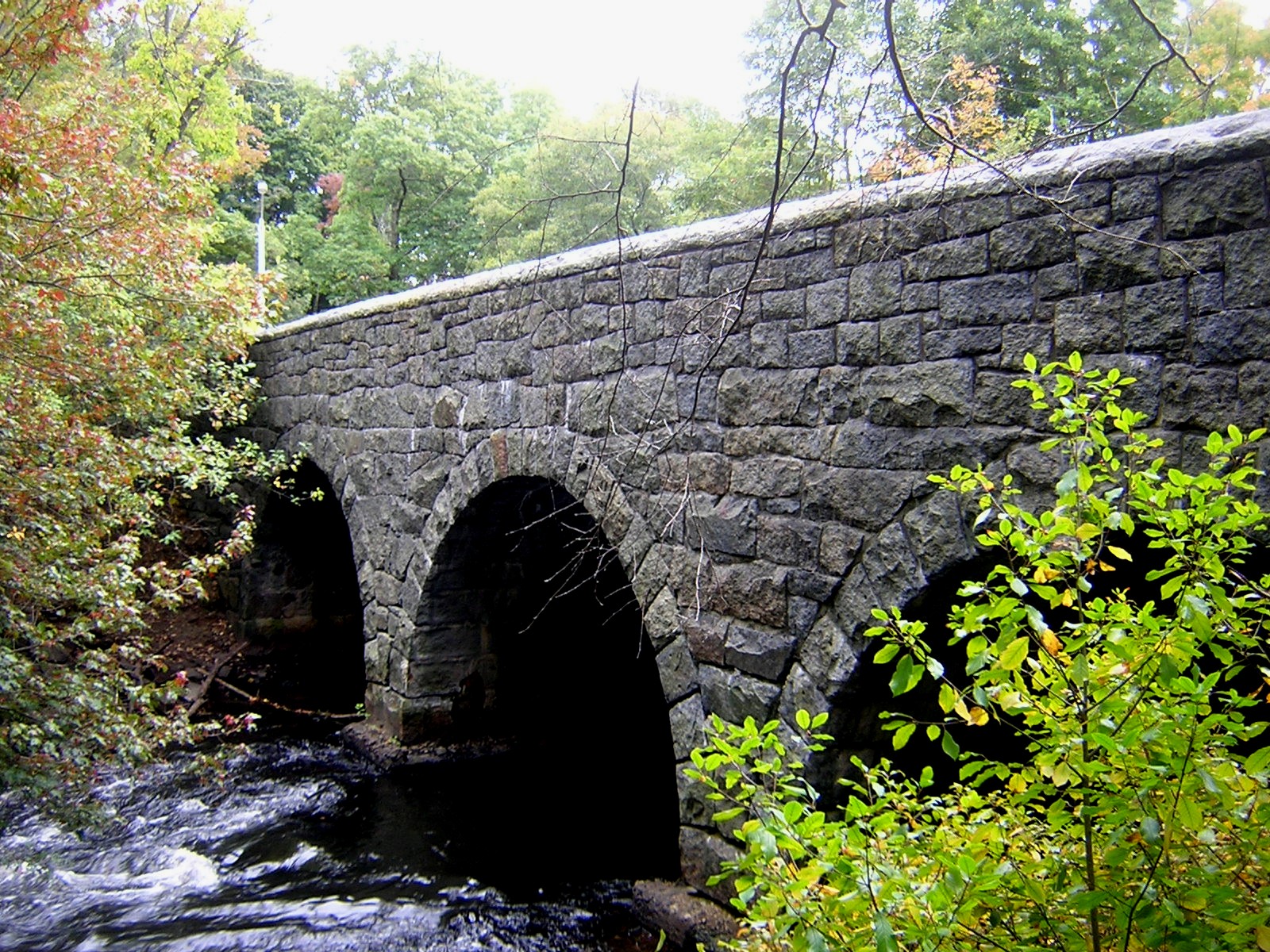
Paul's Bridge on:
[Wikipedia]
[Google]
[Amazon]
Paul's Bridge is a stone bridge carrying the Neponset Valley Parkway over the 
Neponset River
The Neponset River is a river in eastern Massachusetts in the United States. Its headwaters are at the Neponset Reservoir in Foxborough, near Gillette Stadium. From there, the Neponset meanders generally northeast for about to its mouth at Do ...
between Milton and southern Boston, Massachusetts. It was built in 1849 by Thomas Hollis, Jr., of Milton, but was later reconstructed using the original materials. It replaced the earlier Hubbard's Bridge (built prior to 1759), and a subsequent Paul's Bridge (so named at its 1807 reconstruction). Its current span is approximately . The name "Paul" can be attributed to Samuel Paul, the owner of the adjacent land on the Readville
Readville is part of the Hyde Park neighborhood of Boston. Readville's ZIP Code is 02136. It was called Dedham Low Plains from 1655 until it was renamed after the mill owner James Read in 1847. It was part of Dedham until 1867. It is served by ...
(now Boston) side, which was part of Dedham at the time of the bridge's construction.
The 1849 bridge was long and wide, and was constructed of unmortared Quincy granite. Each round arch measures at the springline. The area between the arches is uncoursed rubblestone, and the arches are formed out of cut granite voussoir
A voussoir () is a wedge-shaped element, typically a stone, which is used in building an arch or vault.
Although each unit in an arch or vault is a voussoir, two units are of distinct functional importance: the keystone and the springer. The ...
s. The bridge underwent a major rebuilding between 1932-1935 under the leadership of Arthur A. Shurcliff, FASLA and founder of the AIP, who made it a priority to widen the bridge. Most of the original stone was reused and solid stone parapets replaced the wooden siderails. Instead of a rubblestone finish between the arches on the extended side, it is finished in coursed stone.National Register of Historic Places Inventory- Nomination Form, (1972).
Paul's Bridge was added to the National Register of Historic Places
The National Register of Historic Places (NRHP) is the United States federal government's official list of districts, sites, buildings, structures and objects deemed worthy of preservation for their historical significance or "great artist ...
in 1972, and contributes to a historic district
A historic district or heritage district is a section of a city which contains older buildings considered valuable for historical or architectural reasons. In some countries or jurisdictions, historic districts receive legal protection from ce ...
encompassing the Neponset River Parkway. It is located within the Neponset River Reservation
Neponset River Reservation is a Massachusetts state reservation along the Neponset River in the towns of Milton and Dorchester, near where the river flows through an estuary into the Boston Harbor. It is adjacent to the Dorchester-Milton Lowe ...
, and is maintained by the Massachusetts Department of Conservation and Recreation
The Department of Conservation and Recreation (DCR) is a state agency of the Commonwealth of Massachusetts, situated in the Executive Office of Energy and Environmental Affairs. It is best known for its parks and parkways. The DCR's mission ...
.

See also
*National Register of Historic Places listings in Milton, Massachusetts
This is a list of properties and historic districts in Milton, Massachusetts, that are listed on the National Register of Historic Places.
The locations of National Register properties and districts (at least for all showing latitude and longitu ...
*National Register of Historic Places listings in southern Boston, Massachusetts __NOTOC__
Boston, Massachusetts is home to many listings on the National Register of Historic Places. This list encompasses those locations that are located south of the Massachusetts Turnpike. See National Register of Historic Places listings in ...
*List of bridges on the National Register of Historic Places in Massachusetts
This is a list of bridges and tunnels on the National Register of Historic Places in the U.S. state of Massachusetts.
References
{{National Register of Historic Places in Massachusetts
Bridges
Massachusetts
Bridges
Bridges
A bridg ...
References
{{National Register of Historic Places in Massachusetts Bridges completed in 1849 Road bridges on the National Register of Historic Places in Massachusetts Bridges in Boston Bridges over the Neponset River Bridges in Norfolk County, Massachusetts Milton, Massachusetts National Register of Historic Places in Milton, Massachusetts National Register of Historic Places in Boston Historic district contributing properties in Massachusetts 1849 establishments in Massachusetts Stone arch bridges in the United States