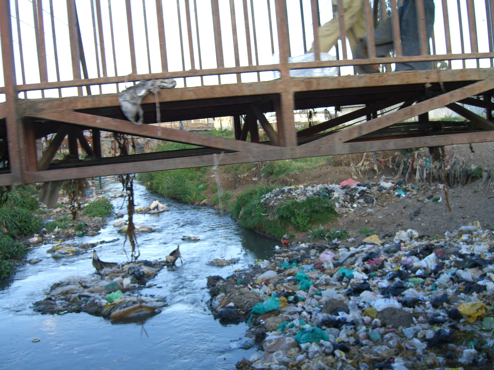
Nairobi River on:
[Wikipedia]
[Google]
[Amazon]
 The Nairobi River is a river that flows across

Map
Wikimapia Nairobi Dam
{{Coord, 1, 11, 59, S, 37, 09, 26, E, region:KE-200_type:waterbody_source:kolossus-dewiki, display=title Rivers of Kenya Nairobi Athi-Galana-Sabaki River
 The Nairobi River is a river that flows across
 Nairobi
Nairobi ( ) is the capital and largest city of Kenya. The name is derived from the Maasai phrase ''Enkare Nairobi'', which translates to "place of cool waters", a reference to the Nairobi River which flows through the city. The city prope ...
, the capital city of Kenya
)
, national_anthem = " Ee Mungu Nguvu Yetu"()
, image_map =
, map_caption =
, image_map2 =
, capital = Nairobi
, coordinates =
, largest_city = Nairobi
, ...
. It is the main river of the Nairobi River Basin, with several parallel streams flowing eastward. All of the Nairobi basin rivers join east of Nairobi and meet the Athi River, which eventually flows into the Indian Ocean
The Indian Ocean is the third-largest of the world's five oceanic divisions, covering or ~19.8% of the water on Earth's surface. It is bounded by Asia to the north, Africa to the west and Australia to the east. To the south it is bounded by ...
. The rivers are mostly narrow and highly polluted, though recent efforts to clean the rivers have improved water quality.
The main stream, the Nairobi River, bounds the northern city center, where it is partly canalized.
Tributaries
The Nairobi River originates from the Ondiri Swamp in Kikuyu. The Nairobi River has several tributaries: * Athi River *Gathara-ini River *Gitathuru River *Kiu River *Mathari River * Mbagathi River *Nairobi River *Ngong River *RuiRuaka River The Motoine River flows to Nairobi Dam, an artificial lake meant to provide potable water to the residents of Nairobi. The stream continues as the Ngong River.Gatharaini
Gatharaini is a settlement in Kenya's Nairobi Province
Nairobi ( ) is the capital and largest city of Kenya. The name is derived from the Maasai phrase ''Enkare Nairobi'', which translates to "place of cool waters", a reference to the Na ...
stream originates in the marshes of the lower reaches of the Aberdare mountains and flows through various populated areas. The stream is impacted by human activities along its channels and in its catchment. In the upper sections of Kiambaa and Kanunga, the stream passes through swampy and marshy areas, with subsistence agriculture and human settlement as the main types of land use. In the midsections of Kiambu, are extensive coffee crops and mixed farming.
In the Eastern Nairobi Section it passes through Nairobi Sewerage Company in Ngundu,Kamulu
In the lower sections of Githurai and Zimmerman, the stream is characterized by coffee farming, intensive mixed farming, and industry such as the Kamiti Tannery Factory. The lower stream waters are brackish and foul. In the past, riverine subsistence agriculture
Subsistence agriculture occurs when farmers grow food crops to meet the needs of themselves and their families on smallholdings. Subsistence agriculturalists target farm output for survival and for mostly local requirements, with little or no s ...
of arrowroots and kale was common throughout the area. Efforts to conserve and preserve this river are yet to be initiated.
Nairobi's rivers are contaminated due to agriculture, slums, and industry. During rainy seasons
The wet season (sometimes called the Rainy season) is the time of year when most of a region's average annual rainfall occurs. It is the time of year where the majority of a country's or region's annual precipitation occurs. Generally, the sea ...
, rivers on the low-lying riverbanks flood.
Kenya has a second river named Nairobi that starts on Mount Kenya and is a tributary of the Sagana and Tana, the country's longest river.

See also
* Water supply and sanitation in KenyaReferences
External links
* River basiMap
Wikimapia Nairobi Dam
{{Coord, 1, 11, 59, S, 37, 09, 26, E, region:KE-200_type:waterbody_source:kolossus-dewiki, display=title Rivers of Kenya Nairobi Athi-Galana-Sabaki River