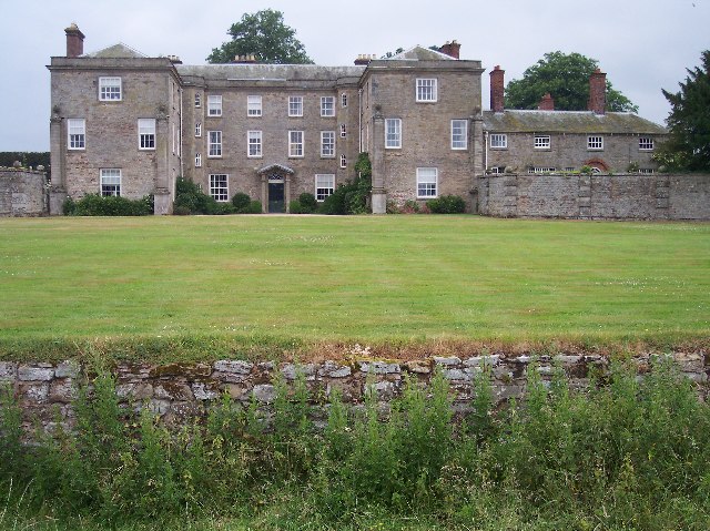
Morville, Shropshire on:
[Wikipedia]
[Google]
[Amazon]
Morville is a village and 
Parish council
Villages in Shropshire Civil parishes in Shropshire {{Shropshire-geo-stub
civil parish
In England, a civil parish is a type of administrative parish used for local government. It is a territorial designation which is the lowest tier of local government. Civil parishes can trace their origin to the ancient system of parishes, w ...
about 3 miles west of Bridgnorth
Bridgnorth is a market town and civil parish in Shropshire, England. The River Severn splits it into High Town and Low Town, the upper town on the right bank and the lower on the left bank of the River Severn. The population at the United Kingd ...
, in the Shropshire
Shropshire (; abbreviated SalopAlso used officially as the name of the county from 1974–1980. The demonym for inhabitants of the county "Salopian" derives from this name.) is a Ceremonial counties of England, ceremonial county in the West M ...
district, in the county of Shropshire
Shropshire (; abbreviated SalopAlso used officially as the name of the county from 1974–1980. The demonym for inhabitants of the county "Salopian" derives from this name.) is a Ceremonial counties of England, ceremonial county in the West M ...
, England. In 2011, the parish had a population of 392. The parish touches Acton Round
Acton Round is a village and Civil parishes in England, civil parish in the England, English country of Shropshire. Acton Round was recorded in the Domesday Book as ''Achetune''. The civil parish includes the village of Muckley.
See also
*Lis ...
, Astley Abbotts
Astley Abbotts is a village and civil parish in Shropshire, England, located immediately north of Bridgnorth, and straddling the B4373 Bridgnorth to Broseley road. According to the 2001 census the parish had a population of 396.
The Church ins ...
, Aston Eyre, Barrow, Bridgnorth
Bridgnorth is a market town and civil parish in Shropshire, England. The River Severn splits it into High Town and Low Town, the upper town on the right bank and the lower on the left bank of the River Severn. The population at the United Kingd ...
, Chetton, Tasley and Upton Cressett.

Landmarks
There are 20 listed buildings in Morville. Morville has a church called St Gregory the Great.History
The generic part of the name "Morville" means 'open land'. Morville was recorded in theDomesday Book
Domesday Book ( ; the Middle English spelling of "Doomsday Book") is a manuscript record of the Great Survey of much of England and parts of Wales completed in 1086 at the behest of William the Conqueror. The manuscript was originally known by ...
as ''Membrefelde''.
See also
* Morville PrioryReferences
External links
Parish council
Villages in Shropshire Civil parishes in Shropshire {{Shropshire-geo-stub