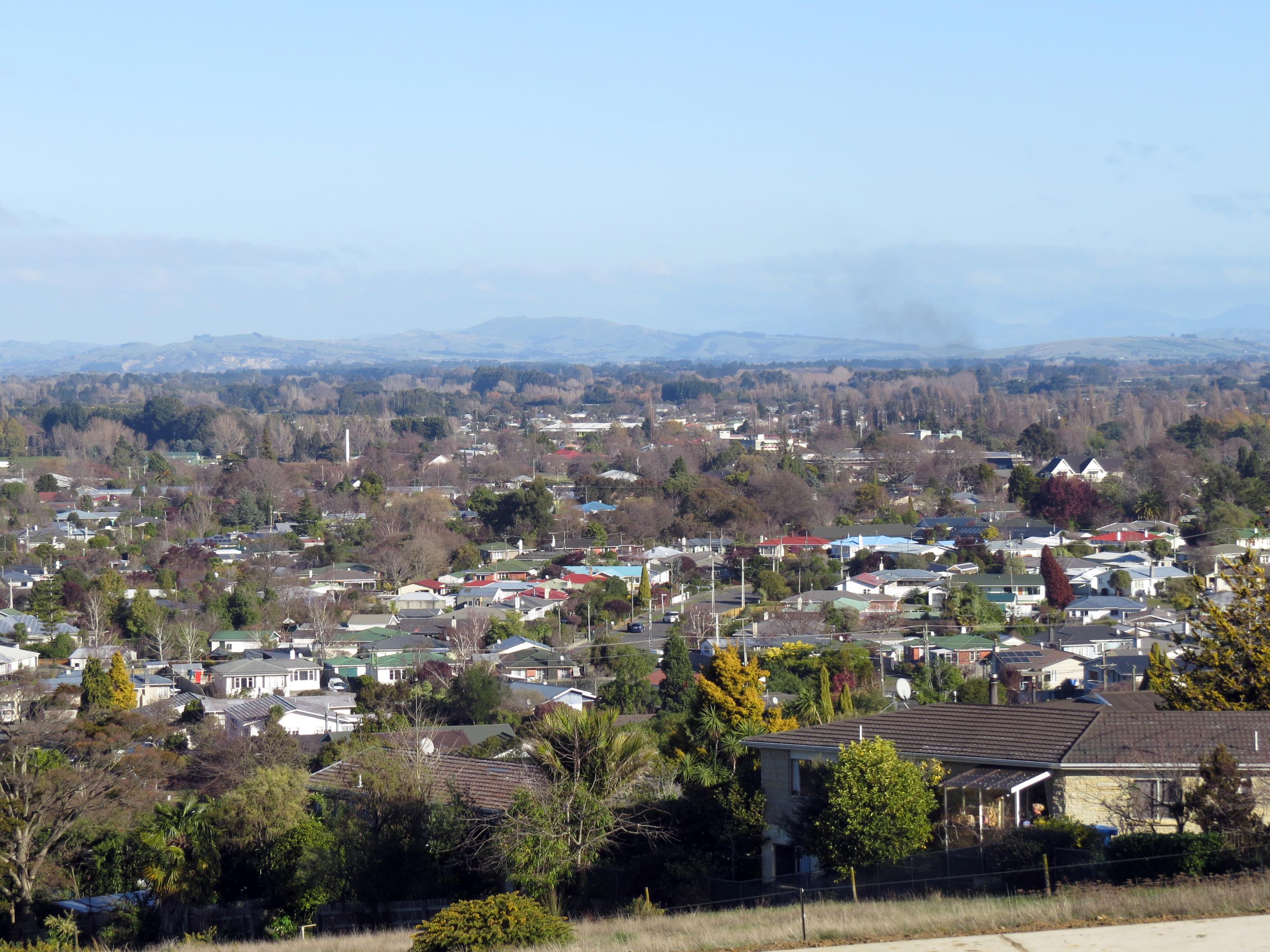
Lansdowne, Masterton on:
[Wikipedia]
[Google]
[Amazon]
Lansdowne, one of Masterton's largest suburbs, is on the left bank of the Waipoua stream at the north-western end of 
Masterton
Masterton ( mi, Whakaoriori), a large town in the Greater Wellington Region of New Zealand, operates as the seat of the Masterton District (a territorial authority or local-government district). It is the largest town in the Wairarapa, a r ...
, New Zealand. On the town's highest ground it provides broad vistas of much of the Wairarapa Valley.
It is further distinguished from the rest of the town by having been subdivided late in the 19th century and because it was administered by the Masterton County Council. It was amalgamated with Masterton Borough in 1921.
Lansdowne was named by an early settler, J. Valentine Smith
John Valentine Smith (1824 – 10 February 1895) was a New Zealand landowner, militia leader, and politician.
Biography
Smith was born in 1824 at Malta, where his father was with the Admiralty. Smith received his education at public scho ...
, who named his station after his father-in-law's station in New South Wales
)
, nickname =
, image_map = New South Wales in Australia.svg
, map_caption = Location of New South Wales in AustraliaCoordinates:
, subdivision_type = Country
, subdivision_name = Australia
, established_title = Before federation
, es ...
. His 2,085 acre estate was bought in 1884 by T. C. Williams.
Parts of Lansdowne, Lansdowne Hill and Lansdowne Terrace, are more affluent than most other Masterton suburbs. The property prices are helped by the suburb's views of the Tararua Ranges
The Tararua Range, often referred to as the Tararua Ranges or Tararua, is one of several mountain ranges in the North Island of New Zealand.
The Tararua Range runs northeast–southwest for from near Palmerston North to the upper reaches of ...
, the presence of a retirement village and two golf courses
A golf course is the grounds on which the sport of golf is played. It consists of a series of holes, each consisting of a tee box, a fairway, the rough and other hazards, and a green with a cylindrical hole in the ground, known as a "cup". Th ...
, on the top of the hill and at Mahunga by the Waipoua stream.

Demographics
Lansdowne, comprising the statistical areas of Lansdowne West and Lansdowne East, covers . It had an estimated population of as of with a population density of people per km2. Lansdowne had a population of 4,311 at the2018 New Zealand census
Eighteen or 18 may refer to:
* 18 (number), the natural number following 17 and preceding 19
* one of the years 18 BC, AD 18, 1918, 2018
Film, television and entertainment
* ''18'' (film), a 1993 Taiwanese experimental film based on the sh ...
, an increase of 393 people (10.0%) since the 2013 census, and an increase of 444 people (11.5%) since the 2006 census. There were 1,686 households. There were 2,049 males and 2,262 females, giving a sex ratio of 0.91 males per female, with 756 people (17.5%) aged under 15 years, 693 (16.1%) aged 15 to 29, 1,725 (40.0%) aged 30 to 64, and 1,131 (26.2%) aged 65 or older.
Ethnicities were 84.3% European/Pākehā, 19.8% Māori, 4.0% Pacific peoples, 5.4% Asian, and 1.3% other ethnicities (totals add to more than 100% since people could identify with multiple ethnicities).
The proportion of people born overseas was 13.5%, compared with 27.1% nationally.
Although some people objected to giving their religion, 46.7% had no religion, 40.9% were Christian, 1.0% were Hindu, 0.1% were Muslim, 0.5% were Buddhist and 2.4% had other religions.
Of those at least 15 years old, 531 (14.9%) people had a bachelor or higher degree, and 828 (23.3%) people had no formal qualifications. The employment status of those at least 15 was that 1,539 (43.3%) people were employed full-time, 516 (14.5%) were part-time, and 126 (3.5%) were unemployed.
Transport
Lansdowne is served by a suburban bus service, which runs four times a day on weekdays, connecting suburban residents to Masterton's CBD. Central Lansdowne is also approximately 2.8 km from Masterton railway station, which runs commuter trains from Masterton, through theWairarapa Line
The Wairarapa Line is a secondary railway line in the south-east of the North Island of New Zealand. The line runs for , connects the capital city Wellington with the Palmerston North - Gisborne Line at Woodville, New Zealand, Woodville, via ...
, terminating at Wellington railway station
Wellington railway station, or Wellington Central station, is the main railway station serving Wellington, New Zealand, and is the southern terminus of the North Island Main Trunk, Wairarapa Line and Johnsonville Line.
The station opened i ...
.
Education
Lakeview School is a co-educational state primary school for Year 1 to 8 students, with a roll of as of . Lansdowne School and Totara Drive Schools were closed by theMinistry of Education
An education ministry is a national or subnational government agency politically responsible for education. Various other names are commonly used to identify such agencies, such as Ministry of Education, Department of Education, and Ministry of Pub ...
in 2004 due to expected roll drops.
References
{{Masterton District, New Zealand Suburbs of Masterton