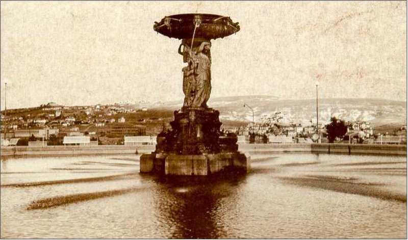
Kızılay Square on:
[Wikipedia]
[Google]
[Amazon]
 July 15 Kızılay National Will Square (), originally Kızılay Square (''Kızılay Meydanı''), is one of the most important centers and junction points of
 The square was named ''Kızılay'' (meaning "
 July 15 Kızılay National Will Square (), originally Kızılay Square (''Kızılay Meydanı''), is one of the most important centers and junction points of
 Ankara
Ankara is the capital city of Turkey and List of national capitals by area, the largest capital by area in the world. Located in the Central Anatolia Region, central part of Anatolia, the city has a population of 5,290,822 in its urban center ( ...
, Turkey
Turkey, officially the Republic of Türkiye, is a country mainly located in Anatolia in West Asia, with a relatively small part called East Thrace in Southeast Europe. It borders the Black Sea to the north; Georgia (country), Georgia, Armen ...
.
Geography
The square at is the intersection of two major boulevards. Atatürk Boulevard () running from south to north is popularly called the "Protocol Road". The east part of the other boulevard is named Ziya Gökalp Boulevard (formerly Kazım Özalp Boulevard) and the west part is named Gazi Mustafa Kemal Boulevard. Kahramanlar Business Center (formerly Kızılay Emek Business Center) is situated to the southeast and Güven Park is situated to the southwest of the square. The ''Kızılay AVM'' shopping mall, which replaced the former ''Kızılay'' (Turkish Red Crescent) headquarters, is situated to the northwest.History
 The square was named ''Kızılay'' (meaning "
Red Crescent
The organized International Red Cross and Red Crescent Movement is a humanitarian movement with approximately 16million volunteers, members, and staff worldwide. It was founded to protect human life and health, to ensure respect for all human ...
" in Turkish) after the Turkish Red Crescent headquarters, which was built on its northwest in 1929.
The Red Crescent building was demolished in 1993 and replaced by the present-day ''Kızılay AVM'' shopping mall, which – after a long legal process regarding its ownership rights – was opened in 2011.)
In those years, the city center was located to the north of Kızılay, but Ankara was redesigned by a group of urban planners including Hermann Jansen.
After the development of the new quarters, the center of the city eventually shifted toward the neighborhoods around the square, and in fact those quarters are now known as Kızılay.
After the 27 May 1960 coup d'état it was formally renamed as ''Liberty Square'' (''Hürriyet Meydanı''); but the popular use of Kızılay Square continued.
Following the failed coup attempt of 15 July 2016, Ankara Metropolitan Municipality initially decided on 26 July 2016 to rename the square as ''July 15 Kızılay Democracy Square'' (''15 Temmuz Kızılay Demokrasi Meydanı''), which was later amended as ''July 15 Kızılay National Will Square'' on 9 August 2016. It is still commonly known as Kızılay Square among the resident population of the city.
Transportation
Kızılay is a stop in the routes of most of the public buses operating both in the south–north and east–west directions. Kızılay is also the terminus of the M1, M2 and M4 lines of theAnkara Metro
The Ankara Metro () is the rapid transit system serving Ankara, the capital of Turkey. At present, Ankara's rapid transit system consists of three metro lines – the ''Ankaray (A1)'', the ''M1 - M2 - M3'' and the ''M4''. The Ankaray, M1, M2, M3 ...
. The station of the Ankaray light rail
Light rail (or light rail transit, abbreviated to LRT) is a form of passenger urban rail transit that uses rolling stock derived from tram technology National Conference of the Transportation Research Board while also having some features from ...
is located below the metro terminal. Kızılay is a central station of Ankaray which connects the northeast of Ankara to the west of the city center.
See also
*Architecture of Turkey
The architecture of Turkey includes heritage from the ancient era of Anatolia to the present day. Significant remains from the Greco-Roman period are located throughout the country. The Byzantine period produced, among other monuments, the ce ...
References