Kurobe Senyō Railway on:
[Wikipedia]
[Google]
[Amazon]
 The is a
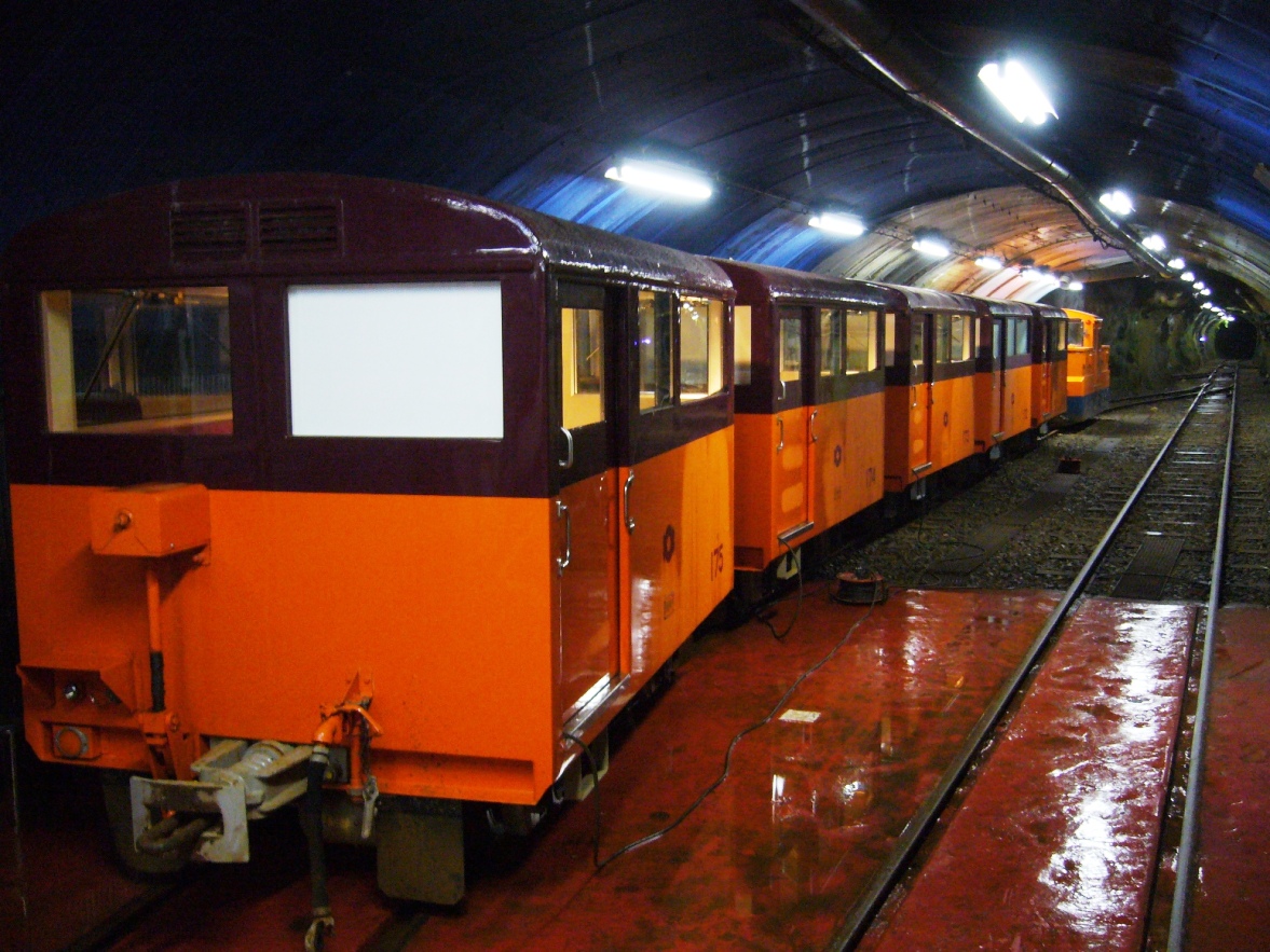
 The Jōbu Track is a 6.4 km, single track line that runs from Keyakidaira-Jōbu Station to Kurobegawa No.4 Power Station-mae. The Jōbu Track was built as a counterpart to the Kurobe Gorge Railway Main Line, with "Jōbu Track" literally meaning "Upper Track". Conversely, the Kurobe Gorge Railway Main Line is sometimes called the .
The section between Keyakidaira and Sennindani was built in 1941 for the construction of the Kurobegawa No.3 Power Station. The section between Sennindani and Kurobegawa No.4 Power Station-mae was built in 1963 for the construction of the No.4 station.
A section between Asohara and Sennindani is known as the . During construction, the temperature of the surrounding rocks was , which caused

 The Jōbu Track forms part of the Kurobe Route, an industrial transportation route which runs between Keyakidaira Station and Kurobe Dam Station, which connect to the Kurobe Gorge Railway Main Line and the Kanden Tunnel Electric Bus respectively. From Keyakidaira Station, a short industrial track leads to Keyakidaira-Kabu station, where a large
Kansai Electric Power Company
official website, explaining the study tour
official website, explaining the study tour {{DEFAULTSORT:Kurobe Senyo Railway Railway lines in Japan Rail transport in Toyama Prefecture 2 ft 6 in gauge railways in Japan Railway lines opened in 1941 Tateyama, Toyama
 The is a
 narrow gauge
A narrow-gauge railway (narrow-gauge railroad in the US) is a railway with a track gauge (distance between the rails) narrower than . Most narrow-gauge railways are between and .
Since narrow-gauge railways are usually built with Minimum railw ...
industrial railway
An industrial railway is a type of railway (usually private) that is not available for public transportation and is used exclusively to serve a particular industrial, logistics, or military site. In regions of the world influenced by British r ...
line in Toyama Prefecture
is a prefecture of Japan located in the Chūbu region of Honshu. Toyama Prefecture has a population of 993,848 (1 January 2025) and has a geographic area of 4,247.61 km2 (1,640.01 sq mi). Toyama Prefecture borders Ishikawa Prefecture to the ...
, Japan
Japan is an island country in East Asia. Located in the Pacific Ocean off the northeast coast of the Asia, Asian mainland, it is bordered on the west by the Sea of Japan and extends from the Sea of Okhotsk in the north to the East China Sea ...
. It is operated by the Kurobe Gorge Railway Company, a wholly owned subsidiary of the Kansai Electric Power Company
, also known as , is an electric utility with its operational area of Kansai region, Japan (including the Keihanshin megalopolis).
The Kansai region is Japan's second-largest industrial area, and in normal times, its most nuclear-reliant. Bef ...
. There are two lines, the and the . Both lines provide access to Kansai Electric's hydroelectric
Hydroelectricity, or hydroelectric power, is Electricity generation, electricity generated from hydropower (water power). Hydropower supplies 15% of the world's electricity, almost 4,210 TWh in 2023, which is more than all other Renewable energ ...
power plants on the Kurobe River
The is a river in Toyama Prefecture, Japan. The river is in length and has a watershed of .
The river rises from Mount Washiba in the Hida Mountains and carves the deep valley known as the Kurobe Gorge. It comes out of the mountains at Un ...
and are generally not open to the public. The Jōbu Track runs regular trains, while the Kuronagi branch sees very infrequent operation.
Jōbu Track
 The Jōbu Track is a 6.4 km, single track line that runs from Keyakidaira-Jōbu Station to Kurobegawa No.4 Power Station-mae. The Jōbu Track was built as a counterpart to the Kurobe Gorge Railway Main Line, with "Jōbu Track" literally meaning "Upper Track". Conversely, the Kurobe Gorge Railway Main Line is sometimes called the .
The section between Keyakidaira and Sennindani was built in 1941 for the construction of the Kurobegawa No.3 Power Station. The section between Sennindani and Kurobegawa No.4 Power Station-mae was built in 1963 for the construction of the No.4 station.
A section between Asohara and Sennindani is known as the . During construction, the temperature of the surrounding rocks was , which caused
 dynamite
Dynamite is an explosive made of nitroglycerin, sorbents (such as powdered shells or clay), and Stabilizer (chemistry), stabilizers. It was invented by the Swedish people, Swedish chemist and engineer Alfred Nobel in Geesthacht, Northern German ...
used for excavating the tunnel to explode prematurely. The area has since cooled to .
Stations
Stations listed in italics are depots. All stations are located inKurobe
is a city in Toyama Prefecture, in the Chūbu region of Japan. , the city had an estimated population of 41,564 in 15,387 households and a population density of 95.8 persons per km2. Its total area was .
Geography
Kurobe is located in northeaste ...
, Toyama Toyama may refer to:
Places
* Toyama Prefecture, a prefecture of Japan located in the Hokuriku region on the main Honshu island
* Toyama (city), the capital city of Toyama Prefecture
* Toyama Station, the main station of Toyama, Toyama
* Toyama Sta ...
except Kurobegawa No.4 Power Station-mae, which is located in Tateyama, Toyama
is a town located in Nakaniikawa District, Toyama Prefecture, Japan.
, the town had an estimated population of 26,212 in 9452 households and a population density of 85 persons per km². The total area of the town was .
Geography
Tateyama is l ...
.
*: Altitude 800 m. Linked to Keyakidaira-Kabu (altitude 599m) by an elevator. Keyakidaira-Kabu is virtually the same station as Keyakidaira, Kurobe Gorge Railway Main Line.
*
*
*
*
*: Altitude . Linked to Incline-Jōbu (altitude 1325m) by a funicular.
Services

 The Jōbu Track forms part of the Kurobe Route, an industrial transportation route which runs between Keyakidaira Station and Kurobe Dam Station, which connect to the Kurobe Gorge Railway Main Line and the Kanden Tunnel Electric Bus respectively. From Keyakidaira Station, a short industrial track leads to Keyakidaira-Kabu station, where a large
 elevator
An elevator (American English) or lift (Commonwealth English) is a machine that vertically transports people or freight between levels. They are typically powered by electric motors that drive traction cables and counterweight systems suc ...
lifts train carriages one-by-one to Keyakidaira-Jōbu Station, above. The Jōbu Track then begins from Keyakidaira-Jōbu and runs to Kurobegawa No.4 Power Station-mae. From there, a funicular
A funicular ( ) is a type of cable railway system that connects points along a railway track laid on a steep grade (slope), slope. The system is characterized by two counterbalanced carriages (also called cars or trains) permanently attached to ...
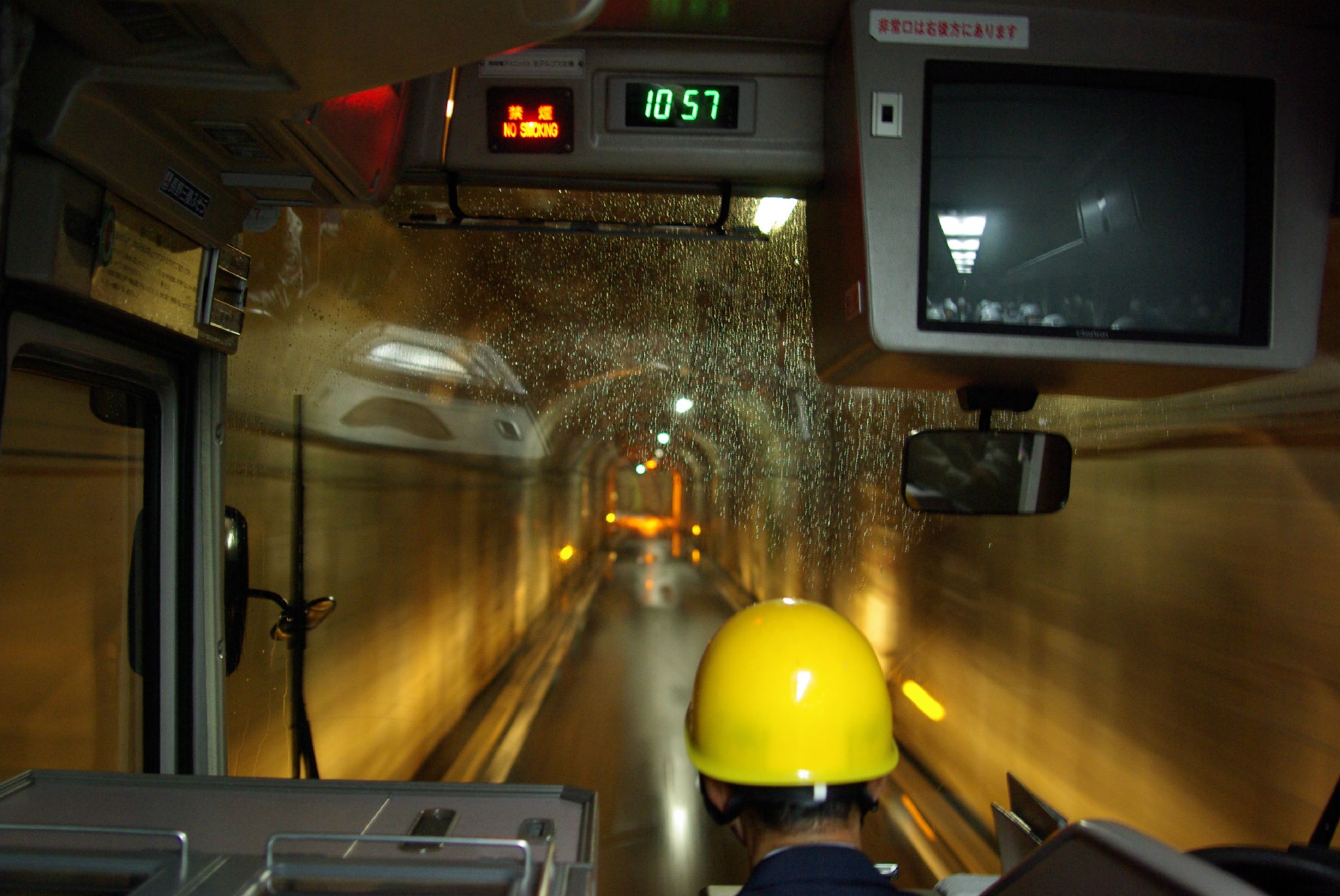
goes to Incline Jōbu Station, above, and a bus connection links Incline Jōbu Station to Kurobe Dam Station, away, via the Kurobe Tunnel.
Motive power on the Jōbu Track is provided by battery-powered locomotives, which tow small freight or passenger cars a few times a day. Battery power is used because the High Temperature Tunnel can flash off the fuels of combustion engines. Because the line runs almost entirely within tunnels, the Jōbu Track operates year-round, unlike the Kurobe Gorge Railway, which closes during winter due to heavy snow.
The Kurobe Route, including the Jōbu Track, is generally not open to the public. However, starting in 1996, visitors are allowed to ride the route as part of a limited study tour. Visitors must book in advance, and in most cases, there are more applicants than the limit, in which case applicants are selected via lottery. In 2007, 34 tours were held with 2040 participants.
Kuronagi Branch Line
The Kuronagi Branch Line runs between of the Kurobe Gorge Railway Main Line and roughly away. The line sees very infrequent service; as such, tourists going to the nearby can walk on the line with permission from a Kuronagi Station attendant. Unlike the Jōbu Track, the line is not entirely within a tunnel.See also
* Tateyama Sabō Erosion Control Works Service Train * Kurobe Gorge Railway * Kanden Tunnel Trolleybus *Kurobe dam
The , or , is a high variable-radius arch dam located on the Kurobe River in Toyama Prefecture, Japan. The tallest dam in Japan, it supports the 335 MW Kurobe No. 4 Hydropower Plant and is owned by Kansai Electric Power Company. It was construct ...
* Tateyama Kurobe Alpine Route
*Industrial railway
An industrial railway is a type of railway (usually private) that is not available for public transportation and is used exclusively to serve a particular industrial, logistics, or military site. In regions of the world influenced by British r ...
External links
Kansai Electric Power Company
official website, explaining the study tour
official website, explaining the study tour {{DEFAULTSORT:Kurobe Senyo Railway Railway lines in Japan Rail transport in Toyama Prefecture 2 ft 6 in gauge railways in Japan Railway lines opened in 1941 Tateyama, Toyama