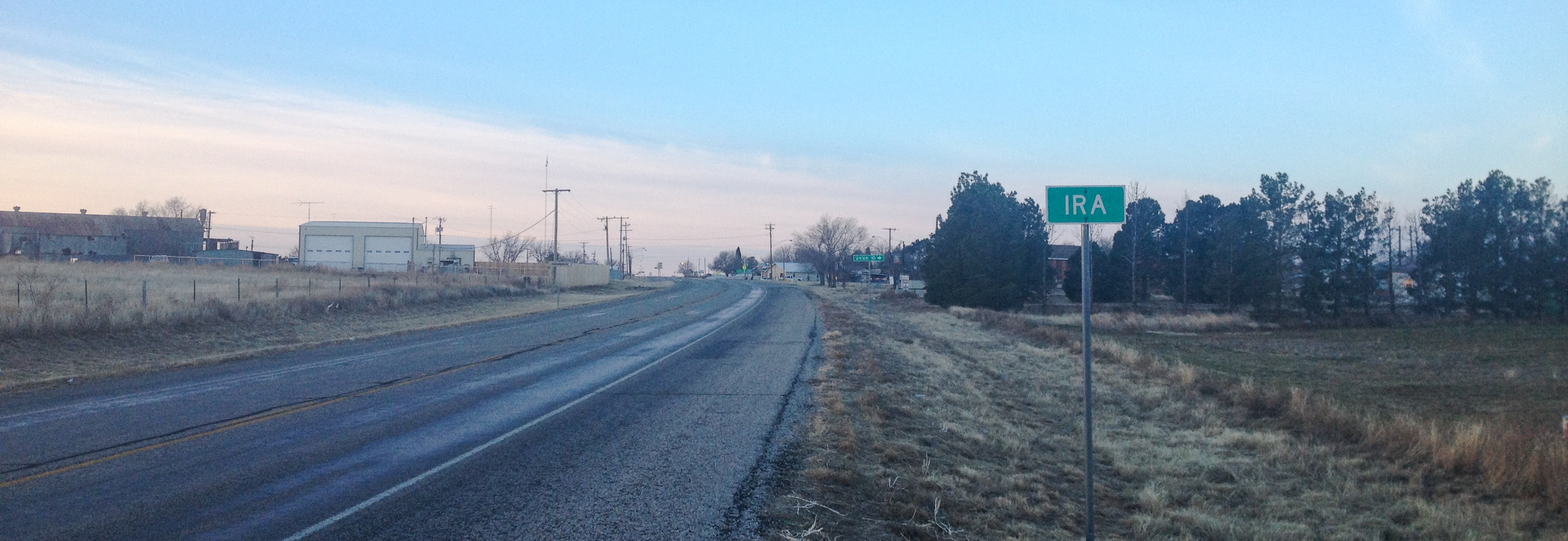
Ira, Texas on:
[Wikipedia]
[Google]
[Amazon]
Ira is an
 Ira's history began sometime in the early 1890s, when Ira Green established a general store in the area. Green's store became a meeting point for the
Photos of the Rolling Plains of West Texas
Unincorporated communities in Texas Unincorporated communities in Scurry County, Texas 1890s establishments in Texas {{ScurryCountyTX-geo-stub
unincorporated community
An unincorporated area is a parcel of land that is not governed by a local general-purpose municipal corporation. (At p. 178.) They may be governed or serviced by an encompassing unit (such as a county) or another branch of the state (such as th ...
in Scurry County, Texas
Texas ( , ; or ) is the most populous U.S. state, state in the South Central United States, South Central region of the United States. It borders Louisiana to the east, Arkansas to the northeast, Oklahoma to the north, New Mexico to the we ...
, United States. It lies in the southwestern corner of the county at the junction of State Highway 350 and Farm to Market Road 1606, 10 miles southwest of Snyder, and has an estimated population of 250.
History
 Ira's history began sometime in the early 1890s, when Ira Green established a general store in the area. Green's store became a meeting point for the
 stagecoach
A stagecoach (also: stage coach, stage, road coach, ) is a four-wheeled public transport coach used to carry paying passengers and light packages on journeys long enough to need a change of horses. It is strongly sprung and generally drawn by ...
and mail route, and a community began to spring up. A school opened in 1893, and Ira Green became postmaster when the community's post office was activated three years later.
After reaching its peak in the early 20th century, Ira survived a period of economic downturn in Scurry County, and in 1980 was reportedly home to 485 residents. This had fallen by almost half by 1990, and in 2000, Ira reported about 250 residents.
Education
The community of Ira is served by the Ira Independent School District and home to the Ira High School Bulldogs.See also
*Llano Estacado
The Llano Estacado (), sometimes translated into English as the Staked Plains, is a region in the Southwestern United States that encompasses parts of eastern New Mexico and northwestern Texas. One of the largest mesas or tablelands on the North A ...
*Colorado River (Texas)
The Colorado River is an approximately river in the United States, U.S. state of Texas. It is the 11th longest river in the United States and the longest river with both its source (river or stream), source and its river delta, mouth within Tex ...
*Mushaway Peak
Mushaway Peak is a small but conspicuous butte located southeast of Gail in central Borden County, Texas. It is one of the region's most venerable landmarks.
The summit of this peak rises to an altitude of above sea level, which is roughly t ...
*Duffy's Peak
Duffy's Peak is a small hill or butte near the Salt Fork Brazos River in Garza County, Texas. Duffy's Peak extends less than above the river, yet despite its small size, it served as an important landmark for early surveyors of the region and i ...
*Farm to Market Road 669
A farm (also called an agricultural holding) is an area of land that is devoted primarily to agricultural processes with the primary objective of producing food and other crops; it is the basic facility in food production. The name is used fo ...
References
External links
*Photos of the Rolling Plains of West Texas
Unincorporated communities in Texas Unincorporated communities in Scurry County, Texas 1890s establishments in Texas {{ScurryCountyTX-geo-stub