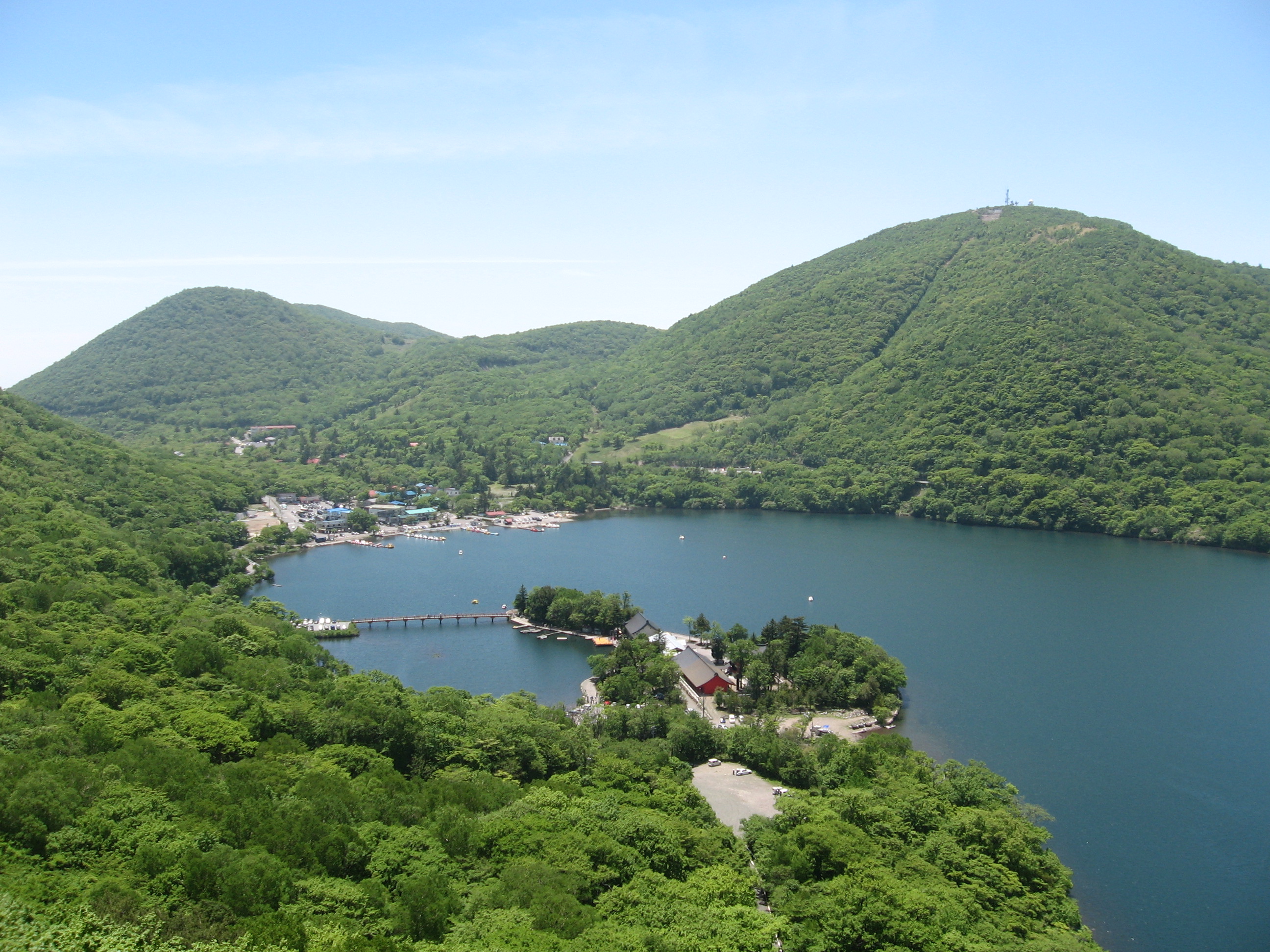
Fujimi, Gunma on:
[Wikipedia]
[Google]
[Amazon]
 was a
was a
 was a
was a village
A village is a human settlement or community, larger than a hamlet but smaller than a town with a population typically ranging from a few hundred to a few thousand. Although villages are often located in rural areas, the term urban v ...
located in Seta District, Gunma Prefecture
is a landlocked Prefectures of Japan, prefecture of Japan located in the Kantō region of Honshu. Gunma Prefecture has a population of 1,937,626 (1 October 2019) and has a geographic area of . Gunma Prefecture borders Niigata Prefecture and Fuk ...
, Japan
Japan is an island country in East Asia. Located in the Pacific Ocean off the northeast coast of the Asia, Asian mainland, it is bordered on the west by the Sea of Japan and extends from the Sea of Okhotsk in the north to the East China Sea ...
.
As of September 1, 2007, the village had an estimated population
Population is a set of humans or other organisms in a given region or area. Governments conduct a census to quantify the resident population size within a given jurisdiction. The term is also applied to non-human animals, microorganisms, and pl ...
of 22,267 and a population density
Population density (in agriculture: Standing stock (disambiguation), standing stock or plant density) is a measurement of population per unit land area. It is mostly applied to humans, but sometimes to other living organisms too. It is a key geog ...
of 316.20 persons per km2. The total area was 70.42 km2.
History
On May 5, 2009, Fujimi was merged into the expanded city ofMaebashi
is the capital city of Gunma Prefecture, in the northern Kantō region of Japan. , the city had an estimated population of 335,352 in 151,171 households, and a population density of 1100 persons per km2. The total area of the city is . It was ...
. Seta District also ceased to exist as a result.
Geography
Located in the northwestern portion of theKantō Plain
The , in the Kantō region of central Honshu, is the largest plain in Japan. Its 17,000 km2 covers more than half of the region extending over Tokyo, Saitama Prefecture, Kanagawa Prefecture, Chiba Prefecture, Gunma Prefecture, Tochigi Prefe ...
, the village stretched from the summit of Mount Akagi
is a stratovolcano in Gunma Prefecture, Japan.
The broad, low dominantly andesitic stratovolcano rises above the northern end of the Kanto Plain. It contains an elliptical, summit caldera with post-caldera lava domes arranged along a NW–SE ...
to the bottom. At the summit of Mount Akagi, there are two lakes, Ōnuma and Konuma, caldera
A caldera ( ) is a large cauldron-like hollow that forms shortly after the emptying of a magma chamber in a volcanic eruption. An eruption that ejects large volumes of magma over a short period of time can cause significant detriment to the str ...
lakes. Alpine plants such as Asian skunk cabbages grow in the marshland
In ecology, a marsh is a wetland that is dominated by herbaceous plants rather than by woody plants.Keddy, P.A. 2010. Wetland Ecology: Principles and Conservation (2nd edition). Cambridge University Press, Cambridge, UK. 497 p More in general ...
. The northern portion of the village was mainly covered by forests without many human dwellings, while the southern portion was flat with farmland.
Surrounding municipalities
*Maebashi
is the capital city of Gunma Prefecture, in the northern Kantō region of Japan. , the city had an estimated population of 335,352 in 151,171 households, and a population density of 1100 persons per km2. The total area of the city is . It was ...
* Kiryū
* Numata
* Shibukawa
(all in Gunma Prefecture)
Education
Primary schools
* Hara Elementary School * Ishii Elementary School * Shirakawa Elementary School * Tokizawa Elementary SchoolJunior high schools
* Fujimi Junior High SchoolReferences
External links
* Dissolved municipalities of Gunma Prefecture Populated places disestablished in 2009 Maebashi {{Gunma-geo-stub