Fairhaven, Ohio on:
[Wikipedia]
[Google]
[Amazon]
 Fairhaven is an
 Fairhaven is an
 unincorporated community
An unincorporated area is a parcel of land that is not governed by a local general-purpose municipal corporation. (At p. 178.) They may be governed or serviced by an encompassing unit (such as a county) or another branch of the state (such as th ...
in eastern Israel Township, Preble County, Ohio
Ohio ( ) is a U.S. state, state in the Midwestern United States, Midwestern region of the United States. It borders Lake Erie to the north, Pennsylvania to the east, West Virginia to the southeast, Kentucky to the southwest, Indiana to the ...
, United States
The United States of America (USA), also known as the United States (U.S.) or America, is a country primarily located in North America. It is a federal republic of 50 U.S. state, states and a federal capital district, Washington, D.C. The 48 ...
. It lies along State Route 177 at its intersection with Israel-Somers Road. Four Mile Creek, which feeds into Acton Lake in southern Preble County, runs on the western edge of Fairhaven. It is located 10½ miles (17 kilometers) southwest of Eaton, the county seat
A county seat is an administrative center, seat of government, or capital city of a county or parish (administrative division), civil parish. The term is in use in five countries: Canada, China, Hungary, Romania, and the United States. An equiva ...
of Preble County. The community is part of the Dayton
Dayton () is a city in Montgomery County, Ohio, United States, and its county seat. It is the List of cities in Ohio, sixth-most populous city in Ohio, with a population of 137,644 at the 2020 United States census, 2020 census. The Dayton metro ...
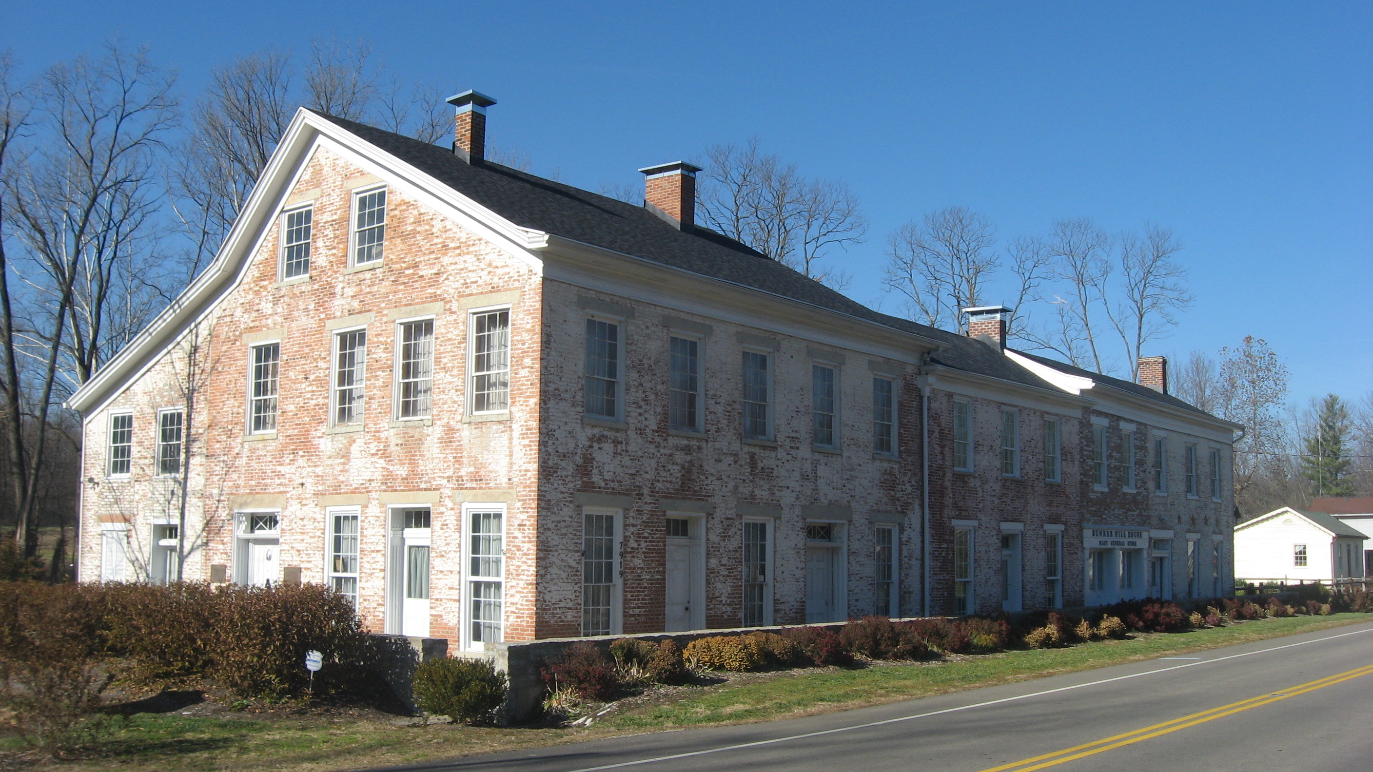
Metropolitan Statistical Area. Fairhaven Church and Fairhaven Community Church are both located in Fairhaven along State Route 177. Fairhaven Community Church hosts a free annual Dinner Drama for the community. Fairhaven is home to the historic Bunker Hill house, a stop along the Underground Railroad.
History
Fairhaven was laid out andplat
In the United States, a plat ( or ) (plan) is a cadastral map, drawn to scale, showing the divisions of a piece of land. United States General Land Office surveyors drafted township plats of Public Lands Survey System, Public Lands Surveys to ...
ted in 1832. Fairhaven is a commendatory name for the scenic location of the original town site. A post office was established at Fairhaven in 1833 and remained in operation until 1932.
References
Unincorporated communities in Preble County, Ohio Unincorporated communities in Ohio {{PrebleCountyOH-geo-stub