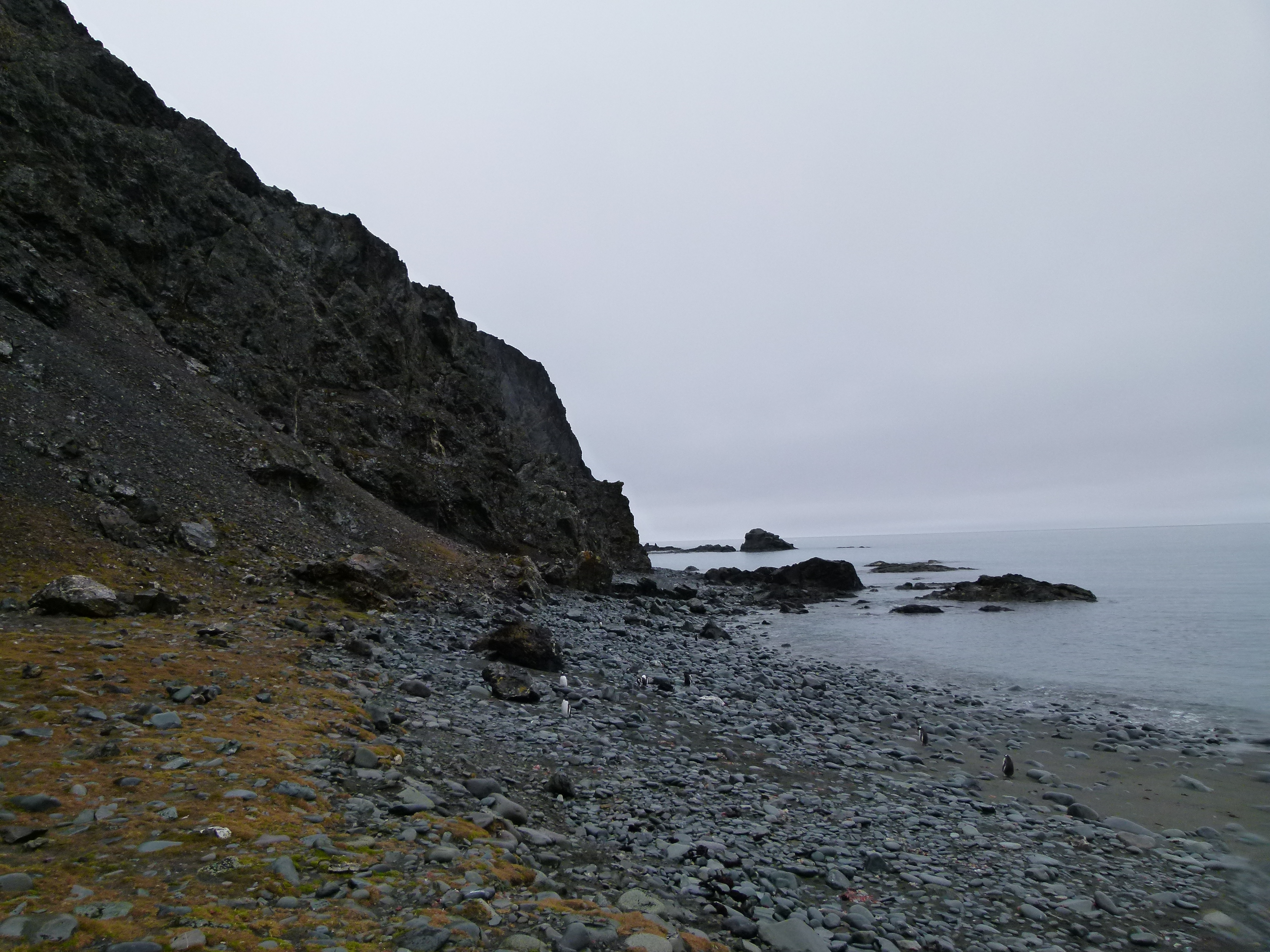
El Peñón (Antarctica) on:
[Wikipedia]
[Google]
[Amazon]


 Henry Bluff is a point forming the southwest side of the entrance to Argentina Cove and the north side of the entrance to
Isla Livingston: Península Hurd.
Mapa topográfico de escala 1:25000. Madrid: Servicio Geográfico del Ejército, 1991. (Map reproduced on p. 16 of the linked work) * L.L. Ivanov. Livingston Island: Central-Eastern Region. Scale 1:25000 topographic map. Sofia: Antarctic Place-names Commission of Bulgaria, 1996. * L.L. Ivanov et al., Antarctica: Livingston Island and Greenwich Island, South Shetland Islands (from English Strait to Morton Strait, with illustrations and ice-cover distribution), Scale 1: 100000 map,
Antarctica: Livingston Island and Greenwich, Robert, Snow and Smith Islands
Scale 1:120000 topographic map. Troyan: Manfred Wörner Foundation, 2009.
Antarctic Digital Database (ADD).
Scale 1:250000 topographic map of Antarctica. Scientific Committee on Antarctic Research (SCAR). Since 1993, regularly upgraded and updated. * L.L. Ivanov. Antarctica: Livingston Island and Smith Island. Scale 1:100000 topographic map. Manfred Wörner Foundation, 2017.
SCAR Composite Antarctic Gazetteer
Headlands of Livingston Island {{LivingstonIsland-geo-stub

 Henry Bluff is a point forming the southwest side of the entrance to Argentina Cove and the north side of the entrance to
 Las Palmas Cove
Las Palmas Cove is a wide embayment indenting for the northwest coast of Hurd Peninsula on Livingston Island in the South Shetland Islands, Antarctica. It is part of South Bay, Livingston Island entered between Henry Bluff and Salisbury Blu ...
in Hurd Peninsula
Hurd Peninsula lies between South Bay and False Bay on the south coast of Livingston Island in the South Shetland Islands, Antarctica. The Spanish Juan Carlos I Antarctic Base and the Bulgarian St. Kliment Ohridski Base are situated on its west ...
, Livingston Island
Livingston Island (Russian name ''Smolensk'', ) is an Antarctic island in the Southern Ocean, part of the South Shetland Islands, South Shetlands Archipelago, a group of List of Antarctic and subantarctic islands, Antarctic islands north of the ...
in the South Shetland Islands
The South Shetland Islands are a group of List of Antarctic and subantarctic islands, Antarctic islands located in the Drake Passage with a total area of . They lie about north of the Antarctic Peninsula, and between southwest of the n ...
, Antarctica
Antarctica () is Earth's southernmost and least-populated continent. Situated almost entirely south of the Antarctic Circle and surrounded by the Southern Ocean (also known as the Antarctic Ocean), it contains the geographic South Pole. ...
. The point is dominated by a prominent monolithic formation rising to 163 m and named ''El Peñón'' ('The Rock') by personnel of the nearby Spanish Antarctic Base. The area was visited by early 19th century sealers Sealer may refer either to a person or ship engaged in seal hunting, or to a sealant; associated terms include:
Seal hunting
* Sealer Hill, South Shetland Islands, Antarctica
* Sealers' Oven, bread oven of mud and stone built by sealers around 1800 ...
operating from nearby Johnsons Dock
Johnsons Dock is a sheltered 500 m wide cove indenting for 900 m the northwest coast of Hurd Peninsula on Livingston Island in the South Shetland Islands, Antarctica. It is part of South Bay entered north of Ballester Point. Surmounted by ...
.
The feature is named after the American sealing schooner ''Henry'' under Captain Benjamin Brunow who visited the South Shetlands in 1820–21.
Location
The point is located at which is 1.27 km southwest ofPolish Bluff
Polish Bluff () is a point forming the southwest side of the entrance to Española Cove and the northeast side of the entrance to Argentina Cove in Hurd Peninsula, Livingston Island in the South Shetland Islands, Antarctica. The area was visi ...
, 1.39 km north-northeast of Salisbury Bluff and 4.96 km south-southeast of Ereby Point
Ereby Point () is a point lying east-northeast of Hannah Point along the north side of South Bay, Livingston Island in the South Shetland Islands, Antarctica. The name "Erebys Bay" was applied to South Bay on an 1825 chart by James Weddell, " ...
(British mapping in 1968, detailed Spanish mapping in 1991, Bulgarian mapping in 1996, 2005 and 2009).
Maps
Isla Livingston: Península Hurd.
Mapa topográfico de escala 1:25000. Madrid: Servicio Geográfico del Ejército, 1991. (Map reproduced on p. 16 of the linked work) * L.L. Ivanov. Livingston Island: Central-Eastern Region. Scale 1:25000 topographic map. Sofia: Antarctic Place-names Commission of Bulgaria, 1996. * L.L. Ivanov et al., Antarctica: Livingston Island and Greenwich Island, South Shetland Islands (from English Strait to Morton Strait, with illustrations and ice-cover distribution), Scale 1: 100000 map,
Antarctic Place-names Commission
The Antarctic Place-names Commission was established by the Bulgarian Antarctic Institute in 1994, and since 2001 has been a body affiliated with the Ministry of Foreign Affairs (Bulgaria), Ministry of Foreign Affairs of Bulgaria.
The Commis ...
of Bulgaria, Ministry of Foreign Affairs, Sofia, 2005.
* L.L. IvanovAntarctica: Livingston Island and Greenwich, Robert, Snow and Smith Islands
Scale 1:120000 topographic map. Troyan: Manfred Wörner Foundation, 2009.
Antarctic Digital Database (ADD).
Scale 1:250000 topographic map of Antarctica. Scientific Committee on Antarctic Research (SCAR). Since 1993, regularly upgraded and updated. * L.L. Ivanov. Antarctica: Livingston Island and Smith Island. Scale 1:100000 topographic map. Manfred Wörner Foundation, 2017.
References
SCAR Composite Antarctic Gazetteer
Headlands of Livingston Island {{LivingstonIsland-geo-stub