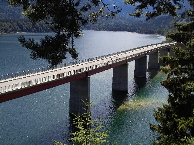
Bundesstraße 307 on:
[Wikipedia]
[Google]
[Amazon]
 The Bundesstraße 307 is a German federal highway which crosses the
 The Bundesstraße 307 is a German federal highway which crosses the
 Bavarian Alps
The Bavarian Alps (, ) is a collective name for several mountain ranges of the Northern Limestone Alps within the German state of Bavaria.
Geography
The term in its wider sense refers to that part of the Eastern Alps that lies on Bavarian state ...
in a west–east direction. It is composed of three separate segments.
The road begins in Vorderriß, where the continuation leads into the Austrian village of Hinterriß. It runs to the east along the river Isar
The Isar () is a river in Austria and in Bavaria, Germany. Its source is in the Karwendel mountain range of the Alps. The Isar river enters Germany near Mittenwald and flows through Krün, Wallgau, Bad Tölz, Munich, and Landshut before reaching ...
and crosses the Sylvenstein Dam
Sylvenstein Dam is an earthen and rockfilled embankment dam in the Isar valley, in the alpine part of Upper Bavaria, Germany which impounds the multipurpose Sylvenstein Reservoir (). It was built with the primary aim of flood protection for the ...
. Further to the east, the road is briefly interrupted by Austrian territory. From here, the road runs northward over the Achen Pass, passes through Kreuth and reaches Lake Tegernsee
Tegernsee () is a Town#Germany, town in the Miesbach (district), Miesbach district of Bavaria, Germany. It is located on the banks of Tegernsee (lake), Lake Tegernsee, which is 747 m (2,451 ft) AMSL, above sea level. A spa town, it is su ...
which it follows along the east coast. The first segment ends in Gmund at the Bundesstraße 318.
The second segment begins in Miesbach
Miesbach () is a Town#Germany, town in Bavaria, Germany, and is the capital of the Miesbach (district), Miesbach district. The district is at an altitude of 697 metres above sea level. It covers an area of approximately 863.50 km2 of alpine ...
at the Bundesstraße 472. From here, the road continues to the south, passing the Schliersee
Schliersee is a small town (Markt) and a municipality in the district of Miesbach in Bavaria in Germany. It is named after the nearby Lake Schliersee. It comprises the districts Schliersee (town), , , , Josefsthal and Spitzingsee.
Among the p ...
, then runs to the east, through Bayrischzell
Bayrischzell is a municipality in the district of Miesbach in Bavaria in Germany.
Geography
Bayrischzell is located in the Mangfallgebirge between Schliersee in the West and Oberaudorf in the East. It is located at the foot of Wendelstein mo ...
and over the Sudelfeld Pass. Soon after, the second segment ends in the small village of Tatzelwurm
In the folklore of the Alpine region of south-central Europe, the ''Tatzelwurm'' (), ''Stollenwurm'', or ''Stollwurm'' is a lizard-like creature, often described as having the face of a cat, with a serpent-like body which may be slender or stubb ...
. The continuation is a toll road leading north to Brannenburg
Brannenburg is a municipality in the district of Rosenheim in Bavaria in Germany. There is a railway station
Rail transport (also known as train transport) is a means of transport using wheeled vehicles running in railway track, tracks, wh ...
.
A third, very short segment begins at the Austrian border near the village of Ettenhausen Ettenhausen is a village and former municipality in the district of Frauenfeld (district), Frauenfeld in the canton of Thurgau, Switzerland.
It was first recorded in 1278 as ''Oetenhusen''.
The municipality also contained the village Iltishausen. ...
. It ends in Marquartstein
Marquartstein is a municipality in the southeastern part of Bavaria, Germany and is part of the Verwaltungsgemeinschaft Marquartstein and Staudach-Egerndach. It is situated in a region called Chiemgau, approximately 10 km south of Lake Chiem ...
at the Bundesstraße 305
''Bundesstraße'' (, ), abbreviated ''B'', is the denotation for German and Austrian national highways.
Germany
Germany's ''Bundesstraßen'' network has a total length of about 40,000 km.
German ''Bundesstraßen'' are labelled with re ...
.
References
{{DEFAULTSORT:Bundesstrasse 307 307