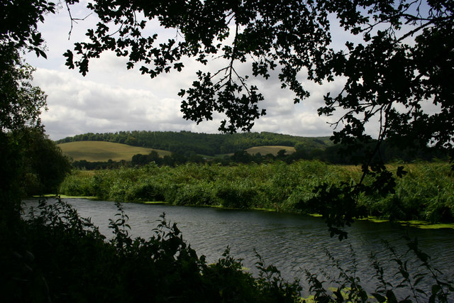
Bell Hill, Dorset on:
[Wikipedia]
[Google]
[Amazon]
 At 258 metres, Bell Hill is one of the highest hills in the county of
 At 258 metres, Bell Hill is one of the highest hills in the county of
 Dorset
Dorset ( ; Archaism, archaically: Dorsetshire , ) is a Ceremonial counties of England, ceremonial county in South West England. It is bordered by Somerset to the north-west, Wiltshire to the north and the north-east, Hampshire to the east, t ...
, England
England is a Countries of the United Kingdom, country that is part of the United Kingdom. It is located on the island of Great Britain, of which it covers about 62%, and List of islands of England, more than 100 smaller adjacent islands. It ...
and a high point on the Wessex Ridgeway
The Wessex Ridgeway is a long-distance footpath in southwest England. It runs from Marlborough in Wiltshire to Lyme Regis in Dorset, via the northern edge of Salisbury Plain and across Cranborne Chase AONB. The footpath was opened in 1994.
At ...
.
Location
Bell Hill lies about 5 miles west ofBlandford Forum
Blandford Forum ( ) is a market town in Dorset, England, on the River Stour, Dorset, River Stour, north-west of Poole. It had a population of 10,355 at the United Kingdom 2021 census, 2021 census.
The town is notable for its Georgian archit ...
. The village of Ibberton nestles against its southwestern foot, whilst a little further to the northeast, below Okeford Hill on the same ridgeline, is the village of Okeford Fitzpaine
Okeford Fitzpaine is a village and Civil parishes in England, civil parish in the English county of Dorset, situated in the Blackmore Vale south of the town of Sturminster Newton. It is sited on a thin strip of greensand under the escarpment ...
.Ordnance Survey
The Ordnance Survey (OS) is the national mapping agency for Great Britain. The agency's name indicates its original military purpose (see Artillery, ordnance and surveying), which was to map Scotland in the wake of the Jacobite rising of ...
1:50,000 Landranger series, no. 194
The summit itself lies on a ridge running from northeast to southwest. To the northwest its escarpment drops steeply in to the Blackmore Vale and Stour Valley, whilst to the southeast the woods of Turnworth Clump and Ringmoor are bracketed by two more ridges, Ibberton Long Down and Turnworth Down, forming a horseshoe with Bell Hill. Another spur runs east from Turnworth Down to Shillingstone Hill, site of a quarry and a popular cross-country race. A trig point
A triangulation station, also known as a trigonometrical point, and sometimes informally as a trig, is a fixed surveying station, used in geodetic surveying and other surveying projects in its vicinity.
The station is usually set up by a map ...
on the Wessex Ridgeway marks this subsidiary summit.
History
There is evidence of prehistoric settlement, with atumulus
A tumulus (: tumuli) is a mound of Soil, earth and Rock (geology), stones raised over a grave or graves. Tumuli are also known as barrows, burial mounds, mounds, howes, or in Siberia and Central Asia as ''kurgans'', and may be found through ...
(a bowl barrow
A bowl barrow is a type of burial mound or tumulus. A barrow is a mound of earth used to cover a tomb. The bowl barrow gets its name from its resemblance to an upturned bowl. Related terms include ''cairn circle'', ''cairn ring'', ''howe'', ''ker ...
) 500 metres southwest of the summit, a cross dyke
A cross dyke or cross-dyke (also referred to as a cross-ridge dyke, covered way, linear ditch, linear earthwork or spur dyke) is a linear earthwork believed to be a prehistoric land boundary that usually measures between in length. A typical cr ...
beyond it and a settlement and field system in the area of the Ringmoor plantation. Ringmoor is a National Trust
The National Trust () is a heritage and nature conservation charity and membership organisation in England, Wales and Northern Ireland.
The Trust was founded in 1895 by Octavia Hill, Sir Robert Hunter and Hardwicke Rawnsley to "promote the ...
property. A disused pit at the foot of the escarpment indicates earlier quarrying activity.
The villages of Belchalwell in the vale a mile to the northwest, and Belchalwell Street at the foot of the scarp, took their names from the original names of the two settlements, Bell and Chaldwell. Bell, now Belchalwell, was named after Bell Hill, and Chaldwell became Belchalwell Street.
Sport
Bell Hill is a designatedparagliding
Paragliding is the recreational and competitive adventure sport of flying paragliders: lightweight, free-flying, foot-launched glider aircraft with no rigid primary structure. The pilot sits in a harness or in a cocoon-like 'pod' suspended be ...
site.
References
{{Authority control Hills of Dorset