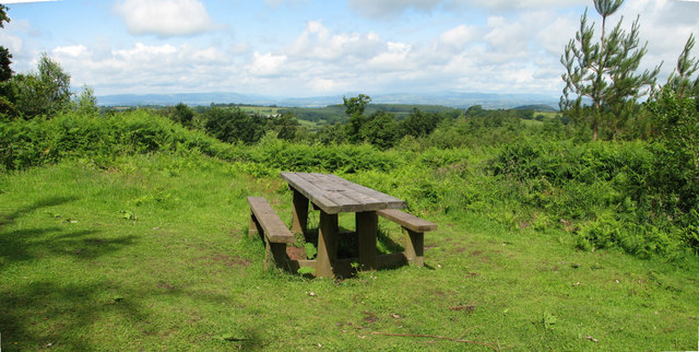
Beacon Hill, Monmouthshire on:
[Wikipedia]
[Google]
[Amazon]
 Beacon Hill is the highest hill in eastern
Monmouthshire
Monmouthshire ( ; ) is a Principal areas of Wales, county in the South East Wales, south east of Wales. It borders Powys to the north; the English counties of Herefordshire and Gloucestershire to the north and east; the Severn Estuary to the s ...
, South Wales
Wales ( ) is a Countries of the United Kingdom, country that is part of the United Kingdom. It is bordered by the Irish Sea to the north and west, England to the England–Wales border, east, the Bristol Channel to the south, and the Celtic ...
. It is located due east of the village of Trellech
Trellech (occasionally spelt Trelech, Treleck or Trelleck; ) is a village and parish in Monmouthshire, south-east Wales. Located south of Monmouth and north-north-west of Tintern, Trellech lies on a plateau above the Wye Valley on the souther ...
, and north-west of Llandogo
Llandogo is a small village in Monmouthshire, south Wales, between Monmouth and Chepstow in the lower reaches of the Wye Valley AONB, two miles north of Tintern. It is set on a steep hillside overlooking the River Wye and across into the Forest o ...
. Its crowning point at 306m / 1006 ft above sea level is marked by an Ordnance Survey
The Ordnance Survey (OS) is the national mapping agency for Great Britain. The agency's name indicates its original military purpose (see Artillery, ordnance and surveying), which was to map Scotland in the wake of the Jacobite rising of ...
triangulation pillar
A triangulation station, also known as a trigonometrical point, and sometimes informally as a trig, is a fixed surveying station, used in geodetic surveying and other surveying projects in its vicinity.
The station is usually set up by a map ...
. The summit, eastern slopes and uppermost western slopes are owned by Natural Resources Wales
Natural Resources Wales () is a Welsh Government sponsored body, which became operational from 1 April 2013, when it took over the management of the natural resources of Wales. It was formed from a merger of the Countryside Council for Wales, E ...
which manages the area not only for timber production but for recreation also.
Geology
The summit of the hill is formed from the Quartz Conglomerate Group which is assigned by geologists to the UpperOld Red Sandstone
Old Red Sandstone, abbreviated ORS, is an assemblage of rocks in the North Atlantic region largely of Devonian age. It extends in the east across Great Britain, Ireland and Norway, and in the west along the eastern seaboard of North America. It ...
- a sequence of sedimentary rock
Sedimentary rocks are types of rock (geology), rock formed by the cementation (geology), cementation of sediments—i.e. particles made of minerals (geological detritus) or organic matter (biological detritus)—that have been accumulated or de ...
s laid down during the late Devonian period
The Devonian ( ) is a geologic period and system of the Paleozoic era during the Phanerozoic eon, spanning 60.3 million years from the end of the preceding Silurian period at million years ago ( Ma), to the beginning of the succeeding C ...
. This pebbly sandstone
Sandstone is a Clastic rock#Sedimentary clastic rocks, clastic sedimentary rock composed mainly of grain size, sand-sized (0.0625 to 2 mm) silicate mineral, silicate grains, Cementation (geology), cemented together by another mineral. Sand ...
occurs in an outcrop
An outcrop or rocky outcrop is a visible exposure of bedrock or ancient superficial deposits on the surface of the Earth and other terrestrial planets.
Features
Outcrops do not cover the majority of the Earth's land surface because in most p ...
through eastern Monmouthshire and neighbouring Gloucestershire
Gloucestershire ( , ; abbreviated Glos.) is a Ceremonial counties of England, ceremonial county in South West England. It is bordered by Herefordshire to the north-west, Worcestershire to the north, Warwickshire to the north-east, Oxfordshire ...
and caps other hills of local significance.British Geological Survey 1:50,000 geological map sheet 233 ''Monmouth''
Access
All freehold land owned by the former Forestry Commission Wales (now succeeded by Natural Resources Wales) was dedicated asaccess land
The freedom to roam, or everyone's right, every person's right or everyman's right, is the general public's right to access certain public or privately owned land, lakes, and rivers for recreation and exercise. The right is sometimes called the ...
under the Countryside and Rights of Way Act 2000
The Countryside and Rights of Way Act 2000 (c. 37), also known as the CRoW Act and "Right to Roam" Act, is a United Kingdom Act of Parliament affecting England and Wales which came into force on 30 November 2000.
Right to roam
The Act impleme ...
and is thus freely available to those on foot. Numerous forest tracks cross the hill's slopes. A car park has been provided on the western side and information panels installed at the site to assist visitors to interpret the extensive views from breaks in the woodland cover.
References
{{Authority control Mountains and hills of Monmouthshire