Agüero Point on:
[Wikipedia]
[Google]
[Amazon]

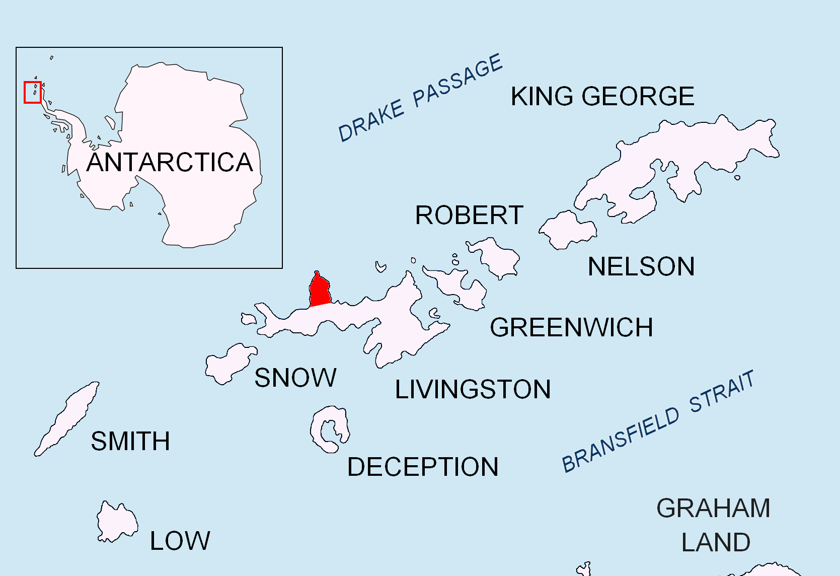
 Agüero Point is the southeast extremity of a trapezoid-shaped and mostly ice-covered headland projecting 900 m from the east coast of
Antarctica: Livingston Island and Greenwich, Robert, Snow and Smith Islands
Scale 1:120000 topographic map. Troyan: Manfred Wörner Foundation, 2009. * L. Ivanov. Antarctica: Livingston Island and Smith Island. Scale 1:100000 topographic map. Manfred Wörner Foundation, 2017.
Cabo Agüero.
SCAR
 Agüero Point is the southeast extremity of a trapezoid-shaped and mostly ice-covered headland projecting 900 m from the east coast of
 Ioannes Paulus II Peninsula
Ioannes Paulus II Peninsula ( bg, Полуостров Йоан Павел II, Poluostrov Yoan Pavel II, ) is an ice-covered peninsula on the north coast of Livingston Island in the South Shetland Islands, Antarctica that is bounded by Hero Bay t ...
into Hero Bay
A hero (feminine: heroine) is a real person or a main fictional character who, in the face of danger, combats adversity through feats of ingenuity, courage, or strength. Like other formerly gender-specific terms (like ''actor''), ''hero' ...
, Livingston Island
Livingston Island (Russian name ''Smolensk'', ) is an Antarctic island in the Southern Ocean, part of the South Shetlands Archipelago, a group of Antarctic islands north of the Antarctic Peninsula. It was the first land discovered south of 60� ...
in the South Shetland Islands
The South Shetland Islands are a group of Antarctic islands with a total area of . They lie about north of the Antarctic Peninsula, and between southwest of the nearest point of the South Orkney Islands. By the Antarctic Treaty of 195 ...
, Antarctica
Antarctica () is Earth's southernmost and least-populated continent. Situated almost entirely south of the Antarctic Circle and surrounded by the Southern Ocean, it contains the geographic South Pole. Antarctica is the fifth-largest co ...
. The point forms the north side of the entrance to Prisoe Cove
Prisoe Cove ( bg, залив Присое, ‘Zaliv Prisoe’ \'za-liv pri-'so-e\) is the 3.7 km wide cove indenting for 1.75 km the north coast of Livingston Island in the South Shetland Islands, Antarctica. Entered between Agüer ...
and, together with nearby Arroyo Point, separates the termini of Urdoviza Glacier to the north from Medven Glacier to the south.
The feature is named after Clodomiro Agüero Soto, a crewman of the Chile
Chile, officially the Republic of Chile, is a country in the western part of South America. It is the southernmost country in the world, and the closest to Antarctica, occupying a long and narrow strip of land between the Andes to the eas ...
an naval vessel ''Yelcho'' which rescued the Ernest Shackleton
Sir Ernest Henry Shackleton (15 February 1874 – 5 January 1922) was an Anglo-Irish Antarctic explorer who led three British expeditions to the Antarctic. He was one of the principal figures of the period known as the Heroic Age of A ...
's expedition fellows members from Elephant Island
Elephant Island is an ice-covered, mountainous island off the coast of Antarctica in the outer reaches of the South Shetland Islands, in the Southern Ocean. The island is situated north-northeast of the tip of the Antarctic Peninsula, west-so ...
in 1916.
Location
The point is located at which is 850 m south-southeast of Arroyo Point, 6.4 km south by east of Black Point and 4 km northwest ofAvitohol Point
Avitohol Point ( bg, нос Авитохол, nos Avitohol, ) is a point on the north coast of Livingston Island, Antarctica projecting into Hero Bay to form the west side of the entrance to Skravena Cove and the southeast side of the entrance ...
(British mapping in 1968, Chilean in 1971, Argentine in 1980, Spanish in 1991, and Bulgarian in 2005, 2009 and 2017).
See also
*Ioannes Paulus II Peninsula
Ioannes Paulus II Peninsula ( bg, Полуостров Йоан Павел II, Poluostrov Yoan Pavel II, ) is an ice-covered peninsula on the north coast of Livingston Island in the South Shetland Islands, Antarctica that is bounded by Hero Bay t ...
* Livingston Island
Livingston Island (Russian name ''Smolensk'', ) is an Antarctic island in the Southern Ocean, part of the South Shetlands Archipelago, a group of Antarctic islands north of the Antarctic Peninsula. It was the first land discovered south of 60� ...
Maps
* L. Ivanov et al. Antarctica: Livingston Island and Greenwich Island, South Shetland Islands. Scale 1:100000 topographic map. Sofia: Antarctic Place-names Commission of Bulgaria, 2005. * L. IvanovAntarctica: Livingston Island and Greenwich, Robert, Snow and Smith Islands
Scale 1:120000 topographic map. Troyan: Manfred Wörner Foundation, 2009. * L. Ivanov. Antarctica: Livingston Island and Smith Island. Scale 1:100000 topographic map. Manfred Wörner Foundation, 2017.
References
Cabo Agüero.
SCAR
Composite Antarctic Gazetteer
The Composite Gazetteer of Antarctica (CGA) of the Scientific Committee on Antarctic Research (SCAR) is the authoritative international gazetteer containing all Antarctic toponyms published in national gazetteers, plus basic information about ...
Headlands of Livingston Island
{{LivingstonIsland-geo-stub