|
Westerlies
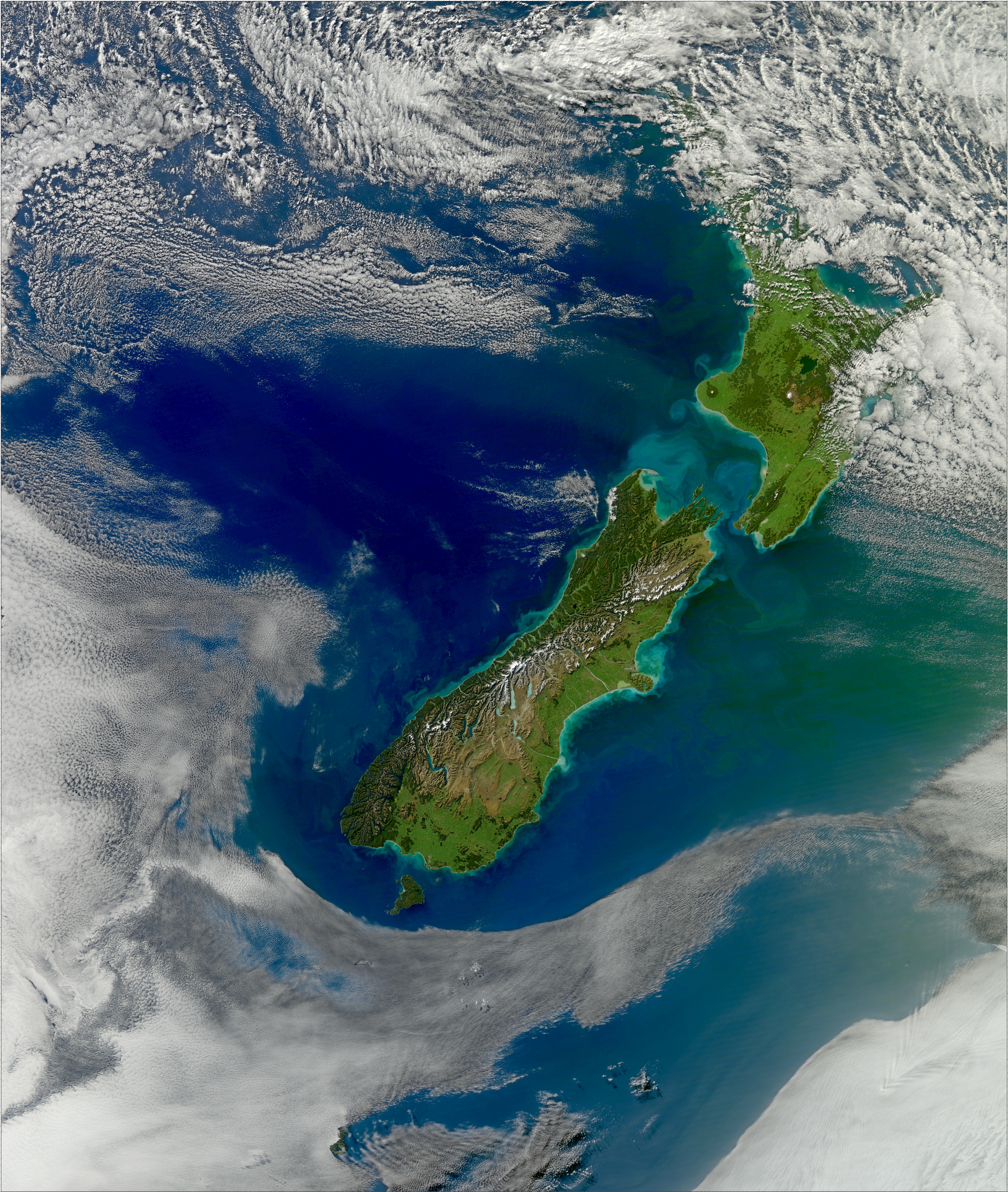
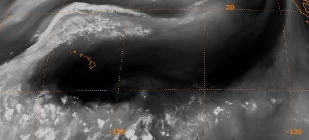
The westerlies, anti-trades, or prevailing westerlies, are prevailing winds from the west toward the east in the middle latitudes between 30 and 60 degrees latitude. They originate from the high-pressure areas in the horse latitudes (about 30 degrees) and trend towards the poles and steer extratropical cyclones in this general manner. Tropical cyclones which cross the subtropical ridge axis into the westerlies recurve due to the increased westerly flow. The winds are predominantly from the southwest in the Northern Hemisphere and from the northwest in the Southern Hemisphere. The westerlies are strongest in the winter hemisphere and times when the pressure is lower over the poles, while they are weakest in the summer hemisphere and when pressures are higher over the poles. The westerlies are particularly strong, especially in the Southern Hemisphere (called also 'Brave West winds' at striking Chile, Argentina, Tasmania and New Zealand), in areas where land is absent, bec ... [...More Info...] [...Related Items...] OR: [Wikipedia] [Google] [Baidu] [Amazon] |
Prevailing Winds
In meteorology, prevailing wind in a region of the Earth's surface is a surface wind that blows predominantly from a particular Wind direction, direction. The dominant winds are the trends in direction of wind with the highest speed over a particular point on the Earth's surface at any given time. A region's prevailing and dominant winds are the result of global patterns of movement in the Earth's atmosphere. In general, winds are predominantly easterly at low latitudes globally. In the mid-latitudes, westerly winds are dominant, and their strength is largely determined by the polar cyclone. In areas where winds tend to be light, the sea breeze-land breeze cycle (powered by differential solar heating and night cooling of sea and land) is the most important cause of the prevailing wind. In areas which have variable terrain, Mountain breeze and valley breeze, mountain and valley breezes dominate the wind pattern. Highly elevated surfaces can induce a thermal low, which then augments ... [...More Info...] [...Related Items...] OR: [Wikipedia] [Google] [Baidu] [Amazon] |
Wind
Wind is the natural movement of atmosphere of Earth, air or other gases relative to a planetary surface, planet's surface. Winds occur on a range of scales, from thunderstorm flows lasting tens of minutes, to local breezes generated by heating of land surfaces and lasting a few hours, to global winds resulting from the difference in absorption (electromagnetic radiation), absorption of solar energy between the climate zones on Earth. The study of wind is called anemology. The two main causes of large-scale atmospheric circulation are the differential heating between the equator and the poles, and the rotation of the planet (Coriolis effect). Within the tropics and subtropics, thermal low circulations over terrain and high plateaus can drive monsoon circulations. In coastal areas the sea breeze/land breeze cycle can define local winds; in areas that have variable terrain, mountain and valley breezes can prevail. Winds are commonly classified by their scale (spatial), spatial ... [...More Info...] [...Related Items...] OR: [Wikipedia] [Google] [Baidu] [Amazon] |
Tropical Cyclone
A tropical cyclone is a rapidly rotating storm system with a low-pressure area, a closed low-level atmospheric circulation, strong winds, and a spiral arrangement of thunderstorms that produce heavy rain and squalls. Depending on its location and strength, a tropical cyclone is called a hurricane (), typhoon (), tropical storm, cyclonic storm, tropical depression, or simply cyclone. A hurricane is a strong tropical cyclone that occurs in the Atlantic Ocean or northeastern Pacific Ocean. A typhoon is the same thing which occurs in the northwestern Pacific Ocean. In the Indian Ocean and South Pacific, comparable storms are referred to as "tropical cyclones". In modern times, on average around 80 to 90 named tropical cyclones form each year around the world, over half of which develop hurricane-force winds of or more. Tropical cyclones tropical cyclogenesis, typically form over large bodies of relatively warm water. They derive their energy through the evaporation of water ... [...More Info...] [...Related Items...] OR: [Wikipedia] [Google] [Baidu] [Amazon] |
Earth
Earth is the third planet from the Sun and the only astronomical object known to Planetary habitability, harbor life. This is enabled by Earth being an ocean world, the only one in the Solar System sustaining liquid surface water. Almost all of Earth's water is contained in its global ocean, covering Water distribution on Earth, 70.8% of Earth's crust. The remaining 29.2% of Earth's crust is land, most of which is located in the form of continental landmasses within Earth's land hemisphere. Most of Earth's land is at least somewhat humid and covered by vegetation, while large Ice sheet, sheets of ice at Polar regions of Earth, Earth's polar polar desert, deserts retain more water than Earth's groundwater, lakes, rivers, and Water vapor#In Earth's atmosphere, atmospheric water combined. Earth's crust consists of slowly moving tectonic plates, which interact to produce mountain ranges, volcanoes, and earthquakes. Earth's outer core, Earth has a liquid outer core that generates a ... [...More Info...] [...Related Items...] OR: [Wikipedia] [Google] [Baidu] [Amazon] |
Coriolis Effect
In physics, the Coriolis force is a pseudo force that acts on objects in motion within a frame of reference that rotates with respect to an inertial frame. In a reference frame with clockwise rotation, the force acts to the left of the motion of the object. In one with anticlockwise (or counterclockwise) rotation, the force acts to the right. Deflection of an object due to the Coriolis force is called the Coriolis effect. Though recognized previously by others, the mathematical expression for the Coriolis force appeared in an 1835 paper by French scientist Gaspard-Gustave de Coriolis, in connection with the theory of water wheels. Early in the 20th century, the term ''Coriolis force'' began to be used in connection with meteorology. Newton's laws of motion describe the motion of an object in an inertial (non-accelerating) frame of reference. When Newton's laws are transformed to a rotating frame of reference, the Coriolis and centrifugal accelerations appear. When applied ... [...More Info...] [...Related Items...] OR: [Wikipedia] [Google] [Baidu] [Amazon] |
Northern Hemisphere
The Northern Hemisphere is the half of Earth that is north of the equator. For other planets in the Solar System, north is defined by humans as being in the same celestial sphere, celestial hemisphere relative to the invariable plane of the Solar System as Earth's North Pole. Due to Earth's axial tilt of 23.439281°, there is a seasonal variation in the lengths of the day and night. There is also a seasonal variation in temperatures, which lags the variation in day and night. Conventionally, winter in the Northern Hemisphere is taken as the period from the December solstice (typically December 21 UTC) to the March equinox (typically March 20 UTC), while summer is taken as the period from the June solstice through to the September equinox (typically on 23 September UTC). The dates vary each year due to the difference between the calendar year and the Year#Astronomical years, astronomical year. Within the Northern Hemisphere, oceanic currents can change the weather patterns that aff ... [...More Info...] [...Related Items...] OR: [Wikipedia] [Google] [Baidu] [Amazon] |
Subtropical Ridge
The horse latitudes are the latitudes about 30 degrees north and south of the Equator. They are characterized by sunny skies, calm winds, and very little precipitation. They are also known as subtropical ridges or highs. It is a high-pressure area at the divergence of trade winds and the westerlies. Etymology A likely and documented explanation is that the term is derived from the "dead horse" ritual of seamen (see Beating a dead horse). In this practice, the seaman paraded a straw-stuffed effigy of a horse around the deck before throwing it overboard. Seamen were paid partly in advance before a long voyage, and they frequently spent their pay all at once, resulting in a period of time without income. This period was called the "dead horse" time, and it usually lasted a month or two. The seaman's ceremony was to celebrate having worked off the "dead horse" debt. As west-bound shipping from Europe usually reached the subtropics at about the time the "dead horse" was worke ... [...More Info...] [...Related Items...] OR: [Wikipedia] [Google] [Baidu] [Amazon] |
Roaring Forties
The Roaring Forties are strong westerlies, westerly winds that occur in the Southern Hemisphere, generally between the latitudes of 40th parallel south, 40° and 50th parallel south, 50° south. The strong eastward air currents are caused by the combination of warm air being displaced upward from the Equator towards the South Pole, Earth's rotation, and the scarcity of landmasses to serve as windbreaks at those latitudes. The Roaring Forties were a major aid to ships sailing the Brouwer Route from Europe to the East Indies or Australasia during the Age of Sail, and in modern times are favoured by Yachting, yachtsmen on round-the-world voyages and competitions. The boundaries of the Roaring Forties are not consistent: the wind-stream shifts north or south depending on the season. The strong and continuous winds in the Roaring Forties make this zone advantageous for wind power in places such as New Zealand and Tasmania. Similar but even stronger conditions that occur at more so ... [...More Info...] [...Related Items...] OR: [Wikipedia] [Google] [Baidu] [Amazon] |
Horse Latitudes
The horse latitudes are the latitudes about 30 degrees north and south of the Equator. They are characterized by sunny skies, calm winds, and very little precipitation. They are also known as subtropical ridges or highs. It is a high-pressure area at the divergence of trade winds and the westerlies. Etymology A likely and documented explanation is that the term is derived from the "dead horse" ritual of seamen (see Beating a dead horse). In this practice, the seaman paraded a straw-stuffed effigy of a horse around the deck before throwing it overboard. Seamen were paid partly in advance before a long voyage, and they frequently spent their pay all at once, resulting in a period of time without income. This period was called the "dead horse" time, and it usually lasted a month or two. The seaman's ceremony was to celebrate having worked off the "dead horse" debt. As west-bound shipping from Europe usually reached the subtropics at about the time the "dead horse" was wo ... [...More Info...] [...Related Items...] OR: [Wikipedia] [Google] [Baidu] [Amazon] |
Winter
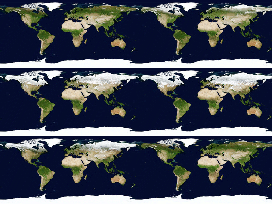
Winter is the coldest and darkest season of the year in temperate and polar climates. It occurs after autumn and before spring. The tilt of Earth's axis causes seasons; winter occurs when a hemisphere is oriented away from the Sun. Different cultures define different dates as the start of winter, and some use a definition based on weather. When it is winter in the Northern Hemisphere, it is summer in the Southern Hemisphere, and vice versa. Winter typically brings precipitation that, depending on a region's climate, is mainly rain or snow. The moment of winter solstice is when the Sun's elevation with respect to the North or South Pole is at its most negative value; that is, the Sun is at its farthest below the horizon as measured from the pole. The day on which this occurs has the shortest day and the longest night, with day length increasing and night length decreasing as the season progresses after the solstice. The earliest sunset and latest sunrise dates outs ... [...More Info...] [...Related Items...] OR: [Wikipedia] [Google] [Baidu] [Amazon] |
Summer
Summer or summertime is the hottest and brightest of the four temperate seasons, occurring after spring and before autumn. At or centred on the summer solstice, daylight hours are the longest and darkness hours are the shortest, with day length decreasing as the season progresses after the solstice. The earliest sunrises and latest sunsets also occur near the date of the solstice. The date of the beginning of summer varies according to definition, climate, tradition, and culture. When it is summer in the Northern Hemisphere, it is winter in the Southern Hemisphere, and vice versa. Etymology The modern English ''summer'' derives from the Middle English ''somer'', via the Old English ''sumor''. Timing From an astronomical view, the equinoxes and solstices would be the middle of the respective seasons, but sometimes astronomical summer is defined as starting at the solstice, the time of maximal insolation, often identified with 21 June or 21 December. By solar reckonin ... [...More Info...] [...Related Items...] OR: [Wikipedia] [Google] [Baidu] [Amazon] |
Gobi Desert
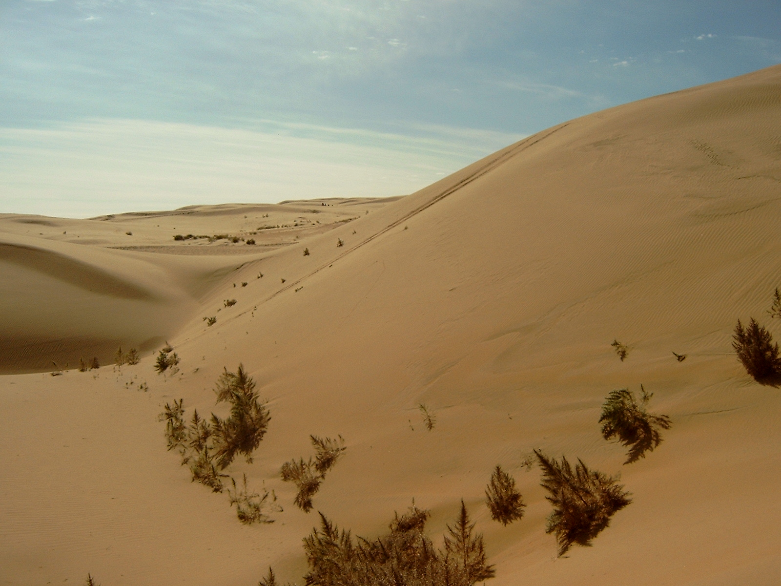
The Gobi Desert (, , ; ) is a large, cold desert and grassland region in North China and southern Mongolia. It is the sixth-largest desert in the world. The name of the desert comes from the Mongolian word ''gobi'', used to refer to all of the waterless regions in the Mongolian Plateau; in Chinese, ''gobi'' is used to refer to rocky, semi-deserts such as the Gobi itself rather than sandy deserts. Geography The Gobi measures from southwest to northeast and from north to south. The desert is widest in the west, along the line joining the Lake Bosten and the Lop Nor (87°–89° east). Its area is approximately . Gobi includes the long stretch of desert extending from the foot of the Pamirs (77° east) to the Greater Khingan Mountains, 116–118° east, on the border of Manchuria; and from the foothills of the Altay, Sayan, and Yablonoi mountain ranges on the north to the Kunlun, Altyn-Tagh, and Qilian mountain ranges, which form the northern edges of the Tibetan Pla ... [...More Info...] [...Related Items...] OR: [Wikipedia] [Google] [Baidu] [Amazon] |


