|
Typhoon Haiyan
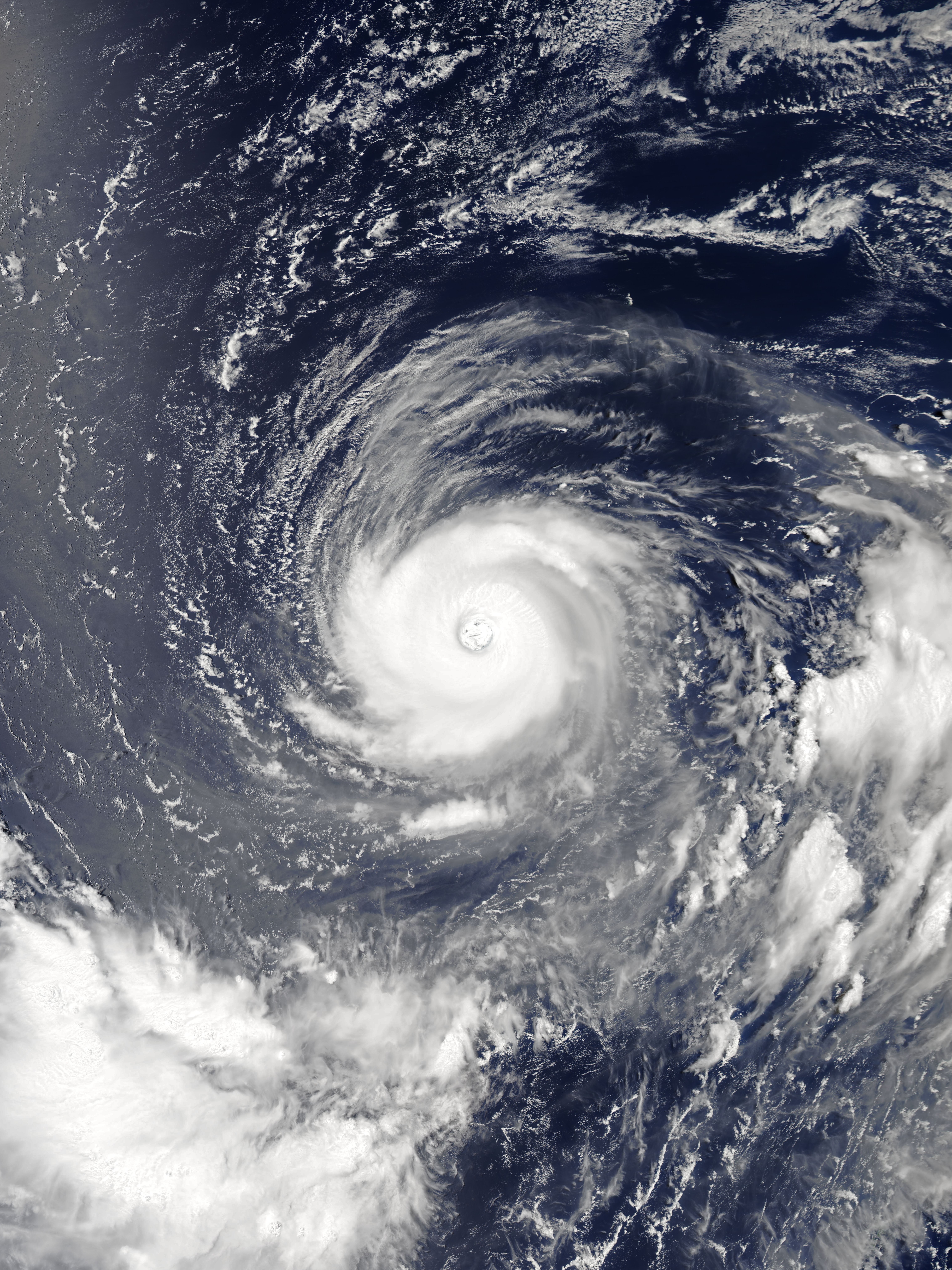
Typhoon Haiyan, known in the Philippines as Super Typhoon Yolanda, was an extremely powerful and catastrophic tropical cyclone that is among List of the most intense tropical cyclones, the most powerful tropical cyclones ever recorded. Upon making landfall, Haiyan devastated portions of Southeast Asia, particularly the Philippines during early November 2013. It is one of Typhoons in the Philippines, the deadliest typhoons on record in the Philippines, killing at least 6,300 people in the region of Visayas alone. In terms of JTWC-estimated 1-minute sustained winds, Haiyan is tied with Typhoon Meranti, Meranti in 2016 Pacific typhoon season, 2016 for being the second strongest landfall (meteorology), landfalling tropical cyclone on record, only behind Typhoon Goni, Goni of 2020 Pacific typhoon season, 2020. It was also the most intense tropical cyclone Tropical cyclones in 2013, worldwide in 2013. The 30th named storm, thirteenth typhoon, and fifth super typhoon of the 2013 Pa ... [...More Info...] [...Related Items...] OR: [Wikipedia] [Google] [Baidu] |
Philippines
The Philippines, officially the Republic of the Philippines, is an Archipelagic state, archipelagic country in Southeast Asia. Located in the western Pacific Ocean, it consists of List of islands of the Philippines, 7,641 islands, with a total area of roughly 300,000 square kilometers, which are broadly categorized in Island groups of the Philippines, three main geographical divisions from north to south: Luzon, Visayas, and Mindanao. With a population of over 110 million, it is the world's List of countries and dependencies by population, twelfth-most-populous country. The Philippines is bounded by the South China Sea to the west, the Philippine Sea to the east, and the Celebes Sea to the south. It shares maritime borders with Taiwan to the north, Japan to the northeast, Palau to the east and southeast, Indonesia to the south, Malaysia to the southwest, Vietnam to the west, and China to the northwest. It has Ethnic groups in the Philippines, diverse ethnicities and Culture o ... [...More Info...] [...Related Items...] OR: [Wikipedia] [Google] [Baidu] |
Super Typhoon
Since 1947, the Joint Typhoon Warning Center (JTWC) has classified all typhoons in the Tropical cyclone basins#Northwestern Pacific Ocean, Northwestern Pacific Ocean with wind speeds of at least —the equivalent of a strong Category 4 on the Saffir–Simpson scale, as ''super typhoons''. Since that year, 316 super typhoons have occurred in the basin, the latest being Typhoon Man-yi (2024), Typhoon Man-yi in 2024 Pacific typhoon season, 2024. Only two List of Pacific typhoon seasons, Pacific typhoon seasons have not included at least one super typhoon, which were the 1949 Pacific typhoon season, 1949 and the 1974 Pacific typhoon season, 1974 seasons. The most typhoons to have reached this intensity in a single season is tied between 1965 Pacific typhoon season, 1965 and 1997 Pacific typhoon season, 1997, with 11 becoming super typhoons. Background All typhoons that reach an intensity of at least are referred to by the Joint Typhoon Warning Center as ''super typhoons.'' The ... [...More Info...] [...Related Items...] OR: [Wikipedia] [Google] [Baidu] |
Hong Kong Observatory
The Hong Kong Observatory is a weather forecast agency of the government of Hong Kong. The Observatory forecasts the weather and issues warnings on weather-related hazards. It also monitors and makes assessments on radiation levels in Hong Kong and provides other meteorological and geophysical services to meet the needs of the public and the shipping, aviation, industrial and engineering sectors. Overview The Observatory was established on 2 March 1883 as the Hong Kong Observatory by Sir George Bowen, the 9th Governor of Hong Kong, with (1852–1941) as its first director. Early operations included meteorological and magnetic observations, a time service based on astronomical observations and a tropical cyclone warning service. The Observatory was renamed the Royal Observatory Hong Kong () after obtaining a Royal Charter in 1912. The Observatory adopted the current name and emblem in 1997 after the transfer of Hong Kong's sovereignty from the UK to China. The Hong K ... [...More Info...] [...Related Items...] OR: [Wikipedia] [Google] [Baidu] |
Japan Meteorological Agency
The Japan Meteorological Agency (JMA; ''気象庁, Kishō-chō'') is a division of the Ministry of Land, Infrastructure, Transport and Tourism dedicated to the Scientific, scientific observation and research of natural phenomena. Headquartered in Minato, Tokyo the government agency, agency collects data on meteorology, hydrology, seismology, volcanology, and other related fields. The JMA is responsible for collecting and disseminating weather data and Forecasting, forecasts to the public, as well as providing specialized information for aviation and Marine weather forecasting, marine sectors. Additionally, the JMA issues warnings for volcanic eruptions and is integral to the nationwide Earthquake Early Warning (Japan), Earthquake Early Warning (EEW) system. As one of the Regional Specialized Meteorological Centers designated by the World Meteorological Organization (WMO), the JMA also Forecasting, forecasts, Tropical cyclone naming, names, and distributes warnings for tropical ... [...More Info...] [...Related Items...] OR: [Wikipedia] [Google] [Baidu] |
Guiuan, Eastern Samar
Guiuan (Help:IPA/Tagalog, [ˈgiˌwan] ; , ), officially the Municipality of Guiuan, is a municipality of the Philippines, municipality in the Philippine Province, province of Eastern Samar, Philippines. It constitutes the southeastern extremity of Samar, Samar Island and some adjacent islands, surrounded by Leyte Gulf and the Philippine Sea (which a marginal sea of the Pacific Ocean), two major bodies of water that makes the town the surfing capital of the Visayas. According to the 2020 census, it has a population of 53,361 people, making it the most populous municipality in Eastern Samar (followed by Dolores, Eastern Samar, Dolores) and the second most populous administrative division in the entire province after the capital city Borongan. Guiuan played a significant part in Philippine history. Historical accounts attested that Ferdinand Magellan's 16th century Magellan expedition, expedition first landed on the island of Homonhon, which lies within the municipality, after their ... [...More Info...] [...Related Items...] OR: [Wikipedia] [Google] [Baidu] |
Philippine Atmospheric, Geophysical And Astronomical Services Administration
The Philippine Atmospheric, Geophysical and Astronomical Services Administration (, abbreviated as PAGASA , which means "hope" as in the Tagalog word ''pag-asa'') is the National Meteorological and Hydrological Services (NMHS) agency of the Philippines mandated to provide protection against natural calamities and to ensure the safety, well-being and economic security of all the people, and for the promotion of national progress by undertaking scientific and technological services in meteorology, hydrology, climatology, astronomy and other geophysical sciences. Created on December 8, 1972, by reorganizing the Weather Bureau, PAGASA now serves as one of the Scientific and Technological Services Institutes of the Department of Science and Technology. History The ''Observatorio Meteorológico de Manila'' Formal meteorological and astronomical services in the Philippines began in 1865 with the establishment of the ''Observatorio Meteorológico de Manila'' (Manila Meteorologica ... [...More Info...] [...Related Items...] OR: [Wikipedia] [Google] [Baidu] |
Kayangel
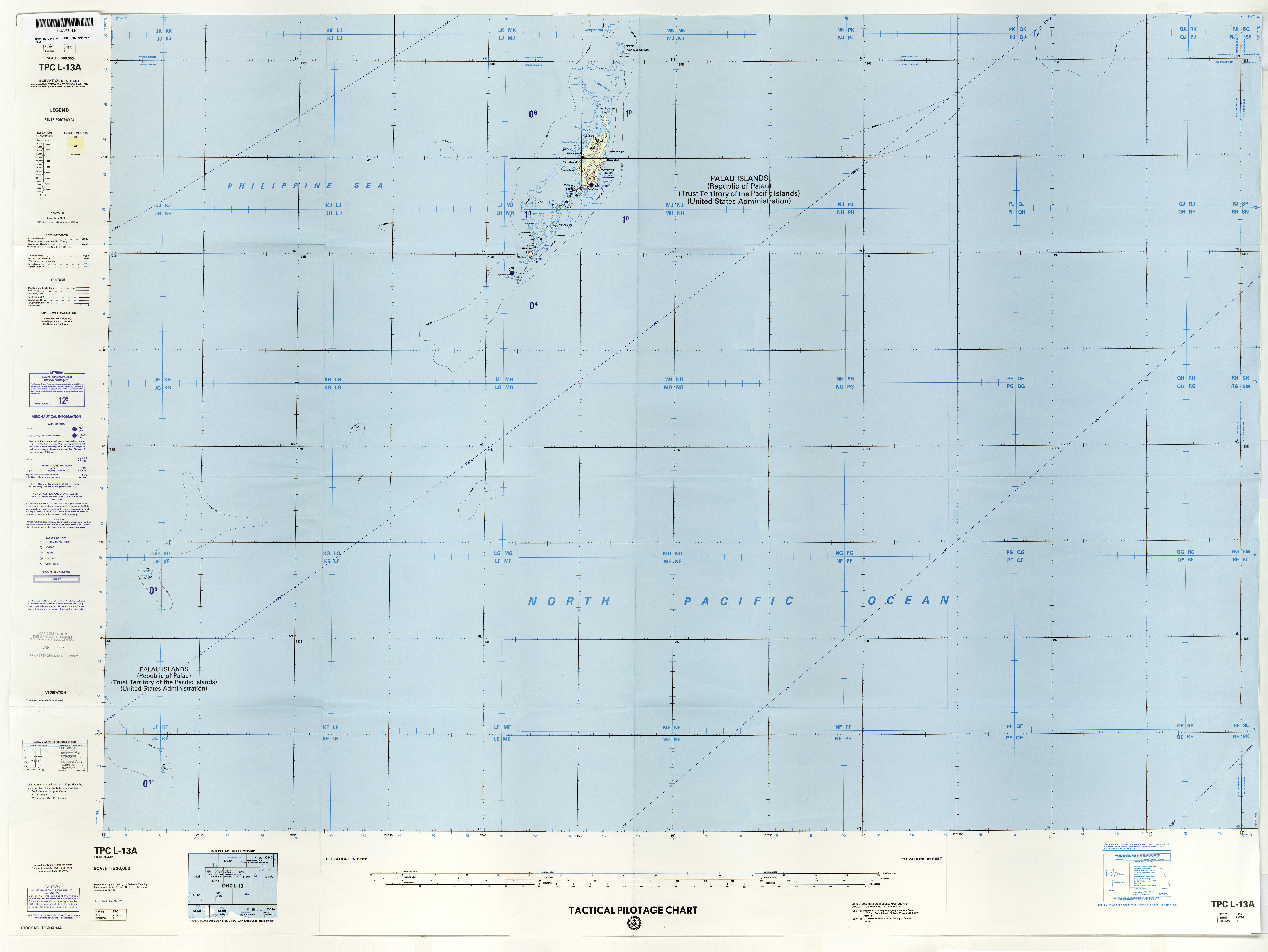
Kayangel (Ngcheangel) is the northernmost state of Palau north of Koror. The land area is about . The population is 54 (2015 census). There is one hamlet in the state - Orukei, which is also its capital. In 2020, Richard Ngiraked was elected governor of the state. History The state was colonized by Spain from the end of the 16th century until 1899 when the territory was sold to the German Empire. This situation continues until the First World War when Japan took control of the atolls. The United States ruled the area from World War II until the independence of Palau. The Palau Parliament passed a joint resolution in January 2005 supporting a 2002 agreement between the Kayangel State and Palau Pacific Energy Inc. (PPE) in 2002, granting the oil company exclusive rights to explore, drill and produce oil in the surrounding marine area for a specified period of time. Initially, the Palau government had opposed this on environmental grounds, but then bowed to a 2003 petition by Kaya ... [...More Info...] [...Related Items...] OR: [Wikipedia] [Google] [Baidu] |
Saffir–Simpson Scale
The Saffir–Simpson hurricane wind scale (SSHWS) is a tropical cyclone intensity scale that classifies hurricanes—which in the Western Hemisphere are tropical cyclones that exceed the intensities of tropical depressions and tropical storms—into five categories distinguished by the intensities of their sustained winds. This measuring system was formerly known as the Saffir–Simpson hurricane scale, or SSHS. To be classified as a hurricane, a tropical cyclone must have one-minute-average maximum sustained winds at above the surface of at least 74 mph (64 kn, 119 km/h; Category 1). The highest classification in the scale, Category 5, consists of storms with sustained winds of at least 157 mph (137 kn, 252 km/h). The classifications can provide some indication of the potential damage and flooding a hurricane will cause upon landfall. The Saffir–Simpson hurricane wind scale is based on the highest wind speed averaged over a ... [...More Info...] [...Related Items...] OR: [Wikipedia] [Google] [Baidu] |
Joint Typhoon Warning Center
The Joint Typhoon Warning Center (JTWC) is a joint United States Navy – United States Air Force command in Pearl Harbor, Hawaii. The JTWC is responsible for the issuing of tropical cyclone warnings in the North-West Pacific Ocean, South Pacific Ocean, and Indian Ocean for all branches of the U.S. Department of Defense and other U.S. government agencies. Their warnings are intended primarily for the protection of U.S. military ships and aircraft, as well as military installations jointly operated with other countries around the world. Its U.S. Navy components are aligned with the Naval Meteorology and Oceanography Command. History The origins of the Joint Typhoon Warning Center (JTWC) can be traced back to June 1945, when the Fleet Weather Center/Typhoon Tracking Center was established on the island of Guam, after multiple typhoons, including Typhoon Cobra of December 1944 and Typhoon Connie in June 1945, had caused a significant loss of men and ships. At this time th ... [...More Info...] [...Related Items...] OR: [Wikipedia] [Google] [Baidu] |
Typhoon
A typhoon is a tropical cyclone that develops between 180° and 100°E in the Northern Hemisphere and which produces sustained hurricane-force winds of at least . This region is referred to as the Northwestern Pacific Basin, accounting for almost one third of the world's tropical cyclones. For organizational purposes, the northern Pacific Ocean is divided into three regions: the eastern (North America to 140°W), central (140°W to 180°), and western (180° to 100°E). The Regional Specialized Meteorological Center (RSMC) for tropical cyclone forecasts is in Japan, with other tropical cyclone warning centres for the northwest Pacific in Hawaii (the Joint Typhoon Warning Center), the Philippines, and Hong Kong. Although the RSMC names each system, the main name list itself is coordinated among 18 countries that have territories threatened by typhoons each year. Within most of the northwestern Pacific, there are no official typhoon seasons as tropical cyclones form througho ... [...More Info...] [...Related Items...] OR: [Wikipedia] [Google] [Baidu] |
Rapid Intensification
Rapid intensification (RI) is any process wherein a tropical cyclone strengthens very dramatically in a short period of time. Tropical cyclone forecasting agencies utilize differing thresholds for designating rapid intensification events, though the most widely used definition stipulates an increase in the maximum sustained winds of a tropical cyclone of at least in a 24-hour period. However, periods of rapid intensification often last longer than a day. About 20–30% of all tropical cyclones undergo rapid intensification, including a majority of tropical cyclones with peak wind speeds exceeding . Rapid intensification constitutes a major source of error for tropical cyclone forecasting, and its predictability is commonly cited as a key area for improvement. The specific physical mechanisms that underlie rapid intensification and the environmental conditions necessary to support rapid intensification are unclear due to the complex interactions between the environment surr ... [...More Info...] [...Related Items...] OR: [Wikipedia] [Google] [Baidu] |
Tropical Cyclogenesis
Tropical cyclogenesis is the development and strengthening of a tropical cyclone in the atmosphere. The mechanisms through which tropics, tropical cyclogenesis occur are distinctly different from those through which temperate cyclogenesis occurs. Tropical cyclogenesis involves the development of a warm core, warm-core cyclone, due to significant convection in a favorable atmospheric environment. Tropical cyclogenesis requires six main factors: sufficiently warm sea surface temperatures (at least ), atmospheric instability, high humidity in the lower to middle levels of the troposphere, enough Coriolis force to develop a low-pressure area, low-pressure center, a pre-existing low-level focus or disturbance, and low vertical wind shear. Tropical cyclones tend to develop during the summer, but have been noted in nearly every month in tropical cyclone basins, most basins. Climate cycles such as ENSO and the Madden–Julian oscillation modulate the timing and frequency of tropical c ... [...More Info...] [...Related Items...] OR: [Wikipedia] [Google] [Baidu] |


