|
Stratocumulus
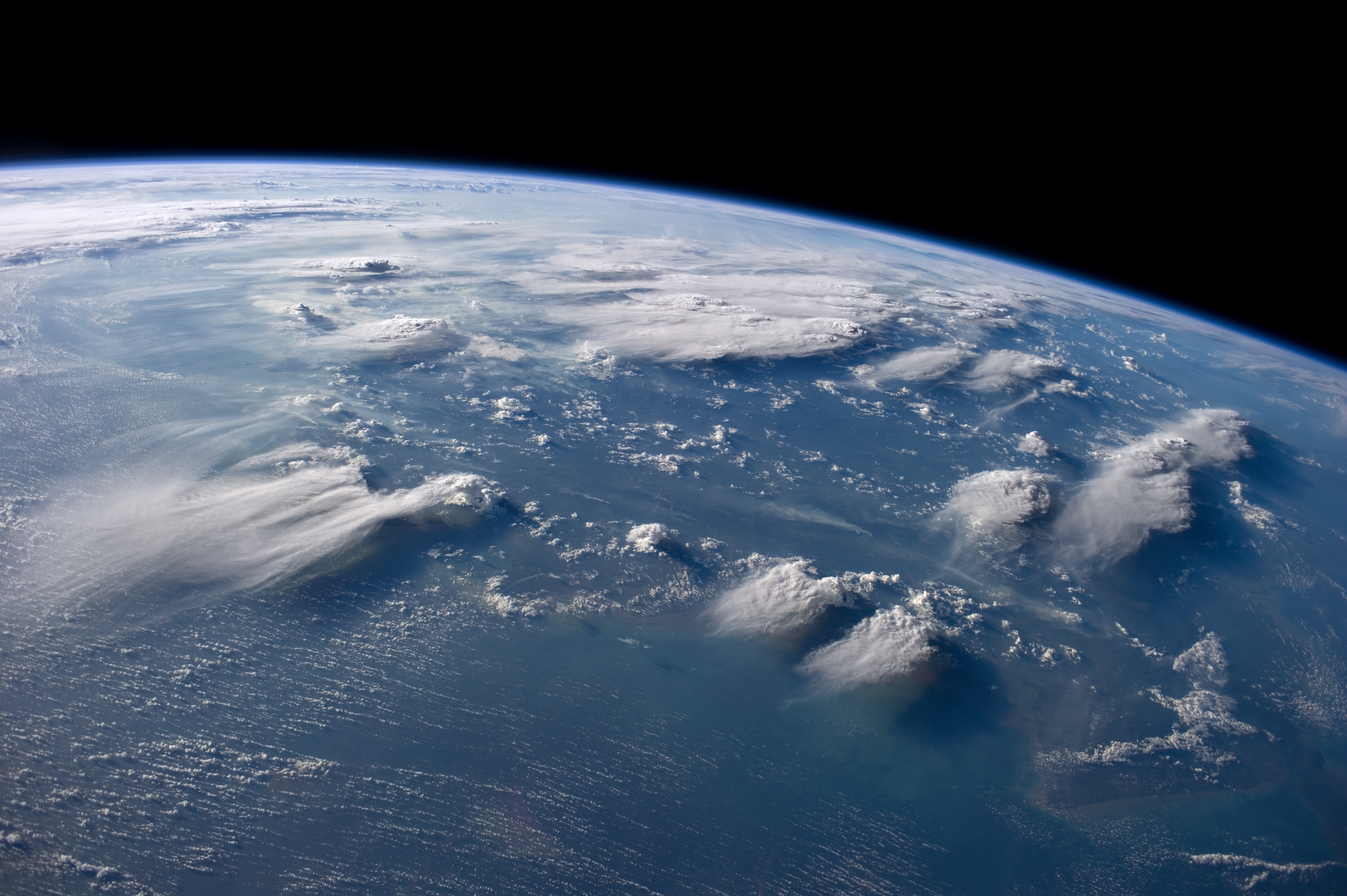
A stratocumulus cloud, occasionally called a cumulostratus, belongs to a genus-type of clouds characterized by large dark, rounded masses, usually in groups, lines, or waves, the individual elements being larger than those in altocumulus, and the whole being at a lower height, usually below . Weak convective currents create shallow cloud layers (see also: sea of clouds) because of drier, stable air above preventing continued vertical development. Historically, in English, this type of cloud has been referred to as a twain cloud for being a combination of two types of clouds. Description Stratocumulus clouds are rounded clumps or patches of white to dark gray clouds that normally form in groups. The individual cloud elements, which cover more than 5 degrees of arc each, can connect with each other and are sometimes arranged in a regular pattern. Occurrence Vast areas of subtropical and polar oceans are covered with massive sheets of stratocumulus. These may organize into distinc ... [...More Info...] [...Related Items...] OR: [Wikipedia] [Google] [Baidu] |
Cloud
In meteorology, a cloud is an aerosol consisting of a visible mass of miniature liquid droplets, frozen crystals, or other particles, suspended in the atmosphere of a planetary body or similar space. Water or various other chemicals may compose the droplets and crystals. On Earth, clouds are formed as a result of saturation of the air when it is cooled to its dew point, or when it gains sufficient moisture (usually in the form of water vapor) from an adjacent source to raise the dew point to the ambient temperature. Clouds are seen in the Earth's homosphere, which includes the troposphere, stratosphere, and mesosphere. Nephology is the science of clouds, which is undertaken in the cloud physics branch of meteorology. The World Meteorological Organization uses two methods of naming clouds in their respective layers of the homosphere, Latin and common name. Genus types in the troposphere, the atmospheric layer closest to Earth's surface, have Latin names because of th ... [...More Info...] [...Related Items...] OR: [Wikipedia] [Google] [Baidu] |
Cumulus Cloud
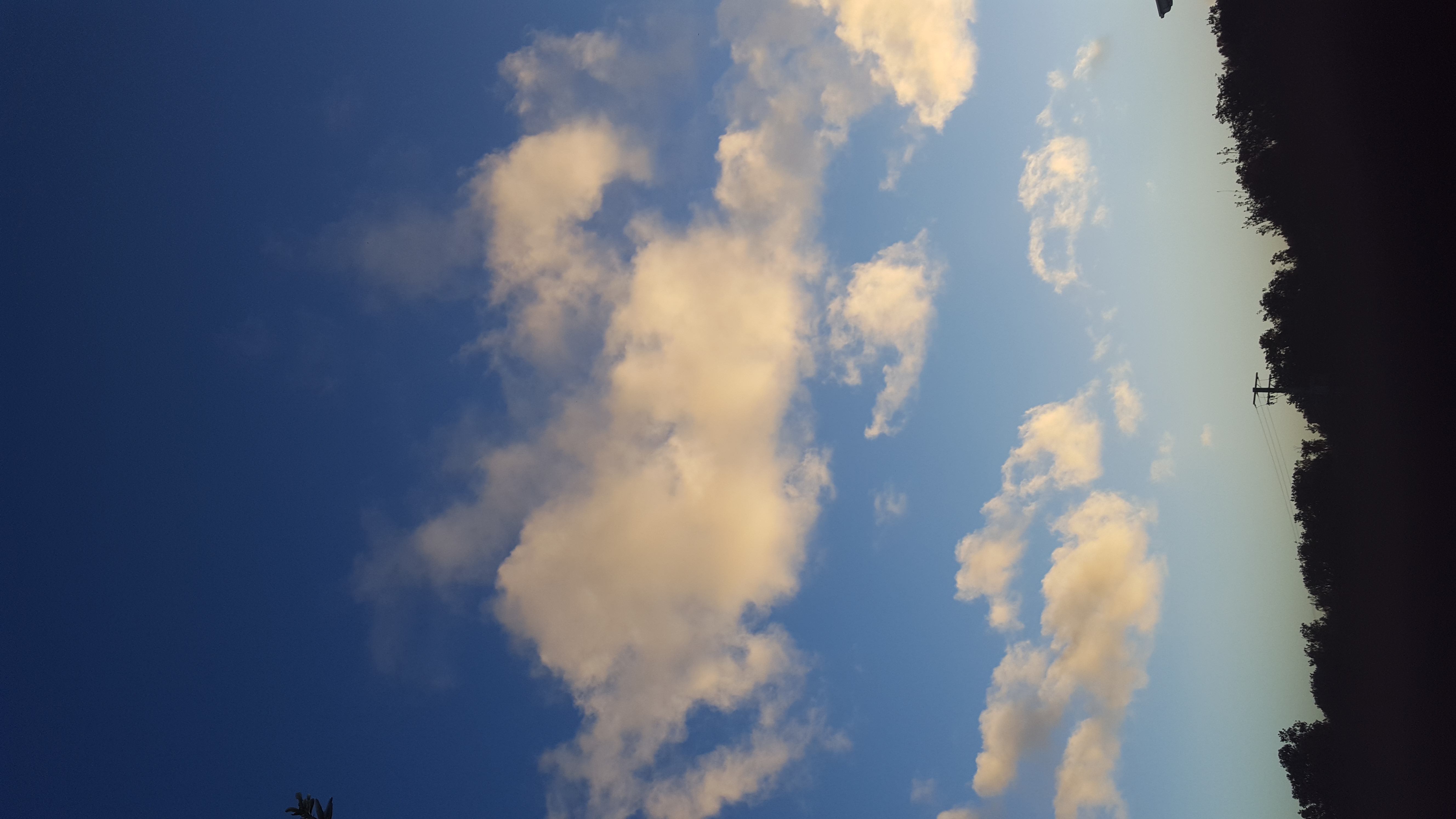
Cumulus clouds are clouds that have flat cloud base, bases and are often described as puffy, cotton-like, or fluffy in appearance. Their name derives from the Latin , meaning "heap" or "pile". Cumulus clouds are low-level clouds, generally less than in altitude unless they are the more vertical cumulus congestus form. Cumulus clouds may appear by themselves, in lines, or in clusters. Cumulus clouds are often precursors of other types of clouds, such as cumulonimbus cloud, cumulonimbus, when influenced by weather factors such as atmospheric instability, instability, humidity, and temperature gradient. Normally, cumulus clouds produce little or no precipitation, but they can grow into the precipitation-bearing cumulus congestus or cumulonimbus clouds. Cumulus clouds can be formed from water vapour, supercooling, supercooled water droplets, or ice crystals, depending upon the ambient temperature. They come in many distinct subforms and generally cool the earth by reflecting the in ... [...More Info...] [...Related Items...] OR: [Wikipedia] [Google] [Baidu] |
Stratus Cloud
Stratus clouds are low-level clouds characterized by horizontal layering with a uniform base, as opposed to convective or cumuliform clouds formed by rising thermals. The term ''stratus'' describes flat, hazy, featureless clouds at low altitudes varying in color from dark gray to nearly white. The word ''stratus'' comes from the Latin prefix ''Strato-'', meaning "layer" or "sheet". Stratus clouds may produce a light drizzle or a small amount of snow. These clouds are essentially above-ground fog formed either through the lifting of morning fog or through cold air moving at low altitudes. Some call these clouds "high fog" for their fog-like form. Formation Stratus clouds form when weak vertical currents lift a layer of air off the ground and it depressurizes, following the lapse rate. This causes the relative humidity to increase due to the adiabatic cooling. This occurs in environments where atmospheric ''stability'' is abundant. Description Stratus clouds look like ... [...More Info...] [...Related Items...] OR: [Wikipedia] [Google] [Baidu] |
Nimbostratus Cloud
A nimbostratus cloud is a multilevel, amorphous, nearly uniform, and often dark-grey cloud that usually produces continuous rain, snow, or sleet, but no lightning or thunder. in the Oxford Dictionaries Online. Although it is usually a low-based stratiform cloud, it actually forms most commonly in the middle level of the troposphere and then spreads vertically into the low and high levels. Nimbostratus usually produces precipitation over a wide area. The prefix '' nimbo-'' comes from the Latin word ', which means "rain bearing cloud" Downward-growing nimbostratus can have the same vertical extent as most large upward-growing [...More Info...] [...Related Items...] OR: [Wikipedia] [Google] [Baidu] |
Altocumulus Cloud
Altocumulus () is a middle-altitude cloud genus that belongs mainly to the physical category, characterized by globular masses or rolls in layers or patchesthe individual elements being larger and darker than those of cirrocumulus and smaller than those of stratocumulus. However, if the layers become tufted in appearance due to increased airmass instability, then the altocumulus clouds become more purely ''cumuliform'' in structure. Like other cumuliform and stratocumuliform clouds, altocumulus signifies convection. A sheet of partially conjoined altocumulus perlucidus is sometimes found preceding a weakening warm front, where the altostratus is starting to fragment, resulting in patches of altocumulus perlucidus between the areas of altostratus. Altocumulus is also commonly found between the warm and cold fronts in a depression, although this is often hidden by lower clouds. Towering altocumulus, known as altocumulus castellanus, frequently signals the development of thu ... [...More Info...] [...Related Items...] OR: [Wikipedia] [Google] [Baidu] |
Crepuscular Rays
Crepuscular rays, sometimes colloquially referred to as god rays, are sunbeams that originate when the Sun appears to be just above or below a layer of clouds, during the twilight period. Crepuscular rays are noticeable when the contrast between light and dark is most obvious. Crepuscular comes from the Latin word , meaning "twilight". Crepuscular rays usually appear orange because the path through the atmosphere at dawn and dusk passes through up to 40 times as much air as rays from a high Sun at noon. Particles in the air scatter short-wavelength light (blue and green) through Rayleigh scattering much more strongly than longer-wavelength yellow and red light. Loosely, the term ''crepuscular rays'' is sometimes extended to the general phenomenon of rays of sunlight Sunlight is the portion of the electromagnetic radiation which is emitted by the Sun (i.e. solar radiation) and received by the Earth, in particular the visible spectrum, visible light perceptible to the hu ... [...More Info...] [...Related Items...] OR: [Wikipedia] [Google] [Baidu] |
Corona (optical Phenomenon)
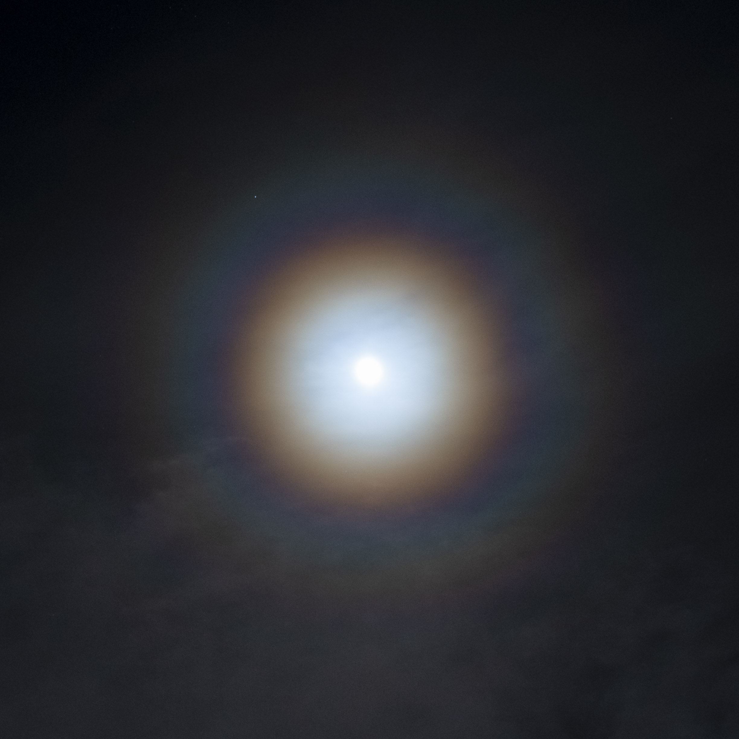
In meteorology, a corona (plural ''coronae'') is an optical phenomenon produced by the diffraction of sunlight or moonlight (or, occasionally, bright starlight or planetlight) by individual small water droplets and sometimes tiny ice crystals of a cloud or on a foggy glass surface. In its full form, a corona consists of several concentric, pastel-colored rings around the celestial object and a central bright area called an ''aureole''. The aureole is often (especially in case of the Moon) the only visible part of the corona and has the appearance of a bluish-white disk which fades to reddish-brown towards the edge. The angular diameter of a corona depends on the sizes of the water droplets involved; smaller droplets produce larger coronae. For the same reason, the corona is the most pronounced when the size of the droplets is most uniform. Coronae differ from halos in that the latter are formed by refraction (rather than diffraction) from comparatively large rather than sm ... [...More Info...] [...Related Items...] OR: [Wikipedia] [Google] [Baidu] |
Rain
Rain is a form of precipitation where water drop (liquid), droplets that have condensation, condensed from Water vapor#In Earth's atmosphere, atmospheric water vapor fall under gravity. Rain is a major component of the water cycle and is responsible for depositing most of the fresh water on the Earth. It provides water for hydroelectricity, hydroelectric power plants, crop irrigation, and suitable conditions for many types of ecosystems. The major cause of rain production is moisture moving along three-dimensional zones of temperature and moisture contrasts known as weather fronts. If enough moisture and upward motion is present, precipitation falls from convection, convective clouds (those with strong upward vertical motion) such as cumulonimbus (thunder clouds) which can organize into narrow rainbands. In mountainous areas, heavy precipitation is possible where upslope flow is maximized within windward sides of the terrain at elevation which forces moist air to condense and ... [...More Info...] [...Related Items...] OR: [Wikipedia] [Google] [Baidu] |
Altostratus Cloud
Altostratus is a middle-altitude cloud genus made up of water droplets, ice crystals, or a mixture of the two. Altostratus clouds are formed when large masses of warm, moist air rise, causing water vapor to condense. Altostratus clouds are usually gray or blueish featureless sheets, although some variants have wavy or banded bases. The sun can be seen through thinner altostratus clouds, but thicker layers can be quite Opacity (optics), opaque. Altostratus clouds usually predict the arrival of warm fronts. Once altostratus clouds associated with a warm front arrive, continuous rain or snow will usually follow in the next 12 to 24 hours. Although altostratus clouds predict the arrival of warmer, wetter weather, they themselves do not produce significant precipitation. Thunderstorms can be embedded in altostratus clouds, however, bringing showers. Because altostratus clouds can contain ice crystals, they can produce some optical phenomena like iridescence and Corona (optical phenome ... [...More Info...] [...Related Items...] OR: [Wikipedia] [Google] [Baidu] |
Gust Front
An outflow boundary, also known as a gust front, is a storm-scale or mesoscale boundary separating thunderstorm-cooled air ( outflow) from the surrounding air; similar in effect to a cold front, with passage marked by a wind shift and usually a drop in temperature and a related pressure jump. Outflow boundaries can persist for 24 hours or more after the thunderstorms that generated them dissipate, and can travel hundreds of kilometers from their area of origin. New thunderstorms often develop along outflow boundaries, especially near the point of intersection with another boundary (cold front, dry line, another outflow boundary, etc.). Outflow boundaries can be seen either as fine lines on weather radar imagery or else as arcs of low clouds on weather satellite imagery. From the ground, outflow boundaries can be co-located with the appearance of roll clouds and shelf clouds. Outflow boundaries create low-level wind shear which can be hazardous during aircraft takeoffs and la ... [...More Info...] [...Related Items...] OR: [Wikipedia] [Google] [Baidu] |


