|
Metes And Bounds
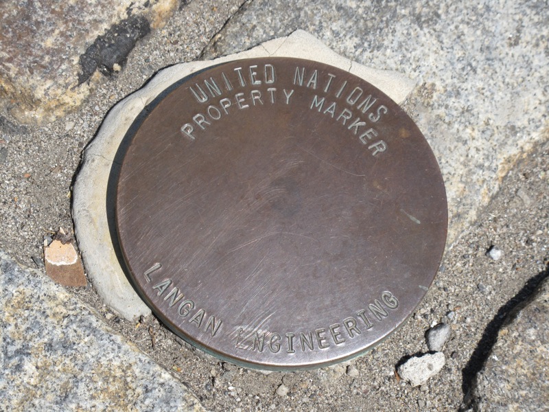
Metes and bounds is a system or method of describing land, real property (in contrast to personal property) or real estate. The system has been used in England for many centuries and is still used there in the definition of general boundaries. The system is also used in the Canadian province of Ontario, and throughout Canada for the description of electoral districts. By custom, it was applied in the original Thirteen Colonies that became the United States and in many other land jurisdictions based on English law, English common law, including Zimbabwe, South Africa, India and Bangladesh. While still in hand-me-down use, this system has been largely overtaken in the past few centuries by newer systems such as rectangular (government survey) and lot and block (recorded plat). Typically the system uses physical features of the local geography, along with directions and distances, to define and describe the boundaries of a parcel of land. The boundaries are described in a running ... [...More Info...] [...Related Items...] OR: [Wikipedia] [Google] [Baidu] |
Real Property
In English common law, real property, real estate, immovable property or, solely in the US and Canada, realty, refers to parcels of land and any associated structures which are the property of a person. For a structure (also called an Land improvement, improvement or Fixture (property law), fixture) to be considered part of the real property, it must be integrated with or affixed to the land. This includes crops, buildings, machinery, wells, dams, ponds, mines, canals, and roads. The term is historic, arising from the now-discontinued form of action, which distinguished between real property disputes and personal property disputes. Personal property, or personalty, was, and continues to be, all property that is not real property. In countries with personal ownership of real property, civil law (legal system), civil law protects the status of real property in real-estate markets, where estate agents work in the market of buying and selling real estate. Scottish civil law calls ... [...More Info...] [...Related Items...] OR: [Wikipedia] [Google] [Baidu] |
Metre
The metre (or meter in US spelling; symbol: m) is the base unit of length in the International System of Units (SI). Since 2019, the metre has been defined as the length of the path travelled by light in vacuum during a time interval of of a second, where the second is defined by a hyperfine transition frequency of caesium. The metre was originally defined in 1791 by the French National Assembly as one ten-millionth of the distance from the equator to the North Pole along a great circle, so the Earth's polar circumference is approximately . In 1799, the metre was redefined in terms of a prototype metre bar. The bar used was changed in 1889, and in 1960 the metre was redefined in terms of a certain number of wavelengths of a certain emission line of krypton-86. The current definition was adopted in 1983 and modified slightly in 2002 to clarify that the metre is a measure of proper length. From 1983 until 2019, the metre was formally defined as the length of the pat ... [...More Info...] [...Related Items...] OR: [Wikipedia] [Google] [Baidu] |
Boundary (real Estate)
A unit of real estate or immovable property is limited by a legal boundary (sometimes also referred to as a property line, lot line or bounds). The boundary (in Latin: ''limes'') may appear as a discontinuation in the terrain: a ditch, a bank, a hedge, a wall, or similar, but essentially, a legal boundary is a conceptual entity, a social construct, adjunct to the likewise abstract entity of property rights. A cadastral map displays how boundaries subdivide land into units of ownership. However, the relations between society, owner, and land in any culture or jurisdiction are conceived of in terms more complex than a tessellation. Therefore, the society concerned has to specify the rules and means by which the boundary concept is materialized and located on the ground. A 'Western' version of the boundary determination might be a legally specified procedure, performed by a chartered surveyor, supported by statements from neighbors and pertinent documents, and resulting in offic ... [...More Info...] [...Related Items...] OR: [Wikipedia] [Google] [Baidu] |
Beating The Bounds
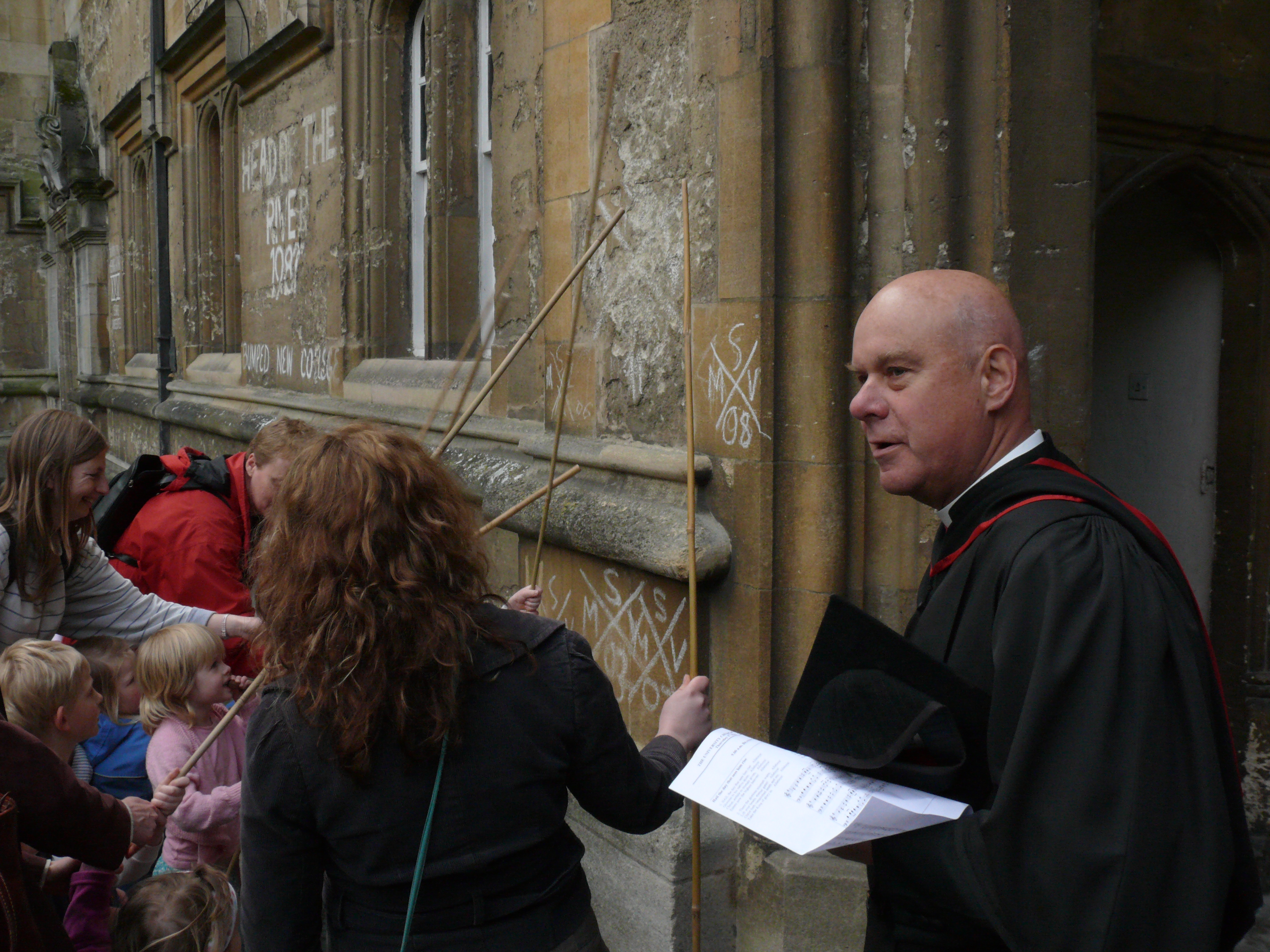
Beating the bounds or perambulating the bounds is an ancient custom still observed in parts of England, Wales, and the New England region of the United States, which involves swatting local landmarks with branches to maintain a shared mental map of parish boundaries, usually every seven years. These ceremonial events occur on what are sometimes called gangdays; the custom of going a-ganging was kept before the Norman Conquest. During the event, a group of prominent citizens from the community, which can be an English church parish, New England town, or other civil division, will walk the geographic boundaries of their locality for the purpose of maintaining the memory of the precise location of these boundaries. While modern surveying techniques have rendered these ceremonial walks largely irrelevant, the practice remains as an important local civic ceremony or legal requirement for civic leaders. Ceremony In former times when maps were rare, it was usual to make a formal peram ... [...More Info...] [...Related Items...] OR: [Wikipedia] [Google] [Baidu] |
Ottawa Centre (federal Electoral District)
Ottawa Centre () is an urban federal electoral district in Ontario, Canada, that has been represented in the House of Commons of Canada since 1968. While the riding's boundaries (mainly to the south and west as the north and east borders have remained the Ottawa River and Rideau River, respectively) have changed over the years to account for population changes, the riding has always comprised the central areas of Ottawa, the nation's capital. The House of Commons of Canada meets in the West Block of the Parliament Buildings on Parliament Hill, which is located within this district. History The riding was created in 1966 from Carleton, Ottawa West and Ottawa East ridings. It initially consisted of that part of Ottawa north of the Rideau River, west of a line following the Rideau Canal to the Canadian Pacific Railway line (currently about where Nicholas Street is), and generally east of Bayswater Road (now Ave.), and south of that the CPR line where the O-Train currently is. ... [...More Info...] [...Related Items...] OR: [Wikipedia] [Google] [Baidu] |
Plat
In the United States, a plat ( or ) (plan) is a cadastral map, drawn to scale, showing the divisions of a piece of land. United States General Land Office surveyors drafted township plats of Public Lands Survey System, Public Lands Surveys to show the distance and bearing between section corners, sometimes including topographic or vegetation information. City, town or village plats show subdivisions broken into City block, blocks with streets and alleys. Further refinement often splits blocks into individual Lot (real estate), lots, usually for the purpose of selling the described lots; this has become known as subdivision (land), subdivision. After the filing of a plat, Land description, legal descriptions can refer to block and lot-numbers rather than portions of section (land), sections. In order for plats to become legally valid, a local governing body, such as a public works department, urban planning commission, zoning board, or another organ of the state must normally r ... [...More Info...] [...Related Items...] OR: [Wikipedia] [Google] [Baidu] |
Republic Of Texas
The Republic of Texas (), or simply Texas, was a country in North America that existed for close to 10 years, from March 2, 1836, to February 19, 1846. Texas shared borders with Centralist Republic of Mexico, the Republic of the Rio Grande, and the United States. The Republic declared its independence from Mexico with the proclamation of the Texas Declaration of Independence, subsequently beginning the Texas Revolution. The proclamation was established after the Centralist Republic of Mexico abolished autonomy from states of the First Mexican Republic, Mexican federal republic. The revolution lasted for six months, with major fighting ending on April 21, 1836, securing independence. The Mexican Congress refused to recognize the independence of the Republic of Texas, as the Treaties of Velasco were signed by Mexican President and General Antonio López de Santa Anna under duress as prisoner. The majority of the Mexican Congress did not approve the agreement. Much of its territor ... [...More Info...] [...Related Items...] OR: [Wikipedia] [Google] [Baidu] |
Public Land Survey System
The Public Land Survey System (PLSS) is the surveying method developed and used in the United States to plat, or divide, real property for sale and settling. Also known as the Rectangular Survey System, it was created by the Land Ordinance of 1785 to survey land ceded to the United States by the Treaty of Paris (1783), Treaty of Paris in 1783, following the end of the American Revolution. Beginning with the Seven Ranges in present-day Ohio, the PLSS has been used as the primary survey method in the United States. Following the passage of the Northwest Ordinance in 1787, the Surveyor General of the Northwest Territory platted lands in the Northwest Territory. The Surveyor General was later merged with the United States General Land Office, which later became a part of the U.S. Bureau of Land Management (BLM). Today, the BLM controls the survey, sale, and settling of lands acquired by the United States. History Originally proposed by Thomas Jefferson to create a nation of "yeom ... [...More Info...] [...Related Items...] OR: [Wikipedia] [Google] [Baidu] |
Land Ordinance Of 1785
The Land Ordinance of 1785 was adopted by the United States Congress of the Confederation on May 20, 1785. It set up a standardized system whereby settlers could purchase title to farmland in the undeveloped west. Congress at the time did not have the power to raise revenue by direct taxation, so land sales provided an important revenue stream. The Ordinance set up a survey system that eventually covered over three-quarters of the area of the continental United States. The earlier Land Ordinance of 1784 was a resolution written by Thomas Jefferson calling for Congress to take action. The land west of the Appalachian Mountains, north of the Ohio River and east of the Mississippi River was to be divided into ten separate states. However, the 1784 resolution did not define the mechanism by which the land would become states, or how the territories would be governed or settled before they became states. The Ordinance of 1785 put the 1784 resolution in operation by providing a mecha ... [...More Info...] [...Related Items...] OR: [Wikipedia] [Google] [Baidu] |
North Magnetic Pole
The north magnetic pole, also known as the magnetic north pole, is a point on the surface of Earth's Northern Hemisphere at which the Earth's magnetic field, planet's magnetic field points vertically downward (in other words, if a magnetic compass needle is allowed to rotate in three dimensions, it will point straight down). There is only one location where this occurs, near (but distinct from) the geographic north pole. The Earth's Magnetic North Pole is actually considered the "south pole" in terms of a typical magnet, meaning that the north pole of a magnet would be attracted to the Earth's magnetic north pole. The north magnetic pole moves over time according to magnetic changes and flux lobe Elongation (materials science), elongation in the Earth's outer core. In 2001, it was determined by the Geological Survey of Canada to lie west of Ellesmere Island in northern Canada at . It was situated at in 2005. In 2009, while still situated within the Canadian Arctic at , it was ... [...More Info...] [...Related Items...] OR: [Wikipedia] [Google] [Baidu] |
Elizabeth I
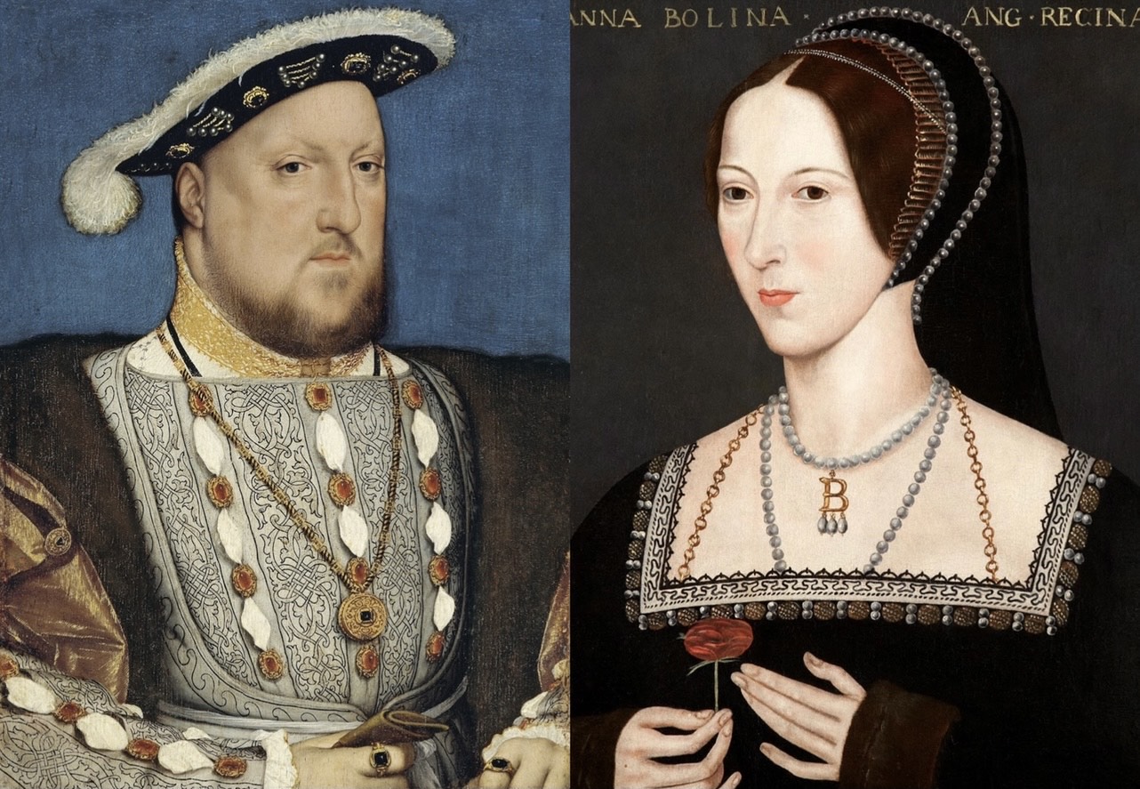
Elizabeth I (7 September 153324 March 1603) was List of English monarchs, Queen of England and List of Irish monarchs, Ireland from 17 November 1558 until her death in 1603. She was the last and longest reigning monarch of the House of Tudor. Her eventful reign, and its effect on history and culture, gave name to the Elizabethan era. Elizabeth was the only surviving child of Henry VIII and his second wife, Anne Boleyn. When Elizabeth was two years old, her parents' marriage was annulled, her mother was executed, and Elizabeth was declared royal bastard, illegitimate. Henry Third Succession Act 1543, restored her to the line of succession when she was 10. After Henry's death in 1547, Elizabeth's younger half-brother Edward VI ruled until his own death in 1553, bequeathing the crown to a Protestant cousin, Lady Jane Grey, and ignoring the claims of his two half-sisters, Mary I of England, Mary and Elizabeth, despite statutes to the contrary. Edward's will was quickly set aside ... [...More Info...] [...Related Items...] OR: [Wikipedia] [Google] [Baidu] |
Mile
The mile, sometimes the international mile or statute mile to distinguish it from other miles, is a imperial unit, British imperial unit and United States customary unit of length; both are based on the older English unit of Unit of length, length equal to 5,280 Foot (unit), English feet, or 1,760 yards. The statute mile was standardised between the Commonwealth of Nations and the United States by an international yard and pound, international agreement in 1959, when it was formally redefined with respect to SI units as exactly . With qualifiers, ''mile'' is also used to describe or translate a wide range of units derived from or roughly equivalent to the #Roman, Roman mile (roughly ), such as the #Nautical, nautical mile (now exactly), the #Italian, Italian mile (roughly ), and the li (unit), Chinese mile (now exactly). The Romans divided their mile into 5,000 (), but the greater importance of furlongs in the Kingdom of England#Tudor period, Elizabethan-era England meant th ... [...More Info...] [...Related Items...] OR: [Wikipedia] [Google] [Baidu] |


