|
Altostratus
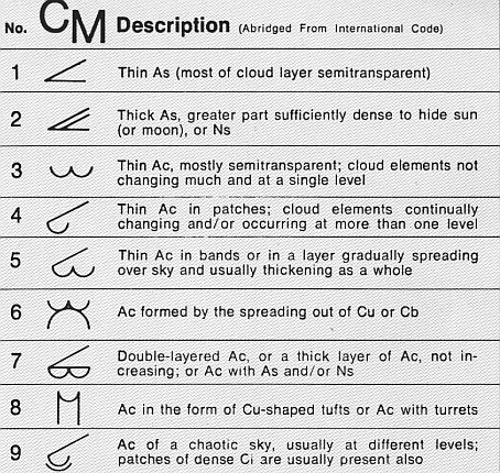
Altostratus is a middle-altitude cloud genus made up of water droplets, ice crystals, or a mixture of the two. Altostratus clouds are formed when large masses of warm, moist air rise, causing water vapor to condense. Altostratus clouds are usually gray or blueish featureless sheets, although some variants have wavy or banded bases. The sun can be seen through thinner altostratus clouds, but thicker layers can be quite opaque. Altostratus clouds usually predict the arrival of warm fronts. Once altostratus clouds associated with a warm front arrive, continuous rain or snow will usually follow in the next 12 to 24 hours. Although altostratus clouds predict the arrival of warmer, wetter weather, they themselves do not produce significant precipitation. Thunderstorms can be embedded in altostratus clouds; however, bringing showers. Because altostratus clouds can contain ice crystals, they can produce some optical phenomena like iridescence and coronas. Description Altostratus clo ... [...More Info...] [...Related Items...] OR: [Wikipedia] [Google] [Baidu] |
Cloud
In meteorology, a cloud is an aerosol consisting of a visible mass of miniature liquid droplets, frozen crystals, or other particles suspended in the atmosphere of a planetary body or similar space. Water or various other chemicals may compose the droplets and crystals. On Earth, clouds are formed as a result of saturation of the air when it is cooled to its dew point, or when it gains sufficient moisture (usually in the form of water vapor) from an adjacent source to raise the dew point to the ambient temperature. They are seen in the Earth's homosphere, which includes the troposphere, stratosphere, and mesosphere. Nephology is the science of clouds, which is undertaken in the cloud physics branch of meteorology. There are two methods of naming clouds in their respective layers of the homosphere, Latin and common name. Genus types in the troposphere, the atmospheric layer closest to Earth's surface, have Latin names because of the universal adoption of Luke H ... [...More Info...] [...Related Items...] OR: [Wikipedia] [Google] [Baidu] |
Warm Front
A warm front is a density discontinuity located at the leading edge of a homogeneous warm air mass, and is typically located on the equator-facing edge of an isotherm gradient. Warm fronts lie within broader troughs of low pressure than cold fronts, and move more slowly than the cold fronts which usually follow because cold air is denser and less easy to remove from the Earth's surface. This also forces temperature differences across warm fronts to be broader in scale. Clouds ahead of the warm front are mostly stratiform, and rainfall defiantly increases as the front approaches. Fog can also occur preceding a warm frontal passage. Clearing and warming is usually rapid after frontal passage. If the warm air mass is unstable, thunderstorms may be embedded among the stratiform clouds ahead of the front, and after frontal passage thundershowers may continue. On weather maps, the surface location of a warm front is marked with a red line of semicircles pointing in the directio ... [...More Info...] [...Related Items...] OR: [Wikipedia] [Google] [Baidu] |
Nimbostratus
A nimbostratus cloud is a multi-level, amorphous, nearly uniform and often dark grey cloud that usually produces continuous rain, snow or sleet but no lightning or thunder. in the Oxford Dictionaries Online Although it is usually a low-based cloud, it actually forms most commonly in the middle level of the troposphere and then spreads vertically into the low and high levels. Nimbostratus usually produces precipitation over a wide area. ''Nimbo-'' is from the Latin word ''nimbus'', which denotes cloud or halo. Downward-growing nimbostratus can have the same vertical extent as most large upward-growing cumulus, but its horizontal extent tends to be even greater. Appearance Nimbostratus has a diffuse |
Altocumulus Cloud
Altocumulus (From Latin ''Altus'', "high", ''cumulus'', "heaped") is a middle-altitude cloud genus that belongs mainly to the ''stratocumuliform'' physical category characterized by globular masses or rolls in layers or patches, the individual elements being larger and darker than those of cirrocumulus and smaller than those of stratocumulus. However, if the layers become tufted in appearance due to increased airmass instability, then the altocumulus clouds become more purely ''cumuliform'' in structure. Like other cumuliform and stratocumuliform clouds, altocumulus signifies convection. A sheet of partially conjoined altocumulus perlucidus is sometimes found preceding a weakening warm front, where the altostratus is starting to fragment, resulting in patches of altocumulus perlucidus between the areas of altostratus. Altocumulus is also commonly found between the warm and cold fronts in a depression, although this is often hidden by lower clouds. Towering altocumulus, known as ... [...More Info...] [...Related Items...] OR: [Wikipedia] [Google] [Baidu] |
Cirrostratus Cloud
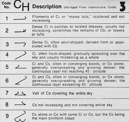
Cirrostratus is a high-level, very thin, generally uniform ''stratiform'' genus-type of cloud. It is made out of ice-crystals, which are pieces of frozen water. It is difficult to detect and it can make halos. These are made when the cloud takes the form of thin cirrostratus nebulosus. The cloud has a fibrous texture with no halos if it is thicker cirrostratus fibratus. On the approach of a frontal system, the cirrostratus often begins as nebulous and turns to fibratus. If the cirrostratus begins as fragmented of clouds in the sky it often means the front is weak. Cirrostratus is usually located above 5.5 km (18,000 ft). Its presence indicates a large amount of moisture in the upper troposphere. Clouds resembling cirrostratus occasionally form in polar regions of the lower stratosphere. Polar stratospheric clouds can take on this appearance when composed of tiny supercooled droplets of water or nitric acid. Cirrostratus clouds sometimes signal the approach of a wa ... [...More Info...] [...Related Items...] OR: [Wikipedia] [Google] [Baidu] |
Precipitation
In meteorology, precipitation is any product of the condensation of atmospheric water vapor that falls under gravitational pull from clouds. The main forms of precipitation include drizzle, rain, sleet, snow, ice pellets, graupel and hail. Precipitation occurs when a portion of the atmosphere becomes saturated with water vapor (reaching 100% relative humidity), so that the water condenses and "precipitates" or falls. Thus, fog and mist are not precipitation but colloids, because the water vapor does not condense sufficiently to precipitate. Two processes, possibly acting together, can lead to air becoming saturated: cooling the air or adding water vapor to the air. Precipitation forms as smaller droplets coalesce via collision with other rain drops or ice crystals within a cloud. Short, intense periods of rain in scattered locations are called showers. Moisture that is lifted or otherwise forced to rise over a layer of sub-freezing air at the surface may be condensed into ... [...More Info...] [...Related Items...] OR: [Wikipedia] [Google] [Baidu] |
Halo (optical Phenomenon)
A halo is an optical phenomenon produced by light (typically from the Sun or Moon) interacting with ice crystals suspended in Earth's atmosphere, the atmosphere. Halos can have many forms, ranging from colored or white rings to arcs and spots in the sky. Many of these appear near the Sun or Moon, but others occur elsewhere or even in the opposite part of the sky. Among the best known halo types are the circular halo (properly called the 22° halo), light pillars, and sun dogs, but many others occur; some are fairly common while others are extremely rare. The ice crystals responsible for halos are typically suspended in cirrus cloud, cirrus or cirrostratus clouds in the upper troposphere (), but in cold weather they can also float near the ground, in which case they are referred to as diamond dust. The particular shape and orientation of the crystals are responsible for the type of halo observed. Light is reflection (physics), reflected and refraction, refracted by the ice crys ... [...More Info...] [...Related Items...] OR: [Wikipedia] [Google] [Baidu] |
Air Mass
In meteorology, an air mass is a volume of air defined by its temperature and humidity. Air masses cover many hundreds or thousands of square miles, and adapt to the characteristics of the surface below them. They are classified according to latitude and their continental or maritime source regions. Colder air masses are termed polar or arctic, while warmer air masses are deemed tropical. Continental and superior air masses are dry, while maritime and monsoon air masses are moist. Weather fronts separate air masses with different density (temperature or moisture) characteristics. Once an air mass moves away from its source region, underlying vegetation and water bodies can quickly modify its character. Classification schemes tackle an air mass' characteristics, as well as modification. Classification and notation The Bergeron classification is the most widely accepted form of air mass classification, though others have produced more refined versions of this scheme over diffe ... [...More Info...] [...Related Items...] OR: [Wikipedia] [Google] [Baidu] |
Anvil Cloud
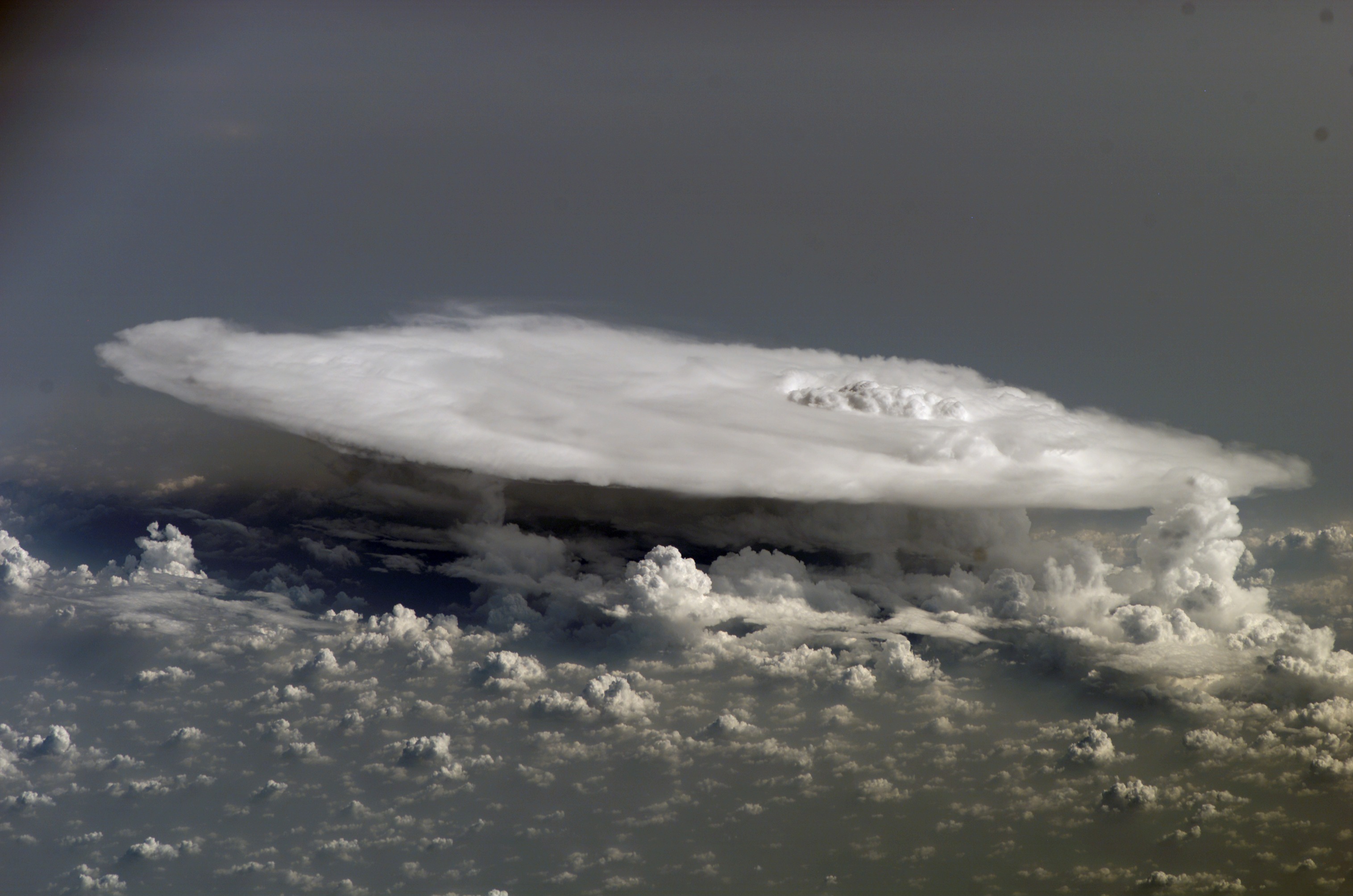
A cumulonimbus incus (Latin ''incus'', "anvil"), also known as an anvil cloud, is a cumulonimbus cloud which has reached the level of stratospheric stability and has formed the characteristic flat, anvil-top shape. It signifies the thunderstorm in its mature stage, succeeding the cumulonimbus calvus stage. Cumulonimbus incus is a sub-form of Cumulonimbus capillatus. Hazards A cumulonimbus incus is a mature thunderstorm cloud generating many dangerous elements. * Lightning: this storm cloud is capable of producing bursts of cloud-to-ground lightning. * Hail: hailstones may fall from this cloud if it's a highly unstable environment (which favours a more vigorous storm updraft). * Heavy rain: this cloud may drop several inches (millimetres) of rain in a short amount of time. This can cause flash flooding. * Strong wind: gale-force winds from a downburst may occur under this cloud. * Tornadoes: in severe cases (most commonly with supercells), it can produce tornadoes. Classi ... [...More Info...] [...Related Items...] OR: [Wikipedia] [Google] [Baidu] |
Relative Humidity
Humidity is the concentration of water vapor present in the air. Water vapor, the gaseous state of water, is generally invisible to the human eye. Humidity indicates the likelihood for precipitation, dew, or fog to be present. Humidity depends on the temperature and pressure of the system of interest. The same amount of water vapor results in higher relative humidity in cool air than warm air. A related parameter is the dew point. The amount of water vapor needed to achieve saturation increases as the temperature increases. As the temperature of a parcel of air decreases it will eventually reach the saturation point without adding or losing water mass. The amount of water vapor contained within a parcel of air can vary significantly. For example, a parcel of air near saturation may contain 28 g of water per cubic metre of air at , but only 8 g of water per cubic metre of air at . Three primary measurements of humidity are widely employed: absolute, relative, and specific. A ... [...More Info...] [...Related Items...] OR: [Wikipedia] [Google] [Baidu] |


