|
Velká Nad Veličkou
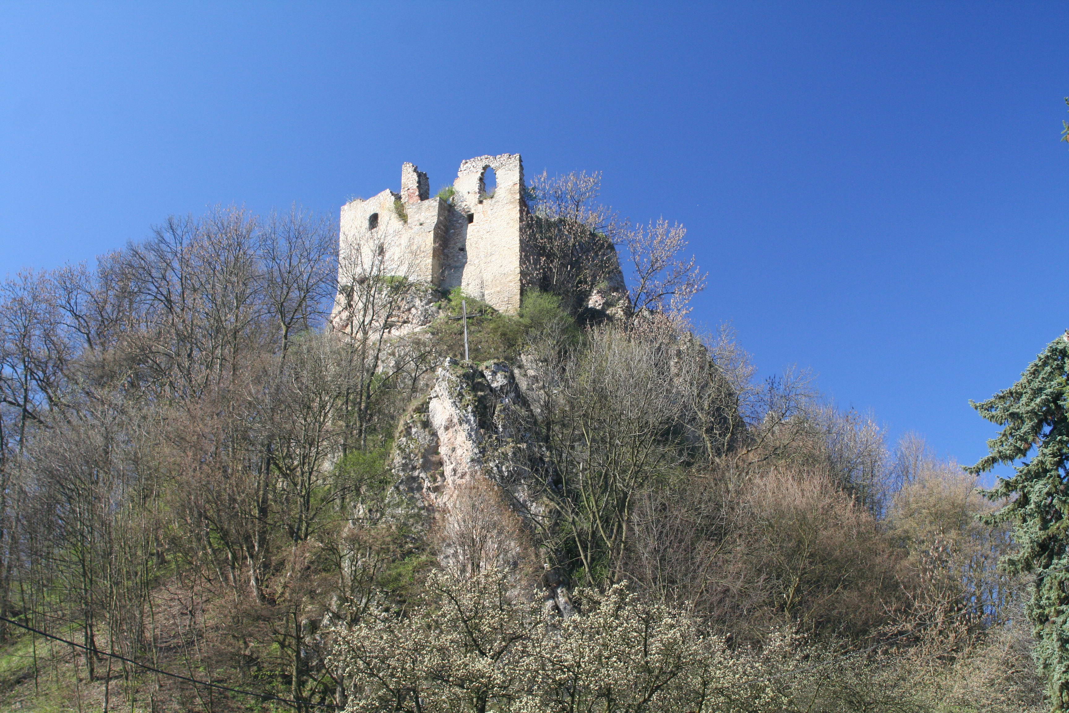
Velká nad Veličkou () is a municipality and village in Hodonín District in the South Moravian Region of the Czech Republic. It has about 2,800 inhabitants. Geography Velká nad Veličkou is located about east of Hodonín and west of Trenčín. It lies in the White Carpathians mountain range. The highest point is the hill Háj at above sea level. The Velička River flows through the municipality. History The first written mention of Velká nad Veličkou is from 1228. In 1370, the settlement was sold to Beneš of Kravaře and merged with the Strážnice estate. Demographics Transport Velká nad Veličkou is located on a railway line heading from Hodonín to Vrbovce, Slovakia. Culture Velká nad Veličkou lies in the ethnographic region of Horňácko. Sights The landmark of Velká nad Veličkou is the Church of Saint Mary Magdalene. The original Gothic church was built in the 14th century. At the end of the 15th century, it was fortified and served as a refuge during rai ... [...More Info...] [...Related Items...] OR: [Wikipedia] [Google] [Baidu] |
Obec
(, ; plural ) is the Czech and Slovak word for a municipality (in the Czech Republic, in Slovakia and abroad). The literal meaning of the word is " commune" or " community". It is the smallest administrative unit that is governed by elected representatives. Cities and towns are also municipalities. Definition The legal definition (according to the Czech code of law with similar definition in the Slovak code of law) is: ''"The municipality is a basic territorial self-governing community of citizens; it forms a territorial unit, which is defined by the boundary of the municipality."'' Every municipality is composed of one or more cadastral areas. Every municipality is also composed of one or more municipal parts (), which are usually town quarters or villages. A municipality can have its own flag and coat of arms. Czech Republic Almost the entire area of the Czech Republic is divided into municipalities, with the only exception being military training areas. The smaller mu ... [...More Info...] [...Related Items...] OR: [Wikipedia] [Google] [Baidu] |
Velička (river)
The Velička is a river in the Czech Republic, a left tributary of the Morava River. It flows through the South Moravian and Zlín regions. It is long. Etymology The river was named after the village of Velká nad Veličkou (formerly called just Velká). Characteristic The Velička originates in the territory of Strání in the White Carpathians mountain range on the slope of the Velká Javořina Mountain at an elevation of and flows to Vracov, where it enters the Morava River at an elevation of . It is long. Its drainage basin has an area of . The average discharge at its mouth is . The longest tributaries of the Velička are: Course The river flows through the municipal territories of Strání, Nová Lhota, Suchov, Javorník, Velká nad Veličkou, Louka, Lipov, Tasov, Hroznová Lhota, Kněždub, Vnorovy, Strážnice and Vracov. Bodies of water There are 31 bodies of water in the basin area. None of them exceed in area. Nature The upper course of the Velič ... [...More Info...] [...Related Items...] OR: [Wikipedia] [Google] [Baidu] |
Gmina Nowy Dwór Gdański
__NOTOC__ Gmina Nowy Dwór Gdański is an urban-rural gmina (administrative district) in Nowy Dwór Gdański County, Pomeranian Voivodeship, in northern Poland. Its seat is the town of Nowy Dwór Gdański, which lies approximately south-east of the regional capital Gdańsk. The gmina covers an area of , and as of 2006 its total population is 17,887 (out of which the population of Nowy Dwór Gdański amounts to 9,948, and the population of the rural part of the gmina is 7,939). Villages Apart from the town of Nowy Dwór Gdański, Gmina Nowy Dwór Gdański contains the villages and settlements of Cyganek, Cyganka, Gozdawa, Jazowa, Jazowa Druga, Kępiny Małe, Kępki, Kmiecin, Łączki Myszewskie, Leśnowo, Lubieszewo, Lubieszewo Pierwsze, Lubieszynek Drugi, Marynowy, Marzęcino, Myszewko, Myszkowo, Nowinki, Orliniec, Orłówko, Orłowo, Orłowskie Pole, Osłonka, Pieczewo, Piotrowo, Powalina, Rakowe Pole, Rakowiska, Rakowo, Robakowiec, Różewo, Rychno ... [...More Info...] [...Related Items...] OR: [Wikipedia] [Google] [Baidu] |
Sister City
A sister city or a twin town relationship is a form of legal or social agreement between two geographically and politically distinct localities for the purpose of promoting cultural and commercial ties. While there are early examples of international links between municipalities akin to what are known as sister cities or twin towns today dating back to the 9th century, the modern concept was first established and adopted worldwide during World War II. Origins of the modern concept Throughout history, many cities have participated in various cultural exchanges and similar activities that might resemble a sister-city or twin-city relationship, but the first officially documented case of such a relationship was a signed agreement between the leaders of the cities of Toledo, Ohio and Toledo, Spain in 1931. However, the modern concept of town twinning appeared during the Second World War. More specifically, it was inspired by the bombing of Coventry on 14 November 1940, known as t ... [...More Info...] [...Related Items...] OR: [Wikipedia] [Google] [Baidu] |
Eduard Urx
Eduard Vincenc Urx (29 January 1903 – 20 April 1942) was a Czechoslovak communist politician, journalist, essayist, literary critic and theorist. A member of the anti-fascist resistance movement, he was captured and murdered by the Nazis during the occupation. Biography Urx was born in 1903 in Velká nad Veličkou, into the family of a forestry official. He was baptized a Catholic but the left the Church in 1924. From 1922 to 1925 he studied philosophy and Czech and German philology at Charles University, but did not finish his studies and became a member of the Free Association of Socialist Students from Slovakia. He joined the Communist Party of Czechoslovakia (KSČ) in 1924. He was involved in the founding of the '' DAV'' magazine. Due to theoretical disagreement he left the group with Peter Jilemnický. Urx was engaged in journalistic and propaganda. Urx was a close associate of Klement Gottwald and supported his new leadership. From 1929 to 1931 and 1938, Urx was the edit ... [...More Info...] [...Related Items...] OR: [Wikipedia] [Google] [Baidu] |
Tatars
Tatars ( )Tatar in the Collins English Dictionary are a group of Turkic peoples across Eastern Europe and Northern Asia who bear the name "Tatar (term), Tatar". Initially, the ethnonym ''Tatar'' possibly referred to the Tatar confederation. That confederation was eventually incorporated into the Mongol Empire when Genghis Khan unified the various steppe tribes. Historically, the term ''Tatars'' (or ''Tartars'') was Endonym and exonym, applied to anyone originating from the vast North Asia, Northern and Central Asian landmass then known as Tartary, a term which was also conflated with the Mongol Empire itself. More recently, however, the term has come to refer more narrowly to related ethnic groups who refer to themselves as ''Tatars'' or who speak languages that are commonly referr ... [...More Info...] [...Related Items...] OR: [Wikipedia] [Google] [Baidu] |
Horňácko
Horňácko (, ''Upper Moravian Slovakia'') is an ethnographic microregion situated in the Hodonín District, South Eastern Moravia, Czech Republic. The region is home to approximately 10,000 people. It is significant for its traditional folk culture, especially the Moravian traditional music, folk music. The region hosts annually the ''Horňácko Folk Festival''. Geography Microregion Horňácko is located in the northwest foothills of the southern part of the White Carpathians, close to the border with Slovakia. The highest peak of the region is Velká Javořina (970 m above sea level), a traditional place of meetings between Czechs and Slovaks. Horňácko consists of nine municipalities: Lipov, Louka (Hodonín District), Louka, Malá Vrbka, Hrubá Vrbka, Javorník (Hodonín District), Javorník, Kuželov, Suchov and Nová Lhota (Hodonín District), Nová Lhota (the village of Vápenky, a part of Nová Lhota, is sometimes considered as the tenth village of Horňácko); the centre ... [...More Info...] [...Related Items...] OR: [Wikipedia] [Google] [Baidu] |
České Dráhy
České dráhy (English: ''Czech Railways''), often shortened to ČD, is the major Rail transport, railway operator in the Czech Republic providing regional and long-distance services. The company was established in January 1993, shortly after the dissolution of Czechoslovakia, as a successor of the Czechoslovak State Railways. It is a member of the International Union of Railways, International Railway Union (UIC Country Code for the Czech Republic is 54), the Community of European Railway and Infrastructure Companies, and the Organization for Cooperation of Railways. With twenty-four thousand employeesAnnual Report of České dráhy, a.s. for the Year 2014, auditor Deloitte Audit s.r.o. ČD Group is the fifth largest Czech company by the number of employees. History In 1827–1836, the Budweis–Linz–Gmunden Horse-Drawn Railway, České Budějovice–Linz railway was built, which was the second Horsecar, horse-drawn railway in continental Europe was established. The first ... [...More Info...] [...Related Items...] OR: [Wikipedia] [Google] [Baidu] |
Vrbovce, Slovakia
Vrbovce ( or ''Verbósz'') is a village stretching out in the protected landscape area of the White Carpathians in Myjava District in the Trenčín Region of north-western Slovakia, on the border with the Czech Republic. History Vrbovce was mentioned in historical documents for the first time in 1394 when it belonged to the Branč castle. Since 1569 its owner was transferred gradually to the Amades, Hédervárys, Nyárys, Zichys families and others. The village was also granted town privileges which were destroyed in a fire in 1757. In 1810 the Vrbovce villagers were granted the right to hold markets. Before the establishment of independent Czechoslovakia in 1918, Vrbovce was part of Nyitra County within the Kingdom of Hungary. From 1939 to 1945, it was part of the Slovak Republic. Geography The municipality lies at an altitude of 317 metres and covers an area of 51.520 km2. From the northern side the village cadastre is bounded with the state border and the border ... [...More Info...] [...Related Items...] OR: [Wikipedia] [Google] [Baidu] |
Strážnice
Strážnice () is a town in Hodonín District in the South Moravian Region of the Czech Republic. It has about 5,300 inhabitants. The historic town centre is well preserved and is protected as an Cultural monument (Czech Republic)#Monument zones, urban monument zone. Etymology The name is derived from (i.e. 'guard') and refers to the original function of the castle which was built here in the 13th century. Geography Strážnice is located about northeast of Hodonín. It lies in the Lower Morava Valley. The highest point is at above sea level. The Morava (river), Morava River flows along the northwestern border of the municipal territory. The Velička (river), Velička River flows through the northern part of Strážnice and joins the Morava just outside the territory of Strážnice. The Baťa Canal flows through the town, crossing the Velička. The southern part of Strážnice lies in the Bílé Karpaty Protected Landscape Area, even though the town does not extend into the Whi ... [...More Info...] [...Related Items...] OR: [Wikipedia] [Google] [Baidu] |
White Carpathians
The White Carpathians (; ; ) are a mountain range on the border of the Czech Republic and Slovakia, part of the Carpathians. They are part of the macroregion of Slovak-Moravian Carpathians, stretching from the Váh river and the Little Carpathians in the south along the border between the Czech Republic and Slovakia to the Morava and the Javorníky range in the north. The mean elevation is 473 m (1,552 ft) and the highest peaks are: * Velká Javořina/Veľká Javorina, * Chmeľová, * Jelenec, * Velký Lopeník/Veľký Lopeník, * Kobylinec, The landscape is protected on both sides of the mountains: Biele Karpaty Protected Landscape Area in Slovakia, founded in 1979, and Bílé Karpaty Protected Landscape Area in the Czech Republic, founded in 1980, a Man and Biosphere Reserve since 1996. The areas contain a wide variety of fauna and flora. Some species found there are endemic, especially some types of orchids which grow only in the meadows of the Whi ... [...More Info...] [...Related Items...] OR: [Wikipedia] [Google] [Baidu] |


