|
United States Army Air Forces In The South Pacific Area
During World War II, the United States Army Air Forces engaged in combat against the Empire of Japan in the South Pacific Area. As defined by the War Department, this consisted of the Pacific Ocean areas which lay south of the Equator between longitude 159° East and 110° West. It included New Zealand, New Caledonia, New Hebrides, Fiji, and most of the Solomon Islands. In early 1942, the area was under the Seventh Air Force. By November, the Thirteenth Air Force, was formed to command and control AAF organizations in the southern areas of the widely separated Seventh Air Force and independent units scattered in the South Pacific Area during the Solomon Islands campaign. As the war progressed, Thirteenth Air Force units moved into the South West Pacific theatre and coordinated their activities with Fifth as part of the Far East Air Forces, a new formation. Airfields and unit assignments COOK ISLANDS * Amuri Field, Aitutaki Island, Cook Islands : * Robinson (Omoka) Field ... [...More Info...] [...Related Items...] OR: [Wikipedia] [Google] [Baidu] |
Aitutaki Airport
Aitutaki Airport is the airport for Aitutaki, one of the Cook Islands . The airport was originally constructed by the United States and New Zealand militaries during World War II. The runway was upgraded in 2004. The terminal building at Aitutaki Airport is a roof with no or few windows. There is a small convenience stall where snacks and drinks can be purchased. Resort meet-and-greet stalls are also inside the terminal. Air Rarotonga serves Aitutaki with Saab 340A and Embraer Bandeirante The Embraer EMB 110 Bandeirante (English: ''pioneer'') is a Brazilian general purpose 15–21 passenger twin-turboprop light transport aircraft designed by Embraer for military and civil use. The EMB 110 was designed by the French engineer Max ... aircraft. Airlines and destinations References External links * * * Airports in the Cook Islands Aitutaki {{CookIslands-geo-stub ... [...More Info...] [...Related Items...] OR: [Wikipedia] [Google] [Baidu] |
Nanumea
Nanumea is the northwesternmost atoll in the Polynesian nation of Tuvalu, a group of nine coral atolls and islands spread over about of the Pacific Ocean just south of the equator and west of the International Date Line. Nanumea is with a population of 512 people (2017 census). Geography Located along one edge of the so-called Polynesian triangle, Nanumea lies just south of the Gilbert Islands, which are Micronesian in language and culture. Nanumea is a classic atoll, a series of low islets sitting on a coral reef shelf surrounding a lagoon. About long by wide in overall size, the dry land area is about . The two largest islets Nanumea and Lakena, which comprise 90% of the dry land area of the atoll. Since the early 1990s, the use of nets and spearing has been prohibited in all parts of the lagoon and the Nanumea Conservation Area was established in 2006. The Nanumea Conservation Area covers about of the central lagoon and consists of about 10% of the reef area of the atol ... [...More Info...] [...Related Items...] OR: [Wikipedia] [Google] [Baidu] |
Nanumea Airfield
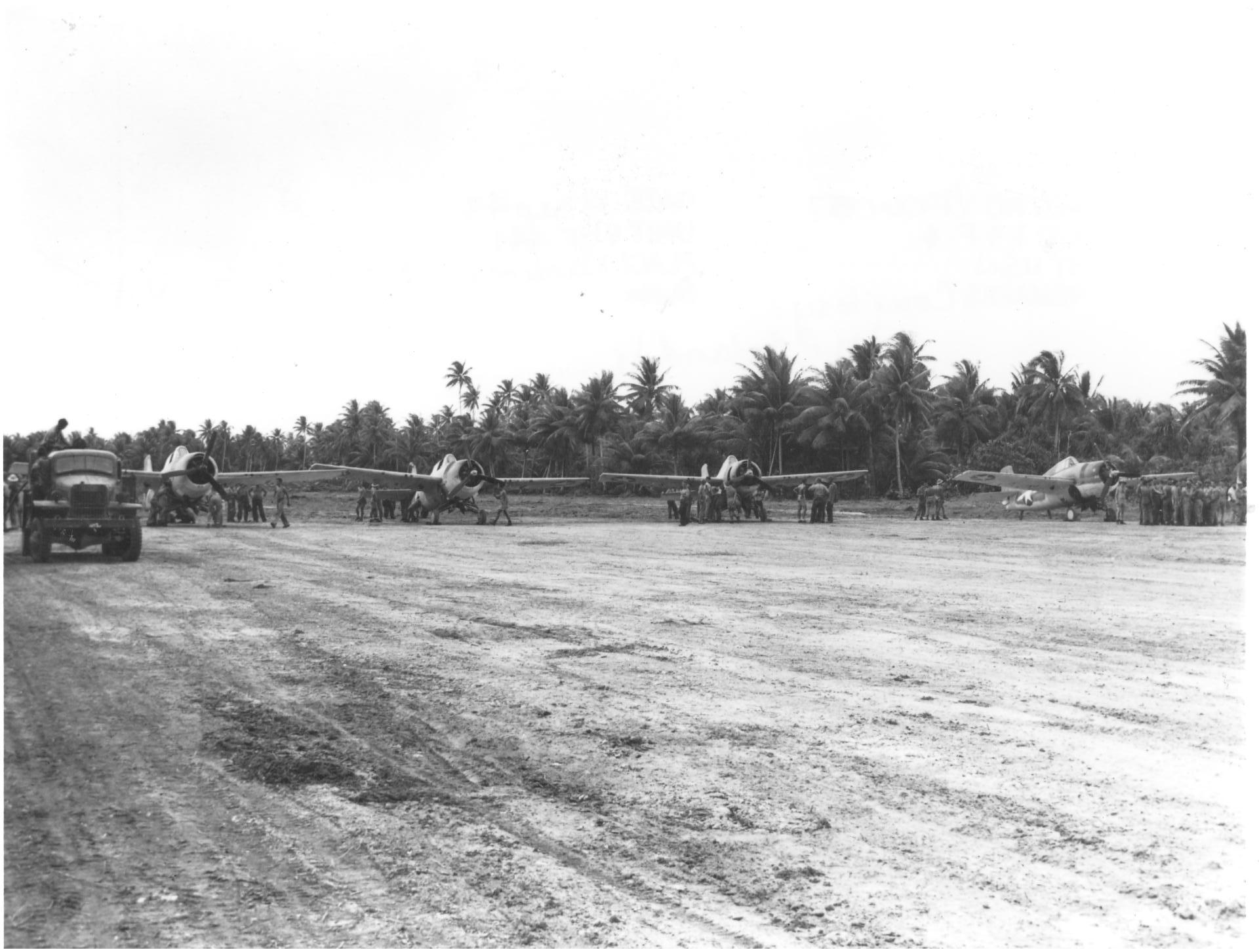
Nanumea Airfield is a former World War II airfield on the island of Nanumea in the Ellice Islands (now known as Tuvalu). History World War II Nanumea Airfield was built by United States Navy Seabees during the Pacific War as an alternative strip to Nukufetau and Funafuti airfields to allow for further dispersal of aircraft in the Ellice Islands (now Tuvalu). On 5 September 1943 elements of the 16th Naval Construction Battalion arrived on Nanumea and on 11 September they started work on a by bomber strip. On 7 September 1943 ten ''Betty'' bombers of the 755th ''Kōkūtai'' (air group) from Tarawa Atoll, Gilbert Islands, drop 20 bombs on Nanumea. The next day ''Betty'' bombers again bombed Nanumea. On 19 September F4F-4s of VMF-441 landed on the strip and continued to use the runway during the remainder of the construction period. The first bombers landed on 12 November. The Seabees also built the camp and operation facilities for the airfield, including an 8,000-barrel tan ... [...More Info...] [...Related Items...] OR: [Wikipedia] [Google] [Baidu] |
42d Attack Squadron
The 42nd Attack Squadron is a dormant United States Air Force unit assigned to the 25th Attack Group and formerly located at Creech Air Force Base near Indian Springs, Nevada. It flew the General Atomics MQ-9 Reaper unmanned aerial vehicle. The 42nd oversaw the training and combat deployment of aerial vehicle and sensor operators assigned to the Reaper. Created as the first operational MQ-9 Reaper squadron in 2006, the squadron flew its final sortie and was subsequently placed in a dormant status on 31 January 2020. History World War I The squadron was organized as the 42nd Aero Squadron on 17 June 1917, shortly after the United States declared war on Germany. Based at Camp Kelly, Texas, the squadron flight-trained new pilots as part of the Air Service until demobilized on 21 February 1919. Training between the wars The squadron was reconstituted in 1922 and became the 42nd School Squadron in January 1923 as part of the 10th School Group at Kelly Field. In 1924 its lineage w ... [...More Info...] [...Related Items...] OR: [Wikipedia] [Google] [Baidu] |
11th Wing
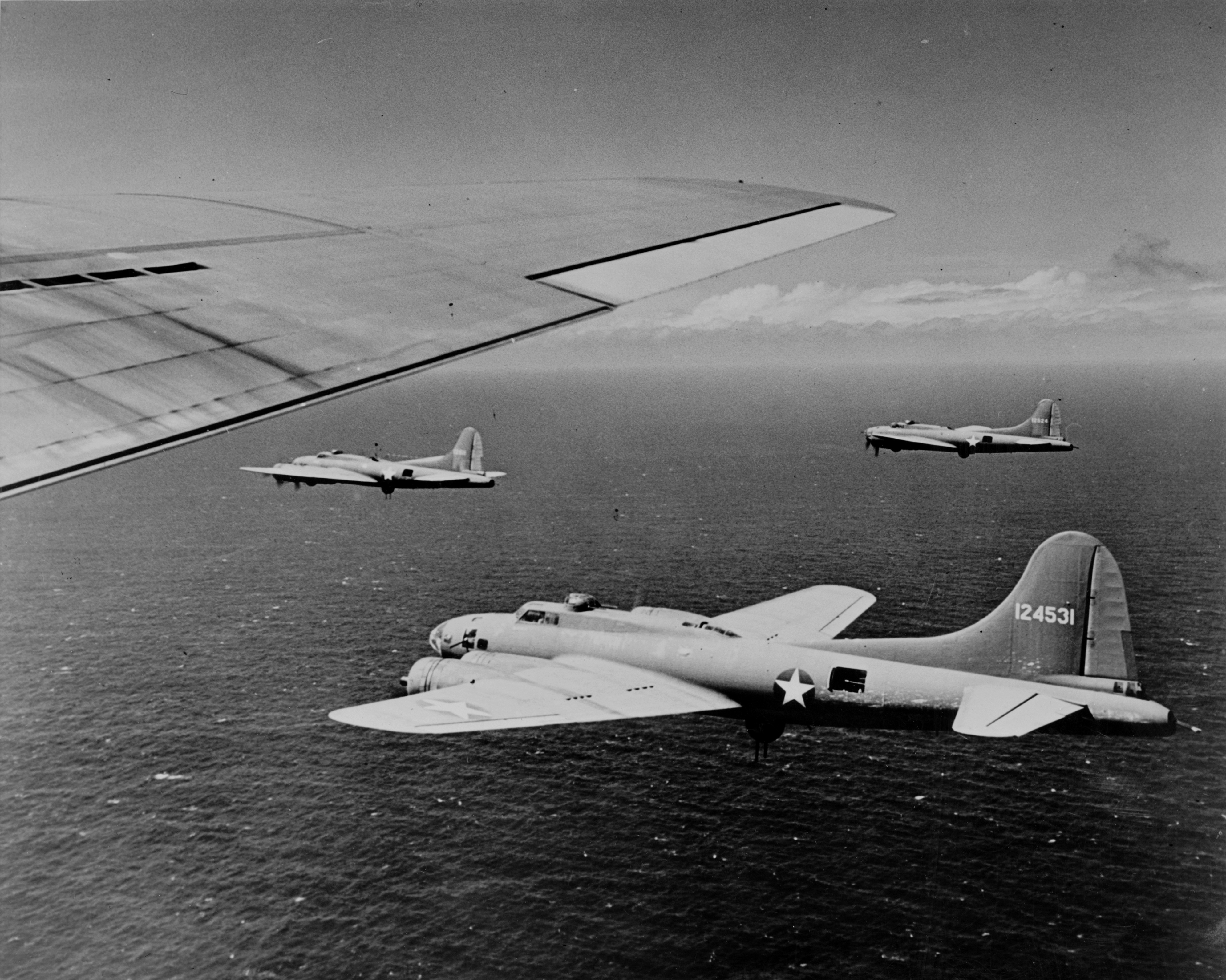
The 11th Wing is a United States Air Force unit assigned to the Air Force District of Washington. It is the host unit at Joint Base Anacostia-Bolling in Washington, D.C. on from June 2020. It previously was stationed at Joint Base Andrews, Maryland where it was the host unit. The 11th Wing was one of the largest wings in the Air Force. It is known as "The Chief's Own", an honorific originally intended to reflect that the Chief of Staff of the United States Air Force personally created the organization. The 11th Wing traces its roots back to the 11th Observation Group which was established on 1 October 1933, but not activated. The group was redesignated as the 11 Bombardment Group (Medium) on 1 January 1938, although not activated until 1 February 1940. Later that year it became a heavy bombardment unit. The group fought in combat in the Pacific Theater of Operations with Boeing B-17 Flying Fortresses and Consolidated B-24 Liberators. The 11th Bombardment Group earned a Navy P ... [...More Info...] [...Related Items...] OR: [Wikipedia] [Google] [Baidu] |
VII Bomber Command
The VII Bomber Command is an inactive United States Air Force unit. Its last assignment was with Seventh Air Force, based on Okinawa. It was inactivated on 31 March 1946. It engaged in patrol operations from Hawaii from January 1942. On the night of 22-23 December 1942, twenty-six Consolidated B-24D Liberators of the 307th Bombardment Group staged through Midway Island for a strike on Wake Island with 135 500-pound general purpose bombs and 21 incendiaries. The attack may have taken the Japanese by surprise, as neither searchlights nor antiaircraft fire were encountered until after the bombing had begun. All planes returned safely, with only slight damage to two. After late 1943, VII Bomber Command served in combat in the Central and Western Pacific. Lineage * Constituted as the 7th Bomber Command on 23 January 1942Maurer indicates that the unit was constituted as the "VII" Bomber Command. However, the unit was constituted and activated with an arabic number in its name. ... [...More Info...] [...Related Items...] OR: [Wikipedia] [Google] [Baidu] |
Ellice Islands
Tuvalu ( or ; formerly known as the Ellice Islands) is an island country and microstate in the Polynesian subregion of Oceania in the Pacific Ocean. Its islands are situated about midway between Hawaii and Australia. They lie east-northeast of the Santa Cruz Islands (which belong to the Solomon Islands), northeast of Vanuatu, southeast of Nauru, south of Kiribati, west of Tokelau, northwest of Samoa and Wallis and Futuna, and north of Fiji. Tuvalu is composed of three reef islands and six atolls. They are spread out between the latitude of 5° and 10° south and between the longitude of 176° and 180°. They lie west of the International Date Line. Tuvalu has a population of 10,507 (2017 census). The total land area of the islands of Tuvalu is . The first inhabitants of Tuvalu were Polynesians, according to well-established theories regarding a migration of Polynesians into the Pacific that began about three thousand years ago. Long before European contact with th ... [...More Info...] [...Related Items...] OR: [Wikipedia] [Google] [Baidu] |
Funafuti Atoll
Funafuti is the capital of the island nation of Tuvalu. It has a population of 6,320 people (2017 census), and so it has more people than the rest of Tuvalu combined, with approximately 60% of the population. It consists of a narrow sweep of land between wide, encircling a large lagoon (''Te Namo'') long and wide. The average depth of the Funafuti lagoon is about 20 fathoms (36.5 metres or 120 feet). With a surface area of , it is by far the largest lagoon in Tuvalu. The land area of the 33 islets around the atoll of Funafuti totals ; taken together, they constitute less than one percent of the total area of the atoll. Cargo ships can enter Funafuti's lagoon and dock at the port facilities on Fongafale. The capital of Tuvalu is sometimes said to be Fongafale or Vaiaku, but, officially, the entire atoll of Funafuti is its capital, since it has a single government that is responsible for the whole atoll. Fongafale The largest island is Fongafale. The island houses four village ... [...More Info...] [...Related Items...] OR: [Wikipedia] [Google] [Baidu] |
Funafuti International Airport
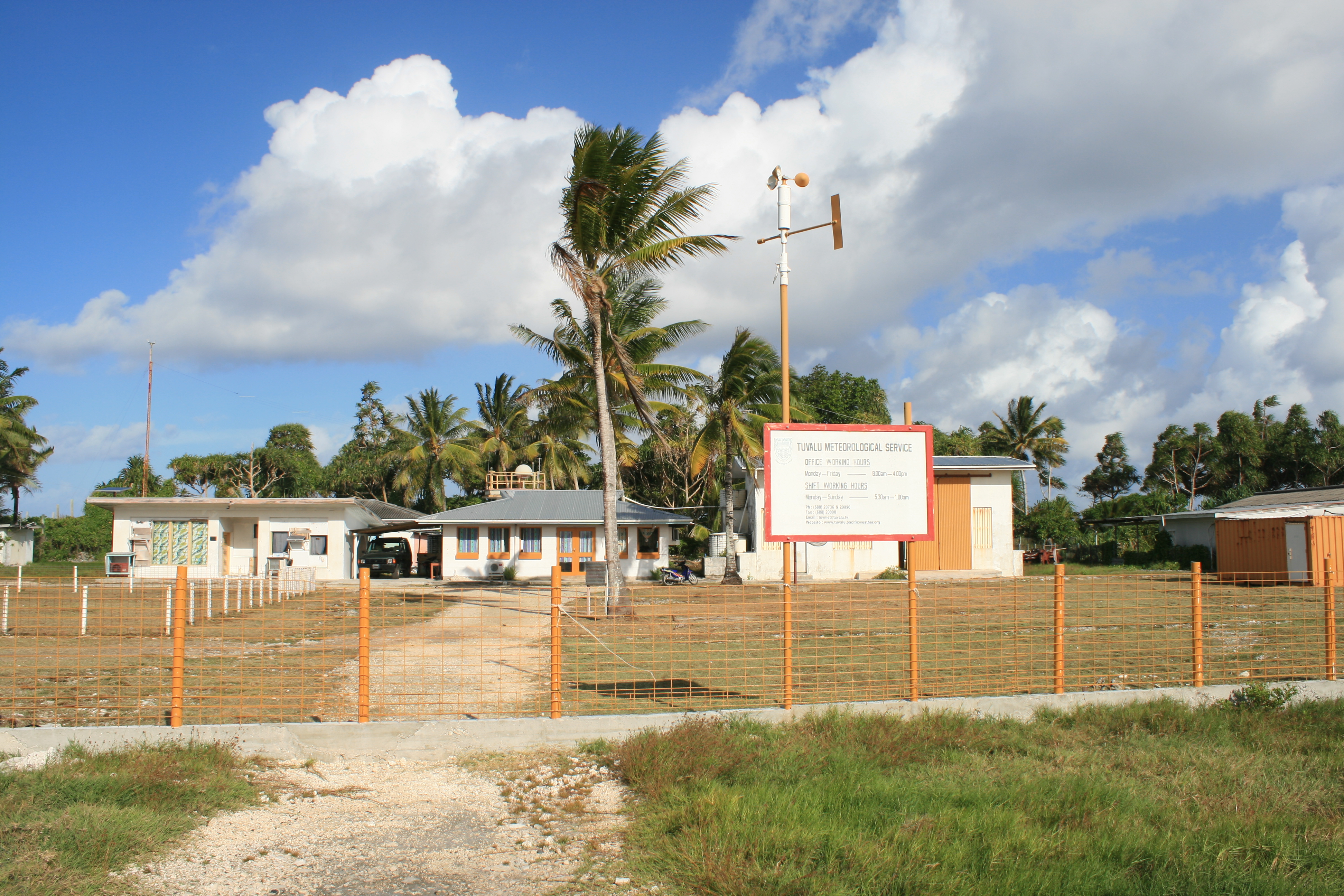
Funafuti International Airport is an airport in Funafuti, in the capital city of the island nation of Tuvalu. It is the sole international airport in Tuvalu. Fiji Airways (trading as Fiji Link) operates between Suva and Funafuti. Air Kiribati provides one flight a week from Tarawa to Funafuti. History Funafuti Airport was built by a Seabee detachment of the 2nd Naval Construction Battalion of the United States Navy in 1943 during World War II. The military airfield included an airstrip, control tower and facilities, with a radio station at Tepuka, connected by cable to the airfield. The base headquarters buildings were at the present-day Teagai Apelu's residence, and a bunker is there to this day. The first offensive operation was launched on 20 April 1943 when 22 B-24 Liberator aircraft from 371 and 372 Bombardment Squadrons bombed Nauru. The next day the Japanese made a predawn raid on the strip at Funafuti that destroyed one B-24 and caused damage to five other planes. On ... [...More Info...] [...Related Items...] OR: [Wikipedia] [Google] [Baidu] |
Penrhyn Island
Penrhyn (also called Tongareva, Māngarongaro, Hararanga, and Te Pitaka) is an atoll in the northern group of the Cook Islands in the south Pacific Ocean. The northernmost island in the group, it is located at north-north-east of the capital island of Rarotonga, 9 degrees south of the equator. Its nearest neighbours are Rakahanga and Manihiki, approximately to the southwest. Once one of the most heavily populated atolls, it was almost completely depopulated by Peruvian slavers in 1864. Geography Penrhyn is a roughly circular coral atoll with a circumference of approximately , enclosing a lagoon with an area of . The atoll is atop the highest submarine volcano in the Cook Islands, rising from the ocean floor. The atoll is low-lying, with a maximum elevation of less than . The total land area is . The atoll rim consists of 18 major islets. Clockwise, from the Northwest, these are: * Tokerau * Painko * Ruahara * Takuua * Veseru * Tuirai * Pokerekere Islet * Kavea * Te ... [...More Info...] [...Related Items...] OR: [Wikipedia] [Google] [Baidu] |


