|
Tidal Scour
Tidal scour is "sea-floor erosion caused by strong tidal currents resulting in the removal of inshore sediments and formation of deep holes and channels". Examples of this hydrological process can be found globally. Two locations in the United States where tidal scour is the predominant shaping force is the San Francisco Bay and the Elkhorn Slough.Silberstein 1989 M, Campbell E. 1989. Elkhorn Slough. Monterey, CA: Monterey Bay Aquarium. 64 p. Tidal force can also contribute to bridge scour. Historical Perspective and Relevance Research on tidal scour is largely centered at Elkhorn Slough in California. The slough was directly exposed to tidal flux beginning in 1947 with the creation of the Moss Landing Harbor. Multiple studies have been done on the slough since tidal exposure to catalog the morphological change and determine how long it will take for the system to reach equilibrium. Formation Tidal scours are formed in tide-dominated deltas and estuaries with the changing ... [...More Info...] [...Related Items...] OR: [Wikipedia] [Google] [Baidu] |
Erosion
Erosion is the action of surface processes (such as Surface runoff, water flow or wind) that removes soil, Rock (geology), rock, or dissolved material from one location on the Earth's crust#Crust, Earth's crust and then sediment transport, transports it to another location where it is deposit (geology), deposited. Erosion is distinct from weathering which involves no movement. Removal of rock or soil as clastic sediment is referred to as ''physical'' or ''mechanical'' erosion; this contrasts with ''chemical'' erosion, where soil or rock material is removed from an area by Solvation, dissolution. Eroded sediment or solutes may be transported just a few millimetres, or for thousands of kilometres. Agents of erosion include rainfall; bedrock wear in rivers; coastal erosion by the sea and Wind wave, waves; glacier, glacial Plucking (glaciation), plucking, Abrasion (geology), abrasion, and scour; areal flooding; Aeolian processes, wind abrasion; groundwater processes; and Mass wastin ... [...More Info...] [...Related Items...] OR: [Wikipedia] [Google] [Baidu] |
Sonar
Sonar (sound navigation and ranging or sonic navigation and ranging) is a technique that uses sound propagation (usually underwater, as in submarine navigation) to navigate, measure distances ( ranging), communicate with or detect objects on or under the surface of the water, such as other vessels. "Sonar" can refer to one of two types of technology: ''passive'' sonar means listening for the sound made by vessels; ''active'' sonar means emitting pulses of sounds and listening for echoes. Sonar may be used as a means of acoustic location and of measurement of the echo characteristics of "targets" in the water. Acoustic location in air was used before the introduction of radar. Sonar may also be used for robot navigation, and sodar (an upward-looking in-air sonar) is used for atmospheric investigations. The term ''sonar'' is also used for the equipment used to generate and receive the sound. The acoustic frequencies used in sonar systems vary from very low ( infrasonic) to e ... [...More Info...] [...Related Items...] OR: [Wikipedia] [Google] [Baidu] |
Geological Processes
Geology (). is a branch of natural science concerned with the Earth and other astronomical objects, the rocks of which they are composed, and the processes by which they change over time. Modern geology significantly overlaps all other Earth sciences, including hydrology. It is integrated with Earth system science and planetary science. Geology describes the structure of the Earth on and beneath its surface and the processes that have shaped that structure. Geologists study the mineralogical composition of rocks in order to get insight into their history of formation. Geology determines the relative ages of rocks found at a given location; geochemistry (a branch of geology) determines their absolute ages. By combining various petrological, crystallographic, and paleontological tools, geologists are able to chronicle the geological history of the Earth as a whole. One aspect is to demonstrate the age of the Earth. Geology provides evidence for plate tectonics, the evoluti ... [...More Info...] [...Related Items...] OR: [Wikipedia] [Google] [Baidu] |
Benthos
Benthos (), also known as benthon, is the community of organisms that live on, in, or near the bottom of a sea, river, lake, or stream, also known as the benthic zone.Benthos from the Census of Antarctic Marine Life website This community lives in or near marine or freshwater sedimentary environments, from tidal pools along the , out to the continental shelf, and then down to the [...More Info...] [...Related Items...] OR: [Wikipedia] [Google] [Baidu] |
Eelgrass
Eelgrass is a common name for several plants and may refer to: * '' Zostera'', marine eelgrass * '' Vallisneria'', freshwater eelgrass See also *'' Potamogeton compressus'', known as eel-grass pondweed {{Short pages monitor ... [...More Info...] [...Related Items...] OR: [Wikipedia] [Google] [Baidu] |
Agricultural Runoff
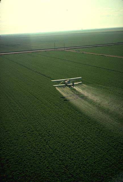
Agricultural pollution refers to biotic and abiotic byproducts of farming practices that result in contamination or degradation of the environment and surrounding ecosystems, and/or cause injury to humans and their economic interests. The pollution may come from a variety of sources, ranging from point source water pollution (from a single discharge point) to more diffuse, landscape-level causes, also known as non-point source pollution and air pollution. Once in the environment these pollutants can have both direct effects in surrounding ecosystems, i.e. killing local wildlife or contaminating drinking water, and downstream effects such as dead zones caused by agricultural runoff is concentrated in large water bodies. Management practices, or ignorance of them, play a crucial role in the amount and impact of these pollutants. Management techniques range from animal management and housing to the spread of pesticides and fertilizers in global agricultural practices, which ... [...More Info...] [...Related Items...] OR: [Wikipedia] [Google] [Baidu] |
Geomorphology
Geomorphology () is the scientific study of the origin and evolution of topographic and bathymetric features generated by physical, chemical or biological processes operating at or near Earth's surface. Geomorphologists seek to understand why landscapes look the way they do, to understand landform and terrain history and dynamics and to predict changes through a combination of field observations, physical experiments and numerical modeling. Geomorphologists work within disciplines such as physical geography, geology, geodesy, engineering geology, archaeology, climatology, and geotechnical engineering. This broad base of interests contributes to many research styles and interests within the field. Overview Earth's surface is modified by a combination of surface processes that shape landscapes, and geologic processes that cause tectonic uplift and subsidence, and shape the coastal geography. Surface processes comprise the action of water, wind, ice, wildfire, and lif ... [...More Info...] [...Related Items...] OR: [Wikipedia] [Google] [Baidu] |
Grain Size
Grain size (or particle size) is the diameter of individual grains of sediment, or the lithified particles in clastic rocks. The term may also be applied to other granular materials. This is different from the crystallite size, which refers to the size of a single crystal inside a particle or grain. A single grain can be composed of several crystals. Granular material can range from very small colloidal particles, through clay, silt, sand, gravel, and cobbles, to boulders. Krumbein phi scale Size ranges define limits of classes that are given names in the Wentworth scale (or Udden–Wentworth scale named after geologists Chester K. Wentworth and Johan A. Udden) used in the United States. The Krumbein ''phi'' (φ) scale, a modification of the Wentworth scale created by W. C. Krumbein in 1934, is a logarithmic scale computed by the equation :\varphi=-\log_2, where :\varphi is the Krumbein phi scale, :D is the diameter In geometry, a diameter of a circle i ... [...More Info...] [...Related Items...] OR: [Wikipedia] [Google] [Baidu] |
Cross-sectional Study
In statistics and econometrics, cross-sectional data is a type of data collected by observing many subjects (such as individuals, firms, countries, or regions) at a single point or period of time. Analysis of cross-sectional data usually consists of comparing the differences among selected subjects, typically with no regard to differences in time. For example, if we want to measure current obesity levels in a population, we could draw a sample of 1,000 people randomly from that population (also known as a cross section of that population), measure their weight and height, and calculate what percentage of that sample is categorized as obese. This cross-sectional sample provides us with a snapshot of that population, at that one point in time. Note that we do not know based on one cross-sectional sample if obesity is increasing or decreasing; we can only describe the current proportion. Cross-sectional data differs from ''time series'' data, in which the same small-scale or aggreg ... [...More Info...] [...Related Items...] OR: [Wikipedia] [Google] [Baidu] |
Lidar
Lidar (, also LIDAR, an acronym of "light detection and ranging" or "laser imaging, detection, and ranging") is a method for determining ranging, ranges by targeting an object or a surface with a laser and measuring the time for the reflected light to return to the receiver. Lidar may operate in a fixed direction (e.g., vertical) or it may scan multiple directions, in a special combination of 3-D scanning and laser scanning. Lidar has terrestrial, airborne, and mobile applications. It is commonly used to make high-resolution maps, with applications in surveying, geodesy, geomatics, archaeology, geography, geology, geomorphology, seismology, forestry, atmospheric physics, laser guidance, airborne laser swathe mapping (ALSM), and Mars Orbiter Laser Altimeter, laser altimetry. It is used to make digital 3D modeling, 3-D representations of areas on the Earth's surface and ocean bottom of the intertidal and near coastal zone by varying the wavelength of light. It has also been in ... [...More Info...] [...Related Items...] OR: [Wikipedia] [Google] [Baidu] |
Bathymetry
Bathymetry (; ) is the study of underwater depth of ocean floors ('' seabed topography''), river floors, or lake floors. In other words, bathymetry is the underwater equivalent to hypsometry or topography. The first recorded evidence of water depth measurements are from Ancient Egypt over 3000 years ago. Bathymetry has various uses including the production of bathymetric charts to guide vessels and identify underwater hazards, the study of marine life near the floor of water bodies, coastline analysis and ocean dynamics, including predicting currents and tides. Bathymetric charts (not to be confused with '' hydrographic charts''), are typically produced to support safety of surface or sub-surface navigation, and usually show seafloor relief or terrain as contour lines (called '' depth contours'' or '' isobaths'') and selected depths ('' soundings''), and typically also provide surface navigational information. Bathymetric maps (a more general term where navigational safet ... [...More Info...] [...Related Items...] OR: [Wikipedia] [Google] [Baidu] |
Tidal Currents
Tides are the rise and fall of sea levels caused by the combined effects of the gravitational forces exerted by the Moon (and to a much lesser extent, the Sun) and are also caused by the Earth and Moon orbiting one another. Tide tables can be used for any given locale to find the predicted times and amplitude (or "tidal range"). The predictions are influenced by many factors including the alignment of the Sun and Moon, the phase and amplitude of the tide (pattern of tides in the deep ocean), the amphidromic systems of the oceans, and the shape of the coastline and near-shore bathymetry (see ''Timing''). They are however only predictions, the actual time and height of the tide is affected by wind and atmospheric pressure. Many shorelines experience semi-diurnal tides—two nearly equal high and low tides each day. Other locations have a diurnal tide—one high and low tide each day. A "mixed tide"—two uneven magnitude tides a day—is a third regular category. Tides v ... [...More Info...] [...Related Items...] OR: [Wikipedia] [Google] [Baidu] |


