|
Tawang District
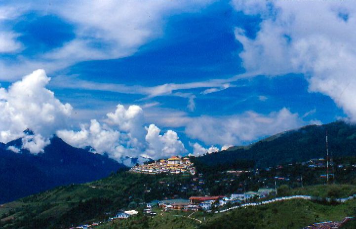
Tawang district (Pron:/tɑ:ˈwæŋ or təˈwæŋ/) is the smallest of the 26 Districts of Arunachal Pradesh, administrative districts of Arunachal Pradesh state in northeastern India. With a population of 49,977, it is the eighth least populous district in the country (out of Districts of India, 707). History Tawang is inhabited by the Monpa people. From 500 BC to 600 AD a kingdom known as Lhomon or Monyul ruled the area. The Monyul kingdom was later absorbed into the control of neighbouring Bhutan and Tibet. Tawang Monastery was founded by the Merak Lama Lodre Gyatso in 1681 in accordance with the wishes of the 5th Dalai Lama, Ngawang Lobsang Gyatso, and has an interesting legend surrounding its name, which means "Chosen by Horse". The sixth Dalai Lama, Tsangyang Gyatso, 6th Dalai Lama, Tsangyang Gyatso, was born in Tawang. Tawang was historically part of Tibet. The Simla Accord (1914), 1914 Simla Accord defined the McMahon Line as the new boundary between British India a ... [...More Info...] [...Related Items...] OR: [Wikipedia] [Google] [Baidu] |
List Of Districts Of Arunachal Pradesh
, the Indian state Arunachal Pradesh comprised 27 districts, Arunachal gets to new districts northeastlivetv.com 8 Feb 2024. not including Itanagar capital complex,List of districts of arunachal Pradesh arunachalpradesh.gov.in, accessed 8 Feb 2024. with more districts proposed. Most of the districts are inhabited by vario ... [...More Info...] [...Related Items...] OR: [Wikipedia] [Google] [Baidu] |
Government Of India
The Government of India (ISO 15919, ISO: Bhārata Sarakāra, legally the Union Government or Union of India or the Central Government) is the national authority of the Republic of India, located in South Asia, consisting of States and union territories of India, 36 states and union territories. The government is led by the president of India (currently ) who largely exercises the executive powers, and selects the Prime Minister of India, prime minister of India and other ministers for aid and advice. Government has been formed by the The prime minister and their senior ministers belong to the Union Council of Ministers, its executive decision-making committee being the Cabinet (government), cabinet. The government, seated in New Delhi, has three primary branches: the legislature, the executive and the judiciary, whose powers are vested in bicameral Parliament of India, Union Council of Ministers (headed by prime minister), and the Supreme Court of India respectively, with a p ... [...More Info...] [...Related Items...] OR: [Wikipedia] [Google] [Baidu] |
Ministry Of Information And Broadcasting (India)
The Ministry of Information and Broadcasting is a ministerial level agency of the Government of India responsible for the formulation and administration of rules, regulations and laws in the areas of information, broadcasting, the press, and the cinema of India. The Ministry is responsible for the administration of the Press Information Bureau and Prasar Bharati, the broadcasting arm of the Indian Government. The Central Board of Film Certification is the other important statutory body subordinate to this ministry, responsible for the regulation and certification of Cinema of India, motion pictures broadcast in India. Organisation * Broadcasting ** Conditional Access System (CAS) ** Community radio, Community Radio Stations ** Prasar Bharati ** Doordarshan ** All India Radio, Akashvani (All India Radio) ** Broadcast Engineering Consultants India Limited ** Uplinking / Downlinking of TV Channels ** Content Regulation on Private TV Channels ** Direct to Home (DTH) ** Internet P ... [...More Info...] [...Related Items...] OR: [Wikipedia] [Google] [Baidu] |
Tawang Chu
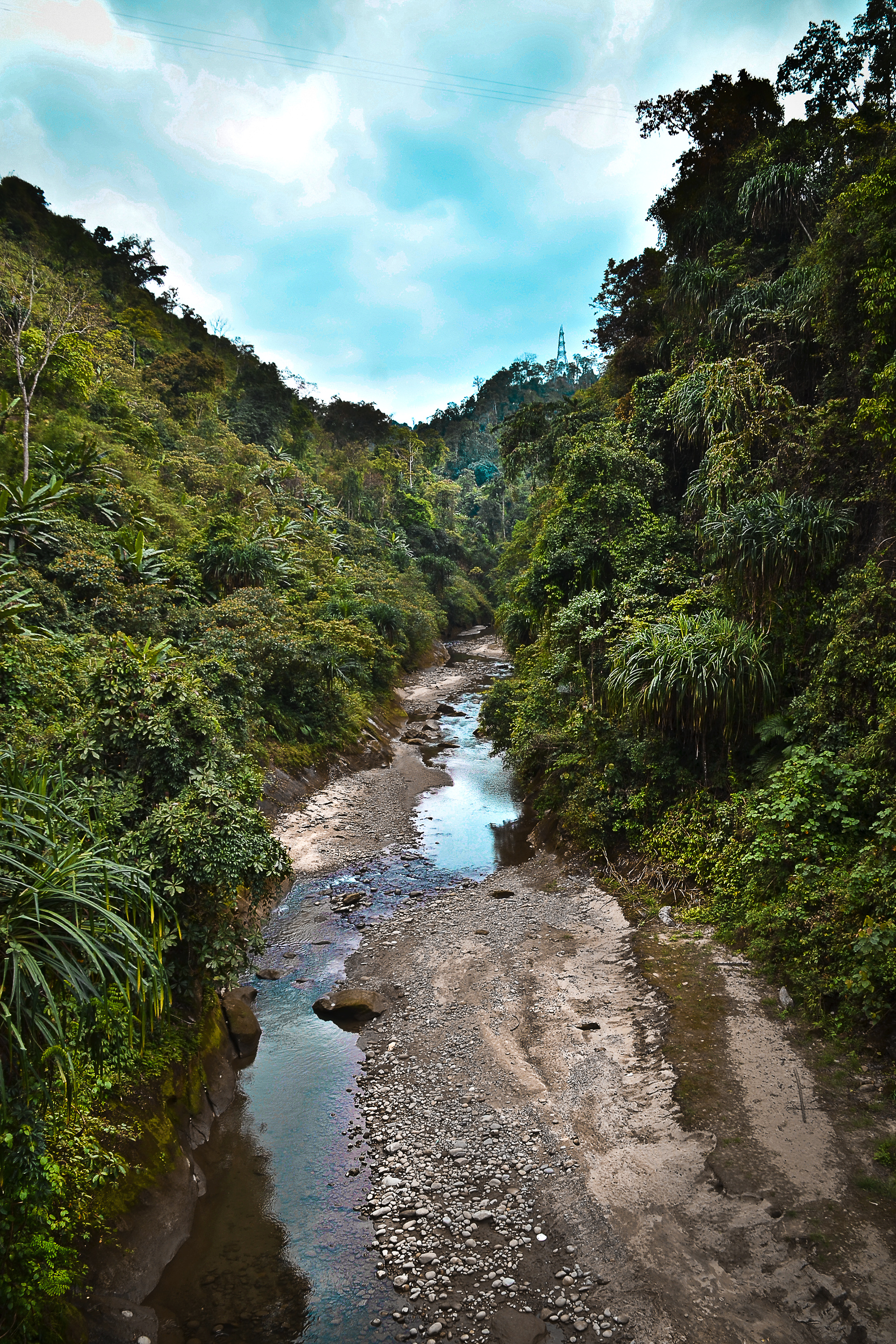
Tawang Chu (Tawang river) is the main river of the Tawang district in Arunachal Pradesh, India. The entire district may be regarded as the basin of the Tawang Chu river. In addition, two south-flowing rivers from Tibet, viz., the Tsona Chu and Nyamjang Chu, join the river within the district. The combined river flows west into Bhutan, where it progresses to the Manas River (tributary of Brahmaputra River) and flows into the Assam state of India. Tawang Chu is formed by the joining of three rivers originating within the Tawang district: the Goshu Chu, Dungma Chu and Gorjo Chu. These rivers merge near the village of Mago (), after which the combined river is called Mago Chu. After Tsona Chu joins it, near Kyelatongbo at an elevation of , the combined river is called Tawang Chu. The river flows west towards Bhutan, passing by the Tawang town on its southern flank. Near Jang, between Mago & Tawang, the Nuranang River joins Tawang Chu. Near Lumla, the Nyamjang Chu The Nyamja ... [...More Info...] [...Related Items...] OR: [Wikipedia] [Google] [Baidu] |
Yangtse, India
Chumi Gyatse Falls (), called Domtsang and Dongzhang waterfalls in Tibetan and Chinese languages respectively, are a collection of waterfalls in the Tawang district in Arunachal Pradesh, India, close to the border with the Tibet Autonomous Region, Tibet region of China. According to the local Buddhist tradition, the 108 holly water falls which originate from in-between the mountains symbolise the blessings of Guru Padmasambhava. The Chumi Gyatse Falls are close to the Line of Actual Control, the de facto border between China and India, just 250 metres away according to one account. Geography The Chumi Gyatse Falls are in an area called Yangtse where the Tsona Chu river flows from Tibet into India's Tawang district. They are along the cliff face of a high plateau ("Yangtse plateau") formed by an east–west mountain range, whose watershed serves as the India–China border as per the McMahon Line. A few hundred meters to the north, lies Domtsang () or Dongzhang () (), a Buddhist ... [...More Info...] [...Related Items...] OR: [Wikipedia] [Google] [Baidu] |
Line Of Actual Control
The Line of Actual Control (LAC), in the context of the Sino-Indian border dispute, is a notional demarcation lineAnanth KrishnanLine of Actual Control , India-China: the line of actual contest, 13 June 2020: "In contrast, the alignment of the LAC has never been agreed upon, and it has neither been delineated nor demarcated. There is no official map in the public domain that depicts the LAC. It can best be thought of as an idea, reflecting the territories that are, at present, under the control of each side, pending a resolution of the boundary dispute." that separates Indian-controlled territory from Chinese-controlled territory. The concept was introduced by Chinese premier Zhou Enlai in a 1959 letter to Jawaharlal Nehru as the "line up to which each side exercises actual control", but rejected by Nehru as being incoherent. Subsequently, the term came to refer to the line formed after the 1962 Sino-Indian War. The LAC is different from the borders claimed by each count ... [...More Info...] [...Related Items...] OR: [Wikipedia] [Google] [Baidu] |
People's Liberation Army
The People's Liberation Army (PLA) is the military of the Chinese Communist Party (CCP) and the People's Republic of China (PRC). It consists of four Military branch, services—People's Liberation Army Ground Force, Ground Force, People's Liberation Army Navy, Navy, People's Liberation Army Air Force, Air Force, and People's Liberation Army Rocket Force, Rocket Force—and four arms—People's Liberation Army Aerospace Force, Aerospace Force, People's Liberation Army Cyberspace Force, Cyberspace Force, People's Liberation Army Information Support Force, Information Support Force, and People's Liberation Army Joint Logistics Support Force, Joint Logistics Support Force. It is led by the Central Military Commission (China), Central Military Commission (CMC) with its Chairman of the Central Military Commission (China), chairman as Supreme Military Command of the People's Republic of China, commander-in-chief. The PLA can trace its origins during the Republic of China (1912– ... [...More Info...] [...Related Items...] OR: [Wikipedia] [Google] [Baidu] |
Indian Army
The Indian Army (IA) (ISO 15919, ISO: ) is the Land warfare, land-based branch and largest component of the Indian Armed Forces. The President of India is the Commander-in-Chief, Supreme Commander of the Indian Army, and its professional head is the Chief of the Army Staff (India), Chief of the Army Staff (COAS). The British Indian Army, Indian Army was established on 1 April 1895 alongside the long established presidency armies of the East India Company, which too were absorbed into it in 1903. Some princely states maintained their own armies which formed the Imperial Service Troops which, along with the Indian Army formed the land component of the Armed Forces of the Crown of India, responsible for the defence of the Indian Empire. The Imperial Service Troops were merged into the Indian Army after Independence of India, independence. The units and regiments of the Indian Army have diverse histories and have participated in several battles and campaigns around the world, earnin ... [...More Info...] [...Related Items...] OR: [Wikipedia] [Google] [Baidu] |
2022 Yangtse Clash
The Yangtse clash of 9 December 2022 occurred at night between the troops of the Indian Army and the Chinese People's Liberation Army (PLA) along their mutually contested Line of Actual Control (LAC) in the Yangtse region of Tawang in the Indian state of Arunachal Pradesh. Violent clashes ensued after the two armies confronted each other with nail-studded clubs and other melee weapons near positions on a border ridgeline in close vicinity of the revered Buddhist site of Chumi Gyatse Falls. The border incident marked the most serious clash between the two armies along their undemarcated frontier since the Galwan Valley clash in June 2020, which had led to the deaths of 20 Indian soldiers and an unknown number of dead on the Chinese side. Independent researchers using satellite imagery found evidence of Chinese troops, numbering about 300 according to reports, from a newly constructed border village moving up towards two Indian outposts at about elevation. This provoked a clash ... [...More Info...] [...Related Items...] OR: [Wikipedia] [Google] [Baidu] |
West Kameng District
West Kameng (pronounced ) is a district of Arunachal Pradesh in northeastern India. It accounts for 8.86% of the total area of the state. The name is derived from the Kameng river, a tributary of the Brahmaputra, that flows through the district. History The area around the Kameng river has traditionally come under the control of the Mon kingdom, Bhutan, Tibet and the Ahom kingdom. Tibetan Buddhism got a strong foothold among the tribal groups as early as in the 7th century, where the Kachen Lama constructed the Lhagyala Gompa in Morshing. Whenever loose control was exerted over the area, small, feudal chiefdoms ruled by the Miji and the Aka chiefs dominated control over the area. This can be evidenced in the fact that ruined fortresses like those in Bhalukpong constructed in the 10th to 12th century and the Dirang fort, which was constructed in the 17th century to defend against invasions from neighbouring chiefdoms. Upon the arrival of the British, the present- ... [...More Info...] [...Related Items...] OR: [Wikipedia] [Google] [Baidu] |
Sino-Indian War
The Sino–Indian War, also known as the China–India War or the Indo–China War, was an armed conflict between China and India that took place from October to November 1962. It was a military escalation of the Sino–Indian border dispute. Fighting occurred along India's border with China, in India's North-East Frontier Agency east of Bhutan, and in Aksai Chin west of Nepal. There had been a series of border skirmishes between the two countries after the 1959 Tibetan uprising, when India granted asylum to the Dalai Lama. Chinese military action grew increasingly aggressive after India rejected proposed Chinese diplomatic settlements throughout 1960–1962, with China resuming previously banned "forward patrols" in Ladakh after 30 April 1962. Amidst the Cuban Missile Crisis, seeing that the U.S. was pre-occupied with dealing with it, China abandoned all attempts towards a peaceful resolution on 20 October 1962,''Webster's Encyclopedic Unabridged Dictionary of the English ... [...More Info...] [...Related Items...] OR: [Wikipedia] [Google] [Baidu] |


