|
Scheldt River
The Scheldt (french: Escaut ; nl, Schelde ) is a river that flows through northern France, western Belgium, and the southwestern part of the Netherlands, with its mouth at the North Sea. Its name is derived from an adjective corresponding to Old English ' ("shallow"), Modern English ''shoal'', Low German ''schol'', West Frisian ''skol'', and Swedish (obsolete) ''skäll'' ("thin"). Course The headwaters of the Scheldt are in Gouy, in the Aisne department of northern France. It flows north through Cambrai and Valenciennes, and enters Belgium near Tournai. Ghent developed at the confluence of the Lys, one of its main tributaries, and the Scheldt, which then turns east. Near Antwerp, the largest city on its banks, the Scheldt flows west into the Netherlands toward the North Sea. Originally there were two branches from that point: the Oosterschelde (Eastern Scheldt); and the Westerschelde (Western Scheldt). In the 19th century, however, the Dutch built a dyke that cuts the r ... [...More Info...] [...Related Items...] OR: [Wikipedia] [Google] [Baidu] |
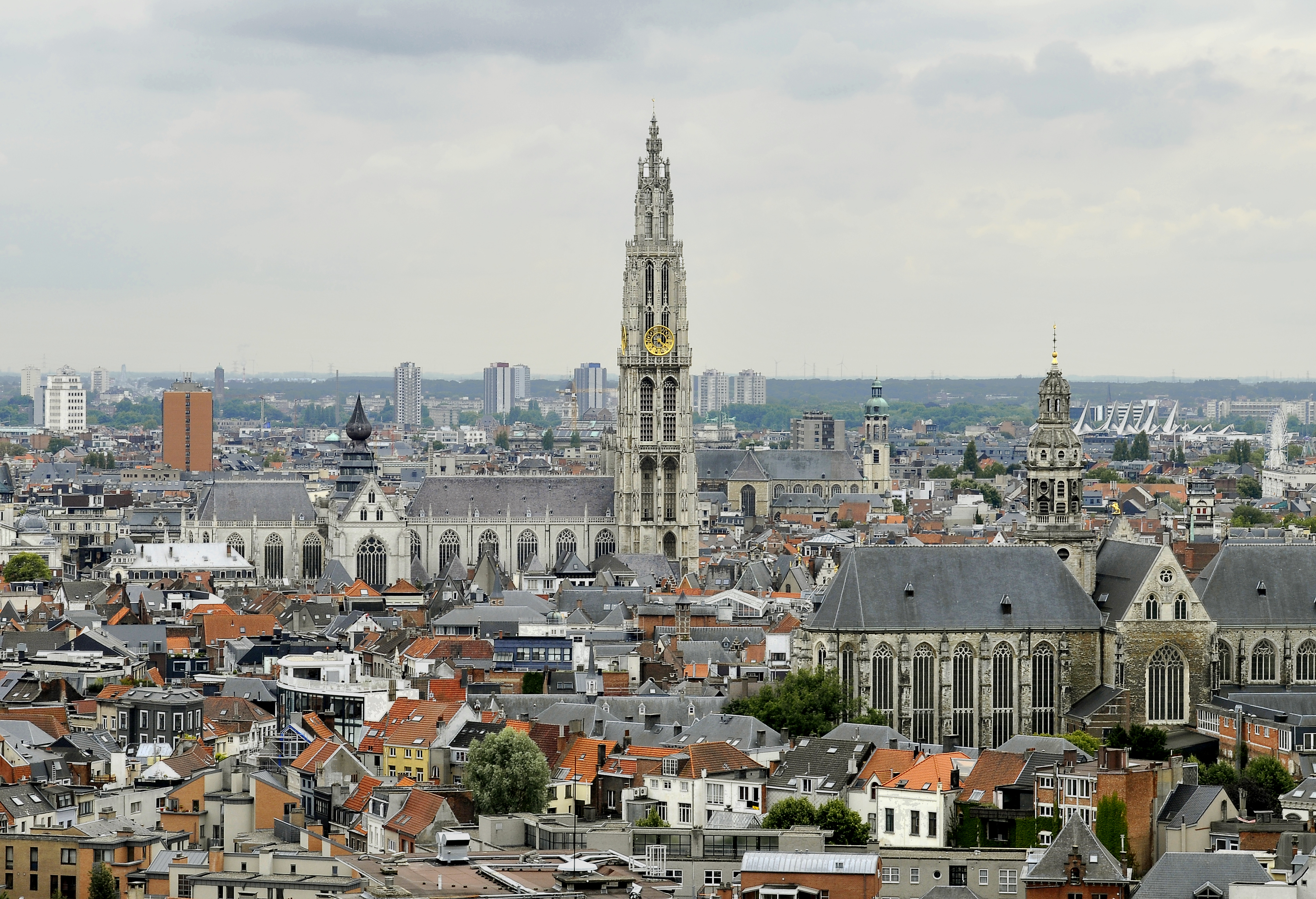
Antwerp
Antwerp (; nl, Antwerpen ; french: Anvers ; es, Amberes) is the largest city in Belgium by area at and the capital of Antwerp Province in the Flemish Region. With a population of 520,504,Statistics Belgium; ''Loop van de bevolking per gemeente'' (Excel file) Population of all municipalities in Belgium, . Retrieved 1 November 2017. it is the most populous municipality in Belgium, and with a metropolitan population of around 1,200,000 people, it is the second-largest metrop ... [...More Info...] [...Related Items...] OR: [Wikipedia] [Google] [Baidu] |
Lys (river)
The Lys () or Leie () is a river in France and Belgium, and a left-bank tributary of the Scheldt. Its source is in Pas-de-Calais, France, and it flows into the river Scheldt in Ghent, Belgium. Its total length is . Historically a very polluted river from the high population density and industrialisation in both Northern France and Belgium, it has seen substantial improvements in recent years, partly due to the decline of the principal industry, the spinning and weaving of flax. The region of the Leie (between Deinze and Ghent) was known as a favourite place for numerous painters in the first half of the 20th century. The source of the Lys is in a village, Lisbourg, east of Fruges, in the Pas-de-Calais department of France. It flows generally northeast through the following departments of France, provinces of Belgium and towns and municipalities: *Pas-de-Calais (F): Thérouanne, Aire-sur-la-Lys * Nord (F): Merville, Armentières, Halluin * Hainaut (B): Comines-Warneton *Wes ... [...More Info...] [...Related Items...] OR: [Wikipedia] [Google] [Baidu] |
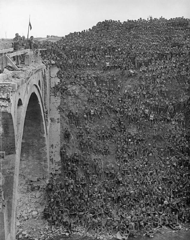
Canal De Saint-Quentin
The Canal de Saint-Quentin () is a canal in northern France connecting the canalised river Escaut in Cambrai to the Canal latéral à l'Oise and Canal de l'Oise à l'Aisne in Chauny. History The canal was built in two phases, the second much longer than the first. The king's ministers Colbert and Mazarin had both proposed linking the rivers Oise and Somme in the 17th century and this resulted in the Canal Crozat, or Canal de Picardie, between Chauny and Saint-Simon in 1738. The remainder, connecting the Seine Basin with the Escaut was a lengthy process. The original designer, Devicq in 1727, died in 1742. Little was accomplished until Napoléon demanded that work begin again in 1801. He officiated at the opening in April 1810. The canal was such a success that the locks had to be duplicated throughout in the early 20th century, at the same time deepening the channel, enlarging the tunnels, and increasing water supplies. Later improvements included electric barge traction on ... [...More Info...] [...Related Items...] OR: [Wikipedia] [Google] [Baidu] |
Waterway
A waterway is any navigable body of water. Broad distinctions are useful to avoid ambiguity, and disambiguation will be of varying importance depending on the nuance of the equivalent word in other languages. A first distinction is necessary between maritime shipping routes and waterways used by inland water craft. Maritime shipping routes cross oceans and seas, and some lakes, where navigability is assumed, and no engineering is required, except to provide the draft for deep-sea shipping to approach seaports (channels), or to provide a short cut across an isthmus; this is the function of ship canals. Dredged channels in the sea are not usually described as waterways. There is an exception to this initial distinction, essentially for legal purposes, see under international waters. Where seaports are located inland, they are approached through a waterway that could be termed "inland" but in practice is generally referred to as a "maritime waterway" (examples Seine Maritime, Loir ... [...More Info...] [...Related Items...] OR: [Wikipedia] [Google] [Baidu] |
Walcheren
Walcheren () is a region and former island in the Dutch province of Zeeland at the mouth of the Scheldt estuary. It lies between the Eastern Scheldt in the north and the Western Scheldt in the south and is roughly the shape of a rhombus. The two sides facing the North Sea consist of dunes and the rest of its coastline is made up of dykes. Middelburg, the provincial capital, lies at Walcheren's centre. Vlissingen, to the south, is the main harbour and the third municipality is Veere. Originally, Walcheren was an island, but the Sloedam, constructed in 1871 for a railway, and poldering after World War II have connected it to the (former) island of Zuid-Beveland, which in turn has been connected to the North Brabant mainland. History Early history As early as Roman times, the island functioned as a point of departure for ships going to Britain; it had a temple of the goddess Nehalennia who was popular with those who braved the waters of the North Sea. The Romans called it "Walla ... [...More Info...] [...Related Items...] OR: [Wikipedia] [Google] [Baidu] |
Vlissingen
Vlissingen (; zea, label=Zeelandic, Vlissienge), historically known in English as Flushing, is a Municipalities of the Netherlands, municipality and a city in the southwestern Netherlands on the former island of Walcheren. With its strategic location between the Scheldt river and the North Sea, Vlissingen has been an important harbour for centuries. It was granted City rights in the Netherlands, city rights in 1315. In the 17th century Vlissingen was a main harbour for ships of the Dutch East India Company (VOC). It is also known as the birthplace of Admiral Michiel de Ruyter. Vlissingen is mainly noted for the yards on the Scheldt where most of the ships of the Royal Netherlands Navy (''Koninklijke Marine'') are built. Geography The municipality of Vlissingen consists of the following places: * City: Vlissingen * Villages: Oost-Souburg, Ritthem, and West-Souburg * Hamlet: Groot-Abeele History The fishermen's hamlet that came into existence at the estuary of the Schelde a ... [...More Info...] [...Related Items...] OR: [Wikipedia] [Google] [Baidu] |
Zeelandic Flanders
Zeelandic Flanders ( ; zea, Zeêuws-Vlaonderen; vls, Zêeuws-Vloandern)''Vlaanderen'' in isolation: . is the southernmost region of the province of Zeeland in the south-western Netherlands. It lies south of the Western Scheldt that separates the region from the remainder of Zeeland and the Netherlands to the north. Zeelandic Flanders is bordered to the south and to the east by Belgium. Geography Zeelandic Flanders is the north-eastern part of the large historical region of Flanders which today lies mostly in Belgium. It shares a land border with the Belgian provinces of East and West Flanders. It is a latitudinally oriented strip of land along the Western Scheldt, a North Sea estuary, and has no land access to the rest of the Netherlands. The area of Zeelandic Flanders is of which is land and is water. The region is bordered by the Zwin nature reserve in the West and the Drowned Land of Saeftinghe in the East. Since local government boundary reforms in 2003, Z ... [...More Info...] [...Related Items...] OR: [Wikipedia] [Google] [Baidu] |
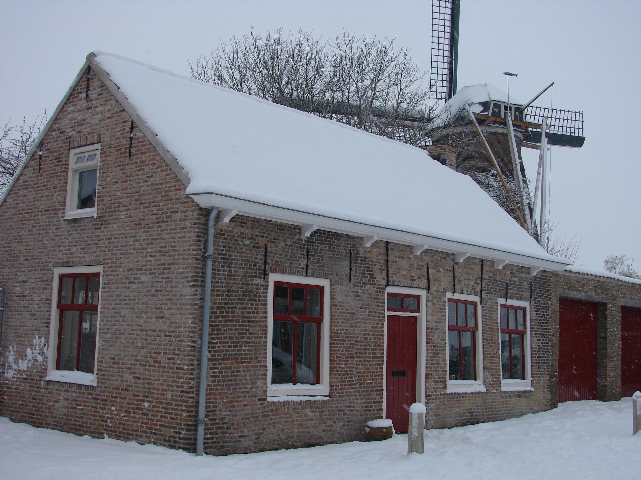
Breskens
Breskens is a harbour town on the Westerschelde in the municipality of Sluis in the province of Zeeland, in the south-western Netherlands. Its population is 4,787 (). The town is noted for the ''Visserijfeesten'' (Fishery Festival), the largest festival in Zeeland. A ferry connection exists between Breskens and Vlissingen. After the opening of the Western Scheldt Tunnel near Terneuzen in 2003, the ferry now only carries pedestrian and bicycle traffic. Sights The lighthouse of Breskens is the oldest remaining cast-iron lighthouse in the Netherlands. It was built in 1867 and became a monument in 1982. History In early 1487 Maximilian I, Holy Roman Emperor, granted the coastal region of the Scheldt as a fief to Philip of Cleves. The coastal areas were drained and the village of Breskens was founded in 1510. On 14 May 1940, with the German army approaching, the Dutch government fled to London. Queen Wilhelmina initially ordered the British captain removing her from the Hagu ... [...More Info...] [...Related Items...] OR: [Wikipedia] [Google] [Baidu] |
Terneuzen
Terneuzen () is a city and municipality in the southwestern Netherlands, in the province of Zeeland, in the middle of Zeelandic Flanders. With almost 55,000 inhabitants, it is the most populous municipality of Zeeland. History First mentioned in 1325, Terneuzen was a strategically located port on the waterways to Ghent, in present-day Belgium. It received city rights in 1584. Tradition has it that Terneuzen was once the home of the legendary Flying Dutchman, Van der Decken, a captain who cursed God and was condemned to sail the seas forever, as described in the Frederick Marryat novel ''The Phantom Ship'' and the Richard Wagner opera ''The Flying Dutchman''. Before 1877, the city was often called Neuzen. Geography The city of Terneuzen is located on the southern shore of the Western Scheldt estuary. The municipality of Terneuzen consists of the following population centres: Economy The Ghent–Terneuzen Canal is still an important shipping route connecting th ... [...More Info...] [...Related Items...] OR: [Wikipedia] [Google] [Baidu] |
Estuary
An estuary is a partially enclosed coastal body of brackish water with one or more rivers or streams flowing into it, and with a free connection to the open sea. Estuaries form a transition zone between river environments and maritime environments and are an example of an ecotone. Estuaries are subject both to marine influences such as tides, waves, and the influx of saline water, and to fluvial influences such as flows of freshwater and sediment. The mixing of seawater and freshwater provides high levels of nutrients both in the water column and in sediment, making estuaries among the most productive natural habitats in the world. Most existing estuaries formed during the Holocene epoch with the flooding of river-eroded or glacially scoured valleys when the sea level began to rise about 10,000–12,000 years ago. Estuaries are typically classified according to their geomorphological features or to water-circulation patterns. They can have many different names, such as bays, ... [...More Info...] [...Related Items...] OR: [Wikipedia] [Google] [Baidu] |
North Brabant
North Brabant ( nl, Noord-Brabant ; Brabantian: ; ), also unofficially called Brabant, is a province in the south of the Netherlands. It borders the provinces of South Holland and Gelderland to the north, Limburg to the east, Zeeland to the west, and the Flemish provinces of Antwerp and Limburg to the south. The northern border follows the Meuse westward to its mouth in the Hollands Diep strait, part of the Rhine–Meuse–Scheldt delta. North Brabant has a population of 2,562,566 as of November 2019. Major cities in North Brabant are Eindhoven (pop. 231,642), Tilburg (pop. 217,259), Breda (pop. 183,873) and its provincial capital 's-Hertogenbosch (pop. 154,205). History The Duchy of Brabant was a state of the Holy Roman Empire established in 1183 or 1190. It developed from the Landgraviate of Brabant and formed the heart of the historic Low Countries, part of the Burgundian Netherlands from 1430 and of the Habsburg Netherlands from 1482, until it was split up after th ... [...More Info...] [...Related Items...] OR: [Wikipedia] [Google] [Baidu] |
Zuid-Beveland
Zuid-Beveland (; "South Beveland") is part of the province of Zeeland in the Netherlands north of the Western Scheldt and south of the Eastern Scheldt. Topography It is a former island, now peninsula, crossed by the Canal through Zuid-Beveland on the west and the Scheldt–Rhine Canal on the east. It consists of four municipalities: * Borsele *Goes *Kapelle * Reimerswaal Goes is Zuid-Beveland's principal urban center. Zuid-Beveland is a former island which was joined (together with Walcheren) to the mainland by a railway embankment in 1903 and to Noord-Beveland by the Delta Works. A shipping canal connecting the Belgian port of Antwerp with the Rhine River traverses Zuid-Beveland. History Third and fourth centuries This was the period during which most of Zeeland appears to have been submerged. The area was and for several centuries would remain almost unpeopled. Middle Ages During the eleventh century the area began to be drained, as little by little polders and c ... [...More Info...] [...Related Items...] OR: [Wikipedia] [Google] [Baidu] |


_p523_BRESKENS.jpg)


