|
San Juan Islands Dispute
The Pig War was a confrontation in 1859 between the United States and the United Kingdom over the British–U.S. border in the San Juan Islands, between Vancouver Island (present-day Canada) and the State of Washington. The Pig War, so called because it was triggered by the shooting of a pig, is also called the Pig Episode, the Pig and Potato War, the San Juan Boundary Dispute, and the Northwestern Boundary Dispute. Despite being referred to as a "war" there were no casualties on either side, aside from the pig. Background Border ambiguity The Oregon Treaty of June 15, 1846, resolved the Oregon boundary dispute by dividing the Oregon Country/Columbia District between the United States and Britain "along the forty-ninth parallel of north latitude to the middle of the channel which separates the continent from Vancouver Island, and thence southerly through the middle of the said channel, and of the Strait of Juan de Fuca, to the Pacific Ocean." However, two straits could ... [...More Info...] [...Related Items...] OR: [Wikipedia] [Google] [Baidu] |
Haro Strait
The Haro Strait is one of the main channels connecting the Strait of Georgia to the Strait of Juan de Fuca, separating Vancouver Island and the Gulf Islands in British Columbia, Canada from the San Juan Islands of Washington (state), Washington state in the United States. Haro Strait is a critical part of the route of the international boundary between Canada and the United States from the western terminus of the 49th parallel north, 49th parallel segment of that boundary, and was chosen by the arbitrator in the San Juan Islands dispute (Pig War (1859), Pig War) over the other main candidate, Rosario Strait, which lies on the east side of the San Juans. Definition According to the United States Geological Survey, USGS, Haro Strait's southern boundary with the Strait of Juan de Fuca is formed by a line between Discovery Island (British Columbia), Discovery Island, just east of Victoria, British Columbia, Victoria, to Cattle Point at the southern tip of San Juan Island. Haro Strait's ... [...More Info...] [...Related Items...] OR: [Wikipedia] [Google] [Baidu] |
United Kingdom Of Great Britain And Ireland
The United Kingdom of Great Britain and Ireland was a sovereign state in the British Isles that existed between 1801 and 1922, when it included all of Ireland. It was established by the Acts of Union 1800, which merged the Kingdom of Great Britain and the Kingdom of Ireland into a unified state. The establishment of the Irish Free State in 1922 led to the remainder later being renamed the United Kingdom of Great Britain and Northern Ireland in 1927. The United Kingdom, having financed the European coalition that defeated France during the Napoleonic Wars, developed a large Royal Navy that enabled the British Empire to become the foremost world power for the next century. For nearly a century from the final defeat of Napoleon following the Battle of Waterloo to the outbreak of World War I, Britain was almost continuously at peace with Great Powers. The most notable exception was the Crimean War with the Russian Empire, in which actual hostilities were relatively limited. How ... [...More Info...] [...Related Items...] OR: [Wikipedia] [Google] [Baidu] |
Charles Wilkes
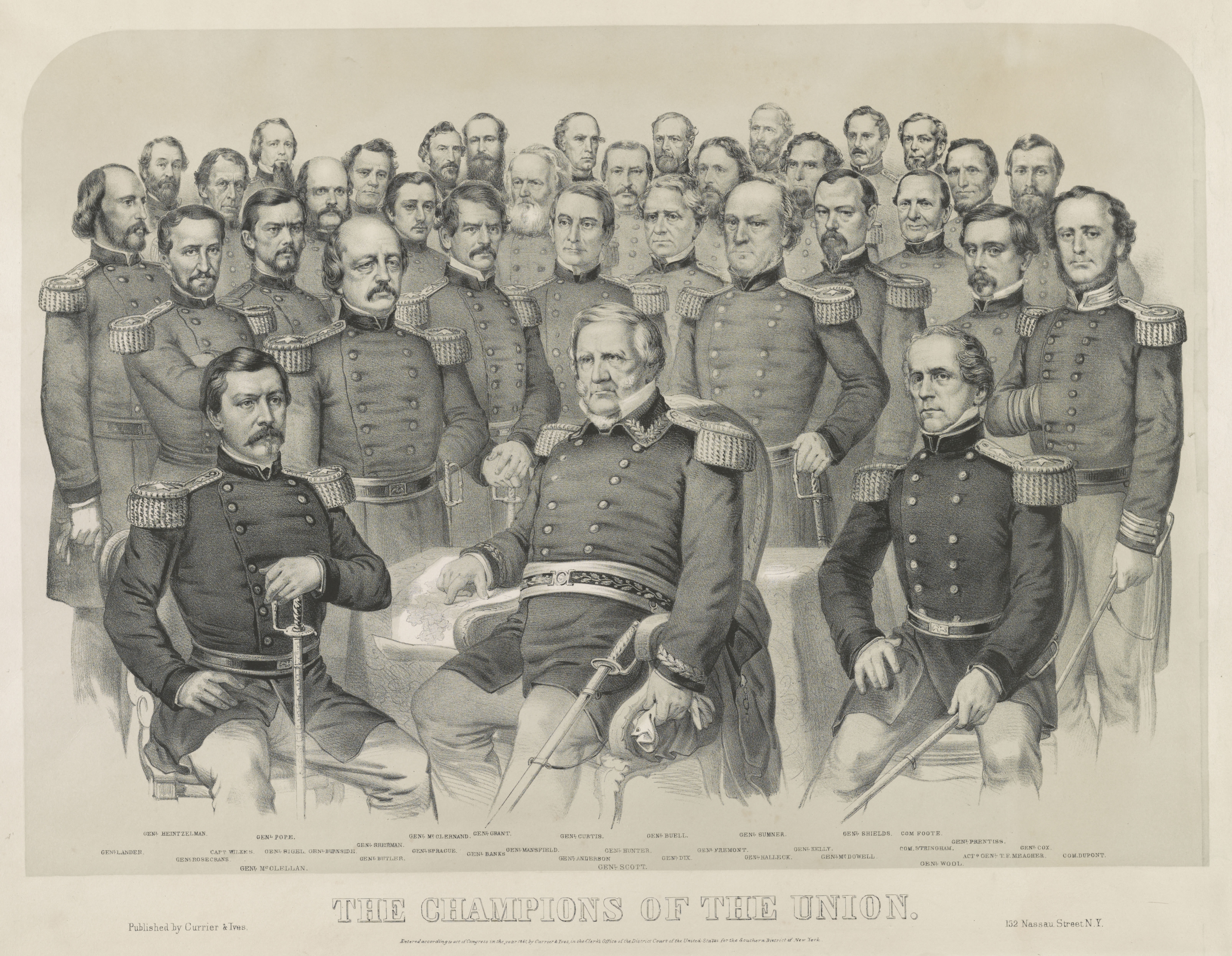
Charles Wilkes (April 3, 1798 – February 8, 1877) was an American naval officer, ship's captain, and explorer. He led the United States Exploring Expedition (1838–1842). During the American Civil War (1861–1865), he commanded ' during the Trent Affair in which he stopped a Royal Mail ship and removed two Confederate diplomats, which almost led to war between the United States and the United Kingdom. Early life and career Wilkes was born in New York City, on April 3, 1798, as the great nephew of the former Lord Mayor of London John Wilkes. His mother was Mary Seton, who died in 1802 when Charles was just three years old. As a result, Charles was raised by his aunt, Elizabeth Ann Seton, who would later convert to Roman Catholicism and become the first American-born woman canonized a saint by the Catholic Church. When Elizabeth was left widowed with five children, Charles was sent to a boarding school, and later attended Columbia College, which is the present-day Columbia Uni ... [...More Info...] [...Related Items...] OR: [Wikipedia] [Google] [Baidu] |
George Vancouver
Captain George Vancouver (22 June 1757 – 10 May 1798) was a British Royal Navy officer best known for his 1791–1795 expedition, which explored and charted North America's northwestern Pacific Coast regions, including the coasts of what are now the Canadian province of British Columbia as well as the US states of Alaska, Washington and Oregon. He also explored the Hawaiian Islands and the southwest coast of Australia. Vancouver Island, the city of Vancouver in British Columbia, Vancouver, Washington in the United States, Mount Vancouver on the Canadian–US border between Yukon and Alaska, and New Zealand's fourth-highest mountain, also Mount Vancouver, are all named after him. Early life George Vancouver was born in the seaport town of King's Lynn (Norfolk, England) on 22 June 1757 - the sixth and youngest child of John Jasper Vancouver, a Dutch-born deputy collector of customs, and Bridget Berners. He came from an old respected family. The surname Vancouver comes ... [...More Info...] [...Related Items...] OR: [Wikipedia] [Google] [Baidu] |
Pacific Ocean
The Pacific Ocean is the largest and deepest of Earth's five oceanic divisions. It extends from the Arctic Ocean in the north to the Southern Ocean (or, depending on definition, to Antarctica) in the south, and is bounded by the continents of Asia and Oceania in the west and the Americas in the east. At in area (as defined with a southern Antarctic border), this largest division of the World Ocean—and, in turn, the hydrosphere—covers about 46% of Earth's water surface and about 32% of its total surface area, larger than Earth's entire land area combined .Pacific Ocean . '' Britannica Concise.'' 2008: Encyclopædia Britannica, Inc. The centers of both the |
Strait Of Juan De Fuca
The Strait of Juan de Fuca (officially named Juan de Fuca Strait in Canada) is a body of water about long that is the Salish Sea's outlet to the Pacific Ocean. The international boundary between Canada and the United States runs down the centre of the Strait. It was named in 1787 by the maritime fur trader Charles William Barkley, captain of ''Imperial Eagle'', for Juan de Fuca, the Greek navigator who sailed in a Spanish expedition in 1592 to seek the fabled Strait of Anián. Barkley was the first non-indigenous person to find the strait, unless Juan de Fuca's story was true. The strait was explored in detail between 1789 and 1791 by Manuel Quimper, José María Narváez, Juan Carrasco, Gonzalo López de Haro, and Francisco de Eliza. Definition The United States Geological Survey defines the Strait of Juan de Fuca as a channel. It extends east from the Pacific Ocean between Vancouver Island, British Columbia, and the Olympic Peninsula, Washington, to Haro Strait, San Juan Cha ... [...More Info...] [...Related Items...] OR: [Wikipedia] [Google] [Baidu] |
49th Parallel North
The 49th parallel north is a circle of latitude that is 49 ° north of Earth's equator. It crosses Europe, Asia, the Pacific Ocean, North America, and the Atlantic Ocean. The city of Paris is about south of the 49th parallel and is the largest city between the 48th and 49th parallels. Its main airport, Charles de Gaulle Airport, lies on the parallel. Roughly of the Canada–United States border was designated to follow the 49th parallel from British Columbia to Manitoba on the Canada side, and from Washington to Minnesota on the U.S. side, more specifically from the Strait of Georgia to the Lake of the Woods. This international border was specified in the Anglo-American Convention of 1818 and the Oregon Treaty of 1846, though survey markers placed in the 19th century cause the border to deviate from the 49th parallel by up to tens of meters. From a point on the ground at this latitude, the sun is above the horizon for 16 hours, 12 minutes during the summer solstice and ... [...More Info...] [...Related Items...] OR: [Wikipedia] [Google] [Baidu] |
Columbia District
The Columbia District was a fur trading The fur trade is a worldwide industry dealing in the acquisition and sale of animal fur. Since the establishment of a world fur market in the early modern period, furs of boreal, polar and cold temperate mammalian animals have been the most ... district in the Pacific Northwest region of British North America in the 19th century. Much of its territory overlapped with the disputed Oregon Country. It was explored by the North West Company between 1793 and 1811, and established as an operating fur district around 1810. The North West Company was absorbed into the Hudson's Bay Company in 1821 under which the Columbia District became known as the Columbia Department. The Oregon Treaty of 1846 marked the effective end of the Hudson's Bay Company's Columbia Department. Early years Beginning in 1807, David Thompson (explorer), David Thompson, working for the North West Company (NWC), explored much of what would become the Columbia Distr ... [...More Info...] [...Related Items...] OR: [Wikipedia] [Google] [Baidu] |
Oregon Country
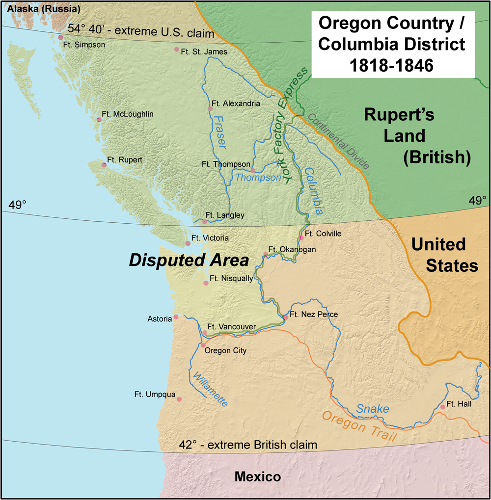
Oregon Country was a large region of the Pacific Northwest of North America that was subject to a long dispute between the United Kingdom and the United States in the early 19th century. The area, which had been created by the Treaty of 1818, consisted of the land north of 42°N latitude, south of 54°40′N latitude, and west of the Rocky Mountains down to the Pacific Ocean and east to the Continental Divide. Article III of the 1818 treaty gave joint control to both nations for ten years, allowed land to be claimed, and guaranteed free navigation to all mercantile trade. However, both countries disputed the terms of the international treaty. Oregon Country was the American name while the British used Columbia District for the region. British and French Canadian fur traders had entered Oregon Country prior to 1810 before the arrival of American settlers from the mid-1830s onwards, which led to the foundation of the Provisional Government of Oregon. Its coastal areas north from ... [...More Info...] [...Related Items...] OR: [Wikipedia] [Google] [Baidu] |
Oregon Boundary Dispute
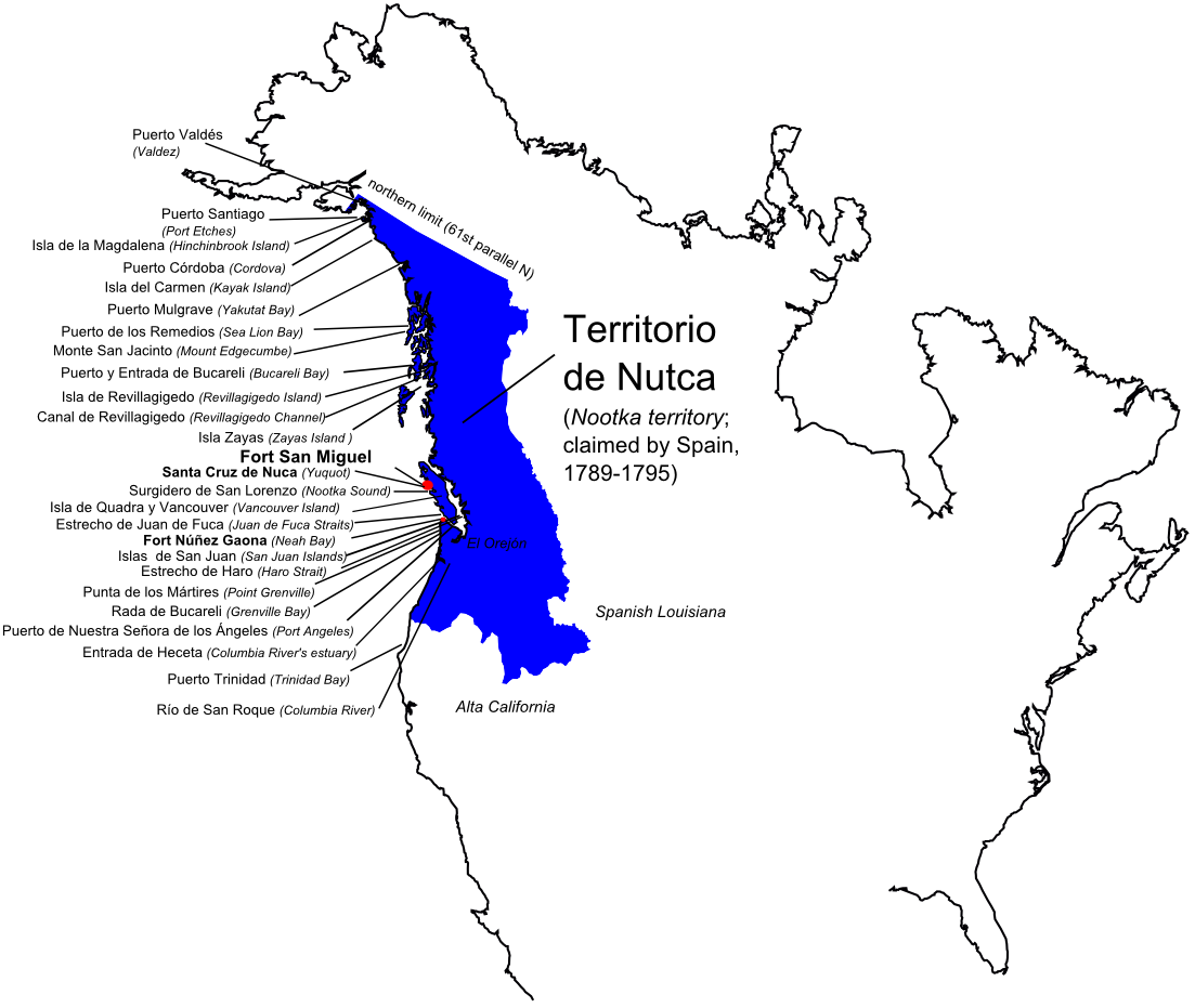
The Oregon boundary dispute or the Oregon Question was a 19th-century territorial dispute over the political division of the Pacific Northwest of North America between several nations that had competing territorial and commercial aspirations in the region. Expansionist competition into the region began in the 18th century, with participants including the Russian Empire, Great Britain, Spain, and the United States. After the War of 1812, the Oregon dispute took on increased importance for diplomatic relations between the British Empire and the fledgling American republic. In the mid-1820s, the Russians signed the Russo-American Treaty of 1824 and the Russo-British Treaty of 1825, and the Spanish signed the Adams–Onís Treaty of 1819, by which Russia and Spain formally withdrew their respective territorial claims in the region, and the British and the Americans acquired residual territorial rights in the disputed area. But the question of sovereignty over a portion of the North ... [...More Info...] [...Related Items...] OR: [Wikipedia] [Google] [Baidu] |
Oregon Treaty
The Oregon Treaty is a treaty between the United Kingdom and the United States that was signed on June 15, 1846, in Washington, D.C. The treaty brought an end to the Oregon boundary dispute by settling competing American and British claims to the Oregon Country; the area had been Condominium (international law), jointly occupied by both Britain and the U.S. since the Treaty of 1818. Background The Treaty of 1818 set the boundary between the United States and British North America along the 49th parallel north, 49th parallel of north latitude from Minnesota to the "Stony Mountains" (now known as the Rocky Mountains). The region west of those mountains was known to the Americans as the Oregon Country and to the British as the Columbia Department or Columbia District of the Hudson's Bay Company. (Also included in the region was the southern portion of another fur district, New Caledonia (Canada), New Caledonia.) The treaty provided for joint control of that land for ten years. ... [...More Info...] [...Related Items...] OR: [Wikipedia] [Google] [Baidu] |
Domestic Pig
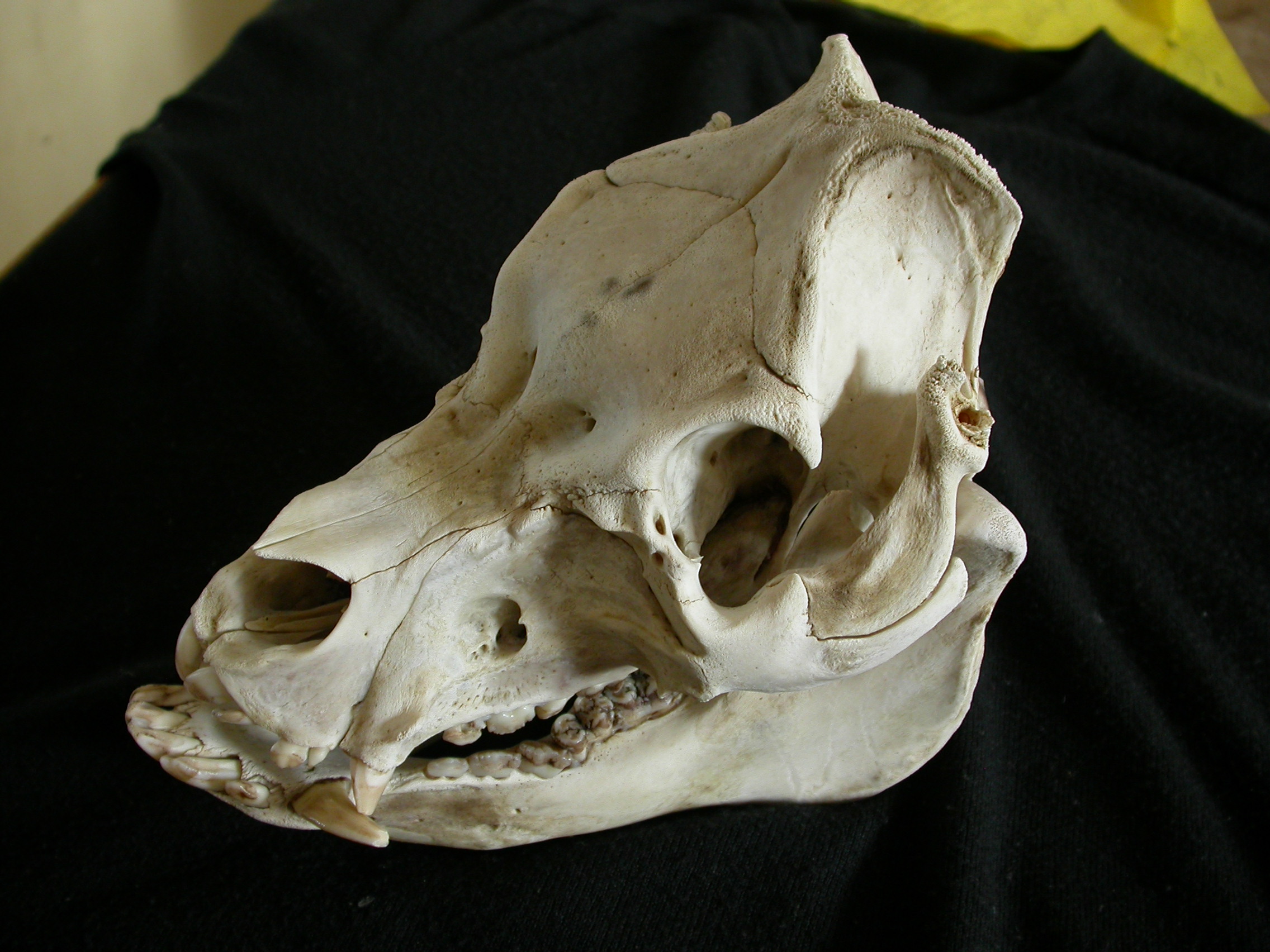
The pig (''Sus domesticus''), often called swine, hog, or domestic pig when distinguishing from other members of the genus '' Sus'', is an omnivorous, domesticated, even-toed, hoofed mammal. It is variously considered a subspecies of ''Sus scrofa'' (the wild boar or Eurasian boar) or a distinct species. The pig's head-plus-body length ranges from , and adult pigs typically weigh between , with well-fed individuals even exceeding this range. The size and weight of hogs largely depends on their breed. Compared to other artiodactyls, a pig's head is relatively long and pointed. Most even-toed ungulates are herbivorous, but pigs are omnivores, like their wild relative. Pigs grunt and make snorting sounds. When used as livestock, pigs are farmed primarily for the production of meat, called pork. A group of pigs is called a ''passel'', a ''team'', or a ''sounder''. The animal's bones, hide, and bristles are also used in products. Pigs, especially miniature breeds, are kept as pets ... [...More Info...] [...Related Items...] OR: [Wikipedia] [Google] [Baidu] |


.jpg)
.jpg)


